
Pocahontas County is a county located in the U.S. state of West Virginia. As of the 2010 census, the population was 8,719. Its county seat is Marlinton. The county was established in 1821. It is named after the daughter of the Powhatan chief of the Native Americans in the United States from Jamestown, Virginia. She married an English settler and their children became ancestors of many of the First Families of Virginia.

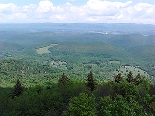
The Monongahela National Forest is a national forest located in the Allegheny Mountains of eastern West Virginia, USA. It protects over 921,000 acres of federally owned land within a 1,700,000 acres proclamation boundary that includes much of the Potomac Highlands Region and portions of 10 counties.

The Allegheny Front is the major southeast- or east-facing escarpment in the Allegheny Mountains in southern Pennsylvania, western Maryland, and eastern West Virginia, USA. The Allegheny Front forms the boundary between the Ridge-and-Valley Appalachians to its east and the Appalachian Plateau to its west. The Front is closely associated with the Appalachian Mountains' Eastern Continental Divide, which in this area divides the waters of the Ohio/Mississippi river system, flowing to the Gulf of Mexico, from rivers flowing into Chesapeake Bay and from there into the Atlantic Ocean.
Snowshoe Mountain is a ski resort in the eastern United States, located in Snowshoe, West Virginia. The resort has skiable terrain across 244 acres (99 ha) and covers a total area of 11,000 acres (44.5 km2) in the Allegheny Mountains, which are a part of the vast Appalachian Mountain Range. It is positioned in the bowl shaped convergence of two mountains, Cheat and Back Allegheny, at the head of the Shavers Fork of the Cheat River.

Spruce Knob, at 4,863 feet (1,482 m), is the highest point in the state of West Virginia and the summit of Spruce Mountain, the highest peak in the Allegheny Mountains.

Snowshoe is an unincorporated community in Pocahontas County, West Virginia, United States, centering on the Snowshoe Mountain ski resort. It is situated in the Allegheny Mountains at a bowl shaped convergence of two high mountain ridges — Cheat and Back Allegheny Mountains — at the head of the Shavers Fork of the Cheat River. Snowshoe is site of the second highest point in the state and the peak elevation for Cheat Mountain, at Thorny Flat, which reaches 4,848 feet (1,478 m) above sea level.
Bald Knob is the highest summit of Back Allegheny Mountain in Pocahontas County, West Virginia and is part of Cass Scenic Railroad State Park. At an altitude of 4,843 feet (1,476 m) above sea level, Bald Knob is the third-highest point in West Virginia and the Allegheny Mountains.

Cass Scenic Railroad State Park is a state park and heritage railroad located in Cass, Pocahontas County, West Virginia.

Shavers Fork of the Cheat River is situated in the Allegheny Mountains of eastern West Virginia, USA. It is 88.5 mi (142.5 km) long and forms the Cheat at its confluence with Black Fork at Parsons. It was traditionally considered one of the five Forks of Cheat and its upper reaches constitute the highest river in the eastern United States.
The Potomac Highlands of West Virginia centers on five West Virginian counties in the upper Potomac River watershed in the western portion of the state's Eastern Panhandle, bordering Maryland and Virginia. Because of geographical proximity, similar topography and landscapes, and shared culture and history, the Potomac Highlands region also includes Pocahontas, Randolph, and Tucker counties, even though they are in the Monongahela River or New River watersheds and not that of the Potomac River.

West Virginia Route 66 is an east–west state highway located within Pocahontas County, West Virginia. The route runs 16.1 miles (25.9 km) from U.S. Route 219 and West Virginia Route 55 near Snowshoe east to West Virginia Route 28 and West Virginia Route 92 south of Green Bank. WV 66 is maintained by the West Virginia Division of Highways.

Shavers Fork Mountain Complex is the name given to the mountains on either side of Shavers Fork in the highlands portions of Randolph County, Pocahontas County, and Tucker County in West Virginia, USA. Much of the land surrounding the river and its adjacent mountains is protected by Monongahela National Forest including about 20,000 acres (81 km2) of designated wilderness.
The Gaudineer Scenic Area (GSA) is a scenic area and National Natural Landmark in the Monongahela National Forest (MNF). It is situated just north of Gaudineer Knob of Shavers Mountain on the border of Randolph and Pocahontas Counties, West Virginia, USA, about 5 miles (8.0 km) northwest of the town of Durbin.

Cheat Mountain is an exceptionally high and rugged ridge situated in the Allegheny Mountains of eastern West Virginia, USA. It is about 50 miles (80 km) long and more than five miles (8 km) wide at its widest. Its highest point is at its southernmost end at Thorny Flat, which has an elevation of 4,848 feet (1,478 m). Several other knobs rise above 4,000 feet (1,200 m) along its length.
Leatherbark Run is the name of a stream in Pocahontas County, West Virginia. It is a tributary of the Greenbrier River.

Shavers Mountain, is a high and rugged ridge situated in the Allegheny Mountains of eastern West Virginia. It is about 35 miles (56 km) long, north to south, and several of its peaks exceed 4,000 feet (1,200 m) in elevation. Shavers Mountain is notable for being "bookended", at its northern and southern ends, by two exceptional natural areas: the Otter Creek Wilderness and the Gaudineer Scenic Area, respectively, both of which preserve small stands of old growth forest on the mountain.

White Top is a knob and spur of Cheat Mountain in southeastern Randolph County, West Virginia, USA. Sitting at an elevation of 4,085 feet (1,245 m), it is located just west of the Shavers Fork of Cheat River and Cheat Bridge. While White Top was originally crossed by the Staunton-Parkersburg Turnpike, modern-day U.S. Route 250 skirts the base of the knob beside Shavers Fork to the north and east.
Gaudineer Knob is a mountain summit on the Randolph/Pocahontas County line in eastern West Virginia, USA. It is the highest elevation of Shavers Mountain, a ridge of the Alleghenies, and is located about 1.7 miles (2.7 km) east of Cheat Bridge. The Gaudineer Knob Lookout Tower, an important US Forest Service (USFS) fire tower, formerly occupied the crown of the knob.
The Greenbrier, Cheat and Elk Railroad (GC&E) was a logging railroad in West Virginia operating in the early 20th century. Its main line ran from Bergoo to Cheat Junction, where it connected with the Western Maryland Railway (WM).

