Eustatia Island

Last updated

Eustatia Island
EustatiaIsland.jpg
Eustatia Island
British Virgin Islands location map.svg
Red pog.svg
Eustatia Island
The location of Eustatia Island within the British Virgin Islands
Caribbean location map.svg
Red pog.svg
Eustatia Island
Eustatia Island (Caribbean)
Geography
Location Caribbean Sea
Coordinates 18°31′N64°22′W / 18.517°N 64.367°W / 18.517; -64.367
Archipelago Virgin Islands
Administration
United Kingdom
British Overseas Territory British Virgin Islands
Additional information
Time zone
ISO code VG

Eustatia Island is a 30-acre island of the British Virgin Islands (BVI) in the Caribbean. The word "Eustatia" [1] is a Greek derived word meaning, "good place to stay." The entire island, and a small neighboring island, Saba Rock, are under the same long term lease. The island is regularly featured and photographed for several publications and was listed as one of the top 20 most beautiful islands in the world in the December 2004 issue of Islands magazine. [2]

Contents

Location and ownership

Eustatia Island is located at latitude 18.51 north and longitude 64.36 west in the eastern section of the British Virgin Islands slightly to the north of Virgin Gorda and Prickly Pear and to the south of Necker Island. The BVI are a group of islands located approximately 1,100 miles southeast of Miami, Florida, 60 miles due east of Puerto Rico and about 120 miles northwest of St. Barts. The island was purchased in 2000 by Mike Hahn, a financier and avid sailor who grew up on Lake Erie. [3] The island is leased by the British Crown to a company registered in the BVI named Eustatia Corporation (company # 1512465) and is entered into the Land Registry as Block 5547A. The head lease granted by the Crown also includes a lease that includes neighboring Saba Rock, a popular restaurant/bar/boutique hotel frequented by sailors, kiteboarders, musicians/actors and creative types. The underlying shareholders of companies in the BVI are not required to register with the Company Registry therefore no definitive information is available on who the underlying owner is. Although the following statement cannot be corroborated by any authentic or reliable information source, it is widely thought among local BVI residents that the island is owned by Larry Page [4] (Page was married on nearby Necker Island).

Climate

Similar to neighboring islands, Eustatia has fresh trade winds, warm year round ambient and water temperatures, and over 300 days of sunshine per year. Trade winds tend to average 10-15 knots from the east northeast. Ambient temperatures range from average day time highs of 85F-90F in the summer to 80F-85F in the winter. Lows average 80F to 75F respectively. Water temperatures are warm year round with the coolest being 77F in the winter to a high 85F in the summer. [5]

While the months of September–November tend to receive the greatest accumulations of rain, there is no official "rainy season". Squalls tend to be intermittent, short lasting, but fairly intense. Relative humidity typically ranges from 60-80%.

Hurricane season is from 1 June through 30 November with the statistical peak in mid September. [6] The last hurricane to hit Eustatia was Hurricane Irma on 11 September 2017. [7] The island was also hit on 30 August 2010, when Hurricane Earl brushed the area as a Category 4 hurricane. [8]

Geography

Eustatia Island is approximately 30 acres (12 ha) in size, 1,870 feet (0.35 miles) in length, 1,020 feet (0.2 miles) in width and is 210 feet in elevation. The terrain is hilly, but not as rugged as some of the BVI’s other islands with most of Eustatia being accessible by foot. Three white sand beaches are located on the island, with the main beach on the south, a smaller beach on the north side, and another beach on the southwest side of the island.

Surrounding area

The North Sound area is considered to be the prime resort and yachting location in the BVI where mega yachts, celebrities and high-net-worth individuals come to enjoy the protected waters, water sports and access to a range of islands and resorts. [9] The protected waters and anchorages combined with proximity to luxury resorts and services, as well as neighboring islands provide privacy and convenience.

The island overlooks Eustatia Sound, a body of water protected by the extensive Eustatia reef and separated from the North Sound area by a narrow gap within which lies Saba Rock. Eustatia Sound is generally off limits to charter boats and provides some of the best water sports activities in the islands. The steady trade winds blowing across the protected waters make Eustatia Sound a windsurfing and kite surfing mecca, while the surrounding reefs provide plenty of opportunities for safe snorkeling and diving.

On Virgin Gorda, the Bitter End Yacht Club offers open air dining through three distinct venues, a 25 slip marina and one of the best known water sports centers in the Caribbean. [10] Saba Rock Island Resort features a 10 deep water slip marina, rooms and suites, a restaurant and bar, nautical museum and salt water tank with sea life. [11] The 140 acre Biras Creek Resort has 31 suites, a marina, a restaurant and 5 star rated services. [12] The Leverick Bay Resort and Marina is situated in the western end of North Sound and offers rooms and suites, full service dock, a 15 slip marina, restaurant, bar and grill, fishing and dive tours, gift shop and nautical gallery. [13] Prickly Pear Island, a designated National Park, features a number of beaches and hiking trails. [14] Necker Island, a world-famous Virgin Limited Edition luxury retreat, [15] and Mosquito Island, are both owned by British billionaire, Sir Richard Branson.

Plants, wildlife, sea life

A variety of tropical flora and fauna including, jasmine, hibiscus, bougainvillea, tamarind, frangipani, allemande, honey suckle, cacti and succulents are found throughout the island. One of the largest mature coconut palm plantations in the BVI is located on the main beach of Eustatia Island. Bird species include sea gulls, pelicans, frigates, boobies, hummingbirds, and doves. Several species of lizards including wood slave, ground, saddleback, and man lizards are also regularly seen throughout the island.

Commonly seen in the surrounding water are a wide variety of reef fish including, grunts, parrotfish, trumpet, trigger, snapper, grouper, wrasse, damsel, porcupine and dozens of other species. Green, Loggerhead, and Hawksbill sea turtles are routinely spotted as are southern and spotted stingrays. [16] Conch, lobster, crabs and other invertebrates are abundant.

Island features

Within the owner’s estate there is a three bedroom hilltop villa with pool and hot tub and sunrise and sunset views, a two bedroom villa on the beach nestled in a palm grove, and a three bedroom cottage. [17] The estate has three white sand beaches, hiking trails, a mountain top pavilion and viewing decks, beach pavilion, and lounging pavilion. There are two additional houses on the southwest tip of the island. The island was carefully developed to keep it in a natural state.

Sustainability

All of the homes on the island utilize an extensive solar system which provides the island with 100 per cent of its electrical requirements through solar conversion. Water requirements are fully sustainable. Water is collected through rainfall, filtered and used for drinking and bathing requirements. An organic sewage treatment process recycles gray water into landscaping. Most furnishings were selected from recycled or sustainable wood species. Light fixtures were salvaged from old naval vessels. [18]

History

During the Golden Age of Piracy the island has been rumored to have been the haunt of pirates. North Sound served as an anchorage for pirates who would have used an "s" route through Eustatia Sound to gain access to the open waters of the Caribbean Sea to escape British ships blocking the entrance and exit to North Sound. This route required superior steering and intimate knowledge of the many shoals and cuts through the reefs in order to not run aground. [19]

Related Research Articles

<span class="mw-page-title-main">British Virgin Islands</span> British Overseas Territory in the Caribbean

The British Virgin Islands (BVI), officially the Virgin Islands, is a British Overseas Territory in the Caribbean, to the east of Puerto Rico and the US Virgin Islands and north-west of Anguilla. The islands are geographically part of the Virgin Islands archipelago and are located in the Leeward Islands of the Lesser Antilles and part of the West Indies.

<span class="mw-page-title-main">Geography of the British Virgin Islands</span> Part of island group of the Caribbean Lesser Antilles

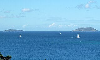
The British Virgin Islands (BVI) are one of three political divisions of the Virgin Islands archipelago located in the Lesser Antilles, between the Caribbean Sea and the North Atlantic Ocean. The BVI are the easternmost part of the island chain. The land area totals and comprises 16 inhabited and more than 20 uninhabited islands. The islands of Tortola, Anegada, Virgin Gorda and Jost van Dyke are the largest. Maritime claims include 12 nmi territorial sea and a 200 nmi exclusive fishing zone. In terms of land use, it is 20% arable land, 6.67% permanent crops and 73.33% other as of a 2005 figure. It has strong ties to nearby U.S. Virgin Islands and Puerto Rico.

<span class="mw-page-title-main">Geography of the United States Virgin Islands</span>

The United States Virgin Islands are a group of several dozen islands and cays located in the Caribbean, about 1,100 miles (1,770 km) southeast of Florida, 600 miles (966 km) north of Venezuela, 40 miles (64 km) east of Puerto Rico, and immediately west and south of the British Virgin Islands.

<span class="mw-page-title-main">Virgin Gorda</span> Island which is part of the British Virgin Islands

Virgin Gorda is the third-largest island and second-most populous of the British Virgin Islands (BVI).

<span class="mw-page-title-main">Virgin Islands National Park</span> 14,700 acres in St. John, Virgin Islands (US) managed by the National Park Service

The Virgin Islands National Park is an American national park preserving about 60% of the land area of Saint John in the United States Virgin Islands, as well as more than 5,500 acres of adjacent ocean, and nearly all of Hassel Island, just off the Charlotte Amalie, Saint Thomas harbor.

<span class="mw-page-title-main">Anegada</span> Northernmost of the British Virgin Islands

Anegada is the northernmost of the British Virgin Islands (BVI), a group of islands that form part of the archipelago of the Virgin Islands. It lies approximately 15 miles (24 km) north of Virgin Gorda. Anegada is the only inhabited British Virgin Island formed from coral and limestone, rather than being of volcanic origin. While the other islands are mountainous, Anegada is flat and low. Its highest point is only about 28 feet (8.5 m) above sea level, earning it its name, which is the Spanish term for the flooded land, "tierra anegada".

<span class="mw-page-title-main">Road Town</span> Capital and the largest city of the British Virgin Islands

Road Town, located on Tortola, is the capital of the British Virgin Islands. It is situated on the horseshoe-shaped Road Harbour in the centre of the island's south coast. The population was about 15,000 in 2018.

<span class="mw-page-title-main">Tortola</span> Largest of the British Virgin Islands

Tortola is the largest and most populated island of the British Virgin Islands, a group of islands that form part of the archipelago of the Virgin Islands. It has a surface area of 55.7 square kilometres with a total population of 23,908, with 9,400 residents in Road Town. Mount Sage is its highest point at 530 metres above sea level.

<span class="mw-page-title-main">Jost Van Dyke</span> Smallest of the four main islands of the British Virgin Islands

Jost Van Dyke is the smallest of the four main islands of the British Virgin Islands, measuring roughly 8 square kilometres. It rests in the northern portion of the archipelago of the Virgin Islands, located in the Atlantic Ocean and Caribbean Sea. Jost Van Dyke lies about 8 km (5 mi) to the northwest of Tortola and 8 km (5 mi) to the north of Saint John. Little Jost Van Dyke lies off its eastern end.

<span class="mw-page-title-main">Peter Island</span> Private island in the British Virgin Islands

Peter Island is a 720 hectares private island located in the British Virgin Islands (BVI). It is about 5 miles (8.0 km) south-west from Road Town, Tortola. The island was named after Pieter Adriensen who was the brother of Abraham Adriensen, Patron of Tortola under the Dutch West India Company in the early 17th century. Pieter Adriensen and Joost van Dyk built a fort and slave pens at Great Harbour on Peter Island to facilitate privateering and the nascent trade in slaves from Angola.

Great Dog Island is an uninhabited islet of the British Virgin Islands in the Caribbean. It is located in a smaller sub-group of islands referred to as the Dog Islands, or more commonly, "The Dogs". Other islets in The Dogs include Little Seal Dog Island, East Seal Dog Island, West Dog Island and George Dog Island, all of which are to the northwest of Virgin Gorda.

<span class="mw-page-title-main">Great Tobago Island</span>

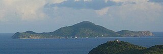
Great Tobago is an uninhabited island of the British Virgin Islands in the Caribbean, located, along with sister island Little Tobago, approximately six miles west of Jost Van Dyke. The Tobagos are the westernmost of the British Virgin Islands. At 210 acres (85 ha) in size, it is surrounded by steep cliffs that also extend below the water. Since the 1990s, Great Tobago, Little Tobago islands, and nearby Mercurious and Watson Rocks are protected as part of the National Parks Trust.

Nanny Cay is an island of the British Virgin Islands in the Caribbean. It is made up of three cays originally known as Big Cay, Little Cay and Miss Peggy Cay. In the 1970s these were consolidated into a single land mass for a marina and resort development. It is connected to Tortola by a short bridge. A marina, hotel, restaurants, condominiums and townhouses have now been built on Nanny Cay.

<span class="mw-page-title-main">Saba Rock</span>

Saba Rock is a small island of the British Virgin Islands in the Caribbean, approximately an acre and a half in size. The island contains a small hotel, restaurant, bar, and gift shop. A dock is available for day visitors and a large mooring field accommodates yachts staying overnight. The resort operates a boat shuttle from Saba Rock to Bitter End Yacht Club and Leverick Bay Marina.

<span class="mw-page-title-main">Dog Islands</span> Group of islets in the Caribbean

Dog Islands are a small group of islets among the British Virgin Islands in the Caribbean.

<span class="mw-page-title-main">Scrub Island (British Virgin Islands)</span>

Scrub Island of the British Virgin Islands in the Caribbean is a part of the Lesser Antilles, a group of islands that are young volcanic or coral islands. It is home to the Scrub Island Resort Marina and Spa.

<span class="mw-page-title-main">Cooper Island (British Virgin Islands)</span> Island in the British Virgin Islands

Cooper Island is a small island of the British Virgin Islands in the Caribbean.

<span class="mw-page-title-main">Bitter End Yacht Club</span> British Virgin Islands resort

The Bitter End Yacht Club is a British Virgin Islands resort located in the protected North Sound of Virgin Gorda. Founded in 1969, the resort is only accessible by boat.

<span class="mw-page-title-main">East End, Saint Thomas, U.S. Virgin Islands</span> Subdistrict

East End is an administrative subdistrict of the island of St. Thomas in the United States Virgin Islands. The largest community is Red Hook, while smaller communities include Benner, Nazareth, Nadir, Frydendal, and Smith Bay. The subdistrict includes the offshore islands of Great Saint James, Little Saint James, Bovoni Cay, Patricia Cay, Cas Cay, Rotto Cay, Thatch Cay, Shark Island, and Dog Island.

Oil Nut Bay is a coral reef bay situated on the northeast coast of Virgin Gorda in the British Virgin Islands, about 1 kilometre (0.62 mi) west of Pajaros Point.

References

  1. Eustatia
  2. "The Most Beautiful Islands in the World". Archived from the original on 11 October 2010. Retrieved 2021-03-02 via eustatiaprivateislandrental.com.
  3. "Luxury Living International Magazine - the Good Life: From Sleet and Snow to Sand and Sun: One Man's Journey to Island Ownership". Archived from the original on 30 April 2012. Retrieved 31 October 2012.
  4. "Gallery: Richest Island Owners". 28 June 2013.
  5. Diving British Virgin Islands, 1997, Jim and Odile Scheiner, p. 15, 25-26, 103-105
  6. The Concise Guide to Caribbean Weather, 1997, David Jones, p. 24
  7. "Nature in St. Eustatius heavily affected by Hurricane Irma - BES Reporter". 18 September 2017.
  8. "2010 Atlantic Hurricane Season". www.nhc.noaa.gov.
  9. Diving British Virgin Islands, 1997, Jim and Odile Scheiner, p.92
  10. "Family Friendly Virgin Gorda Resort - Bitter End Yacht Club". Bitter End Yacht Club.
  11. "Experience the beauty of the British Virgin Islands | Saba Rock Resort". Archived from the original on 27 January 2018. Retrieved 11 October 2010.
  12. "Biras Creek Resort - Biras Creek Resort". www.biras.com.
  13. "Leverick Bay - Home". Leverick Bay.
  14. "British Virgin Islands Vacations, Hotels - Travel Wizard". Travel Wizard.
  15. Limited, VLE. "Our Collection - Virgin Limited Edition". Virgin Limited Edition.
  16. Reef Fish Identification, 1994, Paul Humann, p. 87-90, 113-119, 139-149, 175-181, 193-207, 325, 331, 337-339, 390-395
  17. "Private Rental Available Now - About Eustatia Island". Archived from the original on 11 October 2010. Retrieved 2010-10-11.
  18. "Private Rental Available Now - About Eustatia Island". Archived from the original on 29 October 2010. Retrieved 2010-10-11.
  19. "Pirates & Privateers in the British Virgin Islands". www.b-v-i.com.