Allegany County is located in the northwestern part of the U.S. state of Maryland. As of the 2020 census, the population was 68,106. Its county seat is Cumberland. The name Allegany may come from a local Lenape word, welhik hane or oolikhanna, which means 'best flowing river of the hills' or 'beautiful stream'. A number of counties and a river in the Appalachian region of the U.S. are named Allegany, Allegheny, or Alleghany. Allegany County is part of the Cumberland, MD-WV Metropolitan Statistical Area. It is a part of the Western Maryland "panhandle".
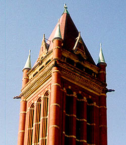
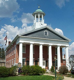
Bedford County is a county located in the U.S. state of Pennsylvania. As of the 2020 census, the population was 47,577. The county seat is Bedford.
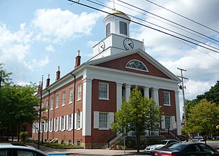
Fulton County is a county located in the U.S. state of Pennsylvania. As of the 2010 census, the population was 14,845, making it the fourth-least populous county in Pennsylvania. Its county seat is McConnellsburg. The county was created on April 19, 1850, from part of Bedford County and named for inventor Robert Fulton.

Bedford Township is a township in Bedford County, Pennsylvania, United States. The population was 5,161 at the 2020 census.
Colerain Township is a township in Bedford County, Pennsylvania, United States. The population was 1,127 at the 2020 census.
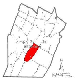
Cumberland Valley Township is a township in Bedford County, Pennsylvania, United States. The population was 1,445 at the 2020 census.

Snake Spring Township is a township in Bedford County, Pennsylvania, United States. The population was 1,830 at the 2020 census.

Southampton Township is a township in Bedford County, Pennsylvania, United States. The population was 839 at the 2020 census.
Rocky Gap State Park is a public recreation area with resort features located on Interstate 68, seven miles (11 km) east of Cumberland in Allegany County, Maryland. The state park's 3,000 acres (1,200 ha) include Lake Habeeb, Evitts Mountain, and the privately owned and operated Rocky Gap Casino Resort. The park offers water recreation, camping facilities, and hiking trails. The park is managed by the Maryland Department of Natural Resources, the resort by Golden Entertainment, Inc.
The Appalachian National Scenic Trail spans fourteen U.S. states during its roughly 2,200 miles (3,500 km)-long journey: Georgia, North Carolina, Tennessee, Virginia, West Virginia, Maryland, Pennsylvania, New Jersey, New York, Connecticut, Massachusetts, Vermont, New Hampshire, and Maine. The southern end is at Springer Mountain, Georgia, and it follows the ridgeline of the Appalachian Mountains, crossing many of its highest peaks and running almost continuously through wilderness before reaching the northern end at Mount Katahdin, Maine.
Morrisons Cove, is an eroded anticlinal valley in Blair and Bedford counties of central Pennsylvania, United States, extending from Evitts Mountain near New Enterprise, north to the Frankstown Branch Juniata River at Williamsburg. The width of the valley varies from 10 to 15 miles between Tussey Mountain on the east to the chain of Dunning, Loop and Lock Mountains on the west. Almost entirely enclosed by these mountains, the only openings in the cove are at Loysburg Gap in the south, McKee Gap in the west, and at Williamsburg to the north. The floor of the valley is mostly level, with many large fertile farm fields. The southern end of the valley drains to the Raystown Branch Juniata River via Yellow Creek through Loysburg Gap, and the northern end drains to the Frankstown Branch, via Clover Creek.

Cumberland, MD-WV MSA, or Cumberland Metro for short, is the Metropolitan Statistical Area of Cumberland, Maryland and the surrounding economic region of Allegany County, Maryland and Mineral County, West Virginia, in the United States.

Evitts Creek is a tributary stream of the North Branch Potomac River in the U.S. states of Pennsylvania and Maryland. The confluence of Evitts Creek and the North Branch Potomac River is located 2 miles (3 km) east of Cumberland, Maryland.

Wills Mountain is a quartzite-capped ridge in the Ridge and Valley physiographic province of the Appalachian Mountains in Pennsylvania and Maryland, United States, extending from near Bedford, Pennsylvania, to near Cumberland, Maryland. It is the northernmost of several mountain ridges included within the Wills Mountain Anticline.
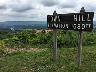
Town Hill is a mountain range located in Allegany County, Maryland and Bedford and Fulton Counties in Pennsylvania. Its southern end is 2.25 miles northwest of Kiefer in Allegany County. It trends northeasterly, and ends about 1.5 miles south of the town of Emmaville in Fulton County. Its highest elevation is 2000 feet.

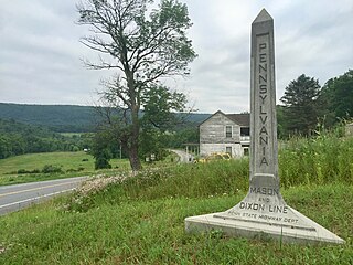
Tussey Mountain is a stratigraphic ridge in central Pennsylvania, United States, trending east of the Bald Eagle, Brush, Dunning and Evitts Mountain ridges. Its southern foot just crosses the Mason–Dixon line near Flintstone, Maryland, running north 130 km (80 mi) to the Seven Mountains of central Pennsylvania, near Tusseyville, making it one of the longest named ridges in this section of the Ridge-and-valley Appalachians. The ridge line separates Morrison Cove from the Woodcock Valley and Friends Cove from the Black Valley. Tussey Mountain lies in, and the ridge line forms parts of the borders of, Centre, Blair, Bedford and Huntingdon counties.

The Standing Stone Trail is an 84.2-mile (135.5 km) linear hiking trail in south-central Pennsylvania, leading from Cowans Gap State Park in Fulton County, north to Detweiler Run Natural Area in Huntingdon County. Most of the trail follows rocky ridgetops in the Appalachian Mountains, with some walking through agricultural valleys and small towns, and it also passes through various segments of Rothrock State Forest and four different State Game Lands. It was constructed to connect the Tuscarora Trail and Mid State Trail, and it is a component of the Great Eastern Trail network.
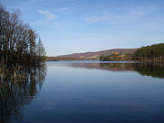
Lake Habeeb is a reservoir of 243 acres (0.98 km2) and is located in Allegany County, Maryland, United States. The lake is fed by Rocky Gap Run, and nestled against the east side of the southern tip of Evitts Mountain. The dam was built by the Army Corps of Engineers in 1970 and Rocky Gap State Park formally opened on July 17, 1974, it attains a maximum depth of 74 feet (23 m) near its earthen dam. It offers three public beach areas along Habeeb's 9.4-mile (15.1 km) shoreline, as well as a fishery.

Doughton Park is the largest recreation area the National Park Service manages on the Blue Ridge Parkway. It is located between mile markers 238.5 - 244.7 on the border between Wilkes and Alleghany Counties in North Carolina. Doughton Park consists of highland meadows with numerous scenic overlooks, miles of hiking and bridle trails, areas for camping and cookouts, and it is one of the few areas on the Parkway that has a restaurant along with an adjacent visitors center maintained by the National Park Service. Elevations in Doughton Park generally range from 3,500 to 4,000 feet. The park is named after North Carolina politician Robert L. Doughton, who lived in nearby Laurel Springs, North Carolina and who as a US Congressman played a key role in the creation of the Blue Ridge Parkway in the 1930s.

Dunning Mountain is a stratigraphic ridge in central Pennsylvania, United States. The mountain's north end is at McKee Gap, which separates it from Short Mountain, and where Halter Creek flows westward towards the Frankstown Branch of the Juniata River. The south end of the mountain is contiguous with Evitts Mountain, but is marked by a sharp bend to the east. The valley formed by the bend is known as "The Kettle," and the broad valley to the east of Dunning Mountain is called Morrisons Cove. The town of Roaring Spring is located at the north end of the mountain on the east side.
