Guntersville, Alabama

Last updated

Guntersville, Alabama
Marshall County Alabama Incorporated and Unincorporated areas Guntersville Highlighted 0132416.svg
Location in Marshall County, Alabama
Coordinates: 34°20′53″N86°17′40″W / 34.34806°N 86.29444°W / 34.34806; -86.29444
Country United States
State Alabama
County Marshall
Government
  MayorLeigh Dollar [1] [2]
Area
[3]
  Total42.70 sq mi (110.59 km2)
  Land25.64 sq mi (66.39 km2)
  Water17.06 sq mi (44.19 km2)
Elevation
[4]
607 ft (185 m)
Population
 (2020) [5]
  Total8,553
  Density333.65/sq mi (128.82/km2)
Time zone UTC−6 (Central (CST))
  Summer (DST) UTC−5 (CDT)
ZIP Code
35976
Area code 256
FIPS code 01-32416
GNIS feature ID2403774 [4]
Website guntersvilleal.org

Guntersville (previously known as Gunter's Ferry and later Gunter's Landing) is a city and the county seat of Marshall County, Alabama, United States. At the 2020 census, the population of the city was 8,553. [5] Guntersville is located in a HUBZone as identified by the U.S. Small Business Administration (SBA).

Contents

History

Guntersville was founded by John Gunter (1765–1835), the great-grandfather of American humorist Will Rogers. [6] Gunter's own great-great-grandfather, of Welsh-English descent, had emigrated to the New World in 1644. Gunter was the wealthy owner of a salt mine in the early 19th century. In order to obtain more land to mine, Gunter struck a deal with the Cherokee tribe that inhabited the area to use in his household as servants. As part of the deal, Gunter married the daughter (Ghe-No-He-Li, aka Katy and Cathrine) of the tribe's chief (Chief Bushyhead of the Paint Clan) and agreed to give salt to the tribe. A town sprung up next to the mine and was named after Gunter. The town of Guntersville puts on a festival every July to celebrate Will Rogers, which involves many activities which were of interest to Rogers.[ citation needed ]

Initially incorporated as "Gunter's Landing" in 1848, it won the contest to become county seat from Warrenton (which had been the seat since 1841). It formally changed its name to Guntersville in 1854. [7]

The United States Navy began operating a fleet of gunboats on the Tennessee River in late 1864. Confederate troops mounted a spirited defense of the river from Guntersville. In January 1865, the USS General Grant attempted to destroy the town in retaliation. [8]

For much of the 20th century, the economy of Guntersville revolved around cotton processing, especially with the Saratoga Victory Mill.

Geography

Guntersville is located in central Marshall County at 34°20′54″N86°17′40″W / 34.34833°N 86.29444°W / 34.34833; -86.29444 (34.348197, −86.294523). [9] U.S. Route 431 (Gunter Avenue and Blount Avenue) is the main road through the city, leading northwest 37 miles (60 km) to Huntsville, and southeast 10 miles (16 km) to Albertville. Gadsden is 36 miles (58 km) to the southeast via US 431.

According to the U.S. Census Bureau, the city of Guntersville has a total area of 42.7 square miles (110.6 km2), of which 25.6 square miles (66.4 km2) are land and 17.1 square miles (44.2 km2), or 40.0%, are water. [3] Guntersville is located at the southernmost point of the Tennessee River on Lake Guntersville, formed by the Guntersville Dam (built by the Tennessee Valley Authority). Geologically, the lake occupies a southern extension of the Sequatchie Valley, which continues south as Browns Valley.

Climate

Climate data for Guntersville, Alabama, 1991–2020 normals, extremes 1910present
MonthJanFebMarAprMayJunJulAugSepOctNovDecYear
Record high °F (°C)78
(26)
82
(28)
88
(31)
94
(34)
99
(37)
103
(39)
106
(41)
105
(41)
102
(39)
99
(37)
87
(31)
78
(26)
106
(41)
Mean maximum °F (°C)69.1
(20.6)
72.7
(22.6)
79.2
(26.2)
84.2
(29.0)
88.8
(31.6)
93.6
(34.2)
95.6
(35.3)
95.7
(35.4)
92.8
(33.8)
85.6
(29.8)
77.0
(25.0)
70.0
(21.1)
97.3
(36.3)
Mean daily maximum °F (°C)50.4
(10.2)
54.8
(12.7)
63.3
(17.4)
71.9
(22.2)
79.5
(26.4)
86.1
(30.1)
88.9
(31.6)
88.7
(31.5)
83.9
(28.8)
73.6
(23.1)
62.0
(16.7)
53.3
(11.8)
71.4
(21.9)
Daily mean °F (°C)41.8
(5.4)
45.3
(7.4)
53.0
(11.7)
61.2
(16.2)
69.6
(20.9)
77.1
(25.1)
80.3
(26.8)
79.9
(26.6)
74.7
(23.7)
63.5
(17.5)
52.1
(11.2)
44.8
(7.1)
61.9
(16.6)
Mean daily minimum °F (°C)33.1
(0.6)
35.8
(2.1)
42.8
(6.0)
50.4
(10.2)
59.7
(15.4)
68.1
(20.1)
71.6
(22.0)
71.1
(21.7)
65.4
(18.6)
53.5
(11.9)
42.3
(5.7)
36.3
(2.4)
52.5
(11.4)
Mean minimum °F (°C)15.9
(−8.9)
20.9
(−6.2)
26.4
(−3.1)
35.5
(1.9)
45.8
(7.7)
59.4
(15.2)
64.8
(18.2)
63.5
(17.5)
52.6
(11.4)
37.8
(3.2)
27.9
(−2.3)
22.3
(−5.4)
14.1
(−9.9)
Record low °F (°C)−11
(−24)
−2
(−19)
11
(−12)
25
(−4)
36
(2)
44
(7)
48
(9)
48
(9)
38
(3)
26
(−3)
7
(−14)
−2
(−19)
−11
(−24)
Average precipitation inches (mm)5.31
(135)
5.40
(137)
5.65
(144)
4.99
(127)
4.56
(116)
4.73
(120)
4.31
(109)
4.02
(102)
4.16
(106)
3.48
(88)
4.19
(106)
5.97
(152)
56.77
(1,442)
Average snowfall inches (cm)0.1
(0.25)
0.5
(1.3)
0.1
(0.25)
0.0
(0.0)
0.0
(0.0)
0.0
(0.0)
0.0
(0.0)
0.0
(0.0)
0.0
(0.0)
0.0
(0.0)
0.0
(0.0)
0.0
(0.0)
0.7
(1.8)
Average precipitation days (≥ 0.01 in)11.912.412.510.710.310.911.49.97.87.79.912.7128.1
Average snowy days (≥ 0.1 in)0.10.20.20.00.00.00.00.00.00.00.00.10.6
Source 1: NOAA [10]
Source 2: National Weather Service [11]

Demographics

Historical population
CensusPop.Note
1870 244
1880 32533.2%
1890 47144.9%
1900 61831.2%
1910 1,14585.3%
1920 1,90966.7%
1930 2,82648.0%
1940 4,39855.6%
1950 5,25319.4%
1960 6,59225.5%
1970 6,491−1.5%
1980 7,0418.5%
1990 7,0380.0%
2000 7,3955.1%
2010 8,19710.8%
2020 8,5534.3%
U.S. Decennial Census [12]
2013 Estimate [13]

2000 census

At the 2000 census, [14] there were 7,395 people, 3,061 households and 1,971 families living in the city. The population density was 312.7 inhabitants per square mile (120.7/km2). There were 3,518 housing units at an average density of 148.8 per square mile (57.5/km2). The racial makeup of the city was 88.17% White, 8.53% Black or African American, 0.49% Native American, 0.41% Asian, 0.01% Pacific Islander, 0.95% from other races, and 1.45% from two or more races. 2.87% of the population were Hispanic or Latino of any race.

There were 3,061 households, of which 27.5% had children under the age of 18 living with them, 47.5% were married couples living together, 13.7% had a female householder with no husband present, and 35.6% were non-families. Of all households, 32.4% were made up of individuals, and 14.4% had someone living alone who was 65 years of age or older. The average household size was 2.28 and the average family size was 2.88.

Age distribution was 22.4% under the age of 18, 7.1% from 18 to 24, 27.0% from 25 to 44, 24.3% from 45 to 64, and 19.2% who were 65 years of age or older. The median age was 41 years. For every 100 females, there were 88.8 males. For every 100 females age 18 and over, there were 84.8 males.

The median household income was $29,882, and the median family income was $39,464. Males had a median income of $36,175 versus $20,480 for females. The per capita income for the city was $18,503. About 11.2% of families and 14.2% of the population were below the poverty line, including 15.2% of those under age 18 and 16.3% of those age 65 or over.

2010 census

At the 2010 census, [15] there were 8,197 people, 3,388 households and 2,167 families living in the city. The population density was 347.3 inhabitants per square mile (134.1/km2). There were 3,872 housing units at an average density of 152.4 per square mile (58.8/km2). The racial makeup of the city was 85.8% White, 7.8% Black or African American, 0.5% Native American, 1.5% Asian, 0.0% Pacific Islander, 2.5% from other races, and 1.9% from two or more races. 3.8% of the population were Hispanic or Latino of any race.

There were 3,388 households, of which 25.3% had children under the age of 18 living with them, 45.9% were married couples living together, 13.8% had a female householder with no husband present, and 36.0% were non-families. Of all households, 31.8% were made up of individuals, and 14.3% had someone living alone who was 65 years of age or older. The average household size was 2.29 and the average family size was 2.87.

Age distribution was 21.0% under the age of 18, 7.4% from 18 to 24, 22.8% from 25 to 44, 28.6% from 45 to 64, and 20.2% who were 65 years of age or older. The median age was 43.9 years. For every 100 females, there were 92.5 males. For every 100 females age 18 and over, there were 96.8 males.

The median household income was $38,094, and the median family income was $57,610. Males had a median income of $39,063 versus $31,410 for females. The per capita income for the city was $23,468. About 16.9% of families and 20.5% of the population were below the poverty line, including 34.9% of those under age 18 and 19.1% of those age 65 or over.

2020 census

Guntersville racial composition [16]
RaceNum.Perc.
White (non-Hispanic)6,94281.16%
Black or African American (non-Hispanic)7458.71%
Native American 340.4%
Asian 931.09%
Other/Mixed 3544.14%
Hispanic or Latino 3854.5%

As of the 2020 United States census, there were 8,553 people, 3,312 households, and 2,179 families residing in the city.

Recreation

Guntersville sits on the shore of 69,100-acre (28,000 ha) Guntersville Lake, the biggest lake in Alabama. [17] The lake is maintained and managed by the Tennessee Valley Authority. The 2014 and 2020 Bassmaster Classic were held on Guntersville Lake. [18]

Government

The current[ date missing ] mayor is Leigh Dollar, the daughter of a previous mayor, and the first female to hold mayor's office in Guntersville.[ citation needed ]

Education

Guntersville has one school system in the town which is made up of four schools; Guntersville Elementary School (Kindergarten-2nd grade), Cherokee Elementary School (3rd–5th grade), Guntersville Middle School (6th–8th grade), and Guntersville High School (9th–12th grade). In 2006 Guntersville High School won the 4A football state championship, which is the only football state championship recorded by a school in Marshall County, Alabama. [19]

Culture

Guntersville was the last place in which Ricky Nelson ever performed as a singer. His last performance was at PJ's Alley in Guntersville on Monday, December 30, 1985. His private plane departed Guntersville the next day, New Year's Eve, and crashed near DeKalb, Texas. [20] [21]

In Hunting Mister Heartbreak: A Discovery of America , the British author Jonathan Raban becomes a temporary resident of the city, to which he takes a liking in his conservative persona as John Rayburn. He is aware, however, that were his real views known the people of Guntersville might have been less welcoming. "Scratch John Rayburn, and he'd confess my own thoughts on politics, books, religion − thoughts that wouldn't wash in Guntersville." [22]

Notable people

Related Research Articles

<span class="mw-page-title-main">Morgan County, Alabama</span> County in Alabama, United States

Morgan County is a county in the north-central part of the U.S. state of Alabama. As of the 2020 census, its population was 123,421. The county seat is Decatur. On June 14, 1821, it was renamed in honor of American Revolutionary War General Daniel Morgan of Virginia. It is a prohibition or dry county, although alcohol sales are allowed in the cities of Decatur, Hartselle, and Priceville. Morgan County is included in the Decatur, AL Metropolitan Statistical Area, which is also included in the Huntsville-Decatur-Albertville, AL Combined Statistical Area. It is a part of the North, Northwest, and North-Central regions of Alabama.

<span class="mw-page-title-main">Marshall County, Alabama</span> County in Alabama, United States

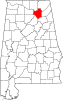
Marshall County is a county of the state of Alabama, United States. As of the 2020 census the population was 97,612. Its county seat is Guntersville. A second courthouse is in Albertville. Its name is in honor of John Marshall, famous Chief Justice of the United States. Marshall County is a dry county, with the exception of the five cities of Albertville, Arab, Grant, Guntersville, and Boaz. Marshall County comprises the Albertville, AL Micropolitan Statistical Area, which is also included in the Huntsville-Decatur-Albertville, AL Combined Statistical Area.

<span class="mw-page-title-main">Cleveland, Alabama</span> Town in Alabama, United States

Cleveland is a town in Blount County, Alabama, United States. At the 2020 census, the population was 1,245.

<span class="mw-page-title-main">Arab, Alabama</span> City in Alabama, United States

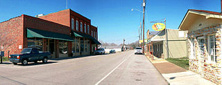
Arab is a city in Marshall County in the northern part of the U.S. state of Alabama, located 10 miles (16 km) from Guntersville Lake and Guntersville Dam, and is included in the Huntsville-Decatur Combined Statistical Area. The population was 8,461 at the 2020 census.

<span class="mw-page-title-main">Good Hope, Alabama</span> City in Alabama, United States

Good Hope is a city in Cullman County, Alabama, United States. As of the 2010 census, the population of the city was 2,264. It incorporated in April 1962.

<span class="mw-page-title-main">Hokes Bluff</span> City in Alabama, United States

Hokes Bluff is a city in Etowah County, Alabama, United States. It is part of the Gadsden Metropolitan Statistical Area. At the 2020 census, the population was 4,446.

<span class="mw-page-title-main">Bridgeport, Alabama</span> City in Alabama, United States

Bridgeport is a city in Jackson County, Alabama, United States. At the time of 2020 census the population was 2,264, down from 2,418 in 2010. Bridgeport is included in the Chattanooga-Cleveland-Dalton, TN-GA-AL Combined Statistical Area.

<span class="mw-page-title-main">Langston, Alabama</span> Town in Alabama, United States

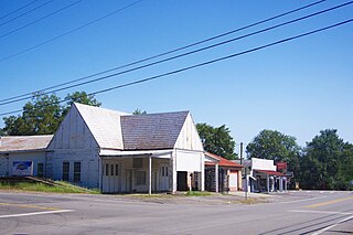
Langston is a town in Jackson County, Alabama, United States, and is included in the Chattanooga-Cleveland-Dalton, TN-GA-AL Combined Statistical Area. In the 2010 census, the population was 270, up from 254. It initially incorporated in 1899. At some point after 1920 it disincorporated, then reincorporated in 1980. Its peak population was 500, in 1920.

<span class="mw-page-title-main">Pisgah, Alabama</span> Town in Alabama, United States

Pisgah is a town in Jackson County, Alabama, United States, and is included in the Huntsville-Decatur Combined Statistical Area. It incorporated in 1947. As of the 2020 census, the population of the town was 681, down from 722 in 2010. Pisgah is located atop Sand Mountain.

<span class="mw-page-title-main">Meridianville, Alabama</span> Census-designated place in Alabama, United States

Meridianville is an unincorporated community and census-designated place (CDP) in Madison County, Alabama, United States, and is included in the Huntsville-Decatur Combined Statistical Area. As of the 2020 census, the population of the CDP was 8,209.

<span class="mw-page-title-main">New Hope, Alabama</span> City in Alabama, United States

New Hope is a city in Madison County, Alabama, United States, and is included in the Huntsville-Decatur Combined Statistical Area. The population was 2,889 at the 2020 census.

<span class="mw-page-title-main">New Market, Alabama</span> Census-designated place in Alabama, United States

New Market is an unincorporated community and census-designated place (CDP) in Madison County, Alabama, United States, and is included in the Huntsville-Decatur Combined Statistical Area. As of the 2020 census, the population of the CDP was 1,543. Although it was the first area settled in Madison County, the town has never been incorporated.

<span class="mw-page-title-main">Owens Cross Roads, Alabama</span> Town in Alabama, United States

Owens Cross Roads is a town in Madison County, Alabama, United States, and is included in the Huntsville-Decatur Combined Statistical Area. It was incorporated on October 9, 1967. The population was 2,594 at the 2020 census.

<span class="mw-page-title-main">Albertville, Alabama</span> City in Alabama, United States

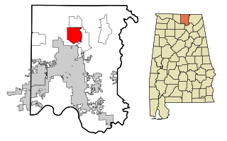
Albertville is a city in Marshall County, Alabama, United States, and is included in the Huntsville-Decatur Combined Statistical Area. The population was 22,386 at the 2020 census. It is the largest city in Marshall County.

<span class="mw-page-title-main">Douglas, Alabama</span> Town in Alabama, United States

Douglas is a town in Marshall County, Alabama, United States. Douglas, a part of the Huntsville–Decatur Combined Statistical Area, had a population of 761 as of the 2020 census. The town incorporated in 1978.

<span class="mw-page-title-main">Grant, Alabama</span> Town in Alabama, United States

Grant is a town in Marshall County, Alabama, United States. As of the 2020 census, the population of Grant was 1,039, up from 896 at the 2010 census. It is included in the Huntsville-Decatur Combined Statistical Area. The town was incorporated on November 15, 1945, with Delbert Hodges serving as the first mayor.

<span class="mw-page-title-main">Union Grove, Alabama</span> Town in Alabama, United States

Union Grove is a town in Marshall County, Alabama, United States, and is included in the Huntsville-Decatur Combined Statistical Area. As of the 2020 census, the population of the town was 67, down from 77 at the 2010 census.

<span class="mw-page-title-main">Hartselle, Alabama</span> City in Alabama, United States

Hartselle is the second largest city in Morgan County, Alabama, United States, 13 miles (21 km) south of Decatur. It is part of the Decatur Metropolitan Area and the Huntsville-Decatur Combined Statistical Area.

<span class="mw-page-title-main">Trinity, Alabama</span> Town in Alabama, United States

Trinity is a town in Morgan County, Alabama, United States. It is included in the Decatur Metropolitan Area and the Huntsville-Decatur Combined Statistical Area. As of the 2020 census, the population of the town was 2,526, up from 2,095 in 2010. It was incorporated in 1901.

<span class="mw-page-title-main">Huntsville, Arkansas</span> City in Arkansas, United States

Huntsville is a city in and the county seat of Madison County, Arkansas, United States. The population was 2,879 at the 2020 census, up from 2,346 in 2010. During the American Civil War in 1862, it was the site of what became known as the Huntsville Massacre. Huntsville is part of the Northwest Arkansas region.

References

  1. "Mayor & Council | City of Guntersville, AL". guntersvilleal.org. Archived from the original on November 28, 2020. Retrieved April 13, 2021.
  2. Cagle, Joe (November 7, 2020). "New mayor, council sworn in". The Advertiser-Gleam. Archived from the original on November 7, 2020. Retrieved April 13, 2021.
  3. 1 2 "2021 U.S. Gazetteer Files". United States Census Bureau. Retrieved April 15, 2022.
  4. 1 2 U.S. Geological Survey Geographic Names Information System: Guntersville, Alabama
  5. 1 2 "Guntersville city, Alabama: 2020 DEC Redistricting Data (PL 94-171)". U.S. Census Bureau. Retrieved April 15, 2022.
  6. Roylance, Frank D. (March 11, 2001). "A family tree's American tale". The Baltimore Sun. Retrieved September 2, 2021.
  7. "Guntersville".
  8. Miller, Francis Trevelyan (1957). The Photographic History of The Civil War. Vol. Six: The Navies. New York: Castle Books. p. 233.
  9. "US Gazetteer files: 2010, 2000, and 1990". United States Census Bureau. February 12, 2011. Retrieved April 23, 2011.
  10. "U.S. Climate Normals Quick Access – Station: Guntersville, AL". National Oceanic and Atmospheric Administration. Retrieved March 4, 2023.
  11. "NOAA Online Weather Data – NWS Huntsville". National Weather Service. Retrieved March 4, 2023.
  12. "U.S. Decennial Census". Census.gov. Retrieved June 6, 2013.
  13. "Annual Estimates of the Resident Population: April 1, 2010 to July 1, 2013". Archived from the original on May 22, 2014. Retrieved June 3, 2014.
  14. "U.S. Census website". United States Census Bureau . Retrieved January 31, 2008.
  15. "U.S. Census website". United States Census Bureau . Retrieved August 3, 2015.
  16. "Explore Census Data". data.census.gov. Retrieved December 11, 2021.
  17. "Lake Guntersville". Outdoor Alabama. Alabama Department of Conservation and Natural Resources. Retrieved October 4, 2021.
  18. Sargeant, Frank; Times, The Huntsville (February 24, 2014). "Randy Howell of Springville wins 2014 Bassmaster Classic (photos)". al. Retrieved September 2, 2021.
  19. "AHSAA | 2006 Football Bracket - Class 4A". dnn.ahsaa.com. Retrieved September 2, 2021.
  20. "Rick Nelson dies in a plane crash". HISTORY. Retrieved September 2, 2021.
  21. "Guntersville musician to be reunited with Ricky Nelson's sons after being reunited with long-lost mementos (Mark McCarter)". al. January 19, 2013. Retrieved September 2, 2021.
  22. Raban, Jonathan (1991). Hunting Mister Heartbreak . New York: HarperCollins. pp.  218. ISBN   0060182091.
  23. "More honors for Bentley". The Advertiser-Gleam. November 18, 2014. Retrieved September 2, 2021.
  24. "SEC football's notable NCAA cases over the years". al. February 26, 2017. Retrieved September 2, 2021.
  25. "The Last Long River Trip of Mississippi Bill Harris". The Advertiser-Gleam. August 9, 2017. Retrieved September 2, 2021.
  26. Martin, Ann Marie (April 29, 2012). "Jefferson Bass writing team will visit Huntsville library to discuss new novel, 'The Inquisitor's Key'". al. Retrieved September 2, 2021.
  27. "Jon Jefferson". HarperCollins Speakers Bureau. Retrieved September 2, 2021.
  28. McGregor, Cindy (March 11, 2017). "Grew up during segregation and made it to NASA". The Advertiser-Gleam. Retrieved September 2, 2021.
  29. "STARNES, Joe | US House of Representatives: History, Art & Archives". history.house.gov. Retrieved September 2, 2021.
  30. "How Conrad Thompson became a wrestling podcasting mogul". al. November 15, 2017. Retrieved September 2, 2021.
  31. Staff REPORTS (October 2, 2019). "Guntersville deems Oct. 12 as Pat Upton Day". sandmountainreporter.com. Retrieved September 2, 2021.