Hamilton, Alabama

Last updated

Hamilton, Alabama
Marion County Alabama Incorporated and Unincorporated areas Hamilton Highlighted 0132848.svg
Location in Marion County, Alabama
Coordinates: 34°8′7″N87°59′20″W / 34.13528°N 87.98889°W / 34.13528; -87.98889
Country United States
State Alabama
County Marion
Area
[1]
  Total38.08 sq mi (98.6 km2)
  Land38.06 sq mi (98.6 km2)
  Water0.01 sq mi (0.03 km2)
Elevation
489 ft (149 m)
Population
 (2020) [2]
  Total7,042
  Density185.01/sq mi (71.43/km2)
Time zone UTC-6 (Central (CST))
  Summer (DST) UTC-5 (CDT)
ZIP code
35570
Area code(s) 205, 659
FIPS code 01-32848
GNIS feature ID0119627
Website hamiltoncityal.org

Hamilton is a city in and the county seat of Marion County, Alabama, United States. It incorporated in 1896 [3] and since 1980 has been the county's largest city, surpassing Winfield. It was previously the largest town in 1910. [4] At the 2020 census, the population was 7,042. [2]

Contents

History

Hamilton was founded in the early 19th century by settlers who moved to the Alabama Territory from Tennessee, Kentucky, Virginia, Georgia and the Carolinas. It is built upon lands that once served as "hunting grounds" for the Chickasaw people. The city was first called "Toll Gate", but its name later changed in honor of one of its distinguished citizens, Captain Albert James Hamilton (known as A.J. Hamilton), who had represented Marion County in the state legislature in the sessions of 1869, 1874 and 1875. Captain Hamilton donated forty acres of his land to the town. The same forty acres were then divided into lots and sold to help defray the cost of building the courthouse. [5] The Toll Gate community was elected in 1881 to be the next county seat, and by 1883 the Marion County courthouse in Pikeville had ceased to be functional. When the courthouse was moved from Pikeville to Toll Gate, the town's name was then changed from Toll Gate to Hamilton. On March 30, 1887, the newly built county courthouse was destroyed by fire. [6] It was again rebuilt with wood, but replaced in 1901 with native sandstone.

During the Civil War, Union forces passed through the town in search of goods and horses. A detachment of Wilson's Cavalry destroyed by fire the plantation belonging to the Helvingstons on the Military Ford, south of Toll Gate (Hamilton). [7]

Geography

Hamilton is located west of the center of Marion County, in the valley of the Buttahatchee River. Interstate 22 passes around the southern and western sides of the city, with access from Exits 7, 11, 14, and 16. I-22 leads west 45 miles (72 km) to Tupelo, Mississippi, and southeast 89 miles (143 km) to Birmingham. U.S. Routes 43 and 278 pass through Hamilton. US 43 leads north 53 miles (85 km) to Florence, while US 278 leads east 74 miles (119 km) to Cullman. The two highways join at the center of Hamilton and lead south together 13 miles (21 km) to Guin.

According to the United States Census Bureau, Hamilton has a total area of 38.1 square miles (99 km2), of which 0.01 square miles (0.03 km2), 0.04%, are water. [1] The Buttahatchee River, a tributary of the Tombigbee River, flows northeast to southwest through the city, east of downtown.

Climate

According to the Köppen Climate Classification system, Hamilton has a humid subtropical climate, abbreviated "Cfa" on climate maps. The hottest temperature recorded in Hamilton was 109 °F (42.8 °C) on August 16, 2007, while the coldest temperature recorded was −19 °F (−28.3 °C) on January 30, 1966. [8]

Climate data for Hamilton, Alabama, 1991–2020 normals, extremes 1962–present
MonthJanFebMarAprMayJunJulAugSepOctNovDecYear
Record high °F (°C)79
(26)
87
(31)
90
(32)
95
(35)
98
(37)
103
(39)
107
(42)
109
(43)
104
(40)
102
(39)
91
(33)
81
(27)
109
(43)
Mean maximum °F (°C)72.3
(22.4)
76.8
(24.9)
84.0
(28.9)
88.1
(31.2)
91.5
(33.1)
95.9
(35.5)
98.3
(36.8)
98.7
(37.1)
95.8
(35.4)
88.8
(31.6)
80.4
(26.9)
72.8
(22.7)
100.2
(37.9)
Mean daily maximum °F (°C)52.5
(11.4)
57.6
(14.2)
66.7
(19.3)
75.1
(23.9)
81.9
(27.7)
88.5
(31.4)
91.5
(33.1)
91.3
(32.9)
86.5
(30.3)
76.1
(24.5)
64.1
(17.8)
55.1
(12.8)
73.9
(23.3)
Daily mean °F (°C)40.4
(4.7)
44.3
(6.8)
52.1
(11.2)
60.1
(15.6)
68.5
(20.3)
76.3
(24.6)
79.8
(26.6)
79.1
(26.2)
73.3
(22.9)
61.6
(16.4)
50.1
(10.1)
43.3
(6.3)
60.7
(16.0)
Mean daily minimum °F (°C)28.3
(−2.1)
31.1
(−0.5)
37.5
(3.1)
45.1
(7.3)
55.1
(12.8)
64.1
(17.8)
68.1
(20.1)
66.9
(19.4)
60.1
(15.6)
47.1
(8.4)
36.1
(2.3)
31.4
(−0.3)
47.6
(8.7)
Mean minimum °F (°C)9.5
(−12.5)
13.9
(−10.1)
19.3
(−7.1)
27.4
(−2.6)
38.5
(3.6)
52.3
(11.3)
59.1
(15.1)
57.3
(14.1)
43.9
(6.6)
29.1
(−1.6)
19.5
(−6.9)
15.2
(−9.3)
7.5
(−13.6)
Record low °F (°C)−19
(−28)
−1
(−18)
5
(−15)
21
(−6)
30
(−1)
37
(3)
48
(9)
46
(8)
30
(−1)
21
(−6)
9
(−13)
−5
(−21)
−19
(−28)
Average precipitation inches (mm)5.46
(139)
6.01
(153)
5.29
(134)
6.09
(155)
5.79
(147)
4.86
(123)
5.12
(130)
4.31
(109)
3.94
(100)
3.84
(98)
4.58
(116)
6.42
(163)
61.71
(1,567)
Average snowfall inches (cm)0.4
(1.0)
0.4
(1.0)
0.3
(0.76)
0.0
(0.0)
0.0
(0.0)
0.0
(0.0)
0.0
(0.0)
0.0
(0.0)
0.0
(0.0)
0.0
(0.0)
0.0
(0.0)
0.2
(0.51)
1.3
(3.27)
Average precipitation days (≥ 0.01 in)10.510.210.58.78.99.610.29.16.36.88.510.0109.3
Average snowy days (≥ 0.1 in)0.40.30.10.00.00.00.00.00.00.00.00.21.0
Source 1: NOAA [9]
Source 2: National Weather Service [8]

Demographics

Historical population
CensusPop.Note
1900 235
1910 42279.6%
1920 48715.4%
1930 69542.7%
1940 1,00244.2%
1950 1,62362.0%
1960 1,93419.2%
1970 3,08859.7%
1980 5,09364.9%
1990 5,78713.6%
2000 6,78617.3%
2010 6,8851.5%
2020 7,0422.3%
U.S. Decennial Census [10]

2000 census

At the 2000 census there were 6,786 people, 2,695 households, and 1,800 families living in the city. The population density was 188.0 inhabitants per square mile (72.6/km2). There were 3,065 housing units at an average density of 84.9 per square mile (32.8/km2). The racial makeup of the city was 90.41% White, 7.59% Black or African American, 0.32% Native American, 0.49% Asian, 0.03% Pacific Islander, 0.49% from other races, and 0.68% from two or more races. 1.71% of the population were Hispanic or Latino of any race. [11] Of the 2,695 households 28.3% had children under the age of 18 living with them, 52.6% were married couples living together, 11.3% had a female householder with no husband present, and 33.2% were non-families. 30.6% of households were one person and 14.4% were one person aged 65 or older. The average household size was 2.26 and the average family size was 2.81.

The age distribution was 19.8% under the age of 18, 8.9% from 18 to 24, 29.0% from 25 to 44, 25.9% from 45 to 64, and 16.5% 65 or older. The median age was 40 years. For every 100 females, there were 106.9 males. For every 100 females age 18 and over, there were 106.6 males.

The median household income was $27,489 and the median family income was $34,485. Males had a median income of $26,362 versus $18,681 for females. The per capita income for the city was $17,505. About 12.0% of families and 17.8% of the population were below the poverty line, including 23.7% of those under age 18 and 19.6% of those age 65 or over.

2010 census

At the 2010 census there were 6,885 people, 2,717 households, and 1,793 families living in the city. The population density was 190.7 inhabitants per square mile (73.6/km2). There were 3,096 housing units at an average density of 85.8 per square mile (33.1/km2). The racial makeup of the city was 89.3% White, 7.7% Black or African American, 0.4% Native American, 0.2% Asian, 0.0% Pacific Islander, 1.2% from other races, and 1.1% from two or more races. 3.1% of the population were Hispanic or Latino of any race. [12] Of the 2,717 households 25.2% had children under the age of 18 living with them, 48.1% were married couples living together, 13.7% had a female householder with no husband present, and 34.0% were non-families. 30.9% of households were one person and 13.7% were one person aged 65 or older. The average household size was 2.30 and the average family size was 2.83.

The age distribution was 19.9% under the age of 18, 7.5% from 18 to 24, 25.1% from 25 to 44, 28.4% from 45 to 64, and 19.0% 65 or older. The median age was 43.2 years. For every 100 females, there were 106.8 males. For every 100 females age 18 and over, there were 111.2 males.

The median household income was $31,297 and the median family income was $42,361. Males had a median income of $31,112 versus $30,542 for females. The per capita income for the city was $17,442. About 12.1% of families and 19.2% of the population were below the poverty line, including 30.1% of those under age 18 and 15.5% of those age 65 or over.

2020 census

Hamilton racial composition [13]
RaceNum.Perc.
White (non-Hispanic)5,90783.88%
Black or African American (non-Hispanic)4916.97%
Native American 300.43%
Asian 230.33%
Pacific Islander 70.1%
Other/Mixed 2924.15%
Hispanic or Latino 2924.15%

As of the 2020 United States census, there were 7,042 people, 2,684 households, and 1,695 families residing in the city.

Arts and culture

Several cemeteries in Hamilton still celebrate annual Decoration Days in the spring and summer.[ citation needed ]

Artifacts

Festivals

Parades

Parks and recreation

Education

Hamilton is a part of the Marion County School District. Hamilton Elementary School, Hamilton Middle School, and Hamilton High School serve the Hamilton area.

Hamilton has a branch campus of Bevill State Community College.

Media

Hamilton's local newspaper, The Journal Record, has a second office in Winfield, Alabama.

Hamilton is home to two local television stations: WMTY TV 46 (cable channel 5 ), and TV8-WATVC.

Infrastructure

Marion County – Rankin Fite Airport is located in Hamilton. [19]

Notable people

Related Research Articles

<span class="mw-page-title-main">Winston County, Alabama</span> County in Alabama, United States

Winston County is a county of the U.S. state of Alabama. As of the 2020 census, the population was 23,540. Its county seat is Double Springs. Known as Hancock County before 1858, the county is named in honor of John A. Winston, the fifteenth Governor of Alabama.

<span class="mw-page-title-main">Lawrence County, Alabama</span> County in Alabama, United States

Lawrence County is a county in the northern part of the U.S. state of Alabama. As of the 2020 census, the population was 33,073. The county seat is Moulton. The county was named after James Lawrence, a captain in the United States Navy from New Jersey.

<span class="mw-page-title-main">Marion County, Alabama</span> County in Alabama, United States

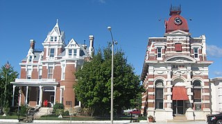
Marion County is a county of the U.S. state of Alabama. As of the 2020 census the population was 29,341. The county seat is Hamilton. The county was created by an act of the Alabama Territorial General Assembly on February 13, 1818. The county seat was originally established in Pikeville in 1820, and moved to Hamilton in 1881. The county was named by planter and US Indian agent John Dabney Terrell, Sr., in recognition of General Francis Marion of South Carolina.

<span class="mw-page-title-main">Marshall County, Alabama</span> County in Alabama, United States

Marshall County is a county of the state of Alabama, United States. As of the 2020 census the population was 97,612. Its county seat is Guntersville. A second courthouse is in Albertville. Its name is in honor of John Marshall, famous Chief Justice of the United States. Marshall County is a dry county, with the exception of the five cities of Albertville, Arab, Grant, Guntersville, and Boaz. Marshall County comprises the Albertville, AL Micropolitan Statistical Area, which is also included in the Huntsville-Decatur-Albertville, AL Combined Statistical Area.

<span class="mw-page-title-main">Shelby County, Alabama</span> County in Alabama, United States

Shelby County is located in the central portion of the U.S. state of Alabama. As of the 2020 census the population was 223,024, making it the sixth-most populous county in Alabama. The county seat is Columbiana. Its largest city is Alabaster. The county is named in honor of Isaac Shelby, Governor of Kentucky from 1792 to 1796 and again from 1812 to 1816. Shelby County is included in the Birmingham–Hoover, AL Metropolitan Statistical Area.

<span class="mw-page-title-main">Boone County, Iowa</span> County in Iowa, United States

Boone County is a county in the U.S. state of Iowa. As of the 2020 census, the population was 26,715. Its county seat is Boone.

<span class="mw-page-title-main">Hanceville, Alabama</span> City in Alabama, United States

Hanceville is a city in Cullman County, Alabama, United States. At the 2020 census, the population was 3,217.

<span class="mw-page-title-main">Gu-Win, Alabama</span> Town in Alabama, United States

Gu-Win is a town in Fayette and Marion counties in the U.S. state of Alabama. It incorporated in 1956. At the 2020 census the population was 141, down from 176 at the 2010 census. Although a small portion of the town is within Fayette County, all of the population as of 2010 resided in Marion County.

<span class="mw-page-title-main">Winfield, Alabama</span> City in Alabama, United States

Winfield is a city in Marion and Fayette counties in the U.S. state of Alabama. The population was 4,845 at the 2020 census, the second largest city in Marion County.

<span class="mw-page-title-main">Moundville, Alabama</span> Town in Alabama, United States

Moundville is a town in Hale and Tuscaloosa counties in the U.S. state of Alabama. It was incorporated on December 22, 1908. From its incorporation until the 1970 census, it was wholly within Hale County. At the 2010 census the population was 2,427, up from 1,809 at the 2000 census. It is part of the Tuscaloosa Metropolitan Statistical Area. Within the town is Moundville Archaeological Site, the location of a prehistoric Mississippian culture political and ceremonial center.

<span class="mw-page-title-main">Vernon, Alabama</span> City in Alabama, United States

Vernon is a city in Lamar County, Alabama, United States. The city is the county seat of Lamar County, and previously served as the seat of its two predecessors, Jones County, which briefly existed in 1867, and for Sanford County from 1868 until it was renamed Lamar in 1877. It incorporated in 1870. At the 2010 census the population was 2,000, down from 2,143 in 2000. It is the largest city in Lamar County as of 2010, and previously held the distinction in 1880 and from 1960 to 1990, falling to 2nd place in 2000 behind Sulligent, but since reclaiming the title.

<span class="mw-page-title-main">Guin, Alabama</span> City in Alabama, United States

Guin is a city in Marion County, Alabama, United States. It incorporated in December 1889. At the 2020 census, the population was 2,195.

<span class="mw-page-title-main">Hackleburg, Alabama</span> Town in Alabama, United States

Hackleburg is a town in Marion County, Alabama, United States. It incorporated on August 23, 1909. At the 2020 census, its population was 1,425, down from 1,516 at the 2010 census.

<span class="mw-page-title-main">Haleyville, Alabama</span> City in Alabama, United States

Haleyville is a city in Winston and Marion counties in the U.S. state of Alabama. It incorporated on February 28, 1889. Most of the city is located in Winston County, with a small portion of the western limits entering Marion County. Haleyville was originally named "Davis Cross Roads", having been established at the crossroads of Byler Road and the Illinois Central Railroad. At the 2020 census the population was 4,361, up from 4,173 at the 2010 census.

<span class="mw-page-title-main">Carrollton, Alabama</span> City in and county seat of Pickens County, Alabama

Carrollton is a city in and the county seat of Pickens County, Alabama, United States. At the 2010 census the population was 1,019, up from 987 in 2000.

<span class="mw-page-title-main">Columbiana, Alabama</span> City in and county seat of Shelby County, Alabama

Columbiana is a city and the county seat of Shelby County, Alabama, United States. At the 2020 census, the population was 4,462.

<span class="mw-page-title-main">McLeansboro, Illinois</span> City in Illinois, United States

McLeansboro is a city in Hamilton County, Illinois, United States. The population was 2,675 at the 2020 census. The estimated population as of 2018 was 2,773. It is the county seat of Hamilton County.

<span class="mw-page-title-main">Mound City, Kansas</span> City and County seat in Kansas, United States

Mound City is a city in and the county seat of Linn County, Kansas, United States. As of the 2020 census, the population of the city was 647.

<span class="mw-page-title-main">Lincolnville, Kansas</span> City in Marion County, Kansas

Lincolnville is a city in Marion County, Kansas, United States. As of the 2020 census, the population of the city was 168. The city was named after Abraham Lincoln, the 16th president of the United States. It is located northeast of Marion, west of the intersection of U.S. Route 77 highway and 290th Street next to the Union Pacific Railroad.

<span class="mw-page-title-main">Friendship (village), Wisconsin</span> Village in Wisconsin, United States

Friendship is a village in Adams County in the U.S. state of Wisconsin. It is the county seat of Adams County. The population was 725 at the 2010 census.

References

  1. 1 2 "2021 U.S. Gazetteer Files". United States Census Bureau. Retrieved April 12, 2022.
  2. 1 2 "Hamilton city, Alabama: 2020 DEC Redistricting Data (PL 94-171)". U.S. Census Bureau. Retrieved April 12, 2022.
  3. Hellmann, Paul T. (February 14, 2006). Historical Gazetteer of the United States. Routledge. ISBN   1135948593 via Google Books.
  4. 1820-2010 U.S. Censuses research on Marion County, Alabama communities
  5. The Heritage of Marion County, Alabama, vol. 47, Clanton, Al. 2000, p. 275 ISBN   1-891647-28-8
  6. Marion Herald, April 5, 1887, pg 8
  7. John M. Allman III (ed.), An Abbreviated History of Marion County, Ala. Archived April 7, 2014, at the Wayback Machine - The Marion County Historical & Genealogical Societies, Alabama Tracks vol. XI #4 1992.
  8. 1 2 "NOAA Online Weather Data – NWS Birmingham". National Weather Service. Retrieved March 4, 2023.
  9. "U.S. Climate Normals Quick Access – Station: Hamilton 3 S, AL". National Oceanic and Atmospheric Administration. Retrieved March 4, 2023.
  10. "U.S. Decennial Census". Census.gov. Retrieved June 6, 2013.
  11. "U.S. Census website". United States Census Bureau . Retrieved January 31, 2008.
  12. "U.S. Census website". United States Census Bureau . Retrieved August 2, 2015.
  13. "Explore Census Data". data.census.gov. Retrieved December 11, 2021.
  14. "The Hamilton Mounds Site". Alabama Indigenous Mound Trail. The University of Alabama. Retrieved December 2, 2021.
  15. "Indian Mounds". Visit Hamilton, AL. Hamilton Area Chamber of Commerce. Retrieved December 2, 2021.
  16. "Jerry Brown Arts Festival" . Retrieved December 2, 2021.
  17. "Buttahatchee River Fall Fest" . Retrieved December 2, 2021.
  18. "Calendar of Events". City of Hamilton, Alabama. Retrieved December 2, 2021.
  19. "Marion County-Rankin Fite Airport". AirNav.com. AirNav, LLC. Retrieved December 2, 2021.