Last updated The Old Cape Henry Light, completed in 1792, was the first federal construction project under the United States Constitution
The history of Virginia Beach, Virginia, goes back to the Native Americans who lived in the area for thousands of years before the English colonists landed at Cape Henry in April 1607 and established their first permanent settlement at Jamestown a few weeks later. The Colonial Virginia period extended until 1776 and the American Revolution, and the area has been part of the Commonwealth of Virginia ever since.
Since 1634, area known today as Virginia Beach has been part of the same unit of local government, except for 11 years. In 1952, when 2-square-mile (5.2km2) resort Town of Virginia Beach became an independent city, followed by the rest of Princess Anne County which whom it was reunited and politically consolidated by mutual approval of residents to form a new independent city in 1963. Selecting the better-known name of the oceanfront strip area, Virginia Beach has since grown to become the most populated city in Hampton Roads, which are each linked by the Hampton Roads Beltway which crosses the harbor of Hampton Roads through two large bridge-tunnels.
Native Americans
Chesepians were the Native American (American Indian) inhabitants of the area now known as South Hampton Roads in Virginia during the Woodland Period and later prior to the arrival of the English settlers in 1607. They occupied an area which is now the Norfolk, Portsmouth, Chesapeake and Virginia Beach areas. They were divided into five provinces or kingdoms: Weapemiooc, Chawanook, Secotan, Pomouic and Newsiooc, each ruled by a king or chief. To their west were the members of the Nansemond tribe.
The main village of the Chesepians was called Skicoak, located in the present independent city of Norfolk. The Chesepians also had two other towns (or villages), Apasus and Chesepioc, both near the Chesapeake Bay in what is now Virginia Beach. Of these, it is known that Chesepioc was located in the present Great Neck area. Archaeologists and other persons have found numerous Native American artifacts, such as arrowheads, stone axes, pottery, beads, and skeletons in Great Neck Point.
Politically, the area was dominated by the Virginia Peninsula-based Powhatan Confederacy. Although the Chesepians belonged to the same eastern-Algonquian speaking linguistic group as members of the Powhatan Confederacy across Hampton Roads, the archaeological evidence suggests that the original Chesepians belonged to another group, the Carolina Algonquian. Powhatan, whose real name was Wahunsunacock, was the most powerful chieftain in the Chesapeake Bay area, dominating more than 30 Algonquin-speaking tribes. The Chesepians did not belong to Powhatan's alliance, but instead defied him.
By 1607, around the time the first permanent English settlement was founded, the Chesaspeakes had united to fight the Powhatan Confederacy, suffering heavy losses. The last time the Chesaspeakes were mentioned in historical documents was in 1627. The Chesaspeakes have no pure descendants. Their tribe, totally defeated by Powhatan, was wiped out completely during this time frame by disease and attrition. According to William Strachey's The Historie of Travaile into Virginia Britanica (1612), the Chesepians were wiped out by Powhatan because Powhatan's priests had warned him that from the Chesapeake Bay a nation should arise, which should dissolve and give end to his empire. Local legend has it that an advisor to the Chief of the Powhatan tribe had a vision in which strangers from the East would come and take their land. Having no prior knowledge of the Europeans that would eventually land at Cape Henry, the Powhatans assumed the vision implicated the Chesepians. The Powhatans wiped out the entire Chesepeian tribe in a proactive defensive measure. Little did they know that the vision was correct. In 1607, a group of three ships (The Susan Constant, The Godspeed and The Discovery), led by Captain Christopher Newport, landed at Cape Henry. This group of 104 men and boys would move inland and establish the first permanent English settlement at Jamestown..
European arrivals
Cape Henry Memorial Cross near the site of the First Landing of English settlers in 1607
The Spanish sailed past the Chesapeake bay and landed in Chincoteague (Virginia) in 1524. Spanish explorers also mapped the Cape Henry coast. The English soon followed with an exploration party under the auspices of Sir Walter Raleigh. His men explored the area between Cape Henry and Cape Lookout in July and August 1584. The first English colony was established by John White on Roanoke Island. However, the colony disappeared, giving rise to the legend of a mysterious Lost Colony. It took more than a dozen years before England sent another expedition to colonize the area, but this attempt failed as well.
The expedition that founded the first permanent settlement set sail on December 19, 1606 from Blackwall, England on three ships commanded by Captain Christopher Newport. It consisted of 105 men and boys sponsored by the proprietary London Company section of the Virginia Company. They had an unusually long voyage of 144 days. On April 26, 1607, they made their first landfall at Cape Henry, in the northeastern part of today's independent city of Virginia Beach, a point where the Chesapeake Bay meets the Atlantic Ocean. It was named in honor of Henry Frederick, Prince of Wales, the eldest son of King James I of England. However the settlers left the area under orders from England to seek a site further inland which would be more sheltered from ships of competing European countries.
In addition to the landing site itself, a nearby settlement called Henry Town near the mouth of the Lynnhaven River was first described by name in a 1613 letter by the Virginia's lieutenant governor, Samuel Argall, who wrote of sending a fishing ship "to Henries Towne for the reliefe of such men as were there."[1] Other extant documents mention several forts at the mouth of the Chesapeake Bay as early as 1610, possibly including Henry Town. These records indicate that settlement at Henry Town was contemporary with the settlement at Jamestown. However, most of the archaeological finds at the Henry Town site date from the middle rather than the early 17th century. Some discoveries suggest that the site is connected to Adam Thoroughgood's nearby tobacco plantation, which dates to about 1635.
Norfolk County
The first written record of the name "Norfolk" is in the land books. It says: at court houlden in the Lower County of New Norfolke the 15th May 1637 [present:] Adam Thorowgood Esq.r. John Sibsey, Edward Windham, William Julian, Francis Mason and Robert Cramm were also present. Thorowgood was commander and presiding justice of the two distinct parishes. He was an important figure in the early history of Virginia Beach.
Adam Thoroughgood (1604–1640) of King's Lynn, Norfolk, England, the younger son of an influential family headed by the Reverend William Thorowgood, is one of the earliest Englishmen to become enamored with the area which became Virginia Beach. At the age of 18, he became an indentured servant to pay for passage to the Virginia Colony. Around 1622, he settled in an area south of the Chesapeake Bay a few miles inland from the Atlantic Ocean. This area had been passed by when the earlier settlements such as Jamestown were established beginning in 1607 in favor of locations further inland which would be less susceptible to attacks by other European forces, such as the Spanish.
Serving his period of indenture, he earned his freedom and became a leading citizen of the area. He was elected to the House of Burgesses for Elizabeth City (or "citiie" as it was then called) in 1629. He also served on the (Royal) Governor's Council, and as a Justice of the Court. He also became a Captain in the local militia.
The London Company lost its franchise and Virginia became a royal colony in 1624. In 1634, the Colony was divided into shires, soon renamed counties, a term still in use in Virginia 350 years later. Adam Thorowgood is credited using the name of his home in England when helping name New Norfolk County when it was formed from Elizabeth City County in 1637. The following year, New Norfolk County was split into Upper Norfolk County (soon renamed Nansemond County) and Lower Norfolk County, which was still quite large, encompassing the entire area now within the modern cities of Portsmouth, Norfolk, Chesapeake, and Virginia Beach. Thorowgood's 1635 patent covered 5,350 acres (21.7km2) of land. Much of the land between Lynnhaven River and Seawell's Point was owned by three men: Captain Thomas Willoughby, Francis Mason and Adam Thorowgood.
Thorowgood's residence after 1634 was along the Lynnhaven River, also named for his home in England. Thoroughgood appears to have had the foresight to realizing earlier than many other leaders that Lower Norfolk County was too large for a single site for convenient worship and court affairs. He led the effort to establish a second parish church, court, and glebe house at what was then known as Churches Point on the Lynnhaven River. Adam Thoroughgood suddenly became ill and died at the age of only 36 in 1640. He was buried at Churches Point in a location now believed to be submerged.
Lower Norfolk County was quite large, and stretched all the way from the Atlantic Ocean west past the Elizabeth River and, as Thoroughgood had earlier envisioned, soon required two courthouses to service the citizenry. Finally, in 1691, Lower Norfolk County was in turn divided to form Norfolk County and Princess Anne County. Princess Anne, the easternmost county in South Hampton Roads, extended northward from the North Carolina border to Cape Henry at the mouth of the Chesapeake Bay, and included all of the area fronting the Atlantic Ocean. It was named after Anne, daughter of James II. Many of the settlers in Lower County of New Norfolk were cavaliers and religious refugees from the reigns of James I and James II; the latter's daughters were held in high regard by their father's subjects. Princess Anne County was to last from 1691 to 1963, over 250 years.
Kempsville is a major historic section of Virginia Beach. Originally named Kempe's Landing and later Kemp's Landing, it was a colonial port of entry at the head of the Eastern Branch of the Elizabeth River.
In 1720, Virginia's governor requested that a lighthouse be built on Cape Henry. It took a long time before the work was started. After being halted in 1774 by the outbreak of the Revolutionary War, the lighthouse was finally completed in 1791. In 1962 it was named Virginia Beach's official symbol.
Incorporated town in 1906, independent city in 1952
Beginning in the late 19th century, the small resort area of Virginia Beach grew in Princess Anne County, particularly after 1888 with the arrival of rail service and electricity. Developers built the original Princess Anne Hotel which opened in 1890 at the oceanfront near the tiny community of Seatack, named for a British "attack by sea" during the War of 1812. In 1891, guests at the new hotel watched the wreck and rescue efforts of the United States Life-Saving Service for the Norwegian bark Dictator. The ship's figurehead, which washed up on the beach several days later, was erected as a modest monument to the victims and rescue along the oceanfront for more than 50 years, and then became the inspiration for the current Norwegian Lady Monuments which were dedicated in 1962 in Virginia Beach, and Moss, Norway.
The "Gay Nineties" and the turn of the century saw a boom in construction of hotels and guest cottages to accommodate increasing numbers of summer vacationers flocking to the seashore. Over time, the grand old hotels and cottages succumbed to fire and the wrecking ball, to be replaced by the modern high-rise hotels and motels that line the shore today. Only one of the old Victorian cottages of that period still exists.
A railroad passenger station at Cape Henry built in 1902 and served by the original Norfolk Southern Railway was restored late in the 20th century and is used as an educational facility by Joint Expeditionary Base East. Another railroad station near 18th Street and Pacific Avenue was torn down. (Part of the original railroad from Norfolk near the Oceanfront is now used as a pedestrian and bicycle path).
The growing resort of Virginia Beach was incorporated as a town in 1906. B.P. Holland was chosen to be the Town's first mayor. He had been a clerk of the original Princess Anne Hotel many years earlier, and had witnessed the wreck of the Dictator. During the next 45 years, Virginia Beach continue to grow in popularity as a seasonal vacation spot, and casinos gave way to amusement parks and family-oriented attractions.
Virginia Beach became a tiny independent city politically independent from Princess Anne County in 1952, although the numerous ties between Virginia Beach and Princess Anne remained. The change was seen as part of a larger reorganization of the boundaries and structures of almost all of the counties, cities and towns in southeastern Virginia which took place between 1952 and 1976.
In the mid 20th century, the northwestern borders of Princess Anne County lost territory to annexation suits by the City of Norfolk after annexing the entire northeastern portion of Norfolk County. Because cities in Virginia cannot annex each other's territory, leaders and residents of Princess Anne County came to see a merger with the tiny independent city of Virginia Beach as a way to prevent the independent City of Norfolk, whose population included a far greater number and proportion of African-Americans (about 43% as opposed to under 20% in Virginia Beach), from annexing more or potentially all of the county.
1963: Consolidation with Princess Anne County
In 1963, after approval by referendum of the voters of the City of Virginia Beach and Princess Anne County, and with the approval of the Virginia General Assembly, the two political subdivisions were consolidated as a new, much larger independent city, retaining the better-known name of the Virginia Beach resort. They needed to do this because of Virginia law states that a city and a county can not merge. They got past that by attaching the bill to the already large Virginia State budget. About the same time, at similar risk of annexations, Norfolk County took similar action, consolidating with the small independent City of South Norfolk and forming another new city. The City of Chesapeake became Virginia Beach's new neighbor to the southwest.
Today, most of the area formerly in Princess Anne County when it was formed in 1691 is now located within the City of Virginia Beach. The only exceptions are some territory of the northwestern portion which became part of the City of Norfolk through annexation and a land swap agreement between the two cities in 1988.
1989: "Greekfest" riots
An increasing number of African American college students converged on the Virginia Beach resort area for the Labor Day Weekend each year in the late 1980s. During the Labor Day weekend of 1989, rioting and looting broke out.[2] Greekfest attendees destroyed property within the hotels and threw televisions, furniture, and other items over hotel balconies. Approximately 100 stores and restaurants stretching over two dozen blocks on the ocean front had been damaged and/or had merchandise stolen. A police horse was killed when it was struck in the head by an item thrown over a balcony. Apparently fearing for their safety, Virginia Beach police abandoned the oceanfront, returning hours later in full riot gear. The Virginia National Guard arrived around dawn and a state of emergency was declared by order of the Governor of Virginia. A nighttime curfew of 8 pm was placed in effect and hundreds of Greekfest attendees caught out in the streets after curfew were arrested by law enforcement authorities over the next two nights.The police blotter listed more than 650 people arrested over the weekend.[3][4]
The King Neptune Statue
The King Neptune statue was built in honor of the Neptune Festival, which is a local festival held each September.[citation needed]
2019: Something in the Water music festival
Virginia Beach native Pharrell Williams organized an oceanfront festival called Something in the Water. The event was, in part, a response to negativity surrounding the annual arrival of college students for spring break previously known as "Greekfest".[5] The event featured other popular music performers from the area including Missy Elliot and Timbaland. Appearances were made by Jay-Z and Snoop Dogg. Other activities included sports demonstrations, arts and technology experiences, professional networking, and an open-air church.
On May 31, 2019, a mass shooting occurred at a municipal building in the Princess Anne area of Virginia Beach, Virginia. The gunman, DeWayne Craddock, who was a disgruntled city employee, fatally shot 12 people and wounded four others. He was then shot dead by responding police officers.
Virginia Beach is an independent city located on the southeastern coast of Virginia, United States. The population was 459,470 at the 2020 census. Although mostly suburban in character, it is the most populous city in Virginia, fifth-most populous city in the Mid-Atlantic and the 42nd-most populous city in the U.S. Located on the Atlantic Ocean at the mouth of the Chesapeake Bay, Virginia Beach is a principal city in the Hampton Roads metropolitan area which has more than 1.8 million inhabitants and is the 37th-largest metropolitan area in the U.S.
Hampton Roads is the name of both a body of water in the United States that serves as a wide channel for the James, Nansemond, and Elizabeth rivers between Old Point Comfort and Sewell's Point near where the Chesapeake Bay flows into the Atlantic Ocean, and the surrounding metropolitan region located in the southeastern Virginia and northeastern North Carolina portions of the Tidewater Region.
South Hampton Roads is a region located in the extreme southeastern portion of Virginia's Tidewater region in the United States with a total population of 1,191,937. It is part of the Virginia Beach-Norfolk-Newport News, VA-NC MSA, which itself has a population of 1,724,876.
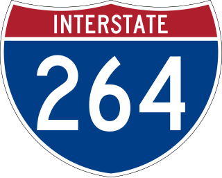
Interstate 264 (I-264) is an Interstate Highway in the US state of Virginia. It serves as the primary east–west highway through the South Hampton Roads region in southeastern Virginia. The route connects the central business districts of Chesapeake, Portsmouth, Norfolk, and Virginia Beach and serves as the most direct link between those cities and the resort beaches along Virginia's Atlantic coast.
Norfolk County was a county of the South Hampton Roads in eastern Virginia in the United States that was created in 1691. After the American Civil War, for a period of about 100 years, portions of Norfolk County were lost and the territory of the county reduced as they were annexed by the independent and growing cities of Norfolk, Portsmouth and South Norfolk.
County of Princess Anne is a former county in the British Colony of Virginia and the Commonwealth of Virginia in the United States, first incorporated in 1691. The county was merged into the city of Virginia Beach on January 1, 1963, ceasing to exist.
The Norwegian Lady Statues are located in the sister cities of Moss, a coastal town and municipality in the county of Østfold, Norway, and at the Oceanfront (boardwalk) in the coastal resort city of Virginia Beach, Virginia in the United States. They commemorate the lives lost in the 1891 shipwreck of the Norwegian barque Dictator off the coast of Virginia Beach and the lifesaving efforts of the community.
Pembroke Manor is an area in the independent city of Virginia Beach, Virginia, United States located around the intersections of Virginia Beach Boulevard and Independence Boulevard. The community's name comes from Pembroke Manor, a plantation built in 1764. The house was donated by the Aragona family to the Princess Anne Historical Society, but currently is under private ownership and serves as Ivy League Academy, a private Christian school for children K4 through 5th grades. It has now been sold and become another business. The structure itself was placed on the National Register of Historic Places in 1970 as #70000887 and is one of the oldest and most significant structures in the City of Virginia Beach.
Virginia Beach Boulevard is a major connector highway which carries U.S. Route 58 most of its length and extends from the downtown area of Norfolk to the Oceanfront area of Virginia Beach, passing through the newly developed New Urbanist Town Center development of the latter as it links the two independent cities in the South Hampton Roads subregion of the Hampton Roads region in southeastern Virginia.
Adam Thoroughgood [Thorowgood] (1604–1640) was a colonist and community leader in the Virginia Colony who helped settle the Virginia counties of Elizabeth City, Lower Norfolk and Princess Anne, the latter, known today as the independent city of Virginia Beach.
The Lynnhaven River is a tidal estuary located in the independent city of Virginia Beach, Virginia, in the United States, and flows into the Chesapeake Bay west of Cape Henry at Lynnhaven Inlet, beyond which is Lynnhaven Roads. It has a small, developed watershed covering 64 square miles (170 km2), terminating at Lynnhaven Bay. It was once famous along the East Coast of the United States for its oysters, which declined through pollution and runoff. It is now being restored by the Lynnhaven River Now restoration project based out of the Brock Environmental Center. A proposed comprehensive project for ecosystem restoration of the Lynnhaven River Basin is currently under consideration by the United States Congress.
U.S. Route 60 (US 60) in the Commonwealth of Virginia runs 303 miles (488 km) west to east through the central part of the state, generally close to and paralleling the Interstate 64 corridor, except for the crossing of the Blue Ridge Mountains, and in the South Hampton Roads area.
State Route 165 is a primary state highway in the U.S. state of Virginia. The state highway runs 39.75 miles (63.97 km) from U.S. Route 17 Business in Chesapeake north to SR 337 in Norfolk. SR 165 is a C-shaped route that connects Chesapeake and Norfolk in the Hampton Roads metropolitan area indirectly via Virginia Beach. The highway's east–west segment connects the Chesapeake communities of Deep Creek and Great Bridge with the Princess Anne part of Virginia Beach. SR 165's northwest–southeast portion connects the Princess Anne area with Virginia Beach's Salem and Kempsville communities and with Norfolk. Within Norfolk, the state highway parallels Interstate 64 (I-64) while passing through the eastern and northern areas of the city near Norfolk International Airport and Naval Station Norfolk. Much of SR 165 is a multi-lane divided highway, but there are significant two-lane stretches in all three of the independent cities the highway serves.
Elizabeth City was one of four incorporations established in the Virginia Colony in 1619 by the proprietor, the Virginia Company of London, acting in accordance with instructions issued by Sir George Yeardley, Governor. This allowed the crown to benefit from the offerings of the new land, including its natural resources, new markets for English goods, and the leverage it provided against the Spanish.
Henry Town, Henry Towne, or Henries Towne was an early English colonial settlement near Cape Henry, the southern point and gateway to the Chesapeake Bay in the Colony and Dominion of Virginia, now in modern Virginia Beach, Virginia, on the East Coast of the United States. Archaeologist Floyd Painter of the Norfolk Museum of Arts and Sciences originally excavated the site in 1955, but it was only conclusively determined to be Henry Town in 2007 by United States Army scientists reviewing the site's artifacts, and no primary source documents exist. It was located east of Norfolk, Virginia and north of Chesapeake and south of the Hampton Roads harbor at approximately 36°54′30″N76°7′20″W. The historical and archeological site is immediately north of U.S. Route 60 on what is now Lake Joyce, formerly an inlet connecting with Pleasure House Creek, a western branch of the Lynnhaven River, itself an estuary of the Chesapeake Bay and Hampton Roads.
The Chesepian or Chesapeake were a Native American tribe who lived near present-day South Hampton Roads in the U.S. state of Virginia. They occupied an area which is now the Norfolk County or Princess Anne County.
The history of Norfolk, Virginia as a modern settlement begins in 1636. The city was named after the English county of Norfolk and was formally incorporated in 1736. The city was burned by orders of the outgoing Virginia governor Lord Dunmore in 1776 during the second year of the American Revolutionary War (1775–1783), although it was soon rebuilt.
Virginia Beach, Virginia is a city that has become a popular tourist destination in recent years on account of its historical, scientific, and performing arts.
Old Donation Church is the third Lynnhaven Parish Church and is the oldest church in Virginia Beach. Records show that the parish's first church services were held in 1637 in the home of Adam Thoroughgood. The first church building was constructed on Mr. Thoroughgood's land in 1639 on the location later known as "Church Point." The vestry, or governing body of the church, was established in 1640.
The following is a timeline of the history of the city of Virginia Beach, Virginia, USA.
This page is based on this Wikipedia article Text is available under the CC BY-SA 4.0 license; additional terms may apply. Images, videos and audio are available under their respective licenses.