National Forest for Wales

Last updated
National Forest for Wales
Coedwig Genedlaethol i Gymru (Welsh)
National Forest for Wales logo.svg
View from Gwydir Forest.jpg
Gwydir Forest, a site of the National Forest for Wales
Type of project Forestation
Country Wales
Ministry Welsh Government
Launched12 April 2020;3 years ago (2020-04-12) [1]
StatusIn progress
Website gov.wales/national-forest-wales
The National Forest for Wales at Bwlch Nant yr Arian
The National Forest for Wales with Tilhill Forestry

The National Forest for Wales (Welsh : Coedwig Genedlaethol i Gymru) is a long-term forestation programme by the Welsh Government, aiming to form a network of woodland throughout Wales. [2]

Contents

Background

Currently only around 15% of Wales is woodlands covering 306,000 hectares (3,060 km2), [3] with forestation (new woodland plantings) efforts in Wales reaching their lowest level since the 1970s, [4] with annual woodland creation not exceeding 2,000 hectares (20 km2) since 1975. [5] In 2020, only 290 hectares (2.9 km2) of woodland was planted. [5]

Advantages of a wide-spread forestation programme allows for the increase in tree coverage, which acts as a carbon sink helping to address climate change. The new or expanded forests can also support biodiversity, and as a habitat for endangered flora and fauna, such as red squirrels and the spreading bellflower. [4]

Woodlands may have a tourism potential, however to accommodate tourism, woodlands would require infrastructure to accommodate visitors, which may impact the conservation efforts of the woodlands. [4]

More woodlands may support an increasing domestic forestry industry, in particular increasing the production and use of timber in the construction industry as a low-carbon alternative to steel and concrete. [4] In 2017, 80% of Wales' timber was imported, with the UK being the second-biggest net importer of forest products in the world. [6]

History

The programme was announced on 12 March 2020. By 4 November 2020, the first fourteen sites of the programme were announced. The sites are part of the Welsh Government estate, and are maintained and managed by Natural Resources Wales. [7]

On 14 July 2021, the Welsh Government opened the application process for "The Woodland Investment Grant" (TWIG), providing financial help to those creating new woodlands in Wales or making improvements to existing woodlands up to the standards set for the programme. These include landowners and those otherwise holding full management control of public or private land. [7] [8] The first round of applications closed on 27 August 2021. [7] The first application window had a budget of £2.5 million and an additional budget for revenue of £250,000, with each grant being awarded between £10,000 and £250,000, and costs claimed by 31 March 2022. [8] The grant received more than 350 expressions of interest from people who want to plant new woodlands in Wales. Another period open to applications was launched in November 2020. [9]

The grant has desirable outcomes for the new woodlands. The grant wants applicants to produce connected, dynamic, multi-purpose woodlands and trees, that demonstrate learning research and innovation. Claimants fulfilling these outcomes are more likely to be recommended by the government. [8]

The programme is in collaboration with the National Museum, National Library and Royal Commission on the Ancient and Historical Monuments of Wales to create a "National Forest People's Collection for Wales". [7]

Aims

There are various aims of the programme: [2] [10]

Woodland sites

National Forest Sites National-forest-wales-woodland-sites.jpg
National Forest Sites

There are currently fourteen sites in the programme across ten principal areas of Wales designated on 4 November 2020: [4] [9] [11] [12]

Related Research Articles

<span class="mw-page-title-main">Powys</span> County and preserved county in Wales

Powys is a county and preserved county in Wales. It borders Gwynedd, Denbighshire, and Wrexham to the north; the English ceremonial counties of Shropshire and Herefordshire to the east; Monmouthshire, Blaenau Gwent, Merthyr Tydfil, Caerphilly, Rhondda Cynon Taf, and Neath Port Talbot to the south; and Carmarthenshire and Ceredigion to the west. The largest settlement is Newtown, and the administrative centre is Llandrindod Wells.

<span class="mw-page-title-main">Principal areas of Wales</span> Subdivisions of Wales; counties and county boroughs

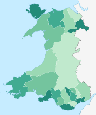
The principal areas of Wales, comprising the counties andcounty boroughs of Wales, are a form of subdivision in Wales. There are currently 22 principal areas in Wales, and they were established in 1996.

<span class="mw-page-title-main">North Wales</span> Geographic region in Wales

North Wales is a region of Wales, encompassing its northernmost areas. It borders mid Wales to the south, England to the east, and the Irish Sea to the north and west. The area is highly mountainous and rural, with Snowdonia National Park and the Clwydian Range and Dee Valley, known for its mountains, waterfalls and trails, wholly within the region. Its population is concentrated in the north-east and northern coastal areas, with significant Welsh-speaking populations in its western and rural areas. North Wales is imprecisely defined, lacking any exact definition or administrative structure. It is commonly defined administratively as its six most northern principal areas, but other definitions exist, with Montgomeryshire historically considered to be part of the region.

<span class="mw-page-title-main">Lists of places in Wales</span>

These are lists of places in Wales.

Betws or Bettws may refer to:

Menter Iaith is a community-based organisation which works to raise the profile of the Welsh language in a specific area. Each local Menter Iaith receives a basic grant from the Welsh Language Board, as well as financial support from a number of other sources, to work with individuals, organisations, and local business to promote the use of Welsh in its area.

Llanfihangel can refer to the following places in Wales:

<span class="mw-page-title-main">Scouting in Wales</span>

Scouting in Wales provides an overview of Scouting activities in Wales. Scout troops have existed in the country since 1908 with the largest number of Scouts and volunteer leaders today linked to the Scout Association of the United Kingdom. This is done through ScoutsCymru, the Welsh Scout Council who split the region further into four regions and a total of 12 Scout Areas. In addition to the Scout Association, there are also traditional Scouting groups belonging to the Baden-Powell Scouts' Association and a number of Scouting clubs within Universities which are affiliated to the Student Scout and Guide Organisation.

<span class="mw-page-title-main">Outline of Wales</span> Overview of and topical guide to Wales

The following outline is provided as an overview of and topical guide to Wales:

<span class="mw-page-title-main">Trunk road agent</span> Type of road authority in Wales

In Wales, a trunk road agent,, is a partnership between two or more county and/or county borough councils for the purposes of managing, maintaining, and improving the network of trunk roads in Wales in their respective areas on behalf of the Welsh Government.

Scheduled monuments are sites of archaeological importance with specific legal protection against damage or development.

<span class="mw-page-title-main">2015 United Kingdom general election in Wales</span>

The 2015 United Kingdom general election in Wales was held on 7 May 2015 and all 40 seats in Wales were contested. The election for each seat was conducted on the basis of first-past-the-post.

Grade II* listed buildings in Wales by county:

<span class="mw-page-title-main">2017 Welsh local elections</span>

The 2017 Welsh local elections were held on 4 May 2017 to elect members of all 22 local authorities in Wales. This included the Isle of Anglesey, which was previously up for election in 2013 due to having its elections delayed for a year. Community council elections also took place on the same day. These local elections were held as part of the 2017 local elections in the United Kingdom. Apart from Anglesey, the last elections were held in 2012. Normally these elections take place every four years, but the 2017 elections were postponed for a year in order to avoid clashing with the 2016 Welsh Assembly election, which itself had been postponed by a year to avoid clashing with the 2015 general election.

<span class="mw-page-title-main">Regions of Wales</span> Undefined class of subdivision in Wales

Wales has traditionally been divided into a number of ambiguous and ill-defined areas described as regions, reflecting historical, geographical, administrative, cultural and electoral boundaries within the country. Presently, the most common form of division of Wales into "regions" has been using cardinal and intercardinal references: north or south-west for example. None of the variously described "regions" have official status or defined boundaries; neither is there a fixed number of regions. Various organisations use different regions and combinations of regions for their individual purposes. This includes devolved institutions, such as Visit Wales, Natural Resources Wales, and the Welsh Government itself, using different sets of Wales' regions. Wales is most commonly sub-divided into between two and four regions, with a North–South divide, and North, Mid, South East and South West division being common. This article lists the various terms applied to be the "regions of Wales" and the regions used by various organisations.

<span class="mw-page-title-main">Celtic rainforests in Wales</span> Temperate rainforests in Wales

There are various areas of temperate rainforests in Wales, also termed a "Celtic rainforest". They are located largely in river valleys, adjacent to the sea, on Wales' western coasts, particularly in Snowdonia (Eryri), Powys and Ceredigion.

<span class="mw-page-title-main">West Wales and the Valleys</span> Statistical region of Wales

West Wales and the Valleys is a UK International Territorial Level 2 statistical region covering the western areas of Wales and the South Wales Valleys. Created as part of the Eurostat's Nomenclature of Territorial Units for Statistics (NUTS), it was used to by the European Union (EU) to deliver the European Regional Development Fund to areas of Wales, until the UK's withdrawal from the EU in 2020. Following which it was mirrored onto the Office for National Statistics' International Territorial Level (ITL) geoclassification system. The remainder of Wales is part of the East Wales statistical region.

References

  1. "National Forest for Wales – Size of Wales" . Retrieved 2022-04-29.
  2. 1 2 "The National Forest for Wales". Wales. 2022-02-01. Retrieved 2022-04-29.
  3. "Natural Resources Wales / Forestry statistics, forecasts and surveys". naturalresources.wales. Retrieved 2022-04-29.
  4. 1 2 3 4 5 "National Forest: the challenge of woodland creation in Wales". research.senedd.wales. Retrieved 2022-04-29.
  5. 1 2 Hayward, Will (2022-03-21). "You can choose where Wales' new national forest will be". WalesOnline. Retrieved 2022-04-29.
  6. Forestry in Wales - A sustainable industry for the 21st century (PDF). Confor. 2017.
  7. 1 2 3 4 "National Forest for Wales". GOV.WALES. Retrieved 2022-04-29.
  8. 1 2 3 "National Forest for Wales – The Woodland Investment Grant (TWIG)". GOV.WALES. Retrieved 2022-04-29.
  9. 1 2 "First sites announced for National Forest – "Among very best woodland in Wales"". GOV.WALES. Retrieved 2022-04-29.
  10. "National Forest for Wales". GOV.WALES. Retrieved 2022-04-29.
  11. "National Forest for Wales: woodland sites". GOV.WALES. Retrieved 2022-04-29.
  12. "Welsh Government choose first sites for 'National Forest' which will span Wales". Nation.Cymru. 2020-11-04. Retrieved 2022-04-29.