Poquonock Bridge, Connecticut

Last updated

Poquonock Bridge
Groton Town Hall, Poquonock Bridge CT.jpg
Groton Town Hall
New London County Connecticut Incorporated and Unincorporated areas Poquonock Bridge Highlighted 2010.svg
Coordinates: 41°20′42″N72°01′29″W / 41.34500°N 72.02472°W / 41.34500; -72.02472
CountryUnited States
State Connecticut
County New London
Town Groton
Area
  Total1.4 sq mi (3.7 km2)
  Land1.4 sq mi (3.5 km2)
  Water0.077 sq mi (0.2 km2)
Elevation
98 ft (30 m)
Population
 (2010)
  Total1,727
  Density1,200/sq mi (470/km2)
Time zone UTC−5 (Eastern (EST))
  Summer (DST) UTC−4 (EDT)
ZIP code
06340
Area code 860
FIPS code09-61730
GNIS feature ID2377852 [1]

Poquonock Bridge is a village and census-designated place (CDP) in the town of Groton in New London County, Connecticut, United States. The population was 1,686 at the 2020 census. [2]

Contents

The village is located just east of the head of the Poquonnock River near the intersection of U.S. Route 1 and Connecticut Route 117. The village was first settled in 1652–53 by James Morgan, James Avery, and Nehemiah Smith. The Groton Town Hall is located in the village.

Geography

According to the United States Census Bureau, the CDP has a total area of 1.4 square miles (3.7 km2), of which 1.4 square miles (3.5 km2) is land, and 0.077 square miles (0.2 km2) (5.07%) is water. [3]

Demographics

As of the census [4] of 2000, there were 1,592 people, 588 households, and 415 families residing in the CDP. The population density was 1,165.8 inhabitants per square mile (450.1/km2). There were 630 housing units at an average density of 461.3 per square mile (178.1/km2). The racial makeup of the CDP was 65.45% White, 14.13% African American, 3.83% Native American, 8.04% Asian, 0.25% Pacific Islander, 1.76% from other races, and 6.53% from two or more races. Hispanic or Latino of any race were 6.16% of the population.

There were 588 households, out of which 38.9% had children under the age of 18 living with them, 41.8% were married couples living together, 22.4% had a female householder with no husband present, and 29.3% were non-families. 23.5% of all households were made up of individuals, and 7.7% had someone living alone who was 65 years of age or older. The average household was 2.71 person, and the average family size was 3.14.

In the CDP, the population was spread out, with 29.8% under the age of 18, 9.2% from 18 to 24, 31.3% from 25 to 44, 19.3% from 45 to 64, and 10.4% who were 65 years of age or older. The median age was 33 years. For every 100 females, there were 95.8 males. For every 100 females age 18 and over, there were 91.4 males.

The median income for a household in the CDP was $33,652, and the median income for a family was $35,592. Males had a median income of $24,219 versus $21,250 for females. The per capita income for the CDP was $14,664. About 11.2% of families and 15.5% of the population were below the poverty line, including 23.5% of those under age 18, and 5.4% of those age 65 or over.

Related Research Articles

<span class="mw-page-title-main">New London County, Connecticut</span> County in Connecticut, United States

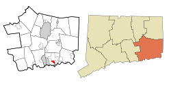
New London County is in the southeastern corner of Connecticut and comprises the Norwich-New London, Connecticut Metropolitan Statistical Area, which is also included in the Hartford-East Hartford, Connecticut Combined Statistical Area. There is no county government and no county seat, as is the case with all eight of Connecticut's counties; towns are responsible for all local government activities, including fire and rescue, snow removal, and schools.

<span class="mw-page-title-main">Terramuggus, Connecticut</span> Census-designated place in Connecticut, United States

Terramuggus is a census-designated place (CDP) in the town of Marlborough, Hartford County, Connecticut, United States. It contains the town center village and surrounding areas. The population was 1,025 at the 2010 census.

<span class="mw-page-title-main">Essex Village, Connecticut</span> Census-designated place in Connecticut, United States

Essex Village is a village and census-designated place (CDP) in the town of Essex, Connecticut, in the United States. The population was 2,583 at the 2020 census, out of 6,733 in the entire town of Essex. The government offices of the town are located within the village.

Heritage Village is a census-designated place (CDP) in the town of Southbury in New Haven County, Connecticut, United States. The population was 3,736 at the 2010 census.

<span class="mw-page-title-main">Long Hill, Groton, Connecticut</span> Census-designated place in Connecticut, United States

Long Hill is a census-designated place (CDP) in the town of Groton in New London County, Connecticut, United States. The population was 4,205 at the 2010 census.

<span class="mw-page-title-main">Noank, Connecticut</span> Census-designated place in Connecticut, United States

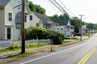
Noank is a village in the town of Groton, Connecticut. This dense community of historic homes and local businesses sits on a small, steep peninsula at the mouth of the Mystic River with a long tradition of fishing, lobstering and boat-building. The village is listed as a historic district on the National Register of Historic Places and is the home of multiple seaside lobster shacks and oyster aquaculture operations. The population was 1,796 at the 2010 census.

<span class="mw-page-title-main">Old Mystic, Connecticut</span> Census-designated place in Connecticut, United States

Old Mystic is a village and census-designated place (CDP) located in the town of Groton, Connecticut. The population was 3,554 at the 2010 census.

<span class="mw-page-title-main">South Woodstock, Connecticut</span> Census-designated place in Connecticut, United States

South Woodstock is a village and census-designated place (CDP) in Woodstock, Windham County, Connecticut, United States. The population was 1,291 at the 2010 census.

Cortland West is a census-designated place and region in Cortland County, New York, United States. The population was 1,356 at the 2010 census.

<span class="mw-page-title-main">Evansburg, Pennsylvania</span> Census-designated place in Pennsylvania, United States

Evansburg is a census-designated place (CDP) in Montgomery County, Pennsylvania, United States. The population was 2,129 at the 2010 census. It is a section of Lower Providence Township and is the namesake of Evansburg State Park.

Woodland Heights is a census-designated place (CDP) in Venango County, Pennsylvania, United States. The population was 1,402 at the 2000 census.

Eagleton Village is a census-designated place (CDP) in Blount County, Tennessee. The population was 5,393 at the 2020 census. It is included in the Knoxville, Tennessee Metropolitan Statistical Area.

<span class="mw-page-title-main">Groton, Vermont</span> Town in Vermont, United States

Groton is a town in Caledonia County, Vermont, United States. The population was 984 at the 2020 census. It contains the places Groton Pond, Rickers Mills, Rickers and West Groton. The unincorporated village of Groton in the southeast corner of town is recorded as the Groton census-designated place (CDP), with a population of 419 at the 2020 census.

<span class="mw-page-title-main">Ayer (CDP), Massachusetts</span> Census-designated place in Massachusetts, United States

Ayer is a census-designated place (CDP) and the primary settlement in the town of Ayer in Middlesex County, Massachusetts, United States. The population of the CDP was 2,986 at the 2020 census, out of 8,479 in the entire town.

<span class="mw-page-title-main">Suffield Depot, Connecticut</span> Census-designated place in Connecticut, United States

Suffield Depot is the name of a census-designated place (CDP) corresponding to the village of Suffield, the primary settlement of the town of Suffield, Connecticut, in Hartford County. The population of the CDP was 1,325 as of the 2010 census.

<span class="mw-page-title-main">Glastonbury Center, Connecticut</span> Census-designated place in Connecticut, United States

Glastonbury Center is a census-designated place (CDP) that constitutes the densely populated center of the town of Glastonbury in Hartford County, Connecticut, United States. The population was 7,387 at the 2010 census, out of a total town population of 34,427.

<span class="mw-page-title-main">Groton (CDP), Massachusetts</span> Census-designated place in Massachusetts, United States

Groton is a census-designated place (CDP) comprising the main village in the town of Groton in Middlesex County, Massachusetts, United States. The population of the CDP was 1,353 at the 2020 census, out of 11,315 in the entire town of Groton.

<span class="mw-page-title-main">Pepperell (CDP), Massachusetts</span> Census-designated place in Massachusetts, United States

Pepperell is a census-designated place (CDP) comprising the main village in the town of Pepperell in Middlesex County, Massachusetts, United States. The population was 2,390 at the 2020 census, out of 11,604 in the entire town of Pepperell.

<span class="mw-page-title-main">Townsend (CDP), Massachusetts</span> Census-designated place in Massachusetts, United States

Townsend is a census-designated place (CDP) comprising the main village in the town of Townsend in Middlesex County, Massachusetts, United States. The population was 1,213 at the 2020 census, out of 9,127 in the entire town.

<span class="mw-page-title-main">Groton (city), Connecticut</span> City in Connecticut

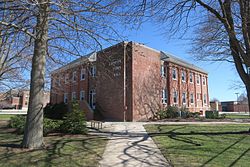
The City of Groton is a dependent political subdivision of the town of Groton, Connecticut. The city was settled in 1655 as Groton Bank, and the area developed into the principal village of the town of Groton. The village of Groton incorporated as a borough in 1903, and the residents of the borough of Groton reincorporated as the city of Groton in 1964. It is the only remaining city in the state of Connecticut that is not governmentally consolidated with its parent town. The city is part of the Southeastern Connecticut Planning Region. The population was 10,389 at the 2010 census.

References

  1. U.S. Geological Survey Geographic Names Information System: Poquonock Bridge
  2. "Profile of General Population and Housing Characteristics: 2020 Demographic Profile Data (DP-1): Poquonock Bridge CDP, Connecticut". United States Census Bureau . Retrieved June 7, 2023.
  3. "Geographic Identifiers: 2010 Demographic Profile Data (G001): Poquonock Bridge CDP, Connecticut". United States Census Bureau . Retrieved October 29, 2012.
  4. "U.S. Census website". United States Census Bureau . Retrieved January 31, 2008.