Old Mystic, Connecticut

Last updated

Old Mystic, Connecticut
MYSTIC BANK, NEW LONDON COUNTY, CT.jpg
Mystic Bank
New London County Connecticut Incorporated and Unincorporated areas Old Mystic Highlighted 2010.svg
Old Mystic, Connecticut
CountryUnited States
State Connecticut
County New London
Town Groton
Area
  Total4.4 sq mi (11 km2)
  Land4.3 sq mi (11 km2)
  Water0.1 sq mi (0.26 km2)
Elevation
138 ft (42 m)
Population
 (2010)
  Total3,554
  Density810/sq mi (320/km2)
Time zone UTC−5 (Eastern (EST))
  Summer (DST) UTC−4 (EDT)
ZIP code
06355
Area code 860
FIPS code09-57180
GNIS feature ID2377846 [1]

Old Mystic is a village [2] and census-designated place (CDP) located in the town of Groton, Connecticut. The population was 3,554 at the 2010 census. [3]

Contents

Geography

According to the United States Census Bureau, the CDP has a total area of 4.4 square miles (11 km2), of which 4.3 square miles (11 km2) is land and 0.1 square miles (0.26 km2), or 2.29%, is water.

Demographics

As of the census [4] of 2000, there were 3,205 people, 1,205 households, and 880 families residing in the CDP. The population density was 750.5 inhabitants per square mile (289.8/km2). There were 1,249 housing units at an average density of 292.5 per square mile (112.9/km2). The racial makeup of the CDP was 90.11% White, 2.43% African American, 0.66% American Indian, 3.43% Asian, 0.06% Pacific Islander, 0.50% from other races, and 2.81% from two or more races. Hispanic or Latino of any race were 1.62% of the population.

There were 1,205 households, out of which 34.6% had children under the age of 18 living with them, 60.0% were married couples living together, 9.4% had a female householder with no husband present, and 26.9% were non-families. 19.5% of all households were made up of individuals, and 5.1% had someone living alone who was 65 years of age or older. The average household size was 2.64 and the average family size was 3.06.

In the CDP, the population was spread out, with 25.7% under the age of 18, 5.5% from 18 to 24, 32.7% from 25 to 44, 25.3% from 45 to 64, and 10.7% who were 65 years of age or older. The median age was 38 years. For every 100 females, there were 96.1 males. For every 100 females age 18 and over, there were 97.2 males.

The median income for a household in the CDP was $63,036, and the median income for a family was $68,500. Males had a median income of $50,095 versus $31,536 for females. The per capita income for the CDP was $27,988. About 1.5% of families and 3.2% of the population were below the poverty line, including 1.6% of those under age 18 and 3.8% of those age 65 or over.

Related Research Articles

<span class="mw-page-title-main">Tsaile, Arizona</span> Census-designated place in Arizona, United States

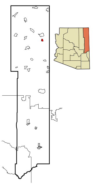
Tsaile is a census-designated place (CDP) in Apache County, Arizona, United States, on the Navajo Nation. The population was 1,205 at the 2010 census.

<span class="mw-page-title-main">Westhaven-Moonstone, California</span> Census-designated place in California, United States

Westhaven-Moonstone is a census-designated place (CDP) located in Humboldt County, California, United States. As of the 2010 census the population was 1,205, up from 1,044 at the 2000 census.

<span class="mw-page-title-main">North Lakeport, California</span> Census-designated place in California, United States

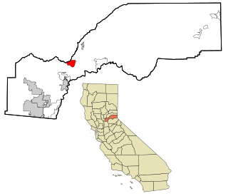
North Lakeport is a census-designated place (CDP) in Lake County, California, United States. The population was 3,314 at the 2010 census, up from 2,879 at the 2000 census.

<span class="mw-page-title-main">Meadow Vista, California</span> Census-designated place in California, United States

Meadow Vista is a census-designated place (CDP) in Placer County, California, United States. It is part of the Sacramento–Arden-Arcade–Roseville Metropolitan Statistical Area. The population was 3,217 at the 2010 census, up from 3,096 at the 2000 census.

<span class="mw-page-title-main">Kensington, Connecticut</span> Census-designated place in Connecticut, United States

Kensington is a census-designated place (CDP) and section of the town of Berlin in Hartford County, Connecticut, United States. The Berlin town offices are located in Kensington. The population was 8,459 at the 2010 census.

<span class="mw-page-title-main">Sherwood Manor, Connecticut</span> Census-designated place in Connecticut, United States

Sherwood Manor is a census-designated place (CDP) within the town of Enfield in Hartford County, Connecticut, United States. The population was 5,410 at the 2010 census.

<span class="mw-page-title-main">Terramuggus, Connecticut</span> Census-designated place in Connecticut, United States

Terramuggus is a census-designated place (CDP) in the town of Marlborough, Hartford County, Connecticut, United States. It contains the town center village and surrounding areas. The population was 1,025 at the 2010 census.

<span class="mw-page-title-main">Weatogue, Connecticut</span> Census-designated place in Connecticut, United States

Weatogue is a village and census-designated place in Simsbury, Hartford County, Connecticut. The population was 2,776 at the 2010 census.

<span class="mw-page-title-main">Essex Village, Connecticut</span> Census-designated place in Connecticut, United States

Essex Village is a village and census-designated place (CDP) in the town of Essex, Connecticut, in the United States. The population was 2,583 at the 2020 census, out of 6,733 in the entire town of Essex. The government offices of the town are located within the village.

Saybrook Manor is a community and census-designated place (CDP) in Old Saybrook, a town in Middlesex County, Connecticut, United States. The population was 1,127 at the 2020 census. The Saybrook Manor section is generally the area south of U.S. Route 1 between the Westbrook town line and the Oyster River.

<span class="mw-page-title-main">Westbrook, Connecticut</span> Town in Connecticut, United States

Westbrook is a town in Middlesex County, Connecticut, United States. The town is part of the Lower Connecticut River Valley Planning Region. The population was 6,769 at the 2020 census. The town center is classified by the U.S. Census Bureau as a census-designated place (CDP).

<span class="mw-page-title-main">Long Hill, Groton, Connecticut</span> Census-designated place in Connecticut, United States

Long Hill is a census-designated place (CDP) in the town of Groton in New London County, Connecticut, United States. The population was 4,205 at the 2010 census.

<span class="mw-page-title-main">Niantic, Connecticut</span> Census-designated place in Connecticut, United States

Niantic is a census-designated place (CDP) and village in the town of East Lyme, Connecticut in the United States. The population was 3,114 at the 2010 census. It is located on Long Island Sound, the Millstone Nuclear Power Plant in nearby Waterford is visible on the bay's eastern horizon line, Rocky Neck State Park is also located in the area. Niantic was once famous for its Niantic River scallops, but the scallop population has been in decline for a number of years.

<span class="mw-page-title-main">Poquonock Bridge, Connecticut</span> Census-designated place in Connecticut, United States

Poquonock Bridge is a village and census-designated place (CDP) in the town of Groton in New London County, Connecticut, United States. The population was 1,686 at the 2020 census.

<span class="mw-page-title-main">East Brooklyn, Connecticut</span> Census-designated place in Connecticut, United States

East Brooklyn is a census-designated place (CDP) located within the town of Brooklyn in Windham County, Connecticut. It is the portion of the Danielson urban cluster within the town of Brooklyn. The population was 2,205 at the 2020 census. US 6 runs through the town and severs the town.

<span class="mw-page-title-main">Galeville, New York</span> Census-designated place in New York, United States

Galeville is a hamlet in Onondaga County, New York, United States. The population was 4,617 at the 2010 census.

Oneida is a census-designated place (CDP) in Schuylkill County, Pennsylvania. The population was 219 at the 2000 census.

<span class="mw-page-title-main">Mila Doce, Texas</span> Census-designated place in Texas

Mila Doce is a census-designated place (CDP) in Hidalgo County, Texas, United States. The population was 6,222 at the 2010 United States Census. It is part of the McAllen–Edinburg–Mission Metropolitan Statistical Area.

<span class="mw-page-title-main">Chatham (CDP), Massachusetts</span> Census-designated place in Massachusetts, United States

Chatham is a census-designated place (CDP) in the town of Chatham in Barnstable County, Massachusetts, United States. The population was 1,421 at the 2010 census, out of 6,125 in the entire town of Chatham.

Eastman is a town in Crawford County, Wisconsin, United States. The population was 790 at the 2000 census. The village of Eastman and the unincorporated community of Charme are located within the town.

References

  1. U.S. Geological Survey Geographic Names Information System: Old Mystic
  2. Principal Communities in Connecticut, Dept. of Economic and Community Development
  3. "Profile of General Population and Housing Characteristics: 2010 Demographic Profile Data (DP-1): Old Mystic CDP, Connecticut". United States Census Bureau . Retrieved October 29, 2012.
  4. "U.S. Census website". United States Census Bureau . Retrieved January 31, 2008.

41°23′29″N71°57′42″W / 41.39139°N 71.96167°W / 41.39139; -71.96167