
Wem is a market town in Shropshire, England, 9 miles (14 km) north of Shrewsbury on the rail line between that town and Crewe in Cheshire.

Cleobury Mortimer is a market town and civil parish in southeast Shropshire, England, which had a population of 3,036 at the 2011 census. It was granted a market charter by Henry III in 1226.

Minsterley is a village and civil parish in Shropshire, England. In the 2011 census, its population was 1,777. Minsterley lies one mile south-west of Pontesbury and 10 miles south-west of Shrewsbury. East from Minsterley along the A488, is the larger village of Pontesbury and to its south the hill range, the Stiperstones. The Rea Brook flows nearby and the smaller Minsterley Brook flows through the centre of the village.

High Ercall, also known in the past as Ercall Magna, is a village in the borough of Telford and Wrekin and ceremonial county of Shropshire, England. The civil parish is still called Ercall Magna, and had a total population of 1,679 at the 2001 census, reducing to 1,639 at the 2011 census. The parish includes the villages of Rowton, Ellerdine and Cold Hatton, and a number of hamlets including Cotwall, Osbaston, Poynton and Roden. Its name is locally pronounced "Arkel".

Hodnet is a village and civil parish in Shropshire, England. The town of Market Drayton lies 5.7 miles (9.2 km) north-east of the village.

New Invention is a hamlet in Shropshire, England on the A488 between Clun and Knighton. It comprises little more than four houses around a cross-roads and a neighbouring farm called The Weir, known in history as the Wear or Ware. Of the four houses, one was a blacksmith's shop, one a pub called the Stag's Head, and one a Methodist chapel built in 1874. It served as one of many local locations for the film Gone to Earth, directed by Michael Powell and Emeric Pressburger. The River Redlake passes through. The population as of the 2011 census is listed under Clun.
Bitterley is a village and civil parish in Shropshire, England. According to the 2001 census the parish had a population of 802, increasing to 902 at the 2011 Census. The village is about 4 miles (6.4 km) east of Ludlow on the western slopes of Titterstone Clee Hill. Bitterley is the location for Bitterley Court about 0.62 miles (1.00 km) east of the modern village. Nearby to the east, is the small hamlet of Bedlam.
Eyton on Severn is a small village in the English county of Shropshire, east of Shrewsbury. It is located on a ridge above the northern bank of the River Severn. The significant tributary of the Cound Brook joins the Severn at Eyton, albeit on the opposite bank. Wroxeter, the village located at a ruined Roman city, is only a mile north-west of the village. The hamlet of Dryton is just east of Eyton. All lie in the parish of Wroxeter and Uppington.

Cound is a village and civil parish on the west bank of the River Severn in the English county of Shropshire, 6.7 miles south east of the county town Shrewsbury. Once a busy and industrious river port Cound has now reverted to a quiet rural community and dormitory village, for commuters to the commercial centres of Shrewsbury and Telford.

Upton is a civil parish north-east of Kislingbury and south-west of Dallington, in Northamptonshire, England about 3.5 miles (6 km) west of Northampton town centre along the A4500 road. Formerly a scattered hamlet, it is now part of the town. The area west of Northampton is now a major area of expansion of the town and named Upton after the parish.
Child's Ercall is a village and civil parish in Shropshire, England. It is located in a rural area between the small towns of Market Drayton and Newport: the civil parish had a total population of 599 at the 2001 census, rising to 732 at the 2011 Census. The closest neighbouring village is Ollerton, around 1 mile to the west.

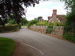
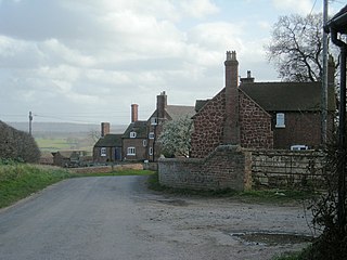
Moreton Corbet is a village in the civil parish of Moreton Corbet and Lee Brockhurst in Shropshire, England. The village's toponym refers to the Corbet baronets, the local landowners.
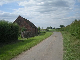
Ellerdine is a small hamlet located six miles north of the market town of Wellington, Shropshire.

Cold Hatton is a small village in Shropshire, located approximately six miles south of Hodnet near the confluence of the River Tern and River Meese. It is in the civil parish of Ercall Magna. Since 1998 it has been part of the Telford and Wrekin unitary district.

Goldstone is a small hamlet in eastern Shropshire, England, in the civil parish of Cheswardine. It lies in an isolated rural area north of Hinstock and Ellerton, around 5 miles (8 km) south of the nearest town, Market Drayton.
Isombridge is a small hamlet in rural Shropshire. It lies on the border of the civil parishes of Wrockwardine and Rodington, north of Wrockwardine village, near the River Tern. Population details are included under Rodington. Immediately to the north is another small hamlet, Marsh Green, which was formerly on the Shrewsbury Canal until the latter's closure.
Burton Court is a Grade II* listed English country manor house in the Parish of Eardisland, southwest of Leominster, Herefordshire, England. The manor dates to at least the 11th century and the current house to the early 14th and 18th century. It lies along the A44 road, about 1 mile (1.6 km) south of Eardisland in the northern part of the hamlet of Lower Burton. It is now run as a Herefordshire wedding and private hire venue. Burton Court featured in Simon Jenkins's book England's Thousand Best Houses.

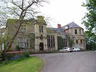
The Siege of High Ercall Hall in High Ercall, Shropshire, England took place during the First English Civil War. There were a total of three sieges. In each of the sieges, the Hall was held by the Royalists and besieged by the Parliamentarians. The final and longest siege took place from July 1645 to March 1646, when the Royalist commander surrendered the hall to the Parliamentarians.
High Ercall Hall or Ercall Hall is the remaining part of a larger complex in the village of High Ercall, Shropshire, 8 miles (13 km) north-east of Shrewsbury.

Broadward is a dispersed hamlet in south Shropshire, England, situated by the border with Herefordshire. It is in the civil parish of Clungunford, a village approximately 2 miles (3.2 km) to the north.

