South Queensferry

Last updated

Queensferry
  • Scottish Gaelic: Cas Chaolais
    (also "Port/Aiseag/Iomarach na Banrìghinn")
Queensferry sign on the B924.JPG
Sign on entering Queensferry, displaying the arms of the burgh
Edinburgh UK location map.svg
Red pog.svg
Queensferry
Location within the City of Edinburgh council area
Scotland location map.svg
Red pog.svg
Queensferry
Location within Scotland
Population10,400 (mid-2020 est.) [1]
OS grid reference NT129783
Council area
Lieutenancy area
Country Scotland
Sovereign state United Kingdom
Post town SOUTH QUEENSFERRY
Postcode district EH30
Dialling code 0131
Police Scotland
Fire Scottish
Ambulance Scottish
UK Parliament
Scottish Parliament
List of places
UK
Scotland
55°59′24″N3°23′53″W / 55.990°N 3.398°W / 55.990; -3.398

Queensferry, also called South Queensferry or simply "The Ferry", is a town to the west of Edinburgh, Scotland. Traditionally a royal burgh of West Lothian, [3] it is now administered by the City of Edinburgh Council. It lies ten miles to the north-west of Edinburgh city centre, on the shore of the Firth of Forth between the Forth Bridge, Forth Road Bridge and the Queensferry Crossing. The prefix South serves to distinguish it from North Queensferry, on the opposite shore of the Forth. Both towns derive their name from the ferry service established by Queen Margaret in the 11th century, which continued to operate at the town until 1964, when the Road Bridge was opened.

Contents

Its population at the 2011 census was 9,026 based on the 2010 definition of the locality which in addition to the burgh includes Dalmeny. [4]

Toponymy

The Gaelic name Taobh a Deas Chas Chaolais means "[the] Southern Side of [the] Steep Strait". The name "Cas Chaolas" (Steep Strait) is older than the English name; it can be applied to either North or South Queensferry, or both. The queen referred to is Saint Margaret of Scotland who is believed to have established a ferry at this point for pilgrims on their way north to St Andrews. She died in 1093 and made her final journey by ferry to Dunfermline Abbey. Her son, David I of Scotland, awarded the ferry rights to the abbey.

Local Traditions

Christmas in Queensferry

A local showcase of talent and celebration in preparation for Christmas. The community gather together for a series of performances from Queensferry's local people. The night ends with a firework display and a switch on of the towns decoration. The show is hosted by familiar faces in the town such as Councillor Norman Work, Ben Graham and Ross Graham, Adam Mitchell or Luke Cumming-McMillan and Jonathan Riley (current).

The Ferry Fair

A local fair dates from the 12th century. The modern fair, dating from the 1930s, takes place each August and includes the crowning of a local school-girl as the Ferry Fair Queen, accompanied by a Ferry Fair Court of other school-children, a procession of floats, pipe bands, and competitive events such as the Boundary Race. The Fair had a dedicated radio station, Jubilee1, which in May 2007 was awarded a licence to evolve into a full Public Service Community Station for North and South Queensferry.

The Burry Man

The Burry Man takes a rest supported by his two attendants. Queensferry Burryman.jpg
The Burry Man takes a rest supported by his two attendants.

Queensferry hosts the strange annual procession of the Burry Man during the Ferry Fair. This unique cultural event is over three hundred years old, and likely pagan in origin. The name 'Burry Man' almost certainly refers to the hooked fruits of the burdock plant - burrs - in which he is covered, although some have suggested that it is a corruption of 'Burgh Man', since the town is traditionally a royal burgh.

A local man is covered from head-to-toe in sticky burrs which adhere to undergarments covering his entire body, leaving only the shoes, hands and two eye holes exposed. On top of this layer he wears a sash, flowers and a floral hat and he grasps two staves. His ability to bend his arms or sit down is very restricted during the long day and his progress is a slow walk with frequent pauses. Two attendants in ordinary clothes assist him throughout the ordeal, helping him hold the staves, guiding his route, and fortifying him with whisky sipped through a straw, whilst enthusiastic children go from door-to-door collecting money on his behalf. The key landmarks on the tour are the Provost's office and each pub in the village.

The Loony Dook

The 2009 Loony Dook Loony Dook (3167158172).jpg
The 2009 Loony Dook

The name "Loony dook" is a combination of "Loony" (short for "lunatic") and "dook", a Scots term meaning "dip" or "bathe", and is an event whereby people dive into the freezing waters of the Firth of Forth on New Year's Day, often in fancy dress. In recent years the event has attracted people from all over the world, including many people visiting Edinburgh to celebrate Hogmanay. A proposal to charge people to participate in this event was introduced in 2011, the proceeds of which benefit RNLI Queensferry. [5]

The event was conceived in 1986 as a joking suggestion by three locals for a New Year's Day hangover cure. The following year it was decided to repeat the event for charity. It has grown to become part of the official Edinburgh Hogmanay celebrations although originally organised solely by locals who utilised facilities at the Queensferry Arms Hotel (now Orocco Pier) for many years for access and changing before and after the event. As the popularity of the event grew participants later paraded ahead of the dook from the Moorings pub (now the Inchcolm) but from 2011, due to factors such as increased crowds, safety issues and popularity, the event has been handled by the organisers of Edinburgh's Hogmanay, with the parade now starting from the Hawes Promenade at the other end of the town. Up to 2016 two of the original Dookers, James MacKenzie and Ian 'Rambo' Armstrong, have the distinction of taking part in every Loony Dook and the two wore specially designed T-shirts with 30yrs to celebrate the achievement. [6]

The event has inspired similar, though smaller in scale, annual New Year Loony Dooks, such as in North Berwick in East Lothian and Kirkcaldy in Fife, both also on the Firth of Forth.

Brass band

Queensferry has a community brass band that evolved from being a school brass band to a youth band and finally to its present status as a competing adult band. It came third in the 2006 Scottish Brass Band Championships 4th section contest [7] and fourth in 2007. [8] In addition to competing, it takes part in many community events including the Ferry Fair and Christmas in Queensferry light switch-on event. There is also a school brass band that has won the Community section of the Scottish Youth Brass Band Championships in 2005 and 2006. [9] [10]

Places of interest

St Mary's Episcopal Church, formerly a Carmelite monastery, dates from the 1450s St. Mary's Church. Queensferry. - geograph.org.uk - 962247.jpg
St Mary's Episcopal Church, formerly a Carmelite monastery, dates from the 1450s

Churches

St Mary's Episcopal Church, also known as the Priory Church, is the town's oldest building, built for the Carmelite Order of friars in the 1450s. It is the only medieval Carmelite church still in use in the British Isles, and is a Category A listed building. [11] After the Scottish Reformation of 1560 it served as the parish church until 1635. In 1890 it was reconsecrated for the Scottish Episcopal Church.

The Old Parish Church on The Vennel dates from 1633 and has an interesting early graveyard. The church became known as the South Church in 1929, and served the Church of Scotland congregation until 1956, when it united with St Andrew's Church. The old South Church building was sold in 1970 and is now a house.

The building which now houses Queensferry Parish Church, located in The Loan, was originally built as South Queensferry United Free Church. Following the union of the Church of Scotland and the United Free Church of Scotland in 1929, the UF Church became known as St Andrew's Church and the old Church of Scotland congregation as the South Church. The two congregations were united in 1956, becoming Queensferry Parish Church. The Reverend John Carrie was minister from 1971 until his untimely death in 2008. In 1972 he started an annual sponsored walk across the Forth Road Bridge for Christian Aid, so far raising over £1,000,000. In 2009 the Rev. David Cameron transferred from Newton Mearns to Queensferry Parish Church.

St Margaret's Roman Catholic church is also located on The Loan. Mass is celebrated daily.

Stately homes

Other significant buildings

South Queensferry Tolbooth Jubilee Clock Tower, South Queensferry.jpg
South Queensferry Tolbooth

Black Castle is a house on the High Street built in 1626. [12] When the original owner, a sea-captain, was lost at sea, his maid was accused of paying a beggar-woman to cast a spell. Both women were burned for witchcraft. Plewlands House is a 17th-century mansion in the centre of the village. It was restored in the 1950s as flats, and is now managed by the National Trust for Scotland. South Queensferry Tolbooth, on the High Street, dates from the 17th century, with a clock-tower built in 1720. [13]

The Hawes Inn, dating from the 17th century, lies east of Queensferry, almost under the Forth Bridge on its south side. It features in Robert Louis Stevenson's novel Kidnapped . Opposite the Hawes Inn is the pier which served the ferry (from which the town derives its name) until the opening of the Forth Road Bridge. The pier is now used by tourist boats including the ferry to Inchcolm.

Modern day Orocco Pier, latterly named the Queensferry Arms Hotel, has been a local inn and place of refreshment since 1664. Located opposite the Jubilee Clock Tower, at 17 High Street, its original facade still boasts many of its original features.

South Queensferry Cemetery on Ferrymuir Lane at the south end of the town is unremarkable other than for the very large number of Royal Navy war graves, many for casualties of the Battle of Jutland (1916) who were brought here for burial. It is maintained and operated by the City of Edinburgh Council. It superseded the small graveyard on The Vennel in the centre of town.

Opened in March 2007 by Dakota Hotels, the 'black box' seen from the A90 is a hotel, Bar & Grill. [14]

Mesolithic settlement

In 2012 as part of the excavations for the new Forth road crossing archaeologists excavated the remains of a mesolithic dwelling dating to around 10,000 years ago and believed to be the earliest home discovered in Scotland, and possibly the entire UK. [15]

Schools

South Queensferry seen from the Forth Road Bridge South queensferry 2.JPG
South Queensferry seen from the Forth Road Bridge

Queensferry has four primary schools (Echline Primary, Queensferry Primary, St Margaret's RC Primary and Dalmeny Primary) and one secondary school (Queensferry High School), with Kirkliston Primary also part of its catchment area.

Landmarks

The local brewery, Ferry Brewery, makes beers named after landmarks around the town, including the Ferry Crossing and the Three Bridges. [16]

View of Forth Bridge from back of Newhalls Inn, South Queensferry, 1887 Forth Bridge - General view from back of Newhalls Inn, South Queensferry.jpg
View of Forth Bridge from back of Newhalls Inn, South Queensferry, 1887

Transport

Queensferry is served by bus services operated by: Lothian Country, McGill's Scotland East and Stagecoach East Scotland. [17] [18] [19]

Dalmeny railway station is located to the east of South Queensferry, where ScotRail operates services on its Fife Circle route.

Notable residents

Related Research Articles

<span class="mw-page-title-main">Fife</span> Council area of Scotland

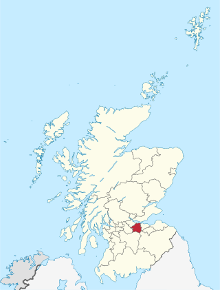
Fife is a council area, historic county, registration county and lieutenancy area of Scotland. It is situated between the Firth of Tay and the Firth of Forth, with inland boundaries with Perth and Kinross and Clackmannanshire. By custom it is widely held to have been one of the major Pictish kingdoms, known as Fib, and is still commonly known as the Kingdom of Fife within Scotland. A person from Fife is known as a Fifer. In older documents the county was very occasionally known by the anglicisation Fifeshire.

<span class="mw-page-title-main">West Lothian</span> Council area of Scotland

West Lothian is one of the 32 council areas of Scotland, and was one of its historic counties. The county was called Linlithgowshire until 1925. The historic county was bounded geographically by the Avon to the west and the Almond to the east. The modern council area occupies a larger area than the historic county. It was reshaped following local government reforms in 1975: some areas in the west were transferred to Falkirk; some areas in the east were transferred to Edinburgh; and some areas that had formerly been part of Midlothian were added to West Lothian.

<span class="mw-page-title-main">Firth of Forth</span> Estuary of Scotlands River Forth

The Firth of Forth is the estuary, or firth, of several Scottish rivers including the River Forth. It meets the North Sea with Fife on the north coast and Lothian on the south.

<span class="mw-page-title-main">North Queensferry</span> Human settlement in Scotland

North Queensferry is a historic coastal village in Fife, Scotland, situated on the Firth of Forth, 9 mi (14 km) from Edinburgh city centre. Located on the North Queensferry Peninsula, it is the southernmost settlement in Fife.

<span class="mw-page-title-main">Broughty Ferry</span> Suburb of Dundee, Scotland

Broughty Ferry is a suburb of Dundee, Scotland. It is situated four miles east of the city centre on the north bank of the Firth of Tay. The area was a separate burgh from 1864 until 1913, when it was incorporated into Dundee. Historically it is within the County of Angus.

<span class="mw-page-title-main">North Berwick</span> Town in East Lothian, Scotland

North Berwick is a seaside town and former royal burgh in East Lothian, Scotland. It is situated on the south shore of the Firth of Forth, approximately 20 miles (32 km) east-northeast of Edinburgh. North Berwick became a fashionable holiday resort in the nineteenth century because of its two sandy bays, the East Bay and the West Bay, and continues to attract holidaymakers. Golf courses at the ends of each bay are open to visitors.

<span class="mw-page-title-main">Inverkeithing</span> Town in Scotland

Inverkeithing is a coastal town, parish and historic Royal burgh in Fife, Scotland, on the Firth of Forth, 9½ miles northwest of Edinburgh city centre and 4 miles south of Dunfermline city centre.

<span class="mw-page-title-main">Burntisland</span> Human settlement in Scotland

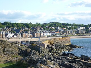
Burntisland is a former Royal burgh and parish in Fife, Scotland, on the northern shore of the Firth of Forth. It was previously known as Wester Kinghorn or Little Kinghorn. The town has a population of 6,269 (2011).

<span class="mw-page-title-main">Fife Circle Line</span> Railway line in Eastern Scotland, UK

The Fife Circle Line is the local rail service north from Edinburgh. It links towns of south Fife and the coastal towns along the Firth of Forth before heading to Edinburgh. Operationally, the service is not strictly a circle route, but, rather, a point to point service that reverses at the Edinburgh end, and has a large bi-directional balloon loop at the Fife end.

<span class="mw-page-title-main">Kirkliston</span> Human settlement in Scotland

Kirkliston is a village and parish to the west of Edinburgh, Scotland, historically within the county of West Lothian but now within the City of Edinburgh council area limits. It lies on high ground immediately north of a northward loop of the Almond, on the old road between Edinburgh and Linlithgow, having a crossroads with the road from Newbridge to Queensferry and beyond to Fife. The B800 is variously named Path Brae, High Street, Station Road, and Queensferry Road as it passes through the town. The B9080 is named Main Street and Stirling Road as it passes through.

<span class="mw-page-title-main">Dalmeny railway station</span> Railway station in Edinburgh, Scotland

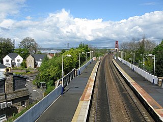
Dalmeny railway station is a railway station serving the towns of Dalmeny and South Queensferry, about 8 miles (13 km) west of Edinburgh city centre. It is on the Fife Circle Line, located just south of the Forth Bridge.

<span class="mw-page-title-main">Dalmeny</span> Human settlement in Scotland

Dalmeny is a village and civil parish in Scotland. It is located on the south side of the Firth of Forth, 1 mile (1.6 km) southeast of South Queensferry and 8 miles (13 km) west of Edinburgh city centre. It lies within the traditional boundaries of West Lothian, and falls under the local governance of the City of Edinburgh Council. Dalmeny is on the route used as the X99 Queensferry off-service loop.

The B800 is a short road in eastern Scotland, connecting the Forth Road Bridge to Kirkliston. It is a two-way single carriageway road.

<span class="mw-page-title-main">Mercat cross</span> Scottish historic structure

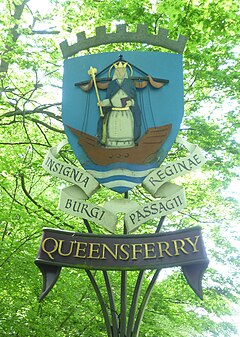
A mercat cross is the Scots name for the market cross found frequently in Scottish cities, towns and villages where historically the right to hold a regular market or fair was granted by the monarch, a bishop or a baron. It therefore served a secular purpose as a symbol of authority, and was an indication of a burgh's relative prosperity. Historically, the term dates from the period before 1707, when the Kingdom of Scotland was an independent state, but it has been applied loosely to later structures built in the traditional architectural style of crosses or structures fulfilling the function of marking a settlement's focal point. Historical documents often refer simply to "the cross" of whichever town or village is mentioned. Today, there are around 126 known examples of extant crosses in Scotland, though the number rises if later imitations are added.

<span class="mw-page-title-main">Queensferry High School</span> State school in South Queensferry, West Lothian, Scotland

Queensferry High School is a six-year comprehensive school in the town of South Queensferry, Scotland, run by the City of Edinburgh Council. It was opened in 1970 by Princess Margaret marking the 900th anniversary of the arrival of Queen Margaret in Queensferry. Currently it has 1036 students, predominantly from Echline Primary School, Queensferry Primary School, Dalmeny Primary School and Kirkliston Primary School. It was made a School of Ambition in 2007.

<span class="mw-page-title-main">City of Edinburgh Council</span> Local government body in Scotland

The City of Edinburgh Council is the local government authority covering the City of Edinburgh council area. Almost half of the council area is the area of Edinburgh, capital of Scotland. With a population of 514,990 in mid-2019, it is the second most populous local authority area in Scotland.

The Firth of Forth was historically crossed by ferry until the opening of the Forth Road Bridge in 1964.

The Dunfermline and Queensferry Railway was a railway company founded to form part of a rail and ferry route between Dunfermline and Edinburgh, in Scotland. It was authorised in 1873 and its promoters had obtained informal promises from the larger North British Railway that the NBR would provide financial help, and also operate the ferry and the necessary railway on the southern side of the Firth of Forth.

The Forth Bridge approach railways were railway lines constructed in the period 1887 to 1890 to form new main lines on the opening of the Forth Bridge at the Queensferry crossing. Until then, only local branch lines approached the location. The North British Railway built new main lines and upgraded some existing lines.

<span class="mw-page-title-main">Loony Dook</span>

The Loony Dook is an annual event held on New Year's Day in which people dive into the freezing waters of the Firth of Forth at South Queensferry, often in fancy dress.

References

  1. "Mid-2020 Population Estimates for Settlements and Localities in Scotland". National Records of Scotland. 31 March 2022. Retrieved 31 March 2022.
  2. "The Lord-Lieutenants (Scotland) Order 1996". Legislation.gov.uk. 4 July 2011. Retrieved 4 May 2016.
  3. "City of Edinburgh Conservation Area Character Appraisal" (PDF).
  4. "Queensferry (City of Edinburgh)" . Retrieved 19 June 2014.
  5. "You'd be barking to splash out £6 on the Loony Dook! - News - Scotsman.com". Edinburghnews.scotsman.com. Retrieved 13 November 2011.
  6. "Friend celebrate 30th time participating in South Queensferry Loony Dook". Linlithgow Gazette. 5 January 2016.
  7. "Scottish Brass Band Association". Sbba.org.uk. Retrieved 7 November 2012.
  8. "Scottish Brass Band Association". Sbba.org.uk. Retrieved 7 November 2012.
  9. "Scottish Brass Band Association". Sbba.org.uk. Retrieved 7 November 2012.
  10. "Scottish Brass Band Association". Sbba.org.uk. Retrieved 7 November 2012.
  11. Historic Environment Scotland. "Hopetoun Road, The Priory Church of St. Mary of Mount Carmel, including Boundary Walls (Category A Listed Building) (LB40391)" . Retrieved 20 March 2019.
  12. "History of 'Black Castle' followed by Update on Brewery Close". Queensferry at War. Retrieved 18 May 2018.
  13. Historic Environment Scotland. "Tolbooth, West Terrace, High Street, South Queensferry (LB40411)" . Retrieved 4 December 2021.
  14. Topping, Alexandra (27 June 2007). "Hotel Review". London: Guardian. Retrieved 13 November 2012.
  15. "Scottish dig unearths '10,000-year-old home' at Echline". BBC News. 18 November 2012. Retrieved 16 November 2014.
  16. "Queensferry Crossing: Why are locals calling the new bridge 'Kevin'?". iNews. 1 September 2017. Retrieved 13 March 2018.
  17. "Fife & Fife+ zones" (PDF). Stagecoach Group.
  18. "First Bus | Bus Tickets, Timetables & Journey Planning" (PDF).
  19. "Lothian Country".
  20. Stephen, Hendry (6 September 2018). Me and the table : my autobiography. London. ISBN   9781786069047. OCLC   1051003500.{{cite book}}: CS1 maint: location missing publisher (link)