
Interstate 83 (I-83) is an Interstate Highway located in the states of Maryland and Pennsylvania in the Eastern United States. Its southern terminus is at a signalized intersection with Fayette Street in Baltimore, Maryland; its northern terminus is at I-81 near Harrisburg, Pennsylvania. I-83 runs from Downtown Baltimore north to I-695 near the northern suburb of Timonium on the Jones Falls Expressway before forming a concurrency with I-695. After splitting from I-695, the route follows the Baltimore-Harrisburg Expressway north to the border between Maryland and Pennsylvania. Upon crossing the state line, I-83 becomes the Veterans of Foreign Wars of the United States Memorial Highway and continues north through York toward the Harrisburg area. The route runs along the southern and eastern portion of the Capital Beltway that encircles Harrisburg before reaching its northern terminus.

The Inner Harbor is a historic seaport, tourist attraction, and landmark in Baltimore, Maryland. It was described by the Urban Land Institute in 2009 as "the model for post-industrial waterfront redevelopment around the world". The Inner Harbor is located at the mouth of Jones Falls, creating the wide and short northwest branch of the Patapsco River. The district includes any water west of a line drawn between the foot of President Street and the American Visionary Art Museum.

Interstate 695 (I-695) is a 51.46-mile-long (82.82 km) auxiliary Interstate Highway that is a full beltway extending around Baltimore, Maryland, United States. I-695 is officially designated the McKeldin Beltway but is colloquially referred to as either the Baltimore Beltway or 695. The route is an auxiliary route of I-95, intersecting that route southwest of Baltimore near Arbutus and northeast of the city near White Marsh. It also intersects other major roads radiating from the Baltimore area, including I-97 near Glen Burnie, the Baltimore–Washington Parkway near Linthicum, I-70 near Woodlawn, I-795 near Pikesville, and I-83 in the Timonium area. The 19.37-mile (31.17 km) portion of the Baltimore Beltway between I-95 northeast of Baltimore and I-97 south of Baltimore is officially Maryland Route 695 (MD 695) and is not part of the Interstate Highway System but is signed as I-695. This section of the route includes the Francis Scott Key Bridge that crosses over the Patapsco River. The bridge and its approaches are maintained by the Maryland Transportation Authority (MDTA) while the remainder of the Baltimore Beltway is maintained by the Maryland State Highway Administration (MDSHA).

Interstate 395 (I-395) is an auxiliary Interstate Highway in the US state of Maryland. Known as Cal Ripken Way, the highway runs 1.98 miles (3.19 km) from I-95 north to Howard Street and Camden Street in Downtown Baltimore, where it provides access to the Inner Harbor and the Baltimore Convention Center. The Interstate also serves the Camden Yards Sports Complex, which contains M&T Bank Stadium and Oriole Park at Camden Yards, homes of the Baltimore Ravens and Baltimore Orioles, respectively. I-395 also serves as the southern terminus of Martin Luther King Jr. Boulevard, an urban arterial that provides a western bypass of Downtown Baltimore and connects I-95 with U.S. Route 40 (US 40), US 1, and I-83. The Interstate is maintained by the Maryland Transportation Authority (MDTA) and, like all Interstates, is a part of the National Highway System.
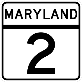
Maryland Route 2 is the longest state highway in the U.S. state of Maryland. The 79.24-mile (127.52 km) route runs from Solomons Island in Calvert County north to an intersection with U.S. Route 1 /US 40 Truck in Baltimore. The route runs concurrent with MD 4 through much of Calvert County along a four-lane divided highway known as Solomons Island Road, passing through rural areas as well as the communities of Lusby, Port Republic, Prince Frederick, and Huntingtown. In Sunderland, MD 2 splits from MD 4 and continues north as two-lane undivided Solomons Island Road into Anne Arundel County, still passing through rural areas. Upon reaching Annapolis, the route runs concurrent with US 50/US 301 to the north of the city. Between Annapolis and Baltimore, MD 2 runs along the Governor Ritchie Highway, a multilane divided highway that heads through suburban areas, passing through Arnold, Severna Park, Pasadena, Glen Burnie, and Brooklyn Park. In Baltimore, the route heads north on city streets and passes through the downtown area of the city.
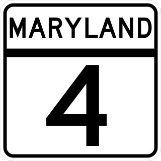
Maryland Route 4 is a state highway in the U.S. state of Maryland. The highway runs 64.85 miles (104.37 km) from MD 5 in Leonardtown north to Southern Avenue in Suitland at the District of Columbia boundary, beyond which the highway continues into Washington as Pennsylvania Avenue. MD 4 is a four- to six-lane highway that connects Washington and communities around Interstate 95 (I-95)/I-495 with southern Prince George's County with southwestern Anne Arundel County. The highway is the primary highway for the length of Calvert County, during most of which the route runs concurrently with MD 2. MD 4 also connects Calvert and St. Mary's counties via the Governor Thomas Johnson Bridge across the Patuxent River. The highway connects the Southern Maryland county seats of Leonardtown, Prince Frederick, and Upper Marlboro.

Interstate 95 (I-95) is an Interstate Highway running along the East Coast of the United States from Miami, Florida, north to the Canada–United States border at Houlton, Maine. In Maryland, the route is a major highway that runs 110.01 miles (177.04 km) diagonally from southwest to northeast, entering from the District of Columbia and Virginia at the Woodrow Wilson Bridge over the Potomac River, northeast to Maryland's border with Delaware near Elkton. It is the longest Interstate Highway within Maryland and is one of the most traveled Interstate Highways in the state, especially between Baltimore and Washington, D.C., despite alternate routes along the corridor, such as the Baltimore–Washington Parkway, U.S. Route 1 (US 1), and US 29. I-95 also has eight auxiliary routes in the state, the most of any state along the I-95 corridor. Portions of the highway, including the Fort McHenry Tunnel and the Millard E. Tydings Memorial Bridge, are tolled.

Charles Street, known for most of its route as Maryland Route 139, runs through Baltimore and the Towson area of Baltimore County. On the north end it terminates at an intersection with Bellona Avenue near Interstate 695 (I-695) and at the south end it terminates in Federal Hill in Baltimore. Charles Street is one of the major routes through the city of Baltimore, and is a major public transportation corridor. For the one-way portions of Charles Street, the street is functionally complemented by the parallel St. Paul Street, Maryland Avenue, Cathedral Street, and Liberty Street.

U.S. Route 1 (US 1) is the easternmost and longest of the major north–south routes of the older 1920s era United States Numbered Highway System, running from Key West, Florida, to Fort Kent, Maine. In the U.S. state of Maryland, it runs 81 miles (130 km) from the Washington, D.C. line to the Pennsylvania state line near the town of Rising Sun.

U.S. Route 40 in the U.S. state of Maryland runs from Garrett County in Western Maryland to Cecil County in the state's northeastern corner. With a total length of 221 miles (356 km), it is the longest numbered highway in Maryland. Almost half of the road overlaps or parallels with Interstate 68 (I-68) or I-70, while the old alignment is generally known as US 40 Alternate, US 40 Scenic, or Maryland Route 144. West of Baltimore, in the Piedmont and Appalachian Mountains / Blue Ridge region of the Western Maryland panhandle of the small state, the portions where it does not overlap an Interstate highway are mostly two-lane roads. The portion northeast of Baltimore going toward Wilmington in northern Delaware and Philadelphia in southeastern Pennsylvania is a four-lane divided highway, known as the Pulaski Highway. This section crosses the Susquehanna River at the north end of the Chesapeake Bay on the Thomas J. Hatem Memorial Bridge.

100 Light St, originally built as the USF&G Building, serving as headquarters of the United States Fidelity and Guarantee Company, a specialized insurance company founded in Baltimore in 1896, and relocated here from its former complex of three adjoining early 20th Century masonry structures at the southwest corner of South Calvert and Redwood Streets. Later occupied by and known as the Legg-Mason Building, it is a 40-story, 161 m (528 ft) skyscraper completed in 1973 in downtown Baltimore, Maryland at 100 Light Street on the city block bounded by South Charles, East Lombard, Light and East Pratt Streets, facing the former "The Basin" of the Helen Delich Bentley Port of Baltimore on the Northwest Branch of the Patapsco River and the newly iconic Inner Harbor downtown business waterfront redevelopment of the 1970s–1980s. It is the tallest building in Baltimore and in Maryland.
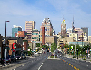
Downtown Baltimore is the central business district of the city of Baltimore traditionally bounded by Martin Luther King, Jr. Boulevard to the west, Franklin Street to the north, President Street to the east and the Inner Harbor area to the south.
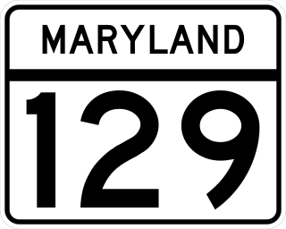
Maryland Route 129 is a state highway in the U.S. state of Maryland, running north-northwesterly from U.S. Route 40 and MD 295 in the city of Baltimore into Baltimore County, ending at Garrison Forest Road east of Reisterstown. The route leaves downtown on the one-way pair of McCulloh Street and Druid Hill Avenue, and then uses the entire length of Park Heights Avenue to the end. MD 129 connects Downtown Baltimore with Druid Hill Park using McCulloh Street and Druid Hill Avenue. As Park Heights Avenue, the state highway is one of two primary radial routes in the northwestern part of the city, providing access to The Maryland Zoo and Pimlico Race Course. In Baltimore County, MD 129 passes through Pikesville, where it has a junction with Interstate 695 (I-695) and serves an affluent rural area north of Pikesville and east of Reisterstown.
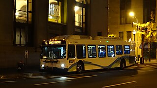
LocalLink 95 is a bus route operated by the Maryland Transit Administration in Baltimore. The line currently runs from the intersection of Roland Avenue and Lake Avenue in Roland Park south to the Inner Harbor via Roland Avenue, University Parkway, Charles Street and St. Paul Street.

Maryland Route 765 is a collection of state highways in the U.S. state of Maryland. These 26 highways are service roads constructed or old alignments maintained to provide access to private property or county highways whose access was compromised by the realignment of MD 2 and MD 4 in Calvert County. There are six signed mainline segments of MD 765 comprising the old alignment of the concurrency of MD 2 and MD 4 through Solomons, Lusby, St. Leonard, and Port Republic, and the county seat of Prince Frederick in southern Calvert County. There are also 20 unsigned sections of MD 765 south of Prince Frederick and along MD 2 between its junction with MD 4 in Sunderland and Owings in northern Calvert County.

The Baltimore City Circuit Courthouses are state judicial facilities located in downtown Baltimore, Maryland. They face each other in the 100 block of North Calvert Street, between East Lexington Street on the north and East Fayette Street on the south across from the Battle Monument Square (1815-1822), which held the original site of the first colonial era courthouse for Baltimore County and Town, after moving the Baltimore County seat in 1767 to the burgeoning port town on the Patapsco River established in 1729-1730.

Charles Center is a large-scale urban redevelopment project in central Baltimore's downtown business district of the late 1950s and early 1960s. Beginning in 1954, a group called the "Committee for Downtown" promoted a master plan for arresting the commercial decline of central Baltimore. In 1955, the "Greater Baltimore Committee", headed by banker and developer James W. Rouse, joined the effort. A plan was developed by noted American urban planner and architect David A. Wallace, (1917−2004), strongly supported by Mayors Thomas L. J. D'Alesandro, Jr. (1947−1959) and Theodore R. McKeldin, and many in their administrations, which formed the basis of a $25 million bond issue voted on by the citizens of Baltimore City during the municipal elections in November 1958. The architects' view of the overall Charles Center Redevelopment Plan with the conceptions of possible buildings, lay-out and plan that was publicized to the voters that spring and summer before, only slightly resembles the actual buildings and designs that later were really constructed by the mid-1970s.

