Maryland Route 25

Last updated

MD Route 25.svg

Maryland Route 25

Falls Road
Maryland Route 25
Maryland Route 25 highlighted in red
Route information
Maintained by Baltimore DOT and MDSHA
Length26.89 mi [1] [2]  (43.28 km)
Existed1927–present
Tourist
routes
MD scenic byway.svg Falls Road Scenic Byway
MD scenic byway.svg Mason and Dixon Scenic Byway
MD scenic byway.svg Horses and Hounds Scenic Byway
Major junctions
South endMD Route 2.svg MD 2 in Baltimore
Major intersections
North endBeckleysville Road near Alesia
Location
Country United States
State Maryland
Counties City of Baltimore, Baltimore
Highway system
MD Route 24.svg MD 24 MD Route 26.svg MD 26

Maryland Route 25 (MD 25), locally known for nearly its entire length as Falls Road, is a state highway in the U.S. state of Maryland. It begins north of downtown Baltimore, just north of Penn Station, and continues north through Baltimore County to Beckleysville Road near the Pennsylvania state line. The road passes through the communities of Hampden, Medfield, Cross Keys, and Mount Washington in the city, and Brooklandville and Butler in Baltimore County. The entire length of MD 25 that uses Falls Roadand its county-maintained continuation north to Alesia is a Maryland Scenic Byway, named the Falls Road Scenic Byway. [3]

Contents

Route description

City of Baltimore

MD 25 begins as a one-way pair, Lafayette Street westbound and Lanvale Street eastbound, at the one-way pair comprising MD 2, Calvert Street northbound and St. Paul Street southbound, in the Charles North neighborhood of Baltimore and within the North Central Historic District. Lafayette Street and Lanvale Street head west as two-lane streets and intersects another one-way pair of streets, northbound Charles Street and southbound Maryland Avenue. Within the CharlesLafayetteMarylandLanvale block is a plethora of historic sites: the Hans Schuler Studio and Residence on Lafayette Street, the Charles Theatre and Baltimore City Passenger Railway Power House and Car Barn on Charles Street, and rowhouses comprising the Buildings at 1601–1830 St. Paul Street and 12–20 E. Lafayette Street. [1] [4]

View south along MD 25 from North Howard Street, just north of MD 25's southern terminus 2020-07-27 12 40 41 View south along Maryland State Route 25 (Falls Road) from the overpass for North Howard Street in Baltimore, Maryland.jpg
View south along MD 25 from North Howard Street, just north of MD 25's southern terminus

West of Maryland Avenue, Lafayette Street and Lanvale Street merge into two-lane undivided Falls Road, which curves northwest and briefly parallels Amtrak's Northeast Corridor railroad line, which enters Penn Station serving Amtrak and MARC's Penn Line to the southeast. As the railroad tracks veer away toward Washington, MD 25 begins to parallel the east side of Jones Falls and MTA Maryland's Baltimore Light RailLink line, which is on the west side of the stream, at the southern end of the stream's deep valley. The highway passes underneath the Howard Street and US 1/US 40 Truck (North Avenue) bridges and by the Baltimore Streetcar Museum buildings and sheds. MD 25 parallels MTA Maryland's Route 25, which comprises the reconstructed streetcar tracks used for streetcar rides from the museum site north under CSX's Baltimore Terminal Subdivision railroad line and past the remains of a roundhouse to the Museum's streetcar turning loop just south of the 28th Street and 29th Street's bridges over the Jones Falls valley. MD 25 passes under Wyman Park Drive just south of the former Stieff Silver Company factory building and Mount Vernon Mill No. 1 (recently renovated for apartments and condos), down the hill from the Stone Hill Historic District. [1] [4]

MD 25 southbound at I-83 southbound in Baltimore 2020-07-27 11 50 08 View south along Maryland State Route 25 (Falls Road) at the exit for Interstate 83 SOUTH in Baltimore, Maryland.jpg
MD 25 southbound at I-83 southbound in Baltimore

At the southern end of the Hampden neighborhood to the east and the Woodberry community on the western hills, MD 25 ascends from the Jones Falls valley and temporarily expands to a four-lane divided street at its ramps with I-83 (Jones Falls Expressway). The partial interchange, which includes ramps from southbound MD 25 to southbound I-83 and from northbound I-83 to northbound MD 25, is next to the historic home "Evergreen on the Falls" now occupied by the Maryland association of the Society for the Prevention of Cruelty to Animals (SPCA). The street becomes undivided and reduces to two lanes at the main street of Hampden, 36th Street or The Avenue. North of 41st Street, MD 25 passes between the neighborhoods of Medfield to the west and Hoes Heights on the east. The highway intersects Cold Spring Lane next to the joint campus of the Baltimore Polytechnic Institute (Baltimore City public high school specializing in math, science, engineering and technology) and the all-girls Western High School and passes between the Village of Cross Keys (an apartment-condo complex with a small shopping center/mall) on the west and the community of Roland Park on the hills above to the east as a four-lane undivided highway. MD 25 intersects Northern Parkway, (built over and segmented with former Belvedere Avenue) then descends again into the Jones Falls valley and passes through the center of Mount Washington. The neighborhood contains the North Baltimore Aquatic Club, where American Olympics team member Michael Phelps trained, and an intersection with Kelly Avenue and its Bridge which connects to the west with the hilly community of Mount Washington, where the highway reduces to two lanes. Here also is the former campus of old Mount Saint Agnes College for women, and its famous "Octagon House", now a corporate campus for several financial and insurance companies), MD 25 leaves the city of Baltimore at its 1919 City Limits just south of West Lake Avenue. [1] [4]

Baltimore to Alesia

View south along MD 25 at MD 137 in Whitehouse 2016-07-12 18 43 07 View south along Maryland State Route 25 (Falls Road) just south of Maryland State Route 137 (Mount Carmel Road) in Whitehouse, Baltimore County, Maryland.jpg
View south along MD 25 at MD 137 in Whitehouse

MD 25 enters the Bare Hills Historic District and Bare Hills area of Baltimore County. The state highway crosses over the Baltimore Light RailLink line again and the Jones Falls next to the Falls Road station. The station is accessed via unsigned MD 746 (Lakeside Drive), which partially runs underneath MD 25 along the latter highway's overpass on its way to the station parking lot. The state highway ascends from the stream valley and curves northwest between Robert E. Lee Memorial Park (a Baltimore City park located just barely in Baltimore County) with its historic Lake Roland and dam from the old 1860 city waterworks system to the northeast and the Bare Hills House on the southbound side of the highway. MD 25 continues north through a well-forested affluent area between Towson (county seat of Baltimore County) to the east and Pikesville to the west with its headquarters for the Maryland State Police. The highway descends to and crosses Jones Falls twice on either side of an underpass of I-83. To the north of the second crossing of the stream, MD 25 has a four-leg intersection with MD 133 (Old Court Road) and Ruxton Road; the latter road has a half-diamond interchange with I-83 that allows access to and from Baltimore. North of MD 133, the highway passes the Rockland Historic District and the historic home "Rockland" in the community of Brooklandville. [2] [4]

MD 25 crosses over I-695 (Baltimore Beltway) then passes "The Cloisters" (former Baltimore City children's museum) and the Brooklandville House before crossing Jones Falls one last time at the east end of the Green Spring Valley as the highway enters Brooklandville. MD 25 has a ramp to the Jones Falls Expressway as the road begins to parallel the expressway. The highway, which is unsigned MD 25A north of I-695 (at which point I-83 continues east on I-695 to follow the Baltimore-Harrisburg Expressway), has its northern terminus at an orthogonal intersection with MD 25 and Joppa Road, which heads east toward Towson. MD 25 makes a sharp turn east at the north end of the parallel section, then turns north onto a four-lane divided highway extending north from the freeway. The highway passes through a commercial area to MD 130 (Greenspring Valley Road), north of which the highway becomes two lanes again. At the northern end of Brooklandville, the state highway meets the western end of MD 131 (Seminary Avenue) and passes by the campuses of Maryvale Preparatory School and Episcopal Church twin institutions, St. Paul's School (for boys) and St. Paul's School for Girls, founded by Old St. Paul's Church in downtown Baltimore at North Charles and East Saratoga Streets, the area's oldest church, founded 1692. MD 25 continues through the region of estate homes until the highway reaches Shawan Road and Tufton Avenue at the hamlet of Shawan, north of which the landscape shifts to farmland. [2] [4]

The northern end of Falls Road at Schalk Road No. 1 near Alesia FallsRoadNorth.jpg
The northern end of Falls Road at Schalk Road No. 1 near Alesia

MD 25 crosses Western Run and passes through the village of Butler, where the highway meets MD 128 (Butler Road). The highway follows Blackrock Run and Indian Run through a pair of ridges. At the second ridge, MD 25 has a Y intersection with MD 88 (Black Rock Road) at Coopersville. The state highway crosses Blackrock Run again and intersects MD 137 (Mount Carmel Road) at Whitehouse between Hampstead and Hereford. MD 25 reaches its northern terminus at Beckleysville Road west of Beckleysville and Prettyboy Reservoir near the BaltimoreCarroll county line. [2] [4] Falls Road continues northwest for 4.2 miles (6.8 km) as a county highway into northeastern Carroll County. Just north of its intersection with Hoffmanville Road near Alesia, the highway becomes a narrow gravel road. Falls Road has a grade crossing of CSX's Hanover Subdivision, then becomes a paved road again shortly before its northern terminus at Schalk Road No. 1 near Gunpowder Falls north of Alesia and south of Lineboro near the Maryland Pennsylvania state line. [5]


History

Turnpike

On the December 27, 1791, the Maryland General Assembly authorized Elisha Tyson, William & Charles Jessop, John Ellicott, George Leggett, Robert Long, Jacob Hart, and John Stricker to lay out a road, not to exceed 40 feet (12 m) wide, from their flour mill-seats on Jones Falls, then in Baltimore County, southerly to Baltimore Town, thereafter known as the Falls Road. [20] On January 19, 1805, A company known as 'The President, Managers and Company, of the Falls Turnpike Road', more commonly called the 'Falls Turnpike', was incorporated and chartered by the Maryland General Assembly. The company was authorized to build and operate a turnpike "for the accommodation of the inhabitants on Jones's Falls, and the country adjacent", running from "the ford by Messieurs [William] Patterson and [John] Stricker's mill" northerly to "the cross roads by the limekiln of Richard Caton" (Brooklandville). Construction was to begin within two years and finish within five. (Completion was extended to January 1, 1813 by the General Assembly on December 23, 1808. [6] ) The law included a statement that "it would be unjust and improper to extend the said turnpike so as to make the same intersect the York-town turnpike...drawing off from said road any portion of the trade that now passes down the said road into Old-town, in the city of Baltimore", but allowed the Falls Turnpike to extend south to the York-town Turnpike (Greenmount Avenue) "at or near a stone bridge opposite the old mill of Josiah Pennington" (Belvidere Street across Jones Falls, just south of Hoffman Street and east of Barclay Street) with the consent of that company. [7] A law passed January 25, 1806 allowed the company to build this extension without the approval of the York-town Turnpike. [8] On December 28, 1812, the General Assembly "confirmed and established" the completed roadway. [9]

Signboard showing toll rates Falls Turnpike tolls.jpg
Signboard showing toll rates

According to Richard Caton, whose limekiln was located near the north end of the turnpike, and who was one of the officers of the company, the turnpike was "excepted to unite the trade of the North with Baltimore...in a direct line to Hanover and Carlisle." This extension was delayed by what Caton thought was a desire to keep the Baltimore and Reister's-town Turnpike's monopoly. [10] A public road extending from Brooklandville north-northwesterly to George Kerlinger's Mill on Gunpowder Falls - near but not on the Pennsylvania state line - was authorized by a state law passed December 24, 1808. [11] The Falls Turnpike began building the road, but lacked funds to complete it, and another law passed January 15, 1817 allowed the company to increase their capitalization and to charge tolls for travel on the extension. [12] On March 12, 1828, the General Assembly ordered the company to, within six months, return this extension to the county for use as a free public road, and the turnpike was thus cut back to Brooklandville. [13]

The turnpike began at the intersection of Cathedral Street and Howard Street (now the diagonal portion of Chase Street, intersecting Cathedral Street about half a block south of Biddle Street). It proceeded north on Cathedral Street, crossing Jones Falls a bit north of North Avenue to the current Falls Road. [14] [15] [16] [17] After North Avenue was built, the turnpike was separated from Cathedral Avenue, ending at North Avenue east of Jones Falls. [18]

The description of allowed rates of toll given in the legislative charter are lengthy, and specify that, for instance, a horse and rider shall be charged 6.25 cents, and a two-horse stagecoach 25 cents, for the entire distance, and a smaller amount in proportion to the distance traveled. [7] Five miles were completed by 1811, allowing the company to erect a toll gate; a second gate had been placed by 1819. Due to the impossibility of determining how far a customer had traveled, the Baltimore County Court allowed the company to charge a full toll for passing over any part of the road. [19] The southern toll gate was located one to two blocks north of North Avenue at the bridge over Jones Falls, [20] and the other was several miles north, near Cross Keys.[ citation needed ]

State highway

MD 25 northbound past Broadway Road/Padonia Road in Baltimore County 2020-07-27 09 42 28 View north along Maryland State Route 25 (Falls Road) at Broadway Road and Padonia Road in Greenwood, Baltimore County, Maryland.jpg
MD 25 northbound past Broadway Road/Padonia Road in Baltimore County

Falls Road was paved in macadam as a state-aid roadthe road was designed by the Highway Division of the Maryland Geological Survey and paved by the county with equal financial support by the state and countyfrom Kelly Avenue in Mount Washington to Padonia Road by 1910. [21] [22] The highway was paved as a 40-foot (12 m)-wide vitrified brick state roadthe road was designed by the Maryland State Roads Commission and its construction fully financed by the statefrom 36th Avenue in Hampden north to the contemporary city limits at Roland Heights Avenue in Medfield in 1911. Falls Road from Roland Heights Avenue north to Kelly Avenue in Mount Washington was paved with a 40-foot (12 m)-wide vitrified brick surface in 1912. [22]

By 1921, Falls Road had been surfaced in macadam from Padonia Road to Ridge Road south of Shawan and then in concrete the remaining distance to Shawan. [23] That same year, the Maryland State Roads Commission planned to reconstruct Falls Road in Baltimore from 36th Street south to North Avenue; that stretch was paved with concrete by 1923. [23] [24] The portion of Falls Road from Butler to Whitehouse, which was then known as Blackrock, was planned as part of an extension of Park Heights Avenue via Butler Road and other highways east of Reisterstown as early as 1910 and as late as 1921. [21] [23] Starting in 1924, Falls Road was paved with concrete north from Shawan. [25] The improved road reached a spot north of Butler by 1927 and to Whitehouse in 1928. [25] [26] [27] The concrete highway was extended to Gunpowder Road in 1930 and to its present terminus at Beckleysville Road by 1933. [28] [29] [30]

MD 25 was one of the original state-numbered highway designation assigned by the Maryland State Roads Commission in 1927. [26] By 1930, the BaltimoreShawan portion of the highway had been widened to a minimum width of 20 feet (6.1 m). [28] Shortly after 1930, work began on a bridge over the Northern Central Railroad, whose right-of-way is now followed by the Baltimore Light RailLink, at Bare Hills; this structure was completed by 1934. [28] [31] MD 25's southern terminus was Charles Street by 1934 and MD 2 by 1956. [32] [33] The state highway's only major relocation was in 1962 and 1963 when the northern stub of the Jones Falls Expressway, now MD 25A, and the associated four-lane divided section of MD 25 in Brooklandville were constructed. [34] [35] With the completion of the Jones Falls Expressway, I-83 became the main highway from the north into downtown Baltimore and MD 25 was relegated to a local thoroughfare. [35] MD 25 was closed for several months for the replacement of the highway's bridges over the Baltimore Light RailLink and Jones Falls at Bare Hills in 1991 and over I-695 near Brooklandville in 1996. [36]


Junction list

CountyLocationmi
[1] [2]
kmDestinationsNotes
Baltimore City 0.000.00North plate.svg
MD Route 2.svg
MD 2 north (Calvert Street)
Southern terminus
0.060.097South plate.svg
MD Route 2.svg
MD 2 south (St. Paul Street)
0.150.24 Charles Street Charles Street is one-way northbound
1.792.88South plate blue.svg
I-83.svg
I-83 south (Jones Falls Expressway)
I-83 exit 8; southbound exit and northbound entrance
3.014.84 Cold Spring Lane
4.306.92 Northern Parkway
Baltimore 7.3411.81West plate.svg
MD Route 133.svg
To plate blue.svg
South plate blue.svg
I-83.svg
MD 133 west (Old Court Road) / Ruxton Road to I-83 south Pikesville
Eastern terminus of MD 133
Brooklandville 8.6713.95To plate blue.svg
I-83.svg
To plate blue.svg
I-695.svg
To I-83  / I-695  Towson, Pikesville, Baltimore, York
Access via MD 25A
8.8214.19West plate.svg
MD Route 130.svg
MD 130 west (Greenspring Valley Road) Reisterstown
Eastern terminus of MD 130
9.2214.84East plate.svg
MD Route 131.svg
MD 131 east (Seminary Avenue) Lutherville
Western terminus of MD 131
Butler 17.8528.73West plate.svg
MD Route 128.svg
MD 128 west (Butler Road) Reisterstown
Eastern terminus of MD 128
19.0530.66West plate.svg
MD Route 88.svg
MD 88 west (Black Rock Road) Hampstead
Eastern terminus of MD 88
23.3037.50MD Route 137.svg MD 137 (Mount Carmel Road) Hereford, Hampstead
26.8943.28Beckleysville Road / Falls Road north Alesia Northern terminus
1.000 mi = 1.609 km; 1.000 km = 0.621 mi

Auxiliary route

MD 25A is the designation for the 0.58-mile (0.93 km) portion of the Jones Falls Expressway north of the Baltimore Beltway in Brooklandville. The highway begins at the interchange between the Jones Falls Expressway and the Baltimore Beltway, which is a cloverleaf interchange with a flyover ramp for the transfer of southbound I-83 from the eastwest beltway to the northsouth expressway. The Jones Falls Expressway continues south as I-83 into Baltimore. The Baltimore Beltway carries I-695 west toward Pikesville and both I-83 and I-695 east toward Towson, where I-83 splits north toward York. The four-lane freeway ends at a four-leg intersection with MD 25 (Falls Road) and Joppa Road. Joppa Road heads east toward Towson; MD 25 heads south as a two-lane road from the west leg of the intersection and north as a short four-lane divided highway continuation of the expressway. The only intermediate junction on MD 25A is a direct ramp from MD 25 to southbound MD 25A at the southern point of where the two highways run parallel. [2] [37] All of MD 25A is a part of the National Highway System as a principal arterial for its entire length. [2] [38]

See also

Related Research Articles

<span class="mw-page-title-main">Interstate 83</span> Interstate Highway in Pennsylvania and Maryland

Interstate 83 (I-83) is an Interstate Highway located in the states of Maryland and Pennsylvania in the Eastern United States. Its southern terminus is at a signalized intersection with Fayette Street in Baltimore, Maryland; its northern terminus is at I-81 near Harrisburg, Pennsylvania. I-83 runs from Downtown Baltimore north to I-695 near the northern suburb of Timonium on the Jones Falls Expressway before forming a concurrency with I-695. After splitting from I-695, the route follows the Baltimore–Harrisburg Expressway north to the border between Maryland and Pennsylvania. Upon crossing the state line, I-83 becomes the Veterans of Foreign Wars of the United States Memorial Highway and continues north through York toward the Harrisburg area. The route runs along the southern and eastern portion of the Capital Beltway that encircles Harrisburg before reaching its northern terminus.

<span class="mw-page-title-main">Maryland Route 45</span> State highway in Maryland, US

Maryland Route 45 is a state highway in the U.S. state of Maryland. Known for most of its length as York Road, the state highway runs 30.06 miles (48.38 km) from U.S. Route 1 /US 40 Truck in Baltimore north to the Pennsylvania state line in Maryland Line, where the highway continues as State Route 3001. MD 45 is the primary highway between Downtown Baltimore and Towson, the county seat of Baltimore County. North of Interstate 695 (I-695), the state highway parallels I-83 and serves the suburban communities of Lutherville, Timonium, Cockeysville, and Hunt Valley. MD 45 also connects the northern Baltimore County communities of Hereford and Parkton. The state highway is maintained by the Maryland State Highway Administration in Baltimore County and by the Baltimore City Department of Transportation in the city, where the highway also follows Greenmount Avenue.

<span class="mw-page-title-main">Maryland Route 7</span> State highway in Maryland, US

Maryland Route 7 (MD 7) is a collection of state highways in the U.S. state of Maryland. Known for much of their length as Philadelphia Road, there are five disjoint mainline sections of the highway totaling 40.23 miles (64.74 km) that parallel U.S. Route 40 (US 40) in Baltimore, Harford, and Cecil counties in northeastern Maryland. The longest section of MD 7 begins at US 40 just east of the city of Baltimore in Rosedale and extends through eastern Baltimore County and southern Harford County to US 40 in Aberdeen. The next segment of the state highway is a C-shaped route through Havre de Grace on the west bank of the Susquehanna River. The third mainline section of MD 7 begins in Perryville on the east bank of the Susquehanna River and ends at US 40 a short distance west of the start of the fourth section, which passes through Charlestown and North East before ending at US 40, just west of Elkton. The fifth segment of the highway begins at South Street and passes through the eastern part of Elkton before reconnecting with US 40 east of Elkton and west of the Delaware state line.

<span class="mw-page-title-main">Maryland Route 147</span> State highway in Maryland, known as Harford Road

Maryland Route 147 is a state highway in the U.S. state of Maryland. Known as Harford Road, the state highway runs 18.82 miles (30.29 km) from U.S. Route 1 and US 40 Truck in Baltimore north to US 1 and US 1 Business in Benson. MD 147 is an alternate route to US 1 between Baltimore and Bel Air, the county seat of Harford County. The state highway is the main street of several neighborhoods in Northeast Baltimore and the Baltimore County suburbs of Parkville and Carney. MD 147 is maintained by the Maryland State Highway Administration in Baltimore and Harford counties and by the Baltimore City Department of Transportation within the city. Harford Road was a pair of turnpikes before the Baltimore–Carney portion of the highway was designated one of the original state roads. The Baltimore County section of MD 147 was constructed in the early 1910s and widened multiple times in the late 1920s and 1930s. The section of the state highway in Harford County was built in the late 1920s.

<span class="mw-page-title-main">Maryland Route 150</span> State highway in, Maryland, US, known as Eastern Ave or Eastern Blvd

Maryland Route 150 (MD 150) is a state highway in the U.S. state of Maryland. Known for most of its length as either Eastern Avenue or Eastern Boulevard, the highway runs 13.01 miles (20.94 km) from U.S. Route 40 (US 40) in Baltimore east to Graces Quarters Road in Chase in eastern Baltimore County. MD 150 connects Baltimore with its southeastern suburbs of Dundalk, Essex, and Middle River. The state highway also links those communities with Interstate 95 (I-95), I-695, I-895, and Martin State Airport. MD 150 was constructed from Baltimore to Middle River and in Chase in the mid-1920s. The road was completed through Middle River in the early 1930s. Between 1942 and 1944, MD 150 was reconstructed as a four-lane divided highway with interchanges to improve access between Baltimore and the Glenn L. Martin Company aircraft manufacturing plant in Middle River. The highway has followed several routes since it was extended west into the city of Baltimore in the mid-1940s; the present route in East Baltimore was established shortly after 2000.

<span class="mw-page-title-main">Charles Street (Baltimore)</span> State Highway in Maryland, US

Charles Street, known for most of its route as Maryland Route 139, runs through Baltimore and the Towson area of Baltimore County. On the north end, it terminates at an intersection with Bellona Avenue near Interstate 695 (I-695). At the south end, it terminates in Federal Hill in Baltimore. Charles Street is one of the major routes through Baltimore, and is a major public transportation corridor. For the one-way portions of Charles Street, the street is functionally complemented by the parallel St. Paul Street, including St. Paul Place and Preston Gardens, Maryland Avenue, Cathedral Street, and Liberty Street.

<span class="mw-page-title-main">Maryland Route 146</span> State highway in Maryland, US

Maryland Route 146 is a state highway in the U.S. state of Maryland. The state highway runs 16.81 miles (27.05 km) from MD 45 in Towson north to MD 23 near Jarrettsville. MD 146 connects Towson with Loch Raven Reservoir, an impoundment of Gunpowder Falls. The state highway also serves the northern Baltimore County community of Jacksonville and Jarrettsville in western Harford County. MD 146 was constructed as two different state highways on either side of Loch Raven Reservoir. The section of the state highway in Towson was built in the 1910s and the portion through Jacksonville to Jarrettsville was constructed in the late 1920s and early 1930s. The gap in MD 146 through Loch Raven Reservoir was filled in two steps of maintenance swaps in the early 1960s and late 1970s.

<span class="mw-page-title-main">U.S. Route 1 in Maryland</span> Section of U.S. Route in Maryland, United States

U.S. Route 1 (US 1) is the easternmost and longest of the major north–south routes of the older 1920s era United States Numbered Highway System, running from Key West, Florida, to Fort Kent, Maine. In the U.S. state of Maryland, it runs 81 miles (130 km) from the Washington, D.C. line to the Pennsylvania state line near the town of Rising Sun.

<span class="mw-page-title-main">Maryland Route 26</span> State highway in Maryland, US

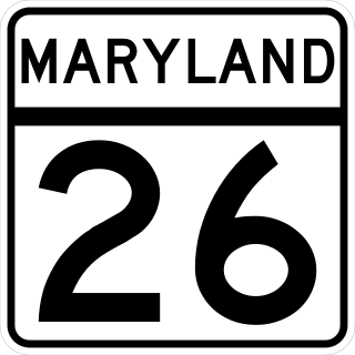
Maryland Route 26 is a state highway in the U.S. state of Maryland. Known for most of its length as Liberty Road, the state highway runs 44.10 miles (70.97 km) from U.S. Route 15 in Frederick east to MD 140 in Baltimore. MD 26 connects Frederick and Baltimore with the highway's namesake of Libertytown in eastern Frederick County, the suburban area of Eldersburg in southern Carroll County, and the western Baltimore County suburbs of Randallstown, Milford Mill, and Lochearn. The highway also serves as a major thoroughfare in the western part of Baltimore, where the street is named Liberty Heights Avenue. MD 26 is maintained by the Maryland State Highway Administration outside of Baltimore and by the Baltimore City Department of Transportation within the city.

<span class="mw-page-title-main">Interstate 70 in Maryland</span> Section of Interstate Highway in Maryland

Interstate 70 (I-70) is a part of the Interstate Highway System that runs from Cove Fort, Utah, to Woodlawn just outside of Baltimore, Maryland. In Maryland, the Interstate Highway runs 91.85 miles (147.82 km) from the Pennsylvania state line in Hancock east to the Interstate's eastern terminus at its junction with I-695. I-70 is the primary east–west Interstate in Maryland; the Interstate Highway connects Baltimore—and Washington, D.C., via I-270—with Western Maryland. The Interstate serves Frederick and Hagerstown directly and provides access to Cumberland via its junction with I-68 at Hancock. I-70 runs concurrently with its predecessor highway, U.S. Route 40 (US 40), from Hancock to Indian Springs in Washington County and from Frederick to West Friendship in Howard County.

<span class="mw-page-title-main">U.S. Route 15 in Maryland</span> Part of the U.S. Highway System in Maryland

U.S. Route 15 (US 15) is a part of the United States Numbered Highway System that runs from Walterboro, South Carolina, north to Painted Post, New York. In Maryland, the highway runs 37.85 miles (60.91 km) from the Virginia state line at the Potomac River in Point of Rocks north to the Pennsylvania state line near Emmitsburg. Known for most of its length as Catoctin Mountain Highway, US 15 is the primary north–south highway of Frederick County. The highway connects the county seat of Frederick with Point of Rocks, Leesburg, Virginia, and Charles Town, West Virginia, to the south and with Thurmont, Emmitsburg, and Gettysburg, Pennsylvania, to the north. US 15 is a four-lane divided highway throughout the state except for the portion between the Point of Rocks Bridge and the highway's junction with US 340 near Jefferson. The highway is a freeway along its concurrency with US 340 and through Frederick, where the highway meets US 40 and Interstate 70 (I-70). US 15 has a business route through Emmitsburg.

<span class="mw-page-title-main">Maryland Route 129</span> State highway in Maryland, US

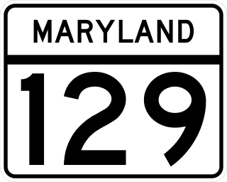
Maryland Route 129 is a state highway in the U.S. state of Maryland, running north-northwesterly from U.S. Route 40 and MD 295 in the city of Baltimore into Baltimore County, ending at Garrison Forest Road east of Reisterstown. The route leaves downtown on the one-way pair of McCulloh Street and Druid Hill Avenue, and then uses the entire length of Park Heights Avenue to the end. MD 129 connects Downtown Baltimore with Druid Hill Park using McCulloh Street and Druid Hill Avenue. As Park Heights Avenue, the state highway is one of two primary radial routes in the northwestern part of the city, providing access to The Maryland Zoo and Pimlico Race Course. In Baltimore County, MD 129 passes through Pikesville, where it has a junction with Interstate 695 (I-695) and serves an affluent rural area north of Pikesville and east of Reisterstown.

<span class="mw-page-title-main">Maryland Route 130</span> State highway in Baltimore County, Maryland, known as Greenspring Valley Rd

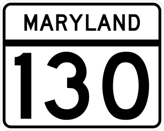
Maryland Route 130 is a state highway located in Baltimore County in the U.S. state of Maryland. Known as Greenspring Valley Road, the state highway runs 5.57 miles (8.96 km) from MD 140 in Garrison east to MD 25 in Brooklandville. MD 130 passes through the Green Spring Valley, an affluent area around the upper reaches of Jones Falls that contains Stevenson University. The state highway was paved by 1910 except for a gap near Stevenson that was closed in the mid-1930s.

<span class="mw-page-title-main">Maryland Route 131</span> State highway in Baltimore County, Maryland, known as Seminary Ave

Maryland Route 131 is a state highway located in Baltimore County in the U.S. state of Maryland. Known as Seminary Avenue, the state highway runs 3.06 miles (4.92 km) from MD 25 in Brooklandville east to MD 45 in Lutherville. MD 131 was mostly constructed by 1910, with the remainder completed in the early 1920s.

Joppa Road is a county highway in the U.S. state of Maryland. The highway extends 14.3 miles (23.0 km) from Maryland Route 25 in Brooklandville east to MD 7 near White Marsh. Joppa Road has three main segments separated by very short breaks on its course through central and eastern Baltimore County. The central segment is a multi-lane highway from MD 45 and MD 146 in the county seat of Towson to U.S. Route 1 in Perry Hall. This highway is mostly a commercial strip and parallels Interstate 695 (I-695) through Towson, Parkville, and Carney. The western and eastern segments of Joppa Road are two-lane roads through mainly residential areas. The western segment connects Brooklandville and Towson via Riderwood. The eastern segment serves parts of Perry Hall and White Marsh.

Old Court Road is a state- and county-maintained highway in the U.S. state of Maryland. Including the adjacent road in Howard County known as Woodstock Road, the highway runs 15.4 miles (24.8 km) from Maryland Route 99 near Woodstock east to Joppa Road near Towson. Old Court Road includes two county-maintained sections and two Maryland state highways, Maryland Route 125 and Maryland Route 133. MD 125 has a length of 3.59 miles (5.78 km) between Woodstock and the edge of Randallstown and MD 133 spans 3.31 miles (5.33 km) between MD 129 and MD 25 in Pikesville. Old Court Road connects the western and central Baltimore County communities of Granite, Randallstown, Milford Mill, Pikesville, and Towson. Old Court Road has been a cross-county highway since the colonial era. The highway was fully paved in Baltimore County by the mid-1920s, including the sections of the highway that became MD 125 and MD 133. MD 133 was extended west to MD 140 and MD 125 was extended west to MD 99 in the early 1930s; MD 125's terminus returned to the Patapsco River in the mid-1950s. Old Court Road was relocated at its eastern end in the early 1960s and in Pikesville in the late 1960s, at which time MD 133 assumed its current course.

<span class="mw-page-title-main">Maryland Route 372</span> State highway in Maryland, United States

Maryland Route 372 is a state highway in the U.S. state of Maryland. Known as Wilkens Avenue, the state highway runs 2.86 miles (4.60 km) from MD 166 in Catonsville east to U.S. Route 1 in Baltimore. MD 372 connects Baltimore and Interstate 695 (I-695) with the University of Maryland, Baltimore County (UMBC), and Spring Grove Hospital Center. Wilkens Avenue begins westward from South Gilmor Street, and was constructed from Monroe Street in Baltimore to Rolling Road in the last quarter of the 19th century. Almost the entire length of the highway was improved in the 1930s for local and long-distance traffic. MD 372's eastern terminus was moved west twice: first in the late 1930s when US 1 was moved to the avenue east of Caton Avenue, and again in the late 1940s when US 1 was moved to its present course.

<span class="mw-page-title-main">Jones Falls</span> Stream in Maryland

The Jones Falls is a 17.9-mile-long (28.8 km) stream in Maryland. It is impounded to create Lake Roland before running through the city of Baltimore and finally emptying into the Baltimore Inner Harbor.

<span class="mw-page-title-main">Maryland Route 186</span> State highway in Montgomery County, Maryland, United States, known as Brookville Road

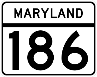
Maryland Route 186 is a state highway in Montgomery County in the U.S. state of Maryland. Known as Brookville Road, the highway runs 1.52 miles (2.45 km) from the District of Columbia boundary at Western Avenue to MD 410 within Chevy Chase. MD 186 passes through an affluent, mainly residential area in its course through the many incorporated and unincorporated areas of Chevy Chase. Brookville Road once connected Tenleytown with what is now MD 97 north of Silver Spring. MD 186 was paved over most of its course by 1910. The northernmost part of the highway was paved when MD 410 was built in the late 1920s.

<span class="mw-page-title-main">U.S. Route 1 Alternate (Baltimore, Maryland)</span> Highway in Maryland

U.S. Route 1 Alternate is an alternate route of US 1 in the U.S. state of Maryland. The highway runs 3.92 miles (6.31 km) between intersections with US 1 in Arbutus and in Baltimore. US 1 Alt. serves the southwestern Baltimore County community of Halethorpe and connects US 1 with full-access interchanges with Interstate 95 (I-95) and I-695. The Washington Boulevard portion of the alternate route was the original road southwest from Baltimore in the 18th century and was part of the turnpike southwest to Washington, D.C. for much of the 19th century. The highway was paved in the early 1910s, expanded in the late 1910s and late 1920s, and became part of US 1 in 1926. The Caton Avenue portion of the alternate route was improved and expanded in the 1930s to serve as a rerouting of US 1 in southwest Baltimore. US 1 Alt. was created in 1949 when US 1 was moved to its present course through Arbutus and southwest Baltimore. The alternate route's interchanges with I-695 and I-95 were constructed in the late 1950s and mid-1970s, respectively.

References

  1. 1 2 3 4 5 Highway Information Services Division (December 31, 2005). Highway Location Reference. Maryland State Highway Administration. Retrieved 2012-10-04.
  2. 1 2 3 4 5 6 7 Highway Information Services Division (December 31, 2013). Highway Location Reference. Maryland State Highway Administration. Retrieved 2012-10-04.
  3. Maryland State Highway Administration, Maryland Scenic Byways, "Maryland Byways guide" (PDF). (7.35  MiB), accessed June 17, 2007
  4. 1 2 3 4 5 6 Google (2012-10-04). "Maryland Route 25" (Map). Google Maps . Google. Retrieved 2012-10-04.
  5. Google (2012-10-04). "Falls Road north of MD 25" (Map). Google Maps . Google. Retrieved 2012-10-04.
  6. Archives of Maryland Online, Session Laws, 1808, Chapter LXIX [ permanent dead link ]: "An act to extend the time for the president, managers and company, of the Falls turnpike road, to complete the said road."[ dead link ]
  7. 1 2 Archives of Maryland Online, Session Laws, 1804, Chapter XCI: "An act to incorporate a company to make a turnpike road to lead from the cross roads near Richard Caton's limekiln, in Baltimore county, nearly in the direction of Jones's Falls, to the city of Baltimore."
  8. Archives of Maryland Online, Session Laws, 1805, Chapter XLVIII [ permanent dead link ]: "A supplement to an act, entitled, An act to incorporate a company to make a turnpike road to lead from the cross roads near Richard Caton's limekiln, in Baltimore county, nearly in the direction of Jones's Falls, to the city of Baltimore."[ dead link ]
  9. Archives of Maryland Online, Session Laws, 1812, Chapter 152 [ permanent dead link ]: "An act to establish and confirm the Falls Turnpike road from the city of Baltimore to Richard Caton's Lime Kiln."[ dead link ]
  10. Maryland Geological Survey Volume Three, 1899, p. 170
  11. Archives of Maryland Online, Session Laws, 1808, Chapter XCIV [ permanent dead link ]: "An act for opening a certain road in Baltimore county therein mentioned."[ dead link ]
  12. Archives of Maryland Online, Session Laws, 1816, Chapter 115 [ permanent dead link ]: "A Further Supplement to an act, entitled, An act to Incorporate a Company to make a Turnpike Road to lead from the Cross Roads near Richard Caton's Limekiln, in Baltimore County, nearly in the direction of Jones's Falls, to the City of Baltimore."[ dead link ]
  13. Archives of Maryland Online, Session Laws, 1827, Chapter 178 [ permanent dead link ]: "A further supplement to an act, entitled an act, to incorporate a company to make a Turnpike Road to lead from the Cross Roads near Richard Caton's lime kiln, in Baltimore county nearly in the direction of Jones' Falls to the City of Baltimore."[ dead link ]
  14. Warner & Hanna, "Mapping Maryland - image18, Warner's and Hannah's, Plan of the City and environs of Baltimore, 1801". Archived from the original on 2011-07-25. Retrieved 2011-06-19., 1801
  15. Archives of Maryland Online, Session Laws, 1805, Chapter XXXIV [ permanent dead link ]: "An act to straighten the road leading into Howard-street in the city of Baltimore."[ dead link ]
  16. Archives of Maryland Online, Session Laws, 1810, Chapter LXXXIX [ permanent dead link ]: "An act to authorise a Lottery or Lotteries in the City of Baltimore for the purposes therein mentioned."[ dead link ]
  17. Map of the city and county of Baltimore, Maryland. From original surveys by J.C. Sidney, C.E., ca. 1857
  18. Atlas of fifteen miles (24 km) around Baltimore, including Anne Arundel County, Maryland. Compiled, drawn, and published from actual surveys, by G. M. Hopkins, 1878
  19. Printed by John D. Toy, Baltimore, Laws, Documents and Judicial Decisions, Relating to the Baltimore and Fredericktown, York and Reisterstown, Cumberland and Boonsborough Turnpike Companies, 1841, pp. 52-55
  20. Baltimore County Circuit Court, Land Survey, Subdivision, and Condominium Plats, Land Records EHA 67, p. 247, North Central Railway Company deed to Mayor and City Council of Baltimore, July 2, 1870
  21. 1 2 Maryland Geological Survey (1910). Map of Maryland (PDF) (Map). Baltimore: Maryland Geological Survey.
  22. 1 2 Weller, O.E.; Parran, Thomas; Miller, W.B.; Perry, John M.; Ramsay, Andrew; Smith, J. Frank (May 1916). Annual Reports of the State Roads Commission of Maryland (1912–1915 ed.). Baltimore: Maryland State Roads Commission. pp. 116, 122, 128. Retrieved 2012-10-05.
  23. 1 2 3 Maryland Geological Survey (1921). Map of Maryland: Showing State Road System and State Aid Roads (PDF) (Map). Baltimore: Maryland Geological Survey.
  24. Maryland Geological Survey (1923). Map of Maryland: Showing State Road System and State Aid Roads (PDF) (Map). Baltimore: Maryland Geological Survey.
  25. 1 2 Mackall, John N.; Darnall, R. Bennett; Brown, W.W. (January 1927). Annual Reports of the State Roads Commission of Maryland (1924–1926 ed.). Baltimore: Maryland State Roads Commission. pp. 43, 69. Retrieved 2012-10-05.
  26. 1 2 Maryland Geological Survey (1927). Map of Maryland: Showing State Road System and State Aid Roads (PDF) (Map). Baltimore: Maryland Geological Survey.
  27. Maryland Geological Survey (1928). Map of Maryland: Showing State Road System and State Aid Roads (PDF) (Map). Baltimore: Maryland Geological Survey.
  28. 1 2 3 Uhl, G. Clinton; Bruce, Howard; Shaw, John K. (October 1, 1930). Report of the State Roads Commission of Maryland (1927–1930 ed.). Baltimore: Maryland State Roads Commission. pp. 68, 82, 198–199. Retrieved 2012-10-05.
  29. Maryland Geological Survey (1930). Map of Maryland Showing State Road System: State Aid Roads and Improved County Road Connections (Map). Baltimore: Maryland Geological Survey.
  30. Maryland Geological Survey (1933). Map of Maryland Showing State Road System: State Aid Roads and Improved County Road Connections (PDF) (Map). Baltimore: Maryland Geological Survey.
  31. Byron, William D.; Lacy, Robert (December 28, 1934). Report of the State Roads Commission of Maryland (1931–1934 ed.). Baltimore: Maryland State Roads Commission. p. 49. Retrieved 2012-10-05.
  32. Maryland State Roads Commission (1934). Map of Maryland Showing State Road System (PDF) (Map). Baltimore: Maryland State Roads Commission.
  33. Maryland State Roads Commission (1956). Maryland: Official Highway Map (PDF) (Map). Baltimore: Maryland State Roads Commission.
  34. Maryland State Roads Commission (1962). Maryland: Official Highway Map (PDF) (Map). Baltimore: Maryland State Roads Commission.
  35. 1 2 Maryland State Roads Commission (1963). Maryland: Official Highway Map (PDF) (Map). Baltimore: Maryland State Roads Commission.
  36. Simmons, Melody (June 17, 1996). "Falls Road Bridge Closing to Affect Businesses, Residents". The Baltimore Sun. Baltimore: Tribune Company. Retrieved 2012-10-05.
  37. Google (2012-10-04). "Maryland Route 25A" (Map). Google Maps . Google. Retrieved 2012-10-04.
  38. National Highway System: Baltimore, MD (PDF) (Map). Federal Highway Administration. October 1, 2012. Retrieved 2014-08-27.
Template:Attached KML/Maryland Route 25
KML is from Wikidata