Major routes are typically assigned one- or two-digit numbers, except where the numbers were chosen to match an adjacent state. Most numbers from 1 to 50 follow a general geographic pattern assigned in 1927 (details below), but later additions are more haphazard. The only suffixed routes other than U.S. Route 9W are short unmarked connections such as Route 76C, an elongated ramp to Interstate 76. The only special state route is Route 33 Business; U.S. Route 1 Business and U.S. Route 1-9 Truck are also present.
A statewide system of major county highways is numbered by the NJDOT in the 500-599 range; these are known as 500 Series County Routes. All counties but two– Bergen and Monmouth– number their other county routes beginning at 600. County routes in Bergen County range from 2 to 134; those in Monmouth County range from 1 to 57. Ocean County also has a system of minor county routes with numbers ranging from 3 to 111 in addition to those beginning with 600.
The initial system of state highways was legislated in 1916, and by 1917 the state began to take over roads from the counties. By 1922, the routes were marked. U.S. Route numbers were added to some of the main routes in 1927.
After a failed renumbering in 1926, a completely new numbering was instituted in 1927, with only four sections of pre-1927 routes remaining as their old numbers suffixed with N - Route 4N, Route 5N, Route 8N and Route 18N. The new numbers followed a general geographical pattern from north to south - 1–12 in northern New Jersey, 21-28 roughly radiating from Newark, 29-37 from Trenton, 38-47 from Camden, and 48–50 in southern New Jersey. Every state highway, even those forming parts of U.S. Routes, was assigned a number. Some short routes were assigned prefixes of S; for instance, Route S26 was a spur of Route 26 south of New Brunswick. One prefixed and suffixed route - Route S4A - was also defined as a second spur of Route 4. As the system grew, some numbers beyond 50 were used, but most new routes received prefixed or suffixed labels.
On January 1, 1953, the second renumbering was implemented. This was not a complete renumbering; instead, the only renumbered routes were those that violated a few guidelines— primarily long concurrencies, especially with U.S. Routes; duplication of numbers with U.S. routes; suffixed routes; and number changes across state borders. Some routes were shortened to remove concurrencies, while others, like Route 25, completely disappeared. Numbers from 53 to 93 were assigned to renumbered routes, while shorter ones received numbers from 152 to 165. The two planned toll roads— the Garden State Parkway and New Jersey Turnpike - received only those names; they had been numbered 4 Parkway and 100.
The majority of new numbers assigned since the 1953 renumbering have been from 166 to 185, with some short routes instead receiving numbers based on their parents (for instance, an old section of U.S. Route 9 became Route 109). Minimal disruption was caused by the assignment of Interstate Highway numbers in the late 1950s. In the 1990s, the majority of special U.S. Highways were renumbered as state routes.
Route 18 is a 42.8-mile-long (68.9 km) state highway in the US state of New Jersey. It begins at an intersection with Route 138 in Wall Township and ends at Interstate 287 (I-287) in Piscataway. Much of the route is a limited-access freeway, including the entire portion in Monmouth County and much of the northern end through New Brunswick and Piscataway. The remainder of the route is a multi-lane divided highway. Route 18 was designated in 1939 as a proposed freeway from Old Bridge to Eatontown. The section west of Old Bridge was formerly designated as part Route S28, a prefixed spur of State Highway Route 28 from Middlesex to Matawan. The designation, assigned in the 1927 renumbering, remained until a second renumbering in 1953. At that point, Route S28 was redesignated as Route 18, though the section from Old Bridge to Matawan was signed as TEMP 18, as this section would be decommissioned when the Route 18 freeway was built.
Route 72 is a state highway in the U.S. state of New Jersey. It runs 28.74 mi (46.25 km) from the Four Mile Circle with Route 70 in Woodland Township in Burlington County to County Route 607 in Ship Bottom on Long Beach Island in Ocean County. Route 72 travels through the Pine Barrens as a two-lane undivided road. After an interchange with the Garden State Parkway, the route becomes a four- to six-lane divided highway through built-up areas of Manhawkin and crosses the Manahawkin Bay via the Manahawkin Bay Bridge onto Long Beach Island.
The Garden State Parkway (GSP) is a controlled-access toll road that stretches the north–south length of eastern New Jersey from the state's southernmost tip near Cape May to the New York state line at Montvale. Its name refers to New Jersey's nickname, the "Garden State". The parkway is designated by the New Jersey Department of Transportation (NJDOT) as Route 444, although this designation is unsigned. At its north end, the road becomes the Garden State Parkway Connector, a component of the New York State Thruway system that connects to the Thruway mainline in Ramapo. The parkway is the longest highway in the state at approximately 172 miles (277 km), and, according to the International Bridge, Tunnel and Turnpike Association, was the busiest toll road in the United States in 2006. The highway has a posted speed limit of 65 miles per hour (105 km/h) for most of its length, and is primarily for passenger vehicle use; trucks weighing over 10,000 pounds (4,500 kg) are prohibited north of exit 105.
Route 440 is a state highway in New Jersey, United States. It comprises two segments, a 5.15-mile (8.29 km) freeway in Middlesex County linking Interstate 287 (I-287) and the New Jersey Turnpike (I-95), in Edison to the Outerbridge Crossing in Perth Amboy and a 8.18-mile (13.16 km) four-lane divided highway in Hudson County running from the Bayonne Bridge in Bayonne to U.S. Route 1/9 Truck in Jersey City. These two segments are connected by New York State Route 440 (NY 440), which runs across Staten Island. The freeway portion in Middlesex County is six lanes wide and interchanges with the Garden State Parkway and US 9 in Woodbridge.
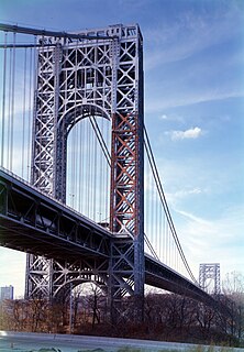
The Palisades Interstate Parkway (PIP) is a 38.25-mile-long (61.56 km) limited-access highway in the U.S. states of New Jersey and New York. The parkway is a major commuter route into New York City from Rockland and Orange counties in New York and Bergen County in New Jersey. The southern terminus of the route is at the George Washington Bridge in Fort Lee, New Jersey, where it connects to Interstate 95 (I-95), New Jersey Route 4, U..S. 1, U.S. 9, and US 46. Its northern terminus is at a traffic circle in Fort Montgomery, New York, where the PIP meets US 9W and US 202 at the Bear Mountain Bridge. At exit 18, the PIP forms a concurrency with US 6 for the remaining duration of its run.
The State Highway System of the U.S. state of Florida comprises the roads maintained by the Florida Department of Transportation (FDOT) or a toll authority. The components are referred to officially as state roads, abbreviated as SR.
In 1927, New Jersey's state highways were renumbered. The old system, which had been defined in sequence by the legislature since 1916, was growing badly, as several routes shared the same number, and many unnumbered state highways had been defined. A partial renumbering was proposed in 1926, but instead a total renumbering was done in 1927.
On January 1, 1953, the New Jersey Highway Department renumbered many of the State Routes. This renumbering was first proposed in 1951 in order to reduce confusion to motorists. A few rules were followed in deciding what to renumber:
Interstate 280 (I-280) is a 17.85-mile (28.73 km) Interstate Highway in the U.S. state of New Jersey. It provides a spur from I-80 in Parsippany-Troy Hills, Morris County to Newark, and I-95 in Kearny, Hudson County. In Kearny, access is provided toward the Holland Tunnel and Lincoln Tunnel to New York City. The western part of the route runs through suburban areas of Morris and Essex counties, crossing the Watchung Mountains. Upon reaching The Oranges, the setting becomes more urbanized and I-280 runs along a depressed alignment before ascending again in Newark. I-280 includes a vertical-lift bridge, the William A. Stickel Memorial Bridge over the Passaic River between Newark and East Newark/Harrison. The highway is sometimes called the Essex Freeway. I-280 interchanges with several roads, including the Garden State Parkway in East Orange and Route 21 in Newark.
Interstate 195 (I-195) is an auxiliary route of the Interstate Highway System located in the U.S. state of New Jersey. Its western end is at I-295 and Route 29 just south of Trenton, New Jersey, in Hamilton Township, Mercer County, while its eastern end is at the Garden State Parkway, Route 34 and Route 138 in Wall Township, Monmouth County. I-195 is 34.17 miles (54.99 km) in length. The route is mostly a four-lane highway that runs through wooded areas in Central Jersey. It has an interchange with the New Jersey Turnpike (I-95) in Robbinsville Township and serves as a main access road to the Six Flags Great Adventure amusement park and the Jersey Shore. I-195 is occasionally referred to as the Central Jersey Expressway. On April 6, 1988, President Ronald Reagan signed H.R. 4263 naming Interstate 195 in New Jersey the James J. Howard Interstate Highway, in honor of the late James J. Howard.
In the U.S. state of New Jersey, county routes exist in all 21 counties. They are typically the fourth type of roadway classified below the Interstate Highway, the U.S. Route numbered highway and the state highway. The County Route system is defined by two types in New Jersey. First, 500 Series County Routes, also called state secondary routes, are county highways numbered in a statewide system with three-digit numbers that begin with 5. These roads form a second network of routes that supplement the facilitation of the State Routes. Each 500 Series route is unique and is not permitted to be duplicated in another county for a separate route. The second category is defined as Non-500 Series County Routes. Non-500 Series County Routes include 1-digit, 2-digit, 600 Series, 700 Series and 800 Series. These, by definition, are discontinuous across county borders and must be contained entirely within that county. Unlike 500 Series County routes, these route numbers are unique to each county, and are typically assigned to more local routes than the statewide 500-series county route system. They are typically of a lesser classification of streets like minor arterials or collector roadways rather than major arterials or thoroughfares. In the counties that use 600-series numbers, the selection of this range was coordinated within the state, gradually replacing older systems of mainly one- and two-digit routes.
Interstate 76 (I-76) is an east–west Interstate Highway in the Eastern United States, running about 435 miles (700 km) from an interchange with I-71 west of Akron, Ohio, east to I-295 in Bellmawr, New Jersey.
Interstate 78 (I-78) is an east–west route stretching from Union Township, Lebanon County, Pennsylvania to New York City. In New Jersey, I-78 is called the Phillipsburg–Newark Expressway and the Newark Bay-Hudson County Extension of the New Jersey Turnpike. The highway runs for 67.83 miles (109.16 km) in the northern part of the state of New Jersey from the Interstate 78 Toll Bridge over the Delaware River at the Pennsylvania state line in Phillipsburg, Warren County east to the Holland Tunnel under the Hudson River at the New York state line in Jersey City, Hudson County. The Phillipsburg-Newark Expressway portion of I-78, formally called the Lightning Division Memorial Highway, runs from the Phillipsburg area east across rural areas of western New Jersey before entering suburban areas in Somerset County. The road crosses the Watchung Mountains, widening into a local-express lane configuration at Route 24 as it continues through urban areas to Newark. Here, I-78 intersects the mainline of the New Jersey Turnpike (I-95) and becomes the Newark Bay Extension, crossing the Newark Bay Bridge and continuing to Jersey City. The route, along with Route 139, follows a one-way pair of surface streets to the Holland Tunnel.
Interstate 95 (I-95) is part of the Interstate Highway System and runs from Miami, Florida, to the Canada–United States border near Houlton, Maine. In the U.S. state of New York, I-95 extends 23.50 miles (37.82 km) from the George Washington Bridge in New York City to the Connecticut state line at Port Chester. From the George Washington Bridge, which carries I-95 across the Hudson River from New Jersey into New York City, it runs across upper Manhattan on the Trans-Manhattan Expressway and continues east across the Harlem River on the Alexander Hamilton Bridge and onto the Cross Bronx Expressway. In the Bronx, I-95 leaves the Cross Bronx at the Bruckner Interchange, joining the Bruckner Expressway to its end. North of the interchange with Pelham Parkway, it then continues northeast via the New England Thruway out of New York City into Westchester County and to the Connecticut state line, where I-95 continues on the Connecticut Turnpike.
An unsigned highway is a highway that has been assigned a route number, but does not bear road markings that would conventionally be used to identify the route with that number. Highways are left unsigned for a variety of reasons, and examples are found throughout the world. Depending on the policy of the agency that maintains the highway, and the reason for not signing the route, the route may instead be signed a different designation from its actual number, with small inventory markers for internal use, or with nothing at all.
In the United States, exit numbers are assigned to freeway junctions, and are usually numbered as exits from freeways. Exit numbers generally are found above the destinations of the exit, as well as a sign in the gore. Exit numbers typically reset at political borders such as state lines. Some major streets also use exit numbers. Freeway exits in the United States are usually numbered in two formats: distance-based and sequential.
In the U.S. state of Pennsylvania, state highways are generally maintained by the Pennsylvania Department of Transportation (PennDOT). Each is assigned a four-digit State Route (SR) number in the present Location Referencing System. Traffic Routes are signed as Interstate Highways, U.S. Routes and Pennsylvania Routes, and are prefixed with one to three zeroes to give a four-digit number. PA Routes are also called Pennsylvania Traffic Routes, and formerly State Highway Routes.
Transportation in New Jersey utilizes a combination of road, rail, air, and water modes. New Jersey is situated between Philadelphia and New York City, two major metropolitan centers of the Boston-Washington megalopolis, making it a regional corridor for transportation. As a result, New Jersey's freeways carry high volumes of interstate traffic and products. The main thoroughfare for long distance travel is the New Jersey Turnpike, the nation's fifth-busiest toll road. The Garden State Parkway connects the state's densely populated north to its southern shore region. New Jersey has the 4th smallest area of U.S. states, but its population density of 1,196 persons per sq. mi causes congestion to be a major issue for motorists.
Route 167 is a short, 0.77-mile-long (1.24 km) state highway in Atlantic and Burlington counties in New Jersey. The route is one of the few discontinuous state highways in New Jersey, split by wetlands, the Garden State Parkway and the Mullica River. Although the alignment is registered by the New Jersey Department of Transportation as 2.76 miles (4.44 km) highway, the amount of roadway is considerably shorter. The route begins at an intersection with U.S. Route 9 (US 9) in Port Republic, where it continues along Old New York Road to an end of roadway at the Parkway embankment. Across the Mullica River, Route 167 continues at a gate for wetlands, heading northward to an intersection with US 9 in Bass River Township.
This page is based on this Wikipedia article Text is available under the CC BY-SA 4.0 license; additional terms may apply. Images, videos and audio are available under their respective licenses.