The Krishna River is a river in the Deccan plateau and is the third-longest river in India, after the Ganges and Godavari. It is also the fourth-largest in terms of water inflows and river basin area in India, after the Ganges, Indus and Godavari. The river, also called Krishnaveni, is 1,400 kilometres (870 mi) long and its length in Maharashtra is 282 kilometres. It is a major source of irrigation in the Indian states of Maharashtra, Karnataka, Telangana and Andhra Pradesh.

The Godavari is India's second longest river after the Ganga river and drains into the third largest basin in India, covering about 10% of India's total geographical area. Its source is in Trimbakeshwar, Nashik, Maharashtra. It flows east for 1,465 kilometres (910 mi), draining the states of Maharashtra (48.6%), Telangana (18.8%), Andhra Pradesh (4.5%), Chhattisgarh (10.9%) and Odisha (5.7%). The river ultimately empties into the Bay of Bengal through an extensive network of distributaries. Measuring up to 312,812 km2 (120,777 sq mi), it forms one of the largest river basins in the Indian subcontinent, with only the Ganga and Indus rivers having a larger drainage basin. In terms of length, catchment area and discharge, the Godavari is the largest in peninsular India, and had been dubbed as the Dakshina Ganga.

Bhavani is an interstate Indian river which flows through Indian states of Kerala and Tamil Nadu, India. It originates from the Western Ghats and is one among the three rivers of Kerala which flows in eastward direction.

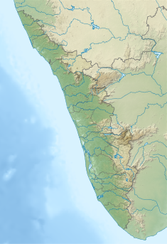
Periyar, IPA:[peɾijɐːr], is the longest river and the river with the largest discharge potential in the Indian state of Kerala. It is one of the few perennial rivers in the region and provides drinking water for several major towns. The Periyar is of utmost significance to the economy of Kerala. It generates a significant proportion of Kerala's electrical power via the Idukki Dam and flows along a region of industrial and commercial activity. The river also provides water for irrigation and domestic use throughout its course besides supporting a rich fishery. Due to these reasons, the river has been named the "Lifeline of Kerala". Kochi city, in the vicinity of the river mouth draws its water supply from Aluva, an upstream site sufficiently free of seawater intrusion. Twenty five percent of Kerala's industries are along the banks of river Periyar. These are mostly crowded within a stretch of 5 kilometres (3 mi) in the Eloor-Edayar region (Udhyogamandal), about 10 kilometres (6 mi) north of Kochi harbor.
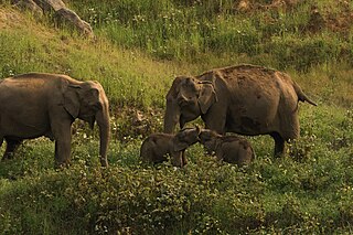
Anaimalai Tiger Reserve, earlier known as Indira Gandhi Wildlife Sanctuary and National Park and as Anaimalai Wildlife Sanctuary, is a protected area in the Anaimalai Hills of Pollachi and Valparai taluks of Coimbatore District and Udumalaipettai taluk in Tiruppur District, Tamil Nadu, India. The Tamil Nadu Environment and Forests Department by a notification dated 27 June 2007, declared an extent of 958.59 km2 that encompassed the erstwhile IGWLS&NP or Anaimalai Wildlife Sanctuary, as Anaimalai Tiger Reserve under the Wildlife Protection Act, 1972. According to the National Tiger Conservation Authority, the Reserve presently includes a core area of 958.59 km2 and buffer/peripheral area of 521.28 km2 forming a total area of 1479.87 km2.

The Idukki Dam is a double curvature arch dam constructed across the Periyar River in a narrow gorge between two granite hills locally known as Kuravan and Kurathi in Idukki, Kerala, India. At 168.91 metres (554.2 ft), it is one of the highest arch dams in Asia. It is constructed and owned by the Kerala State Electricity Board. It supports a 780 MW hydroelectric power station in Moolamattom, which started generating power on 4 October 1975. The dam type is a concrete, double curvature parabolic, thin arc dam. The Indo-Canadian project was inaugurated by the Prime Minister Indira Gandhi on February 17, 1976.
Pollachi is a town and a taluk headquarters in Coimbatore district, Tamil Nadu state, India. Located about 40 km (25 mi) to the south of Coimbatore, it is the second largest town in the district after Coimbatore. Pollachi is a popular marketplace for jaggery, vegetables and cattle. As of 2011, the town had a population of 90,180.

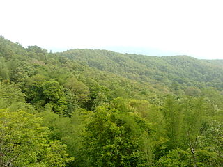
Valparai is a Taluk and hill station in the Coimbatore district of Tamil Nadu, India. It consists of Anamalai Tiger Reserve. It is located 3,474 feet (1,059 m) above sea level on the Anaimalai Hills range of the Western Ghats. There are a total of 56 estates here. The game of football is very popular here. State level competitions are held every year. The foothill starts exactly from Monkey Falls which is at a distance of 38 kilometres (24 mi) to Valparai. The route to Valparai from the foothills consists of 40 hairpin bends. The Kerala state border town of Malakkappara is at a distance of 27 kilometres from Valparai. While major portions of the land are owned by private tea companies, large forest areas continue to be out of bounds.
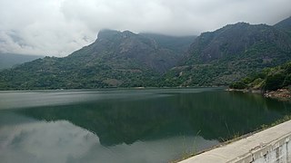
Mullaperiyar DamIPA:[mulːɐpːeɾijɐːr], is a masonry gravity dam on the Periyar River of Idukki district of Indian state of Kerala. It is situated 150km south east of Kochi. It is located 881 m (2,890 ft) above the sea level, on the Cardamom Hills of the Western Ghats in Thekkady, Idukki District of Kerala, India. It was constructed between 1887 and 1895 by John Pennycuick and also reached in an agreement to divert water eastwards to the Madras Presidency area. It has a height of 53.6 m (176 ft) from the foundation, and a length of 365.7 m (1,200 ft). The Periyar National Park in Thekkady is located around the dam's reservoir. The dam is built at the confluence of Mullayar and Periyar rivers. The dam is located in Kerala on the river Periyar, but is operated and maintained by the neighbouring state of Tamil Nadu. Although the Periyar River has a total catchment area of 5398 km2 with 114 km2 downstream from the dam in Tamil Nadu, the catchment area of the Mullaperiyar Dam itself lies entirely in Kerala and thus not an inter-State river. On 21 November 2014, the water level hit 142 feet for first time in 35 years. The reservoir again hit the maximum limit of 142 feet on 15 August 2018, following incessant rains in the state of Kerala. In a UN report published in 2021, the dam was identified as one among the world's big dams which needs to be decommissioned for being 'situated in a seismically active area with significant structural flaws and poses risk to 3.5 million people if the 100+ years old dam were to fail'.

Banasura Sagar Dam, which impounds the Karamanathodu tributary of the Kabini River, is part of the Indian Banasurasagar Project consisting of a dam and a canal project started in 1979. The goal of the project is to support the Kakkayam Hydro electric power project and satisfy the demand for irrigation and drinking water in a region known to have water shortages in seasonal dry periods. The dam is also known as Kuttiyadi Augmentation Main Earthen Dam. The dam has a height of 38.5 metres (126 ft) and length of 685 metres (2,247 ft).

Parambikulam Dam is an embankment dam on the Parambikulam River, Parambikulam located in the Palakkad district in the Western Ghats of Kerala, India, ranks number one in India as well as in the top ten embankment dams in the world in volume in the year 2000.
Parambikulam Tiger Reserve, which also includes the erstwhile Parambikulam Wildlife Sanctuary, is a 643.66 square kilometres (248.5 sq mi) protected area lying in Palakkad district and Thrissur district of Kerala state, South India. The Wildlife Sanctuary, which had an area of 285 square kilometres (110 sq mi) was established in part in 1973 and 1984. It is in the Sungam range of hills between the Anaimalai Hills and Nelliampathy Hills. Parambikulam Wildlife Sanctuary was declared as part of the Parambikulam Tiger Reserve on 19 February 2010. Including the buffer zone, the tiger reserve has a span of 643.66 km2. The Western Ghats, Anamalai Sub-Cluster, including all of Parambikulam Wildlife Sanctuary, has been declared by the UNESCO World Heritage Committee as a World Heritage Site. The Tiger Reserve is the home of four different tribes of indigenous peoples including the Kadar, Malasar, Muduvar and Mala Malasar settled in six colonies. Parambikulam Tiger Reserve implements the Project Tiger scheme along with various other programs of the Government of India and the Government of Kerala. The operational aspects of administering a tiger reserve is as per the scheme laid down by the National Tiger Conservation Authority. People from tribal colonies inside the reserve are engaged as guides for treks and safaris, and are provided employment through various eco-tourism initiatives. Parambikulam Tiger Reserve is among the top-ten best managed Tiger Reserve in India. The tiger reserve hosts many capacity building training programmes conducted by Parambikulam Tiger Conservation Foundation in association with various organisations.

Jayakwadi dam is an earthen dam located on Godavari river at the site of Jayakwadi village in Paithan taluka of Sambhajinagar district in Maharashtra, India. It is a multipurpose project. The water is mainly used to irrigate agricultural land in the drought-prone Marathwada region of the state. It also provides water for drinking and industrial usage to nearby towns and villages and to the municipalities and industrial areas of Sambhajinagar and Jalna districts. The surrounding area of the dam has a garden and a bird sanctuary.
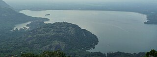
Aliyar ( Reservoir is a 6.48 km2 reservoir located in Aliyar village near Pollachi town in Coimbatore District, Tamil Nadu, South India. The dam is located in the foothills of Valparai, in the Anaimalai Hills of the Western Ghats. It is about 65 kilometres from Coimbatore. The dam offers some ideal getaways including a park, garden, aquarium, play area and a mini Theme-Park maintained by Tamil Nadu Fisheries Corporation for visitors enjoyment. The scenery is beautiful, with mountains surrounding three quarters of the reservoir. Boating is also available.

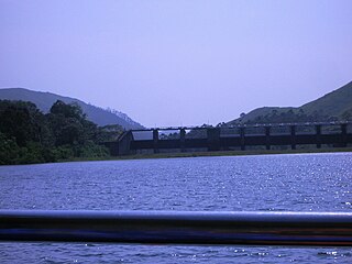
Upper Solaiyar or Upper Sholayar Dam is located 20 km (12 mi) from Valparai, a hill station in the Anaimalai Hills of the Coimbatore district, Tamil Nadu India. As it is a part of the hydroelectric project of Tamil Nadu, special permission is required to visit the dam.
Chimmini Dam is situated in Echippara in Chalakudy taluk of Thrissur District of Kerala state of India. It is constructed across Kurumali river, a tributary of the Karuvannur river. Chimmini is the largest dam of Thrissur district. The Chimminy Wild Life Sanctuary is located close to the dam. Construction of the 495-metre masonry and 686-metre earthen dam started in 1975 and it was completed in 1996. Total cost of the project was Rs 59.71 crore although the cost of construction of the dam was initially estimated at Rs 36.15 crore.

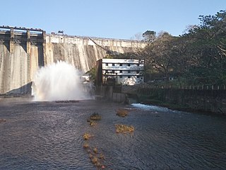
Idamalayar Dam is a multipurpose concrete gravity dam located at Ennakkal between Ayyampuzha and Bhoothathankettu in Ernakulam district of Kerala on the Idamalayar, a tributary of the Periyar River in Kerala, South India. The dam however extends east as far as Malakkappara. Completed in 1985, with a length of 373 metres (1,224 ft) and a height of 102.8 metres (337 ft), the dam created a multipurpose reservoir covering 28.3 km2 (10.9 sq mi) in the scenic hills of the Anamalais.

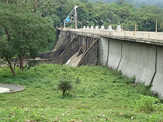
The Bhadra Dam or Lakkavalli Dam, which has created the Bhadra Reservoir, is located on the Bhadra River a tributary of Tungabhadra River. Bhadra Dam is located in the border of Bhadravathi and Tarikere, in the western part of Karnataka in India. The benefits derived from the reservoir storage are irrigation with gross irrigation potential of 162,818 hectares, hydro power generation of 39.2 MW, drinking water supply and industrial use. The dam commissioned in 1965 is a composite earth cum masonry structure of 59.13 metres (194.0 ft) height with length of 1,708 metres (5,604 ft) at the crest level, which submerges a land area of 11,250.88 hectares.
Peringalkuthu Dam is a concrete dam built across the Chalakkudi River in Thrissur district, Kerala state of India. It also contains Peringalkuthu Hydro Electric Power Project of Kerala State Electricity Board who owns the dam. This is the first hydro electric power project to build on the Chalakkudi River. The gross storage capacity of the dam is 32 million cubic meters. The dam is situated in deep forest and special permission is needed to visit the dam.
Peruvaripallam Dam is an earth-filled embankment dam on the Peruvaripallam River in Palakkad district of Kerala, India. The dam's reservoir is connected to the nearby Thunacadavu Reservoir to the south by an open cut channel. It is part of the Parambikulam Aliyar (Irrigation) Project. The Parambikulam Dam is located to the south.