
Dartmouth is an urban community and former city located in the Halifax Regional Municipality of Nova Scotia, Canada. Dartmouth is located on the eastern shore of Halifax Harbour. Dartmouth has been nicknamed the City of Lakes, after the large number of lakes located within its boundaries.

Halifax is the capital and largest municipality in the Canadian province of Nova Scotia, and the largest municipality in Atlantic Canada. As of the 2021 Census, the municipal population was 439,819, with 348,634 people in its urban area. The regional municipality consists of four former municipalities that were amalgamated in 1996: Halifax, Dartmouth, Bedford, and Halifax County.

Bedford is a former town and current urban community of the Halifax Regional Municipality, in Nova Scotia, Canada. It was an independent town from 1980 to 1996. Bedford is on the northwestern end of Bedford Basin, an extension of the Halifax Harbour, which ends just before Nova Scotia Highway 102 and the Bedford Bypass, next to Lower Sackville. Bedford is at the junctions of Trunks 1, 2, and 7.
Spryfield is an unincorporated suburban community in Halifax, Nova Scotia, Canada. It was founded about 1770, by Captain William Spry, who purchased land there and established the settlement with the aid of stationed soldiers from the nearby Halifax garrison. In 1783, he sold the property and returned to England. The name "Spryfield" is also sometimes used to refer to the general area of Halifax's South Mainland, which includes a number of communities along the Herring Cove and Purcell's Cove Roads.

The North End of Halifax is a subdivision of Halifax, Nova Scotia occupying the northern part of Halifax Peninsula immediately north of Downtown Halifax. The area once included historic Africville, and parts of it were severely damaged in the Halifax Explosion during World War I. A neighbourhood with strong African Nova Scotian roots, the area has undergone gentrification in recent years.

Eastern Passage is an unincorporated suburban community in Halifax Regional Municipality Nova Scotia, Canada.
Nova Scotia Community College, commonly referred to as NSCC, is a community college serving the province of Nova Scotia through a network of 14 campuses and three community learning centres.

Cole Harbour is a former village and current community located in Nova Scotia, Canada that is part of the Halifax Regional Municipality.
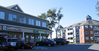
Clayton Park is a community of Halifax, Nova Scotia, Canada.
The Eastern Shore is a region of the Canadian province of Nova Scotia. It is the Atlantic coast running northeast from Halifax Harbour to the eastern end of the peninsula at the Strait of Canso.
Halifax, Nova Scotia, was originally inhabited by the Miꞌkmaq. The first European settlers to arrive in the future Halifax region were French, in the early 1600s, establishing the colony of Acadia. The British settled Halifax in 1749, which sparked Father Le Loutre's War. To guard against Miꞌkmaw, Acadian, and French attacks on the new Protestant settlements, British fortifications were erected in Halifax (1749), Bedford (1749), Dartmouth (1750), and Lawrencetown (1754). St. Margaret's Bay was first settled by French-speaking Foreign Protestants at French Village, Nova Scotia, who migrated from Lunenburg, Nova Scotia, during the American Revolution. All of these regions were amalgamated into the Halifax Regional Municipality (HRM) in 1996. While all of the regions of HRM developed separately over the last 250 years, their histories have also been intertwined.
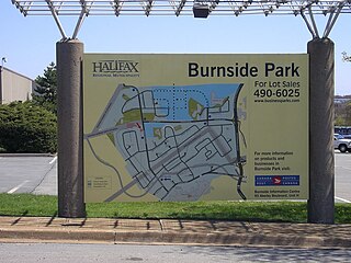
Burnside is a Canadian urban neighbourhood located along the northeast shore of Bedford Basin of the Halifax Regional Municipality in Dartmouth, Nova Scotia.
Albro Lake is a neighbourhood in the North End of the community of Dartmouth in Nova Scotia's Halifax Regional Municipality.
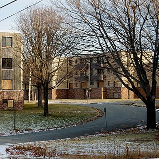
Shannon Park is an urban neighbourhood and former national defence site in the north end of Dartmouth on the eastern shore of Halifax Harbour in the Halifax Regional Municipality (HRM) in Nova Scotia, Canada. It is immediately south of the A. Murray MacKay Bridge in the community of Dartmouth. It straddles Highway 111, a CN Rail freight line, and Halifax Harbour. It is bordered on the south by Tuft's Cove.
Imperoyal is a small neighbourhood on the eastern side of Halifax Harbour in the community of Dartmouth, Nova Scotia. The area is mostly taken up by the former Dartmouth Refinery and by petroleum storage and transfer facility owned by Irving Oil Limited. A book on the topic is written by John D. Hartley entitled Imperoyal Village.
Woodlawn is an area of eastern Dartmouth, Nova Scotia in the Halifax Regional Municipality, Nova Scotia that is mainly residential and retail. It is situated within an area with Highway 111 on the west, Portland Street on the east and Main Street on the North side. The first three digits of the postal code are B2W.
Westphal is an unincorporated community located in Dartmouth, Nova Scotia and outside of Dartmouth, Nova Scotia. Some of Westphal is considered part of Dartmouth, Nova Scotia and some of it is considered separate from Dartmouth, Nova Scotia. The area is bound by Port Wallace in the north, Waverley Road in the west, Lake Major Road in the east, and Main Street in the south. The area also includes the watershed and water filtration plant for the Halifax Regional Water Commission that supplies drinking water for the residents of Dartmouth and surrounding communities east of Halifax Harbour.
Dartmouth founded in 1750, is a Metropolitan Area and former city in the Canadian province of Nova Scotia.
Russell Lake West is a planned residential subdivision and commercial development in the eastern part of the community of Dartmouth in the Halifax Regional Municipality, Nova Scotia. The area began construction in 2006 with the creation of Exit 8 on Highway 111, providing access from the southwest to the area via Mount Hope Avenue, which as of October 2011, Exit 8 also provides direct access into the Woodside Industrial Park. Russell Lake West is located next to the community of Woodside and a park and walking trails provide direct access to and from Woodside. The subdivision covers 251 ha, and houses approximately 3,200 people. and houses approximately 3,200 people.
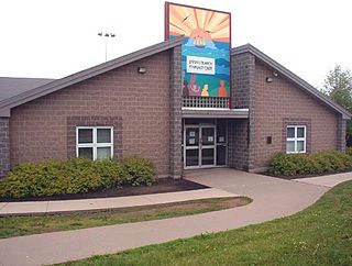
Dartmouth North Community Centre is a Community centre in Albro Lake a neighbourhood in the north end of the community of Dartmouth in Nova Scotia's Halifax Regional Municipality. Albro Lake is also known as District 9.


