
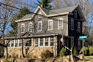
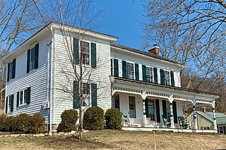
Ringoes is an unincorporated community and census-designated place (CDP) located within East Amwell Township in Hunterdon County, in the U.S. state of New Jersey. The community is served by the United States Postal Service as ZIP Code 08551 and as of the 2020 United States census, the CDP's population was 849.

Annandale is the penultimate station heading westbound on New Jersey Transit's Raritan Valley Line, located in the Annandale section of Clinton Township in Hunterdon County, New Jersey, United States. The station is located just off interchange 18 of Interstate 78 at the junction of Main Street and East Street. The final stop before High Bridge, it has one low-level side platform, with a shelter, 77 parking spaces and bicycle racks.

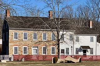
Pittstown is an unincorporated community located at the intersection of the boundaries of Alexandria, Franklin and Union townships in Hunterdon County, New Jersey. The area is named after William Pitt. The area is served as United States Postal Service ZIP Code 08867. The area was named Hofftown in the 18th century after landowner Lawrence Hoff. The Pittstown Historic District was listed on the state and national registers of historic places in 1990.

Whitehouse, also spelled White House, is an unincorporated community located within Readington Township in Hunterdon County, New Jersey. The community lies along the former Jersey Turnpike, just west of Mechanicsville. The Whitehouse–Mechanicsville Historic District, which includes historic places in both Whitehouse and Mechanicsville, was added to the National Register of Historic Places on March 17, 2015.

Norton is an unincorporated community located within Union Township, in Hunterdon County, New Jersey. Norton is located on County Route 635, approximately 1.5 mi (2.4 km) northwest of Interstate 78. The village is included in the Van Syckel Corner District, which was added to the National Register of Historic Places in 1979.

Fairmount is an unincorporated community located along County Route 517 in Tewksbury Township of Hunterdon County, New Jersey. The community was first known as Parkersville, named after proprietor James Parker (1725–1797). The southern section of the community is known as Lower Fairmount.
Potterstown is an unincorporated community along the border of Clinton and Readington townships in Hunterdon County, New Jersey.
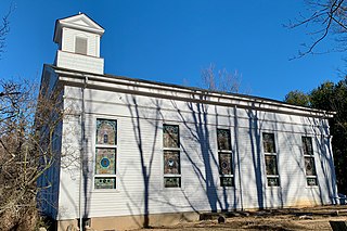
Cokesbury, historically known as Cokesburg, is an unincorporated community located on the border of Clinton and Tewksbury townships in Hunterdon County, New Jersey. It was named after two Methodist bishops, Coke and Asbury. The Cokesbury Historic District was listed on the state and national registers of historic places in 1997.

Little York is an unincorporated community located along the border of Alexandria and Holland townships in Hunterdon County, in the U.S. state of New Jersey. Little York is located on County Route 614 3.1 miles (5.0 km) north-northeast of Milford. Little York has a post office with ZIP Code 08834.
Cherryville is an unincorporated community located within Franklin Township, in Hunterdon County, in the U.S. state of New Jersey.
Mount Pleasant is an unincorporated community located along County Route 519 on the border of Alexandria Township and Holland Township, in Hunterdon County, New Jersey. The Mount Pleasant Historic District was listed on the National Register of Historic Places in 1987.
Amsterdam is an unincorporated community located within Holland Township in Hunterdon County, in the U.S. state of New Jersey. Located on the southern flank of the Musconetcong Mountain, the area was settled in the first half of the 18th century. It was later named after Amsterdam, Netherlands. The Amsterdam Historic District, encompassing the community, was listed on the state and national registers of historic places in 1995.
Anthony is an unincorporated community located within Lebanon Township in Hunterdon County, in the U.S. state of New Jersey.

Larisons Corners, also spelled Larison's Corners, is an unincorporated community located along the border of East Amwell and Raritan townships in Hunterdon County, New Jersey, United States.

Lower Valley is an unincorporated community located along County Route 513 in Califon Borough and Lebanon Township of Hunterdon County, New Jersey. It is at the western end of Long Valley, historically known as German Valley, the valley of the South Branch Raritan River south of Schooley's Mountain.

Perryville is an unincorporated community located at the intersection of Interstate 78 and Perryville Road within Union Township in Hunterdon County, New Jersey.

Reaville is an unincorporated community located along the border of East Amwell and Raritan townships in Hunterdon County, New Jersey. By the 1830s, it was known as Greenville. It was later renamed after Runkle Rea, the first postmaster in 1850.

Mount Airy is an unincorporated community located within West Amwell Township in Hunterdon County, in the U.S. state of New Jersey.
Van Syckel is an unincorporated community located within Union Township in Hunterdon County, New Jersey. The Van Syckel Corner District was listed on the National Register of Historic Places in 1979.

Wertsville is an unincorporated community located along County Route 602 in East Amwell Township of Hunterdon County, New Jersey, United States.


