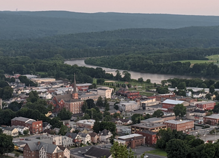
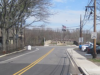
Port Jervis is a city located at the confluence of the Neversink and Delaware rivers in western Orange County, New York, United States, north of the Delaware Water Gap. Its population was 8,775 at the 2020 census. The communities of Deerpark, Huguenot, Sparrowbush, and Greenville are adjacent to Port Jervis. Matamoras, Pennsylvania, is across the river and connected by the Mid-Delaware Bridge. Montague Township, New Jersey, also borders the city. The Tri-States Monument, marking the tripoint between New York, New Jersey, and Pennsylvania, lies at the southwestern corner of the city.

Portland is a borough in Northampton County, Pennsylvania. The population of Portland was 494 at the 2020 census. Portland is part of the Lehigh Valley metropolitan area, which had a population of 861,899 and was thus the 68th most populous metropolitan area in the U.S. as of the 2020 census.

The Susquehanna River is a major river located in the Mid-Atlantic region of the United States, overlapping between the lower Northeast. At 444 miles (715 km) long, it is the longest river on the East Coast of the United States. By watershed area, it is the 16th-largest river in the United States, and also the longest river in the early 21st-century continental United States without commercial boat traffic.
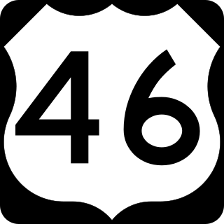
U.S. Route 46 (US 46) is an east–west U.S. Highway completely within the state of New Jersey, running for 75.34 mi (121.25 km), making it the shortest signed, non-spur U.S. Highway. The west end is at an interchange with Interstate 80 (I-80) and Route 94 in Columbia, Warren County, on the Delaware River. The east end is in the middle of the George Washington Bridge over the Hudson River in Fort Lee, Bergen County, while the route is concurrent with I-95 and US 1-9. Throughout much of its length, US 46 is closely paralleled by I-80. US 46 is a major local and suburban route, with some sections built to or near freeway standards and many other sections arterials with jughandles. The route runs through several communities in the northern part of New Jersey, including Hackettstown, Netcong, Dover, Parsippany-Troy Hills, Wayne, Clifton, Ridgefield Park, Palisades Park, and Fort Lee. It crosses over the Upper Passaic River at several points. The road has been ceremonially named the United Spanish–American War Veterans Memorial Highway.

Hurricane Diane was the first Atlantic hurricane to cause more than an estimated $1 billion in damage, including direct costs and the loss of business and personal revenue. It formed on August 7 from a tropical wave between the Lesser Antilles and Cape Verde. Diane initially moved west-northwestward with little change in its intensity, but began to strengthen rapidly after turning to the north-northeast. On August 12, the hurricane reached peak sustained winds of 105 mph (165 km/h), making it a Category 2 hurricane. Gradually weakening after veering back west, Diane made landfall near Wilmington, North Carolina, as a strong tropical storm on August 17, just five days after Hurricane Connie struck near the same area. Diane weakened further after moving inland, at which point the United States Weather Bureau noted a decreased threat of further destruction. The storm turned to the northeast, and warm waters from the Atlantic Ocean helped produce record rainfall across the northeastern United States. On August 19, Diane emerged into the Atlantic Ocean southeast of New York City, becoming extratropical two days later and completely dissipating by August 23.

Titusville is an unincorporated community and census-designated place (CDP) located within Hopewell Township in Mercer County, in the U.S. state of New Jersey. The area includes a post office with its own ZIP Code (08560), several restaurants, gas stations, a firehouse, and a small cluster of homes. The Washington Crossing State Park, dedicated to George Washington's crossing of the Delaware River in 1776, is adjacent to the community.
The Belvidere-Delaware Railroad was a railroad running along the eastern shore of the Delaware River from Trenton, New Jersey north via Phillipsburg, New Jersey to the small village of Manunka Chunk, New Jersey. It became an important feeder line for the Lehigh Valley Railroad's join to the Central Railroad of New Jersey, which was constructed into Phillipsburg, NJ at about the same time. This connected Philadelphia and Trenton, NJ at one end of the shortline railroad to the rapidly growing lower Wyoming Valley region, and via the Morris Canal or the CNJ, a slow or fast connection to New York City ferries crossing New York Harbor from Jersey City, NJ. In 1871 the CNJ leased various railroads in Pennsylvania, most from the Lehigh Coal & Navigation Company allowing the CNJ to penetrate to the upper Wyoming Valley, over some stretches, competing directly with the Lehigh Valley Railroad and with the Lehigh Canal and the trunk road connection of the Belvidere Delaware Railroad to New York became less profitable since Philadelphia connected more easily to Northeastern Pennsylvania thereafter without needing a double-crossing of the Delaware River; a general revenue decline ensued, leading to the Pennsylvania Railroad acquiring the rights, where it served as part of the Pennsylvania Railroad (PRR) system, carrying mainly anthracite coal and iron ore from northeastern Pennsylvania to population centers along the coast.
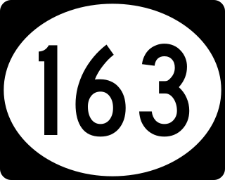
Route 163 is a short 0.30-mile (0.48 km) long state highway in the county of Warren in New Jersey. The route, which is currently a stub, used to be the approach to the destroyed Darlington's Bridge at Delaware Station, which was a road bridge over the Delaware River, connecting the settlement of Delaware, New Jersey with Portland, Pennsylvania. Until 1953, the bridge carried U.S. Route 46 over the river. The bridge has been destroyed, but the approaches are still state-maintained. A still-existing bridge carries an abandoned ex-Delaware, Lackawanna and Western Railroad line across the river just north of the former road crossing. The unsigned Route 163 runs from US 46 north to a dead end on the east side of US 46, all in Knowlton Township, New Jersey. From the dead end, the bridge approach continued northwest and west over US 46 to the bridge.
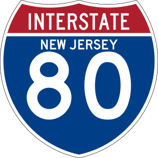
Interstate 80 (I-80) is a major Interstate Highway in the United States, running from San Francisco, California, eastward to the New York metropolitan area. In New Jersey, I-80 runs for 68.35 miles (110.00 km) from the Delaware Water Gap Toll Bridge at the Pennsylvania state line to its eastern terminus at I-95 in Teaneck, Bergen County. I-95 continues from the end of I-80 to the George Washington Bridge for access to New York City. The highway runs parallel to U.S. Route 46 (US 46) through rural areas of Warren and Sussex counties before heading into more suburban surroundings in Morris County. As the road continues into Passaic and Bergen counties, it heads into more urban areas. The New Jersey Department of Transportation (NJDOT) identifies I-80 within the state as the Christopher Columbus Highway.
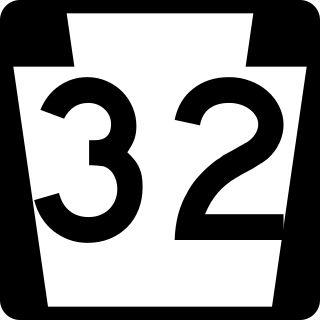
Pennsylvania Route 32 is a scenic two-lane highway that runs along the west side of the Delaware River in Bucks County, Pennsylvania. Signed north-south, it runs from U.S. Route 1 in Falls Township outside of Morrisville northwest to PA 611 in the village of Kintnersville in Nockamixon Township. PA 32 passes through Washington Crossing Historic Park, a Revolutionary War-themed historical park on the site of George Washington's crossing on the night of December 25–26, 1776. It also passes through the boroughs of Morrisville, Yardley, and New Hope.

The Lumberville–Raven Rock Bridge, also known as the Lumberville Foot Bridge, is a free pedestrian bridge over the Delaware River. The bridge connects Bull's Island Recreation Area near Raven Rock, Delaware Township in Hunterdon County, New Jersey to Lumberville, Solebury Township in Bucks County, Pennsylvania, United States. The bridge, which is one of the two exclusively pedestrian bridges over the Delaware River, is owned and operated by the Delaware River Joint Toll Bridge Commission.
Lumberville is a village on the Delaware River in Solebury Township, Bucks County, Pennsylvania, United States. It is located seven miles north of New Hope and is situated along River Road. Its ZIP Code is 18933.

Raven Rock is an unincorporated community and hamlet along the Delaware River approximately three miles (4.8 km) north of Stockton along New Jersey Route 29. The hamlet was known earlier as Saxtonville. It is located within Delaware Township in Hunterdon County, in the U.S. state of New Jersey. It is the site of Bull's Island Recreation Area. The rock outcrop for which it is named is the southwest corner of the Hunterdon Plateau.
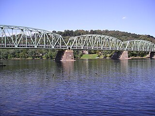
The Northampton Street Bridge is a bridge that crosses the Delaware River, connecting Easton, Pennsylvania, and Phillipsburg, New Jersey, United States. It is maintained by the Delaware River Joint Toll Bridge Commission despite not being a toll bridge. It is known locally as the "Free Bridge" thus distinguishing it from the Easton–Phillipsburg Toll Bridge just upstream to the north. The crossing was first a ferry crossing run by David Martin, beginning in 1739.
The Upper Black Eddy–Milford Bridge is a free bridge that crosses over the Delaware River in the United States. Owned and operated by the Delaware River Joint Toll Bridge Commission, it carries Bridge Street, connecting CR 519 in Milford, Hunterdon County, New Jersey, with Pennsylvania Route 32 in Upper Black Eddy, Bucks County, Pennsylvania.
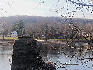
The Yardley–Wilburtha Bridge was a bridge spanning the Delaware River. A majority of the bridge was washed away by severe flooding in 1955 and was later demolished in 1961 after the completion of the nearby Scudder Falls Bridge.

Fox Point State Park is a Delaware state park on 108 acres (44 ha) along the Delaware River in New Castle County, Delaware in the United States. The park, which opened in 1995, has been built atop a former hazardous waste site that has been rehabilitated under an adaptive reuse program that was spearheaded by S. Marston Fox and the Fox Point Civic Association. Fox Point State Park is open for year-round use from 8:00 am until sunset. The park offers recreational opportunities on biking and pedestrian trails with picnic facilities, a playground and volleyball and horseshoes facilities. Fox Point State Park is just off Interstate 495 and is the northern terminus of Delaware's Coastal Heritage Greenway.
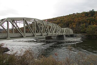
The Pond Eddy Bridge is a petit truss bridge spanning the Delaware River between the hamlet of Pond Eddy in Lumberland, New York and the settlement informally called Pond Eddy in Shohola Township, Pennsylvania. It is accessible from NY 97 in Lumberland on the New York side and two dead-end local roads, Flagstone Road and Rosa Road on the Pennsylvania side. The bridge was built in 1903 by the Oswego Bridge Company to replace an old suspension bridge that had washed away in a flood earlier in the year. It connected the bluestone quarries in Pennsylvania to New York.
The Lehigh and Susquehanna Railroad is a defunct railroad that operated in eastern Pennsylvania during the 19th and 20th centuries. The company was a subsidiary of the Lehigh Coal & Navigation Company (LC&N). For much of its lifetime, however, it was leased by the Central Railroad of New Jersey.
The Point Pleasant–Byram Bridge was a bridge that spanned the Delaware River between Point Pleasant, Bucks County, Pennsylvania and the Byram section of Kingwood, Hunterdon County, New Jersey.


