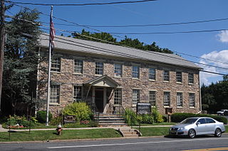
Hunterdon County is a county located in the western section of the U.S. state of New Jersey. At the 2020 census, the county was the state's 18th-most populous county, with a population of 128,947, its highest decennial count ever and an increase of 598 (+0.5%) from the 2010 census count of 128,349, which in turn reflected an increase of 6,360 (5.2%) from the 121,989 counted in the 2000 census. Its county seat is Flemington.

Bethlehem Township is a township in Hunterdon County, in the U.S. state of New Jersey. It is part of the New York metropolitan area. As of the 2020 United States census, the township's population was 3,745, a decrease of 234 (−5.9%) from the 2010 census count of 3,979, which in turn reflected an increase of 159 (+4.2%) from the 3,820 counted in the 2000 census.

Clinton Township is a township in Hunterdon County, in the U.S. state of New Jersey. As of the 2020 United States census, the township's population was 13,505, an increase of 27 (+.2%) from the 2010 census count of 13,478, which in turn reflected an increase of 521 (+4.0%) from the 12,957 counted in the 2000 census.

Delaware Township is a township in Hunterdon County, in the U.S. state of New Jersey. Part of the township is on the Hunterdon Plateau, while the southern portions are in the Amwell Valley. As of the 2020 United States census, the township's population was 4,560, a decrease of three people (−0.1%) from the 2010 census count of 4,563, which in turn reflected an increase of 85 (+1.9%) from the 4,478 counted in the 2000 census.

East Amwell Township is a township in Hunterdon County, in the U.S. state of New Jersey. As of the 2020 United States census, the township's population was 3,917, a decrease of 96 (−2.4%) from the 2010 census count of 4,013, which in turn reflected a decline of 442 (−9.9%) from the 4,455 counted in the 2000 census.

High Bridge is a borough in Hunterdon County, in the U.S. state of New Jersey. As of the 2020 United States census, the borough's population was 3,546, a decrease of 102 (−2.8%) from the 2010 census count of 3,648, which in turn reflected a decline of 128 (−3.4%) from the 3,776 counted in the 2000 census.

Holland Township is a township in Hunterdon County, in the U.S. state of New Jersey. As of the 2020 United States census, the township's population was 5,177, a decrease of 114 (−2.2%) from the 2010 census count of 5,291, which in turn reflected an increase of 167 (+3.3%) from the 5,124 counted in the 2000 census.

Kingwood Township is a township in Hunterdon County, in the U.S. state of New Jersey, located on the Hunterdon Plateau. As of the 2020 United States census, the township's population was 3,802, a decrease of 43 (−1.1%) from the 2010 census count of 3,845, which in turn reflected an increase of 63 (+1.7%) from the 3,782 counted in the 2000 census.

Lebanon is a borough in Hunterdon County,in the U.S. state of New Jersey. As of the 2020 United States census, the borough's population was 1,665, the highest ever in any decennial census and an increase of 307 (+22.6%) from the 2010 census count of 1,358, which in turn reflected an increase of 293 (+27.5%) from the 1,065 counted in the 2000 census.

Lebanon Township is a township located at the northernmost point of Hunterdon County, in the U.S. state of New Jersey. As of the 2020 United States census, the township's population was 6,195, a decrease of 393 (−6.0%) from the 2010 census count of 6,588, which in turn reflected an increase of 772 (+13.3%) from the 5,816 counted in the 2000 census.

Raritan Township is a township in Hunterdon County, in the U.S. state of New Jersey. As of the 2020 United States census, the township's population was 23,447, an increase of 1,262 (+5.7%) from the 2010 census count of 22,185, which in turn reflected an increase of 2,376 (+12.0%) from the 19,809 counted in the 2000 census. The township is located within the heart of the Amwell Valley and Raritan Valley regions, as the South Branch of the Raritan River flows through the center of the township. The northwestern portion of the township is located on the Hunterdon Plateau.

Readington Township is a township located in the easternmost portion of Hunterdon County, in the U.S. state of New Jersey. As of the 2020 United States census, the township's population was 16,128, an increase of two people (+0.0%) from the 2010 census count of 16,126, which in turn reflected an increase of 323 (+2.0%) from the 15,803 counted in the 2000 census.

Union Township is a township in Hunterdon County, in the U.S. state of New Jersey. The southwest half of the township lies on what is known as the Hunterdon Plateau, the northwest corner consists of the Musconetcong Ridge and the northeast section is part of the lower-lying Newark Basin around Spruce Run Reservoir. As of the 2020 United States census, the township's population was 6,507, an increase of 599 (+10.1%) from the 2010 census count of 5,908, which in turn reflected a decline of 252 (−4.1%) from the 6,160 counted in the 2000 census.

West Amwell Township is a township in Hunterdon County, in the U.S. state of New Jersey. As of the 2020 United States census, the township's population was 3,005, a decrease of 835 (−21.7%) from the 2010 census count of 3,840, which in turn reflected an increase of 1,457 (+61.1%) from the 2,383 counted in the 2000 census.

Raven Rock is an unincorporated community and hamlet along the Delaware River approximately three miles (4.8 km) north of Stockton along New Jersey Route 29. The hamlet was known earlier as Saxtonville. It is located within Delaware Township in Hunterdon County, New Jersey, United States. It is the site of Bull's Island Recreation Area. The rock outcrop for which it is named is the southwest corner of the Hunterdon Plateau.

Rosemont is an unincorporated community located within Delaware Township in Hunterdon County, in the U.S. state of New Jersey. Its ZIP code is 08556. Located at the top of a small hill, the center of the community is located along Kingwood Stockton Road near its intersections with Raven Rock Rosemont Road and Rosemont Ringoes Road. Farmland and residences make up the surrounding area while the center of the settlement includes residences, a post office, and an antique shop.

Hamden is an unincorporated community located within Clinton Township, in Hunterdon County, New Jersey, United States.

Rockefellows Mills is an unincorporated community located within Raritan Township in Hunterdon County, New Jersey, United States. The settlement is located along the South Branch Raritan River near Three Bridges. The river is spanned in the area by the historic Rockafellows Mill Bridge built in 1900 and part of the Raritan–Readington South Branch Historic District. Most of the area within the Raritan Township side of the river is forested however on the north side of the river in Readington Township, some farmland dots the area.

Snydertown is an unincorporated community located within East Amwell Township in Hunterdon County, New Jersey, United States. The settlement is located on the southern face of Sourland Mountain at the intersection of Linvale Road and Snydertown Road. In the past, a mill operated in Snydertown.

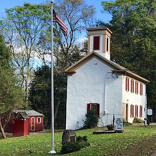
Sandy Ridge is an unincorporated community located within Delaware Township in Hunterdon County, New Jersey, United States. As its name implies, the community is located at the top of a small hill that is sandwiched between the Hunterdon Plateau and the Sourland Mountains. Sandy Ridge Road is the main road east and west through the community while County Route 605 is a minor arterial road that passes north and south through the area. CR 605 enters from the south on Sandy Ridge-Mt. Airy Road, jogs to the west on Sandy Ridge Road for 0.04 miles (64 m), and exits to the north on Cemetery Road towards CR 523. The area consists of mainly residences with some farmland and forestland. The Sandy Ridge Church is a Baptist church founded in 1818 with its current building constructed in 1866 and is located in the center of Sandy Ridge.


