McCracken County is a county located in the far west portion of U.S. state of Kentucky. As of the 2020 census, the population was 67,875. The county seat and only municipality is Paducah. McCracken County was the 78th county formed in the state, having been created in 1825. It is part of the historic Jackson Purchase, territory sold by the Chickasaw people to General Andrew Jackson and Governor Isaac Shelby; this territory was located at the extreme western end of Kentucky.

Trigg County is a county located on the far southwestern border of the U.S. state of Kentucky. As of the 2020 census, the population was 14,061. Its county seat is Cadiz. Formed in 1820, the county was named for Stephen Trigg, an officer in the American Revolutionary War who was killed at the Battle of Blue Licks, now in Robertson County, Kentucky. It was a victory for British and allied troops.

Taylor County is a county located in the U.S. state of Kentucky. As of the 2020 census, the population was 26,023. Its county seat is Campbellsville. Settled by people from Virginia, Pennsylvania, Maryland, and North Carolina after the American Revolutionary War, the county was organized in 1848 in the Highland Rim region. It is named for United States Army General Zachary Taylor, later President of the United States. Taylor County was the 100th of the 120 counties created by Kentucky. The Campbellsville Micropolitan Statistical Area includes all of Taylor County.

Rockcastle County is a county located in the southeastern part of the U.S. state of Kentucky. As of the 2020 census, the population was 16,037. Its county seat is Mt. Vernon. The county was founded in 1810 and named for the Rockcastle River, which runs through it. The river, in turn, is named for its majestic rock cliffs. Rockcastle County is part of the Richmond-Berea, KY Micropolitan Statistical Area, which is also included in the Lexington-Fayette–Richmond–Frankfort, KY combined statistical area.

Nicholas County is a county located in the U.S. state of Kentucky. As of the 2020 census, the population was 7,537. Its county seat is Carlisle, which is also the only incorporated community in the county. Founded in 1799, the county is named for Col. George Nicholas, the "Father of the Kentucky Constitution."

Lyon County is a county located in the U.S. state of Kentucky. As of the 2020 census, the population was 8,680. Its county seat is Eddyville. The county was formed from Caldwell County, Kentucky in 1854 and named for former Congressman Chittenden Lyon.

Livingston County is a county located in the U.S. state of Kentucky. As of the 2020 census, the population was 8,888. Its county seat is Smithland and its largest community is Ledbetter. The county was established in 1798 from land taken from Christian County and is named for Robert R. Livingston, a member of the Committee of Five that drafted the U.S. Declaration of Independence. The county was strongly pro-Confederate during the American Civil War and many men volunteered for the Confederate Army. Livingston County is part of the Paducah, KY-IL Metropolitan Statistical Area. It is a prohibition or dry county with the exception of Grand Rivers which voted to allow alcohol sales in 2016.

Lincoln County is a county located in south-central Kentucky. As of the 2020 census, the population was 24,275. Its county seat is Stanford. Lincoln County is part of the Danville, KY Micropolitan Statistical Area.

Hickman County is a county located in the U.S. state of Kentucky. As of the 2020 census, the population was 4,521, making it the third-least populous county in Kentucky. Its county seat is Clinton. The county was formed in 1821. It is the least densely populated county in the state and is a prohibition or dry county.

Calloway County is a county located in the southwest portion of the U.S. Commonwealth of Kentucky. As of the 2020 census, the population was 37,103. Its county seat is Murray. The county was founded in November 1822 and named for Colonel Richard Callaway, one of the founders of Boonesborough. Calloway County comprises the Murray, KY Micropolitan Statistical Area. As of July 18, 2012 Calloway County is a moist county: the sale of alcohol in the county is prohibited, with the exception of the city of Murray.
Ballard County is a county located in the west portion of the U.S. state of Kentucky. As of the 2020 census, the population was 7,728. Its county seat is Wickliffe and its largest city is LaCenter. The county was created by the Kentucky State Legislature in 1842 and is named for Captain Bland Ballard, a soldier, statesman, and member of the Kentucky General Assembly. Ballard County is part of the Paducah, KY-IL Metropolitan Statistical Area.

Riverside is a city in St. Clair County, Alabama, United States. It incorporated in 1886. At the 2010 census the population was 2,208, up from 1,564 in 2000.

Carlisle is a city in Lonoke County, Arkansas, United States. It is the easternmost municipality within the Little Rock–North Little Rock–Conway Metropolitan Statistical Area. Carlisle was incorporated in 1878. As of the 2010 census it had a population of 2,214.
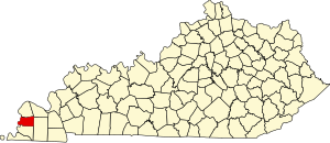
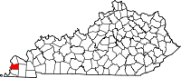
Arlington is a home rule-class city in Carlisle County, Kentucky, in the United States. The population was 324 at the 2010 census, a drop from 395 in 2000. It was formally incorporated by the state assembly in 1876. Arlington is included in the Paducah, KY-IL Metropolitan Statistical Area.

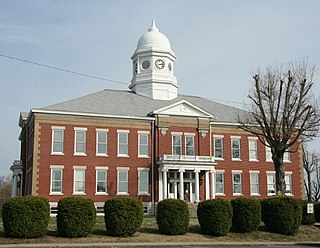
Bardwell is a home rule-class city in and the county seat of Carlisle County, Kentucky, United States. The city was formally incorporated by the state assembly in 1878. The population was 714 at the 2020 census, down from 723 in 2010. Bardwell is included in the Paducah, KY-IL Metropolitan Statistical Area.
Crossgate is a home rule-class city in Jefferson County, Kentucky, United States. The population was 225 at the 2010 census.

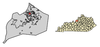
Carlisle is a home rule-class city in Nicholas County, Kentucky, United States. The population was 2,010 at the 2010 census. It is the county seat of Nicholas County. It is located at the junction of Kentucky Route 32 and Kentucky Route 36, about halfway between Lexington and Maysville.

Darien is a village in Walworth County, Wisconsin, United States. The population was 1,573 at the 2020 census. The village is located within the Town of Darien.
Darien is a town in Walworth County, Wisconsin, United States. The population was 1,651 at the 2020 census. The Village of Darien is located within the town. The unincorporated community of Bardwell is located in the town. The unincorporated communities of Allen's Grove and Fairfield are also located partially in the town.
Rumford is a census-designated place (CDP) in the town of Rumford in Oxford County, Maine, United States. The population was 4,795 at the 2000 census.