Madison County, Kentucky

Last updated

Madison County
Madison County, Kentucky courthouse.JPG
Map of Kentucky highlighting Madison County.svg
Location within the U.S. state of Kentucky
Kentucky in United States.svg
Kentucky's location within the U.S.
Coordinates: 37°43′N84°17′W / 37.72°N 84.28°W / 37.72; -84.28
CountryFlag of the United States.svg United States
StateFlag of Kentucky.svg  Kentucky
FoundedDecember 15, 1785
Named for James Madison
Seat Richmond
Largest cityRichmond
Area
  Total443 sq mi (1,150 km2)
  Land437 sq mi (1,130 km2)
  Water6.0 sq mi (16 km2)  1.3%
Population
 (2020)
  Total92,701
  Estimate 
(2023)
96,735 Increase2.svg
  Density210/sq mi (81/km2)
Time zone UTC−5 (Eastern)
  Summer (DST) UTC−4 (EDT)
Congressional district 6th
Website www.madisoncountyky.us

Madison County is a county located in the central part of the U.S. state of Kentucky. At the 2020 census, its population was 92,701. [1] Its county seat is Richmond. [2] The county is named for Virginia statesman James Madison, who later became the fourth President of the United States. [3]

Contents

The county is part of the Richmond-Berea, KY Micropolitan Statistical Area which is also included in the Lexington-Fayette–Richmond–Frankfort, KY combined statistical area.

Madison County is considered a moist county, meaning that although the county prohibits the sale of alcoholic beverages (and is thus a dry county), it contains a city where retail alcohol sales are allowed. Nevertheless, two of the county's 19 precincts are completely dry. [4] Alcohol can also be sold by the drink in Berea, [5] Richmond, and at Arlington and The Bull golf clubs. In 2023, the county voted to become wet. [6]

Madison County is home to Eastern Kentucky University, Berea College, and historic Boone Tavern. [7] Famous pioneer Daniel Boone lived in Madison County and built Fort Boonesborough, now a state historic site.

History

Indian trader John Findley, Daniel Boone, and four others first came into the area that is now Madison County in 1769 on a hunting and exploring expedition. In 1774, the Transylvania Company, led by Judge Richard Henderson of North Carolina, purchased 20,000,000 acres (8,100,000 ha) of land west of the Appalachians (including present-day Madison County) from the Cherokee Nation. Daniel Boone was hired to cut a trail through the Cumberland Gap and establish a settlement on the Kentucky River. The settlement at Fort Boonesborough began in April 1775.

In 1785, Madison County was established from a portion of Lincoln County, Virginia. [8] [9]

Geography

According to the United States Census Bureau, the county has a total area of 443 square miles (1,150 km2), of which 437 square miles (1,130 km2) is land and 6.0 square miles (16 km2) (1.3%) is water. [10]

Major highways

Adjacent counties

Demographics

Historical population
CensusPop.Note
1790 5,772
1800 10,49081.7%
1810 15,54048.1%
1820 15,9542.7%
1830 18,75117.5%
1840 16,355−12.8%
1850 15,727−3.8%
1860 17,2079.4%
1870 19,54313.6%
1880 22,05212.8%
1890 24,34810.4%
1900 25,6075.2%
1910 26,9515.2%
1920 26,284−2.5%
1930 27,6215.1%
1940 28,5413.3%
1950 31,1799.2%
1960 33,4827.4%
1970 42,73027.6%
1980 53,35224.9%
1990 57,5087.8%
2000 70,87223.2%
2010 82,91617.0%
2020 92,70111.8%
2023 (est.)96,735 [11] 4.4%
U.S. Decennial Census [12]
1790-1960 [13] 1900-1990 [14]
1990-2000 [15] 2010-2020 [1]

As of the census [16] of 2000, there were 70,872 people, 27,152 households, and 18,218 families residing in the county. The population density was 161 per square mile (62/km2). There were 29,595 housing units at an average density of 67 per square mile (26/km2). The racial makeup of the county was 93.01% White, 4.44% Black or African American, 0.28% Native American, 0.72% Asian, 0.02% Pacific Islander, 0.34% from other races, and 1.19% from two or more races. 0.97% of the population were Hispanics or Latinos of any race.

There were 27,152 households, out of which 31.50% had children under the age of 18 living with them, 53.10% were married couples living together, 10.70% had a female householder with no husband present, and 32.90% were non-families. 25.20% of all households were made up of individuals, and 7.60% had someone living alone who was 65 years of age or older. The average household size was 2.42 and the average family size was 2.90.

By age, 21.90% were under 18, 18.80% from 18 to 24, 29.40% from 25 to 44, 20.10% from 45 to 64, and 9.80% 65 or older. The median age was 31 years. Both the relatively large 18-to-24 population and the relatively low median age can be explained by the presence of Eastern Kentucky University, and to a considerably lesser extent Berea College. For every 100 females, there were 93.30 males. For every 100 females age 18 and over, there were 90.20 males.

The median income for a household in the county was $32,861, and the median income for a family was $41,383. Males had a median income of $31,974 versus $22,487 for females. The per capita income for the county was $16,790. About 12.00% of families and 16.80% of the population were below the poverty line, including 17.80% of those under age 18 and 17.10% of those age 65 or over.

Government

The Madison County courthouse is located at 135 W Irvine Street in Richmond.

   County Judge-Executive: Reagan Taylor    County Clerk: Kenny Barger    Sheriff: Mike Coyle    Coroner: Jimmy Cornelison    Jailer: Steve Tussey    County Attorney: Jennie Haymond    Circuit Clerk: David M. Fernandez    County Property Valuation Administrator (PVA): Billy Ackerman    County Surveyor: Stuart W. Spencer

Elections

United States presidential election results for Madison County, Kentucky [17]
Year Republican Democratic Third party
No.%No.%No.%
2020 27,35662.23%15,58135.45%1,0202.32%
2016 23,43162.70%11,79331.56%2,1475.75%
2012 21,12863.41%11,51234.55%6822.05%
2008 19,69460.53%12,39238.09%4511.39%
2004 18,92261.62%11,52537.53%2600.85%
2000 13,68257.81%9,30939.33%6752.85%
1996 9,21248.23%8,14242.62%1,7489.15%
1992 8,71943.94%8,00540.35%3,11715.71%
1988 9,95859.39%6,67239.79%1360.81%
1984 11,30963.09%6,50936.31%1080.60%
1980 8,43747.74%8,20846.45%1,0265.81%
1976 6,58146.63%7,29951.71%2341.66%
1972 8,65965.60%4,32832.79%2121.61%
1968 5,32544.83%3,88432.70%2,66922.47%
1964 4,26638.09%6,87761.40%570.51%
1960 6,69254.35%5,62145.65%00.00%
1956 5,95550.85%5,67048.42%850.73%
1952 5,88649.82%5,90149.94%280.24%
1948 4,61944.63%5,34451.64%3863.73%
1944 5,46848.36%5,76951.02%700.62%
1940 5,78946.91%6,48452.54%670.54%
1936 6,03448.76%6,25950.58%820.66%
1932 5,81145.10%6,95754.00%1160.90%
1928 6,32557.03%4,73642.71%290.26%
1924 5,27651.26%4,89547.56%1211.18%
1920 6,01251.21%5,64748.10%800.68%
1916 3,01747.56%3,29551.94%320.50%
1912 2,09434.67%2,99249.54%95315.78%

Education

Schools

Madison County is served by two school districts: [18]

The county is also served by Model Laboratory School which is part of Eastern Kentucky University.

Colleges and universities

Communities

Economy

Military

The Blue Grass Army Depot is located just south of Richmond.[ citation needed ]

Notable people

Sister communities

See also

Related Research Articles

<span class="mw-page-title-main">Whitley County, Kentucky</span> County in Kentucky, United States

Whitley County is a county located in the southeastern part of the U.S. state of Kentucky. As of the 2020 census, the population was 36,712. Its county seat is at Williamsburg, though the largest city is Corbin, and the county's District Court sits in both cities. Whitley County is included in the London, KY Micropolitan Statistical Area.

<span class="mw-page-title-main">Rockcastle County, Kentucky</span> County in Kentucky, United States

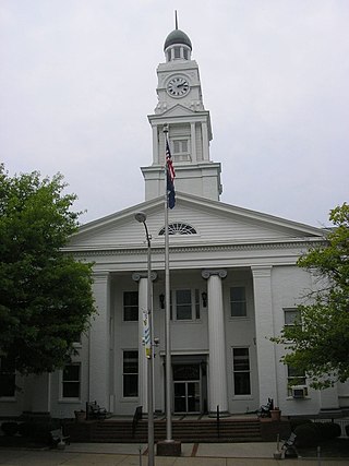
Rockcastle County is a county located in the southeastern part of the U.S. state of Kentucky. As of the 2020 census, the population was 16,037. Its county seat is Mt. Vernon. The county was founded in 1810 and named for the Rockcastle River, which runs through it. The river, in turn, is named for its majestic rock cliffs. Rockcastle County is part of the Richmond-Berea, KY Micropolitan Statistical Area, which is also included in the Lexington-Fayette–Richmond–Frankfort, KY combined statistical area.

<span class="mw-page-title-main">Owsley County, Kentucky</span> County in Kentucky, United States

Owsley County is a county located in the Eastern Coalfield region of the U.S. state of Kentucky. As of the 2020 census, the population was 4,051, making it the second-least populous county in Kentucky. The county seat is Booneville. The county was organized on January 23, 1843, from Clay, Estill, and Breathitt counties and named for William Owsley (1782–1862), the judge of the Kentucky Court of Appeals and Governor of Kentucky (1844–48). According to the 2010 census reports, Owsley County has the second-highest level of child poverty of any county in the United States. In terms of income per household, the county is the poorest in the nation. Between 1980 and 2014, the rate of death from cancer in the county increased by 45.6 percent, the largest such increase of any county in the United States.

<span class="mw-page-title-main">Nicholas County, Kentucky</span> County in Kentucky, United States

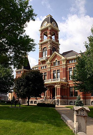
Nicholas County is a county located in the U.S. state of Kentucky. As of the 2020 census, the population was 7,537. Its county seat is Carlisle, which is also the only incorporated community in the county. Founded in 1799, the county is named for Col. George Nicholas, the "Father of the Kentucky Constitution."

<span class="mw-page-title-main">Laurel County, Kentucky</span> County in Kentucky, United States

Laurel County is a county located in the southeastern portion of the U.S. state of Kentucky. As of the 2020 census, the population was 62,613. Its county seat is London. After a special election in January 2016 alcohol sales are permitted only in the city limits of London. The ordinance went into effect on March 27, 2016, 60 days after results of the election. Laurel County is included in the London, KY Micropolitan Statistical Area.

<span class="mw-page-title-main">Kenton County, Kentucky</span> County in Kentucky, United States

Kenton County is a county located in the northern part of the Commonwealth of Kentucky. As of the 2020 census, the population was 169,064, making it the third most populous county in Kentucky. Its county seats are Covington and Independence. It was, until November 24, 2010, the only county in Kentucky to have two legally recognized county seats. The county was formed in 1840 and is named for Simon Kenton, a frontiersman notable in the early history of the state.

<span class="mw-page-title-main">Jackson County, Kentucky</span> County in Kentucky, United States

Jackson County is located in the Commonwealth of Kentucky. As of the 2020 census, the population was 12,955. Its county seat is McKee. The county was formed in 1858 from land given by Madison, Estill, Owsley, Clay, Laurel, and Rockcastle counties. It was named for Andrew Jackson, seventh President of the United States. Jackson County became a moist county via a "local-option" referendum in the Fall of 2019 that legalized the sale of alcoholic beverages in the city of McKee.

<span class="mw-page-title-main">Henry County, Kentucky</span> County in Kentucky, United States

Henry County is a county located in the north central portion of the U.S. state of Kentucky bordering the Kentucky River. As of the 2020 census, the population was 15,678. Its county seat is New Castle, but its largest city is Eminence. The county was founded in 1798 from portions of Shelby County. It was named for the statesman and governor of Virginia Patrick Henry. Henry County is included in the Louisville/Jefferson County, KY-IN Metropolitan Statistical Area. Since the 1990s, it has become an increasingly important exurb, especially as land prices have become higher in neighboring Oldham County. With regard to the sale of alcohol, it is classified as a wet county.

<span class="mw-page-title-main">Clark County, Kentucky</span> County in Kentucky, United States

Clark County is a county located in the U.S. state of Kentucky. As of the 2020 census, the population was 36,972. Its county seat is Winchester. The county was created in 1792 from Bourbon and Fayette counties and is named for Revolutionary War hero George Rogers Clark. Clark County is part of the Lexington-Fayette, KY Metropolitan Statistical Area.

<span class="mw-page-title-main">Carter County, Kentucky</span> County in Kentucky, United States

Carter County is a county located in the U.S. state of Kentucky. As of the 2020 census, the population was 26,627. Its county seat is Grayson. Carter County is in the Huntington-Ashland, WV-KY-OH Metropolitan Statistical Area. It is home to Carter Caves State Resort Park.

<span class="mw-page-title-main">Campbell County, Kentucky</span> County in Kentucky, United States

Campbell County is a county located in the northern part of the U.S. state of Kentucky. As of the 2020 census, the population was 93,076. Its county seats are Alexandria and Newport. The county was formed on December 17, 1794, from sections of Scott, Harrison, and Mason Counties and was named for Colonel John Campbell (1735–1799), a Revolutionary War soldier and Kentucky legislator. Campbell County, with Boone and Kenton Counties, is part of the Northern Kentucky metro community, and the Cincinnati-Middletown, OH-KY-IN Metropolitan Statistical Area.

<span class="mw-page-title-main">Boone County, Kentucky</span> County in Kentucky, United States

Boone County is a county located on the Ohio River in the northernmost part of the Commonwealth of Kentucky. As of the 2020 census, the population was 135,968, making it the fourth-most populous county in Kentucky. Its county seat is Burlington. The county was formed in 1798 from a portion of Campbell County. and was named for frontiersman Daniel Boone. Boone County, with Kenton and Campbell Counties, is of the Northern Kentucky metro area, and the Cincinnati-Middletown, OH-KY-IN Metropolitan Statistical Area. It is the location of the Cincinnati/Northern Kentucky International Airport, which serves Cincinnati and the tri-state area.

<span class="mw-page-title-main">Bell County, Kentucky</span> County in Kentucky, United States

Bell County is a county located in the southeast part of the U.S. state of Kentucky. As of the 2020 census, the population was 24,097. Its county seat is Pineville and its largest city is Middlesboro. The county was formed in 1867, during the Reconstruction era from parts of Knox and Harlan counties and augmented from Knox County in 1872. The county is named for Joshua Fry Bell, a US Representative. It was originally called "Josh Bell", but on January 31, 1873, the Kentucky legislature shortened the name to "Bell",

<span class="mw-page-title-main">McKee, Kentucky</span> City in Kentucky, United States

McKee is a home rule-class city located in the Commonwealth of Kentucky. It is the seat and second-largest community of Jackson County, KY. As of the 2020 census, the population of the city was 803. The city was founded on April 1, 1882, and was named for Judge George R. McKee. In 2019, the city held a vote regarding the sale of alcohol, which passed, making the city wet.

<span class="mw-page-title-main">Berea, Kentucky</span> City in Kentucky, United States

Berea is a home rule-class city in Madison County, Kentucky, in the United States. The town is best known for its art festivals, historic restaurants and buildings, and as the home to Berea College, a private liberal arts college. The population was 15,539 at the 2020 census. It is one of the fastest-growing towns in Kentucky, having increased by 27.4% since 2000. Berea is a principal city of the Richmond−Berea Micropolitan Statistical Area, which includes Madison and Rockcastle counties. It was formally incorporated by the state assembly in 1890.

<span class="mw-page-title-main">Richmond, Kentucky</span> City in Kentucky, United States

Richmond is a home rule-class city in and the county seat of Madison County, Kentucky, United States. It is named after Richmond, Virginia, and is home to Eastern Kentucky University. The population was 34,585 at the 2020 census. Richmond is the fourth-largest city in the Bluegrass region and the state's seventh-largest city. It is the ninth largest population center in the state with a Micropolitan population of 106,864. The city serves as the center for work and shopping for south-central Kentucky. In addition, Richmond is the principal city of the Richmond-Berea, Kentucky Micropolitan Area, which includes all of Madison and Rockcastle counties.

<span class="mw-page-title-main">Harrodsburg, Kentucky</span> City in Kentucky, United States

Harrodsburg is a home rule-class city in Mercer County, Kentucky, United States. It is the seat of its county. The population was 9,064 at the 2020 census.

<span class="mw-page-title-main">Walton, Kentucky</span> City in Kentucky, United States

Walton is a home rule-class city in Boone and Kenton counties in the U.S. state of Kentucky. The population was 5,460 at the 2020 census.

<span class="mw-page-title-main">Knox County, Kentucky</span> County in Kentucky, United States

Knox County is a county located in Appalachia near the southeastern corner of the U.S. state of Kentucky. As of the 2020 census, the population was 30,193. Its county seat is Barbourville. The county is named for General Henry Knox. It is one of the few coal-producing counties in Kentucky that has not suffered massive population loss. Knox County is included in the London, KY Micropolitan Statistical Area.

The Richmond-Berea Micropolitan Statistical Area, as defined by the United States Census Bureau, is an area consisting of two counties in Kentucky, anchored by the cities of Richmond and Berea. As of the 2000 census, the μSA had a population of 87,454.

References

  1. 1 2 "State & County QuickFacts". United States Census Bureau. Retrieved June 29, 2022.
  2. "Find a County". National Association of Counties. Archived from the original on May 31, 2011. Retrieved June 7, 2011.
  3. The Register of the Kentucky State Historical Society, Volume 1. Kentucky State Historical Society. 1903. pp.  36.
  4. Lanier, Yvette (August 1, 2007). "Berea votes down alcohol sales again". Lexington Herald-Leader . Retrieved August 1, 2007.[ dead link ]
  5. "Berea prepares for future with alcohol sales". Richmond Register. September 30, 2015. Retrieved January 13, 2016.
  6. "Madison County is wet, what's next?". May 23, 2023. Retrieved July 27, 2023.
  7. Foust, Michele. "200-year-old Kentucky pottery business a sight to see ", Atlanta Journal-Constitution, February 25, 2007. Retrieved on February 23, 2009.
  8. Collins, Lewis (1882). Collins' Historical Sketches of Kentucky: History of Kentucky, Volume 2. Collins & Company. p. 26.
  9. "Madison County". The Kentucky Encyclopedia. 2000. Archived from the original on July 17, 2019. Retrieved August 23, 2014.
  10. "2010 Census Gazetteer Files". United States Census Bureau. August 22, 2012. Archived from the original on August 12, 2014. Retrieved August 17, 2014.
  11. "Annual Estimates of the Resident Population for Counties: April 1, 2020 to July 1, 2023". United States Census Bureau. Retrieved March 14, 2024.
  12. "U.S. Decennial Census". United States Census Bureau. Retrieved August 17, 2014.
  13. "Historical Census Browser". University of Virginia Library. Retrieved August 17, 2014.
  14. "Population of Counties by Decennial Census: 1900 to 1990". United States Census Bureau. Retrieved August 17, 2014.
  15. "Census 2000 PHC-T-4. Ranking Tables for Counties: 1990 and 2000" (PDF). United States Census Bureau. Archived (PDF) from the original on March 27, 2010. Retrieved August 17, 2014.
  16. "U.S. Census website". United States Census Bureau . Retrieved January 31, 2008.
  17. Leip, David. "Dave Leip's Atlas of U.S. Presidential Elections". uselectionatlas.org. Retrieved July 4, 2018.
  18. "2020 CENSUS - SCHOOL DISTRICT REFERENCE MAP: Madison County, KY" (PDF). U.S. Census Bureau. Archived (PDF) from the original on July 26, 2022. Retrieved July 25, 2022. - Text list - For more detailed boundaries of the independent school districts see: "Appendix B: Maps Of Independent School Districts In Operation In FY 2014-FY 2015 Using 2005 Tax District Boundaries – Berea ISD" (PDF). Research Report No. 415 – Kentucky's Independent School Districts: A Primer. Frankfort, KY: Office of Education Accountability, Legislative Research Commission. September 15, 2015. p. 93 (PDF p. 107/174). Archived (PDF) from the original on December 10, 2020.
  19. Galbreath, Charles Burleigh (February 28, 1925). "History of Ohio". American Historical Society, Incorporated via Google Books.
  20. "Tribble, Andrew A. · Notable Kentucky African Americans Database". nkaa.uky.edu.
  21. "Marker Dedicated to Vaudevillian Andrew Tribble in Madison County". WEKU. October 2, 2019.
  22. "Bentley, Daniel S." Notable Kentucky African Americans Database, University of Kentucky . Retrieved February 5, 2023.

37°43′N84°17′W / 37.72°N 84.28°W / 37.72; -84.28