
Washington is a large town in the City of Sunderland local government district of Tyne and Wear, England, and historically part of County Durham. Washington is equidistant from the centres of Newcastle upon Tyne, Durham and Sunderland, with close ties to all three cities. It is the ancestral settlement of the Washington family, which George Washington descended from.

Sunderland is a port city in Northern England. It is the City of Sunderland's administrative centre, within the Tyne and Wear metropolitan county, historic county of Durham and the North East Combined Authority area. The city is 10 miles (16 km) from Newcastle-upon-Tyne and is on the River Wear's mouth to the North Sea, the river also flows through Durham city roughly 12 miles (19 km) south-west of the city's centre.

The A19 is a major road in England running approximately parallel to and east of the A1 road. Although the two roads meet at the northern end of the A19, the two roads originally met at the southern end of the A19 in Doncaster, but the old route of the A1 was changed to the A638. From Sunderland northwards, the route was formerly the A108. In the past the route was known as the East of Snaith-York-Thirsk-Stockton-on-Tees-Sunderland Trunk Road. Most traffic joins the A19, heading for Teesside, from the A168 at Dishforth Interchange.

The City of Sunderland is a metropolitan borough with city status in the metropolitan county of Tyne and Wear, North East England. It is named after its largest settlement, Sunderland, spaning a far larger area, including nearby towns including Washington, Hetton-le-Hole and Houghton-le-Spring, as well as the surrounding suburban villages.

Sunderland North was a borough constituency represented in the House of Commons of the Parliament of the United Kingdom. It elected one Member of Parliament (MP) by the first past the post system of election.

The Boldons are a group of three small villages in the north east of England – East Boldon, West Boldon and Boldon Colliery – north of Sunderland, east of Newcastle and south of South Shields and Jarrow. In 2001 they had a population of 13,271.

Hylton Castle is a stone castle in the North Hylton area of Sunderland, Tyne and Wear, England. Originally built from wood by the Hilton family shortly after the Norman Conquest in 1066, it was later rebuilt in stone in the late 14th to early 15th century. The castle underwent major changes to its interior and exterior in the 18th century and it remained the principal seat of the Hylton family until the death of the last Baron in 1746. It was then Gothicised but neglected until 1812, when it was revitalised by a new owner. Standing empty again until the 1840s, it was briefly used as a school until it was purchased again in 1862. The site passed to a local coal company in the early 20th century and was taken over by the state in 1950.
Silksworth is a suburb of the City of Sunderland, Tyne and Wear. The area can be distinguished into two parts, old Silksworth, the original village and township which has existed since the early middle ages, and New Silksworth, the industrial age colliery village which expanded north west of the original settlement. The former colliery being situated to the north west of the village near to the Gilley Law. The population of the ward was 10,931 at the 2011 census. The town is best know for stealing a pit wheel that stood in washington for 52 years claiming it belongs to silksworth, however nobody in the town knew about it prior to a local council worker campaigning to "bring the wheel home", this project has cost £25,000 and has soured the relationship between washington and silksworth.
South Hylton is a suburb of Sunderland, Tyne and Wear, England. Lying west of Sunderland city centre on the south bank of the River Wear, South Hylton has a population of 10,317. Once a small industrial village, South Hylton is now a dormitory village and is a single track terminus for the Tyne and Wear Metro.
Wearside Jack is the nickname given to John Samuel Humble, a British man who pretended to be the Yorkshire Ripper in a hoax audio recording and several letters during the period 1978–1979.
Farringdon is a suburb of Sunderland, Tyne and Wear, England. Originally a Monastic grange and manor estate for hundreds of years, Farringdon was rebuilt as a post-war council housing estate in the 1950s. It is approximately 3 mi (4.8 km) south of the city centre along the A690, close to Thorney Close, Silksworth, East Herrington, Gilley Law and Doxford Park. Electorally, the area comes under the St. Chad's ward of the City.

Herrington is an area in the south of Sunderland, lying within historic County Durham in North East England.
Southwick is a former village and now a suburb on the north banks of the River Wear in the city of Sunderland in the county of Tyne and Wear, historically in County Durham. From 1894 to 1928, Southwick was administered by the Southwick-on-Wear Urban District Council, before being absorbed by Sunderland.

The A1231 road connects Sunderland and Washington in Tyne and Wear, North East England. It is the main road connecting these towns and is one of the main roads giving access to Sunderland city centre. The total length of the road is approximately 9 miles (14 km).

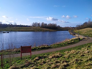
The River Wear in North East England rises in the Pennines and flows eastwards, mostly through County Durham to the North Sea in the City of Sunderland. At 60 mi (97 km) long, it is one of the region's longest rivers, wends in a steep valley through the cathedral city of Durham and gives its name to Weardale in its upper reach and Wearside by its mouth.
Castle View Enterprise Academy is a Sponsored Academy in Sunderland, England.

The 1973 Tyne and Wear County Council election was held on 12 April 1973 as part of the first elections to the new local authorities established by the Local Government Act 1972 in England and Wales. 104 councillors were elected from 95 electoral divisions across the region's five boroughs. Each division returned either one or two county councillors each by First-past-the-post voting for a four-year term of office. The election took place ahead of the elections to the area's metropolitan borough councils, which followed on 10 May 1973.
