Washington, Tyne and Wear

Last updated

Washington
Town
Washington Village Green (geograph 7320007).jpg
The old Washington village green
Tyne and Wear UK location map.svg
Red pog.svg
Washington
Location within Tyne and Wear
Population67,085 
OS grid reference NZ3157
Metropolitan borough
Metropolitan county
Region
Country England
Sovereign state United Kingdom
Post town WASHINGTON
Postcode district NE37, NE38
Dialling code 0191
Police Northumbria
Fire Tyne and Wear
Ambulance North East
UK Parliament
List of places
UK
England
Tyne and Wear
54°54′N1°31′W / 54.90°N 1.52°W / 54.90; -1.52

Washington is a town in the City of Sunderland district of Tyne and Wear, England. Historically part of County Durham, it is the ancestral settlement of the local Washington family, from which the first President of the United States George Washington descended.

Contents

It is located between Chester-le-Street, Gateshead and Sunderland. Washington was designated a new town in 1964. It became part of the Borough of Sunderland in 1974, which became a city in 1992. [1] The town has expanded dramatically since its designation; new villages were created and areas were reassigned from Chester-le-Street, to offer housing and employment to those moving from adjoining areas and further afield. At the 2011 census, Washington had a population of 67,085, compared to 53,388 in 2001. [2]

History

Toponymy

Early references appear around 1096 in Old English as Wasindone[ citation needed ]. The etymological origin is disputed and there are several proposed theories for how the name "Washington" came about. Early interpretations included Wasindone (people of the hill by the stream, 1096), or Wassyngtona (settlement of Wassa's people, 1183). [3]

Hwæsa

The origins of the name Washington are not fully known. The most supported theory (especially amongst local historians) is that Washington is derived from Anglo-Saxon Hwæsingatūn, which roughly means "estate of the descendants (family) of Hwæsa". Hwæsa (usually rendered Wassa or Wossa in modern English) is an Old English name meaning "wheat sheaf".

Due to the evolution of English grammar, modern English lacks the Germanic grammatical features that permeated Anglo-Saxon English. This causes confusion for many in regard to the name Hwæsingatūn. It is essentially composed of three main (albeit grammatically altered) elements:

  • "Hwæsa" – most likely the name of a local Anglo-Saxon chieftain or farmer.
  • "ing" – a Germanic component that has lost its original context in English: ing means roughly "[derived] of/from". In the name Hwæsingatūn, "ing" is conjugated to "inga" in accordance with the genitive plural declension of OE.
  • "tūn" – root of the modern English "town", and is a cognate of German Zaun (fence), Dutch tuin (garden) and Icelandic tún (paddock). The word means "fenced off estate" or more accurately "estate with defined boundaries".

The combined elements (with all correct conjugations in place) therefore create the name Hwæsingatūn with a full and technical meaning of "the estate of the descendants of Hwæsa".

However, there has been no evidence found of any chieftain/land owner/farmer in the area by the name of Hwæsa, although any such records from the time would likely have been long lost by now.

Washing

Another of the popular origin theories is that Washington is in fact derived from the Old English verb wascan and the noun dūn meaning "hill"; thus making the name Wascandūn, meaning "washing hill". This theory likely originates from the proximity of the river Wear to the actual Anglo-Saxon hall at the time (most likely where Washington Old Hall stands today).

This idea is not backed by linguistic evidence. Combining the two Old English words "wascan" and "dūn" would actually have meant "washed hill" and not "washing hill". Also, the Old English "dūn" meant a range of gently rolling hills, as evidenced by the naming of the North and South Downs in southern England.

Old Hall

The Old Hall Washington Old Hall (geograph 5906778).jpg
The Old Hall

The Old Hall may have been built by William de Hertburn, who moved to the area in 1183. As was the custom, he took the name of his new estates (Wessyngtonlands)[ citation needed ], and became William de Wessyngton. By 1539, when the family moved to Sulgrave Manor in Northamptonshire, the spelling "Washington" had been adopted.

The present Hall is an early 17th-century small English manor house of sandstone. Only the foundations and the arches between the Kitchen and the Great Hall remain of the original house.

George Washington connection

Plaque in Durham Cathedral's cloisters for John Washington, who was Prior there. John Washington plaque.JPG
Plaque in Durham Cathedral's cloisters for John Washington, who was Prior there.

William de Wessyngton (originally William Bayard[ citation needed ], later de Hertburne) was a forebear of George Washington, [4] the first president of the United States, after whom the US capital, a state and many other places in the United States are named. Though George Washington's great-grandfather John Washington left for Virginia from Northamptonshire in the East Midlands region of England, Washington Old Hall was the family home of George Washington's ancestors. The present structure incorporates small parts of the medieval home in which they lived. [5] American Independence Day is marked each year by a ceremony at Washington Old Hall. [6]

Dame Margaret's Hall

Sir Isaac Lowthian Bell and his wife Margaret, grandparents of Gertrude Bell, lived in Washington New Hall on The Avenue. After Margaret's death in 1871, Sir Isaac set up an orphanage in the house, named Dame Margaret Home in his late wife's honour. It later became a Dr Barnardo's home until World War II. After the war, it was taken over by the National Coal Board as a training centre, and then a children's home again. It is now a number of private apartments. [7]

Building the New Town

Front Street in 1965 Front Street, New Washington (15145980642).jpg
Front Street in 1965

Washington's design was developed through the New Towns concept aiming to achieve sustainable socio-economic growth. The new town is divided into 18 residential "villages". It was originally also divided into the 15 numbered districts, which confused many visitors to the area. The numbered districts were abolished in 1983 though survived for a while on road signs and in postal addresses. [8]

Land in the south west of the area designated for the town was purchased from the Lambton family, the Earls of Durham. Their estate of the same name includes their ancestral home, Lambton Castle.

Washington in 1973 Washington 1973.jpg
Washington in 1973

In 1970, Washington hosted the English Schools Athletic Association (ESAA) annual National Championships, attended by the then Lord Lieutenant of County Durham. On 15 November 1977, the very first SavaCentre hypermarket (a Sainsbury's and British Home Stores joint venture) opened at The Galleries. [9] By 2005, however, it had been rebranded as a traditional Sainsbury's as the SavaCentre brand was phased out. [10]

Geography

The town is made up of villages and includes the five ancient townships of Washington. Its villages are:

The town also has ten industrial estates, some of which are named after famous northern engineers, such as Parsons, Armstrong, Stephenson, Phineas Crowther, Pattinson, Swan and Emerson.

Community and culture

The wetlands reserve Ponds at Washington Wetland Centre - geograph.org.uk - 3931454.jpg
The wetlands reserve
The 'F' Pit mining museum Washington F Pit - geograph.org.uk - 614458.jpg
The 'F' Pit mining museum

The has a Wildfowl and Wetlands Trust nature reserve and The Washington 'F' Pit mining museum. The Washington Arts Centre is a converted farm building. The Centre includes an exhibition gallery, community theatre, artist studios and a recording studio. The North East Land, Sea and Air Museums is just north of the old RAF Usworth base. The Nissan plant takes up much of the rest. The municipal airport previously run from the site was closed in 1984 to make way for the Nissan plant.

Industry

View of Washington 'F' Pit, May 1965 Washington 'F' Colliery (15061535589).jpg
View of Washington 'F' Pit, May 1965

Historically, Washington was heavily involved in the coal industry with a number of pits. One of these in the Albany district of Washington is preserved as the 'F' Pit Museum (Washington colliery shafts alphabetically A to I e.g. the 'F' Pit). A number of the old communities of Washington grew up around the pits (e.g. Little Usworth grew up around the Usworth Colliery before being renamed Sulgrave. In support of the mines, there was a series of wagonways and later railway lines to transport the coal. The wagonways took coal to Staithes on the River Wear, where it could be loaded onto barges to be taken to the seagoing vessels at Sunderland.

Washington was also involved in the chemical industry and the Washington Chemical Works was a major employer in the 19th century. This later became the Cape/Newalls Works, which produced insulation. The Pattinson Town area of Washington grew up around the chemical works. This area is now the Pattinson South industrial estate and the Teal Farm housing estate.

Currently, Washington's main industries include electronics, car assembly, chemicals, electrical goods and government offices at the Town Centre and beside the Wetlands Centre. The Nissan automotive plant is the largest car assembler in Britain and the largest private-sector employer in the City of Sunderland.

Goodyear Tire and Rubber Company, the American tyre production giant, opened a new factory in Washington in 1968, which later became Dunlop and Sumitomo Tyres. However, it closed on 5 July 2006 with the loss of 585 jobs. [11] The site is now occupied by Rolls-Royce Holdings making aero engine blades, and British Aerospace.

Education

There are several primary, secondary schools and colleges in the villages of Washington.

Primary schools

Secondary schools

Colleges

Other

The North East of England Japanese Saturday School (北東イングランド補習授業校 Hokutō Ingurando Hoshū Jugyō Kō), a Japanese weekend supplementary school, held its classes in the Oxclose Community School in Oxclose. [12]

Sport

Washington F.C. is a club based in the Northern League Division Two which is the tenth level of the English game.

In 2005, Washington R.F.C was established. The club currently plays in Durham and Northumberland Division 3.

Politics

Sharon Hodgson has been the Member of Parliament for Washington since 2005. Official portrait of Mrs Sharon Hodgson MP crop 2.jpg
Sharon Hodgson has been the Member of Parliament for Washington since 2005.

Washington is part of the Washington and Sunderland West parliamentary constituency and is represented in the House of Commons by Sharon Hodgson of the Labour Party.

Transport

The Galleries Bus Station Washington Galleries Bus Station (geograph 5190861).jpg
The Galleries Bus Station

There is a major bus station situated at The Galleries, and another at Concord in the north of Washington. The primary provider of transport (buses) in the area is Go North East, with local services as well as connections to Newcastle upon Tyne, Sunderland, and many other towns and cities in the region.

Major roads run through Washington: the A182, the A1231 (Sunderland Highway) and the A195 all connect to the A1(M) motorway (which acts as the western boundary of Washington proper) or its feeder, the A194. Washington Services is situated between Junctions 64 and 65 of the A1(M), and incorporates a Travelodge.

The town's railway station closed to passengers in the 1960s due to the Beeching cuts and to freight in 1991. The now overgrown site is on the disused Leamside Line which connected Durham and Sunderland via the town to Newcastle. The line was lifted and mothballed by Network Rail and partly is in use as an unmarked footpath. In June 2009, the Association of Train Operating Companies called for a scheme funding the reopening of 33 stations (including the town's station) on 14 lines closed by the Beeching Axe and seven new-build parkway stations. [13] The first stage of a business case was published in 2022, this involved extending the Tyne and Wear Metro to Washington if Government funding was secured. [14]

Notable people

Related Research Articles

<span class="mw-page-title-main">Seaham</span> Seaside town in County Durham, England

Seaham is a seaside town in County Durham, England. Located on the Durham Coast, Seaham is situated 6 miles south of Sunderland and 13 miles (21 km) east of Durham. The town grew from the late 19th century onwards as a result of investments in its harbour and coal mines. The town is twinned with the German town of Gerlingen.

Ryhope is a coastal village along the southern boundary of the City of Sunderland, in Tyne and Wear, North East England. With a population of approximately 14,000, measured at 10.484 in the 2011 census, Ryhope is 2.9 miles to the centre of Sunderland, 2.8 miles to the centre of Seaham, and 1.2 miles from the main A19.

<span class="mw-page-title-main">Newbottle, Tyne and Wear</span> Human settlement in England

Newbottle is a village in the City of Sunderland in Tyne and Wear, England. The village is situated between Durham 8 miles (13 km) and Sunderland is 5 miles (8.0 km). It was historically a part of County Durham.

<span class="mw-page-title-main">Penshaw</span> Human settlement in England

The village of Penshaw, formerly known as Painshaw or Pensher, is an area of the metropolitan district of the City of Sunderland, in Tyne and Wear, England. Historically, Penshaw was located in County Durham.

<span class="mw-page-title-main">Felling, Tyne and Wear</span> Human settlement in England

Felling is a town in the Metropolitan Borough of Gateshead in Tyne and Wear, England. Historically part of County Durham, the town became part of the metropolitan borough of Gateshead in 1974. It lies on the B1426 Sunderland Road and the A184 Felling bypass, than 1 mile (1.6 km) east of Gateshead, 1 mile (1.6 km) south east of Newcastle-upon-Tyne and 10 miles north west of the City of Sunderland. In 2011, Felling had a population of 8,908.

<span class="mw-page-title-main">Great Lumley</span> Human settlement in England

Great Lumley is a village in County Durham, England. It is situated south east of Chester-le-Street, near Lumley Castle. It has a population of 3,843, reducing to 3,684 at the 2011 census.

<span class="mw-page-title-main">Whitburn, Tyne and Wear</span> Village in South Tyneside, England.

Whitburn is a village in South Tyneside, in the metropolitan county of Tyne and Wear on the coast of North East England. It is located 3 miles (4.8 km) north of the city of Sunderland and 4 miles (6.4 km) south of the town of South Shields. Historically, Whitburn is part of County Durham. Other nearby population centres include Seaburn, Cleadon and Marsden. The village lies on a south-facing slope, part of Durham's Magnesian Limestone plateau, which overlooks Sunderland. The population for the combined Whitburn and Marsden Ward in the 2011 UK Census was 7,448. For much of its history, Whitburn was a fishing and agricultural community. The village contains three schools, three churches, a cricket club, recreational grounds, a pub and a variety of shops.

<span class="mw-page-title-main">Ryton, Tyne and Wear</span> Village in England

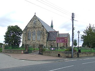
Ryton is a village in Tyne and Wear, England. It is in the Metropolitan Borough of Gateshead, historically part of County Durham. In 2011, the population of the Ryton, Crookhill and Stella ward was 8,146. It is 6 miles (9.7 km) west of Newcastle upon Tyne.

Castletown is a suburb of Sunderland in Tyne and Wear, England. A former mining community, the Hylton Colliery was located at the east end of the village; it lies north of the River Wear, and is near to Hylton Castle and Washington. At Hylton Riverside, on the eastern fringe of Castletown, there is a large retail park.

<span class="mw-page-title-main">Kibblesworth</span> Human settlement in England

Kibblesworth is a village 2 miles (3.2 km) west of Birtley, Tyne and Wear, England. Kibblesworth was a mainly rural community until the development of the pit and brickworks and the resulting increase in population. Following the closure of the pit in 1974, few of the residents now work in the village. Historically in County Durham, it was transferred into the newly created county of Tyne and Wear in 1974.

<span class="mw-page-title-main">A183 road (England)</span> Road in Tyne & Wear

The A183 road runs from South Shields in Tyne and Wear, through Sunderland and ends at Chester-le-Street in County Durham. It is a major route in South Tyneside, Sunderland and Chester-le-Street serving many areas and landmarks along its route.

<span class="mw-page-title-main">Fatfield</span> Human settlement in England

Fatfield is an area of Washington, in the City of Sunderland metropolitan borough in Tyne and Wear, England.

<span class="mw-page-title-main">Fence Houses</span> Village in Tyne and Wear, England

Fence Houses, or Fencehouses is a village in the City of Sunderland in Tyne and Wear, England.

<span class="mw-page-title-main">Springwell Village</span> Human settlement in England

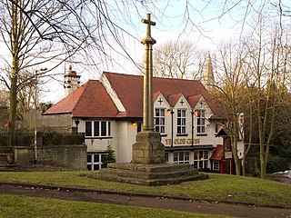
Springwell Village is a village in the City of Sunderland, bordering Gateshead, approximately 7.6 miles (12.2 km) from Newcastle upon Tyne, 9 miles (14 km) from Sunderland, and 13 miles (21 km) from Durham. In 2011, Census data for the City of Sunderland ward of Washington West recorded a total population of 11,833.

<span class="mw-page-title-main">Oxclose</span>

Oxclose is an area of Washington, Tyne and Wear, England. It is located between the A1231, A182 and A195 highways, close to Sunderland, and is well served by links from the A1(M) which passes within 1 mile (1.6 km) of Oxclose's boundaries. Oxclose covers an area of approximately 0.1 square miles (300,000 m2) and has a population of around 3800.

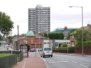
Concord is an area of Washington, Tyne and Wear, England. Historically, Concord was part of County Durham, joining the county of Tyne and Wear in 1974, following its creation.

<span class="mw-page-title-main">Harraton</span> District in Tyne & Wear, England

Harraton is a suburb of Washington, in the Sunderland metropolitan borough, in Tyne and Wear, England. Harraton is near the River Wear and is 3 miles north-east of Chester-le-Street, 2 miles south-west of Washington town centre and 9 miles south-southwest of Sunderland.

Oxclose Community Academy is a coeducational secondary school located in Oxclose in the town of Washington, Tyne and Wear, Tyne and Wear, England.

References

  1. "Report for Washington Area Committee". Sunderland City Council. 7 January 2010. Retrieved 1 January 2019.
  2. "citypopulation.de" . Retrieved 28 April 2014.
  3. "A guide to Washington, Tyne and Wear. Washington tourist information, local contacts, attractions and reviews".
  4. "Guide to American Presidents: GEORGE WASHINGTON". Burke's Peerage and Gentry. Retrieved 31 March 2012.
  5. "Washington Old Hall". National Trust. Retrieved 31 March 2012.
  6. "LOCAL STUDIES CENTRE FACT SHEET NUMBER 12:Washington Old Hall". Sunderland City Council. Archived from the original on 3 November 2014. Retrieved 31 March 2012.
  7. "Dame Margaret's Home, Washington, Durham". Children's Homes.
  8. "Why Washington had district numbers instead of village names, and why the scheme was scrapped" . Retrieved 12 December 2022.
  9. "The Sainsbury Archive". Museum of London.
  10. "Washington Savacentre Football League".
  11. "Tyre factory shuts for last time". 5 July 2006.
  12. "北東イングランド補習授業校 - North East England Japanese Saturday School" . Retrieved 30 March 2021.
  13. "Move to reinstate lost rail lines". BBC News. 15 June 2009. Retrieved 15 June 2009.
  14. Meechan, Simon (4 November 2022). "Washington Metro extension plans, map, new stations and next stage". ChronicleLive. Retrieved 7 November 2022.
  15. "Jordan Pickford". Everton F.C.
  16. "George Clarke". www.ncl.ac.uk. Retrieved 6 July 2023.