
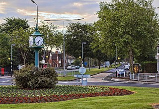
Washington is a large town in the City of Sunderland local government district of Tyne and Wear, England, and historically part of County Durham. Washington is equidistant from the centres of Newcastle upon Tyne, Durham and Sunderland, with close ties to all three cities. It is the ancestral settlement of the Washington family, which George Washington descended from.
Killingworth, formerly Killingworth Township, is a suburb town of Newcastle upon Tyne, England. It is administered as part of the borough of North Tyneside.
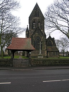
Carlton is a village in the Metropolitan Borough of Barnsley in South Yorkshire, England. It is situated between the villages of Athersley and Royston. The village is split in two with one half in the Monk Bretton ward and the rest in the Royston ward of the Barnsley MBC. It was built up on coking and coal mining industries and now has one of the largest industrial estates within the surrounding area. In the industrial estate lies a glass recycling plant, called Rexam. To its east stands the Mr Kipling cake factory, owned by Premier Foods.

Immingham is a town, civil parish and ward in the North East Lincolnshire unitary authority of England. It is situated on the south-west bank of the Humber Estuary, and is 6 miles (10 km) north-west from Grimsby.

Bargeddie is a village in North Lanarkshire, Scotland, just inside the suburban fringe of Glasgow, 8 miles (13 km) east of the city centre, and close to the junction of the M73 and M8 motorways. The nearest major town is Coatbridge, 2 miles (3 km) to the east.
Burnopfield is a village in County Durham, in England. It is situated north of Stanley and Annfield Plain, close to the River Derwent and is 564 feet above sea level. There are around 4,553 inhabitants in Burnopfield. It is located 7 miles from Newcastle upon Tyne and 15 miles from Durham.
Langley Moor is a former mining village in County Durham, England. It lies between Brandon, Meadowfield and the Neville's Cross area of Durham.
Byrness is a village within Rochester civil parish in Northumberland, England. It is approximately 37 miles (60 km) north-west of Newcastle upon Tyne on the A68, and is the last village in England before the A68 climbs the Cheviot Hills to cross Carter Bar into Scotland. Byrness's village church features a stained-glass window commemorating the workers who died during the building of Catcleugh Reservoir nearby. Much of the village was built by the Forestry Commission to house workers for the extensive forests that surround it. Situated on the Pennine Way, Byrness has an inn, campsite and other accommodation offering rest and sustenance for weary walkers.
Birstall is a large village in the metropolitan borough of Kirklees, West Yorkshire, England. It is part of Birstall and Birkenshaw ward which had a population of 16,298 at the 2011 census. Historically in the West Riding of Yorkshire, and part of the Heavy Woollen District, the town is approximately 6 miles (10 km) south-west of Leeds and situated close to the M62 motorway. The village is situated between Leeds, Bradford, Huddersfield and Wakefield.
Albany is a suburb of Washington in the City of Sunderland in Tyne and Wear, historically part of County Durham. It is in the north of the town. The village is also relatively close to The Galleries Shopping Centre, Washington.
Willerby is a village and civil parish located on the western outskirts of the city of Kingston upon Hull in the East Riding of Yorkshire, England.
Blebo Craigs, or Blebocraigs is a village in rural Fife, Scotland. The village contains around one hundred houses on the south-facing slope of the hill. Blebo Craigs is 5 miles from St Andrews.
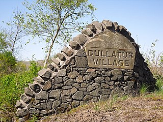
Dullatur is a village near Cumbernauld, Scotland. Like Condorrat, Castlecary and Luggiebank, it predates the new town of Cumbernauld, and of those only Condorrat was officially included in the designated area. Its name is anglicised from the Gaelic Dubh Leitir, which means "dark slope". The route of the Antonine Wall passes just to the north of Dullatur. Two Roman temporary marching camps were located at Dullatur between the forts at Croy Hill and Westerwood. The camps have been excavated several times by archaeologists following aerial photography and proposed housebuilding. Both camps have now been built over, and no visible remains can be seen on the ground today. Digital reconstructions of the larger and the smaller of the camps have been created. When building the nearby Forth and Clyde Canal in the 18th century a number of finds were made in Dullatur Bog. Thomas Watson recorded: "a number of swords, pistols, and other weapons were dug out; also the bodies of men and horses, and what seems somewhat marvellous, a trooper, completely armed, and seated on his horse, in the exact posture in which he had perished." It was supposed that the man was escaping the Battle of Kilsyth which is due north of Dullatur Bog.

Busby is a village in East Renfrewshire, Scotland. Busby is in the same urban area as Glasgow, although it is administratively separate. It lies on the White Cart Water six miles south of Glasgow City Centre and 3⁄4 mile northwest of the outskirts of East Kilbride. It directly adjoins the town of Clarkston, with which the village is closely associated.
Nerston is a village situated on the northern green-belt boundary of the new town of East Kilbride in South Lanarkshire, Scotland.
Benton is a district 4 miles (6 km) to the north east of Newcastle upon Tyne. A section of this district is administratively part of the city, but the greater part, which lies inside the Parish of St Bartholomew, Longbenton, is within North Tyneside. The population of the North Tyneside Ward taken at the Census 2011 was 10,359.

Anlaby is a village forming part of the western suburbs of Kingston upon Hull, in the East Riding of Yorkshire, England. It forms part of the civil parish of Anlaby with Anlaby Common.
Westoe was originally a village near South Shields, Tyne & Wear, England, but has since become part of the town and is now used to refer to the area of the town where the village once was. It is also an electoral ward for local politics purposes.
Dairycoates is an area of Kingston upon Hull, East Riding of Yorkshire, England, a former hamlet.

Blairlinn is the site of one of Cumbernauld's several industrial estates built as satellite developments on the periphery of the Scottish town's residential areas.

