Rappahannock County is a county located in the northern Piedmont region of the Commonwealth of Virginia, US, adjacent to Shenandoah National Park. As of the 2020 Census, the population was 7,348. Its county seat is Washington. The name "Rappahannock" comes from the Algonquian word lappihanne, meaning "river of quick, rising water" or "where the tide ebbs and flows." The county is included in the Washington-Arlington-Alexandria, DC-VA-MD-WV Metropolitan Statistical Area.

Fairfax County, officially the County of Fairfax, is a county in the Commonwealth of Virginia. It is part of Northern Virginia and borders both the city of Alexandria and Arlington County and forms part of the suburban ring of Washington, D.C. The county is predominantly suburban in character with some urban and rural pockets.

Burke is an unincorporated section of Fairfax County, Virginia, United States, traditionally defined as the area served by the Burke post office. Burke includes two census-designated places: the Burke CDP, population 42,312 in 2020 and the Burke Centre CDP, population 17,518 in 2020.

Clifton is an incorporated town located in southwestern Fairfax County, Virginia, United States, with a population of 282 at the time of the 2010 census, up from 185 at the 2000 census.

Pimmit Hills is a census-designated place (CDP) in Fairfax County, Virginia, United States, a neighborhood within a densely populated urban area. The name derives from Pimmit Run, the stream that was named for John Pimmit.

Reston is a census-designated place in Fairfax County, Virginia, and a principal city of the Washington metropolitan area. As of the 2020 U.S. Census, Reston's population was 63,226.

Springfield is a census-designated place (CDP) in Fairfax County, Virginia, United States. The Springfield CDP is recognized by the U.S. Census Bureau with a population of 30,484 as of the 2010 census. Homes and businesses in bordering CDPs including North Springfield, West Springfield, and Newington are usually given a Springfield mailing address. The population of the collective areas with Springfield addresses is estimated to exceed 100,000. The CDP is a part of Northern Virginia, the most populous region of the Washington Metropolitan Area.

Vienna is a town in Fairfax County, Virginia, United States. As of the 2020 U.S. census, Vienna has a population of 16,473. Significantly more people live in ZIP codes with the Vienna postal addresses, bordered approximately by Interstate 66 on the south, Interstate 495 on the east, Route 7 to the north, and Hunter Mill Road to the west, than in the town itself.

Stephens City is an incorporated town in the southern part of Frederick County, Virginia, United States, with a population of 2,016 at the time of the 2020 census, and an estimated population of 2,096 in 2022. Founded by Peter Stephens in the 1730s, the colonial town was chartered and named for Lewis Stephens in October 1758. It was originally settled by German Protestants from Heidelberg. Stephens City is the second-oldest municipality in the Shenandoah Valley after nearby Winchester, which is about 5 mi (8 km) to the north. "Crossroads", the first free black community in the Valley in the pre-Civil War years, was founded east of town in the 1850s. Crossroads remained until the beginning of the Civil War when the freed African Americans either escaped or were recaptured. Stephens City was saved from intentional burning in 1864 by Union Major Joseph K. Stearns. The town has gone through several name changes in its history, starting as "Stephensburg", then "Newtown", and finally winding up as "Stephens City", though it nearly became "Pantops". Interstate 81 and U.S. Route 11 pass close to and through the town, respectively.

Lexden is a suburb of Colchester and former civil parish, now in the unparished area of Colchester, in the Colchester district, in the county of Essex, England. It was formerly a village, and has previously been called Lessendon, Lassendene and Læxadyne. In 2011 the ward had a population of 5,549.

Sterling, Virginia, refers most specifically to a census-designated place (CDP) in Loudoun County, Virginia, United States. The population of the CDP as of the 2010 United States Census was 27,822. The CDP boundaries are confined to a relatively small area between Virginia State Route 28 on the west and Virginia State Route 7 on the northeast, excluding areas near SR 606 and the Dulles Town Center.
Kirkwood is a national historic designated neighborhood on the east side of Atlanta, Georgia, United States. It is a historic streetcar suburb situated entirely in DeKalb County, bordered by the neighborhoods of Lake Claire, East Lake, Edgewood, and Oakhurst. Kirkwood is bound on the north by DeKalb Avenue, on the south by Memorial Drive and Interstate 20, on the west by Montgomery Street, and on the east by 1st Ave. A large part of the neighborhood is listed on the National Register of Historic Places as Kirkwood Historic District.
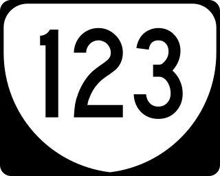
State Route 123 is a primary state highway in the U.S. state of Virginia. The state highway runs 29.27 miles (47.11 km) from U.S. Route 1 in Woodbridge north to the Chain Bridge across the Potomac River into Washington from Arlington. It goes by four local names. From its southern terminus to the Occoquan River Bridge, it is known as Gordon Boulevard. From the Occoquan River Bridge to the city of Fairfax it is known as Ox Road. From Fairfax until it enters the Town of Vienna, it is known as Chain Bridge Road. Then, as it passes through the Town of Vienna, it is known as Maple Avenue. After leaving the Town of Vienna, the name reverts to Chain Bridge Road, and continues this way until the intersection with I-495 in Tysons. Between Tysons and the George Washington Memorial Parkway, it is known as Dolley Madison Boulevard. After crossing over the George Washington Memorial Parkway, the name once again reverts to Chain Bridge Road and continues this way until the end of the road, at Chain Bridge. SR 123 is a partial circumferential highway in Northern Virginia that connects Woodbridge in eastern Prince William County with the independent city of Fairfax and the Fairfax County communities of Vienna, Tysons, and McLean, the last being the home of the National Counterterrorism Center and the Central Intelligence Agency. The state highway also connects all of the major highways that radiate from Washington, including Interstate 95 (I-95), I-66, US 29, US 50, SR 267, and the George Washington Memorial Parkway. Furthermore, SR 123 crosses another pair of circumferential highways, I-495 and the Fairfax County Parkway, and SR 7, a major northwest–southeast highway through Northern Virginia. The state highway is a part of the National Highway System for its entire length.

Hollin Hills is a historic district and neighborhood in southeast Fairfax County, Virginia. It is located primarily in the Fort Hunt area of the county with some portions remaining in the Hybla Valley and Groveton areas since a shift for census purposes prior to 2010. The community contains more than 30 acres (12 ha) of parkland across seven distinct parks, a pool and swim club, a bocce court, and a pickleball and tennis club, operated and maintained by the Civic Association of Hollin Hills (CAHH).

Colchester is a historic unincorporated community on the Occoquan River in Fairfax County, Virginia.
Alexandria is an independent city in the northern region of the Commonwealth of Virginia, United States. It lies on the western bank of the Potomac River approximately 7 miles (11 km) south of downtown Washington, D.C. Alexandria is the third-largest "principal city" of the Washington metropolitan area which is part of the larger Washington-Baltimore combined statistical area.

Hollindale is an unincorporated community in Fort Hunt, Fairfax County, Virginia, United States close to the George Washington Memorial Parkway in ZIP code 22306. As of 2013, it had 945 residents. Mount Vernon Presbyterian Church and Hollin Meadows Elementary School are located within the community. Hollindale is set along the hilly woodlands across from the Potomac. It was built around several estates and on what used to be Sherwood Dairy Farm, and is adjacent to the Hollin Hills community. It is dominated by mid-century modern homes, colonials, and Tudors.

State Route 612 in Fairfax and Prince William Counties, Virginia is a secondary state highway. The two counties are separated by water, so SR 612 contains a bridge that is one of only eight crossings between the counties. Because of this, SR 612 is heavily traveled during rush hour.

George Mason is a census-designated place (CDP) in Fairfax County, Virginia, United States. The population as of the 2010 census was 9,496. It consists of George Mason University and some adjacent neighborhoods to the south and southwest of the city of Fairfax, and is named for American Founding Father George Mason.