Greenbriar, Virginia

Last updated

Greenbriar, Virginia
2018-11-01 13 57 34 View west along U.S. Route 50 (Lee Jackson Memorial Highway) from the overpass for Virginia State Route 286 (Fairfax County Parkway) in Greenbriar, Fairfax County, Virginia.jpg
Route 50 on the northern edge of Greenbriar
USA Virginia Northern location map.svg
Red pog.svg
Greenbriar
Location within Fairfax county
USA Virginia location map.svg
Red pog.svg
Greenbriar
Greenbriar (Virginia)
Usa edcp location map.svg
Red pog.svg
Greenbriar
Greenbriar (the United States)
Coordinates: 38°52′18″N77°23′57″W / 38.87167°N 77.39917°W / 38.87167; -77.39917
CountryUnited States
State Virginia
County Fairfax
Area
  Total1.58 sq mi (4.08 km2)
  Land1.57 sq mi (4.06 km2)
  Water0.008 sq mi (0.02 km2)
Elevation
365 ft (111 m)
Population
 (2020)
  Total8,421
  Density5,363.7/sq mi (2,074.1/km2)
Time zone UTC−5 (Eastern (EST))
  Summer (DST) UTC−4 (EDT)
ZIP code
22033
FIPS code 51-32592
GNIS feature ID2584853

Greenbriar is a census-designated place in Fairfax County, Virginia, United States. The population at the 2020 census was 8,421. [1] The community between Fairfax City and Chantilly dates from the late 1960s, when it was developed by Levitt & Sons. [2] The community is famous for having only one road within its territory that does not start with an "M" or "P", which is Acorn Hill (added in 1994 with the addition of five mansions to the community). A popular (but not proven) belief is that the roads were named after the architect's two children. One drawback for residents of the community is that with nearly identical sounding named roads (for example, Mayport and Maylock) in such close proximity to each other and house numbers being the same, the US Postal Service along with UPS and FedEx sometimes deliver items to the wrong house.

Contents

Geography

Greenbriar is located in western Fairfax County, bordered by Chantilly to the west, Fair Lakes to the south, and Fair Oaks to the east. U.S. Route 50 forms the northern border of the CDP. US 50 leads east 5 miles (8 km) to the center of Fairfax, and 22 miles (35 km) to downtown Washington, D.C. According to the U.S. Census Bureau, the Greenbriar CDP has a total area of 1.6 square miles (4.1 km2), of which 0.01 square miles (0.02 km2), or 0.54%, is water. [3]

Demographics

2020 census

This section includes some information from the 2022 American Community Survey

At the 2020 census there were 8,421 people, 3,229 housing units and 3,021 households residing in the CDP. The population density was 5,363.7 inhabitants per square mile (2,074.1/km2). The average housing unit density was 2,056.7 per square mile (795.3/km2). The racial makeup of the CDP was 54.55% White, 5.46% African American, 0.49% Native American, 25.27% Asian, 0.06% Pacific Islander, 4.75% from other races, and 9.42% from two or more races. Hispanic or Latino of any race was 11.45% of the population. [1]

Of the households, 2.7% were non-family households, 56.9% were married couple families, 23.7% were a male family householder with no spouse, and 16.7% were a female family householder with no spouse. The average family household had 3.17 people. [1]

The median age was 40.3, 23.4% of people were under the age of 18, and 15.2% were 65 years of age or older. The largest ancestry is the 11.8% who had German ancestry, 34.9% spoke a language other than English at home, and 26.5% were born outside the United States, 42.9% of whom were naturalized citizens. [1]

The median income for a household in the CDP was $127,100, and the median income for a family was $159,412. 9.9% of the population were military veterans, and 62.6% had a batchelor's degree or higher. In the CDP 7.2% of the population was below the poverty line, including 8.9% of those under the age of 18 and 4.3% of those aged 65 or over, with 7.3% of the population without health insurance. [1]

2010 census

The population at the 2010 census was 8,166. [4]

Amenities

A private pool is located in the community, but pool memberships are not available for sale from the Pool Club. Instead, residents may choose to purchase their memberships from other members who are selling their memberships. Residents sometimes list those memberships for sale in the community newspaper Greenbriar Flyer. As a member, one makes an annual payment to cover the costs of the pool's maintenance and staff, as well as for hosting swim meets for residents of other communities around Fairfax County. The swim teams at Greenbriar are known as the Greenbriar Dolphins.

Unlike most communities which are bound to a homeowners' association, Greenbriar has only a civic association which collects a strictly voluntary $25 annual donation from each owner, which pays for events that the community hosts throughout the year, including Bands in the Park, where during the summer, local music groups will play for residents at Greenbriar Commons Park; as well as the annual community phone Directory.

The Civic Association, however, has no bylaws for residents, which makes it attractive and a high demand-market community to live in within western Fairfax County.

Related Research Articles

<span class="mw-page-title-main">Burke, Virginia</span> Unincorporated section of Fairfax County, Virginia

Burke is an unincorporated section of Fairfax County, Virginia, United States, traditionally defined as the area served by the Burke post office. Burke includes two census-designated places: the Burke CDP, population 42,312 in 2020 and the Burke Centre CDP, population 17,518 in 2020.

<span class="mw-page-title-main">Centreville, Virginia</span> Census-designated Place in Virginia, United States

Centreville is a census-designated place (CDP) in Fairfax County, Virginia, United States and a suburb of Washington, D.C. The population was 73,518 as of the 2020 census. Centreville is approximately 20 miles (32 km) west of Washington, D.C.

<span class="mw-page-title-main">Chantilly, Virginia</span> CDP in Virginia, United States

Chantilly is a census-designated place (CDP) in western Fairfax County, Virginia. The population was 24,301 as of the 2020 census. Chantilly is named after an early-19th-century mansion and farm, which in turn took the name of an 18th-century plantation that was located in Westmoreland County, Virginia. The name "Chantilly" originated in France with the Château de Chantilly, about 28 miles north of Paris.

<span class="mw-page-title-main">Fort Hunt, Virginia</span> Census-designated place in Virginia, United States

Fort Hunt is a census-designated place (CDP) in Fairfax County, Virginia, United States. The area is named after Fort Hunt, which was built on the bank of the Potomac River in 1897 to defend Washington, D.C. from naval attack and is now a public park. The area is also notable for its high population of senior citizens and for being one of the first suburbs in wealthy Fairfax County. The population was 17,231 at the 2020 census.

<span class="mw-page-title-main">Franconia, Virginia</span> Census-designated place in Virginia, United States

Franconia is a census-designated place (CDP) in Fairfax County, Virginia, United States. The population was 18,943 at the 2020 census.

<span class="mw-page-title-main">Great Falls, Virginia</span> Census-designated place in Virginia, United States

Great Falls is a census-designated place in Fairfax County, Virginia, United States. The population at the 2020 census was 15,953.

<span class="mw-page-title-main">Lorton, Virginia</span> Census-designated place in Virginia, United States

Lorton is a census-designated place (CDP) in Fairfax County, Virginia, United States. The population was 20,072 as of the 2020 census.

<span class="mw-page-title-main">Merrifield, Virginia</span> Census-designated place in Virginia, United States

Merrifield is a census-designated place (CDP) in Fairfax County, Virginia, United States. The population was 20,488 at the 2020 census.

<span class="mw-page-title-main">Newington, Virginia</span> Census-designated place in Virginia, United States

Newington is a census-designated place (CDP) in Fairfax County, Virginia, United States. As of the 2020 census, the population was 13,223. The population was 12,943 at the 2010 census. The 2010 census showed a significant decrease after half the population was split off to the newly created Newington Forest CDP.

<span class="mw-page-title-main">Oakton, Virginia</span> Census-designated place in Virginia

Oakton is a census-designated place (CDP) in Fairfax County, Virginia, United States. The population was 36,732 at the 2020 census. Located in Northern Virginia, its center is 16 miles (26 km) west of Washington, D.C.

<span class="mw-page-title-main">Fairfax Station, Virginia</span> Census-designated place in Virginia, United States

Fairfax Station is a census-designated place (CDP) in Fairfax County, Virginia, United States. The population was 12,420 at the 2020 census. Located in Northern Virginia, its center is located 22 miles (35 km) southwest of Washington, D.C.

<span class="mw-page-title-main">Dranesville, Virginia</span> Census-designated place in Virginia, United States

Dranesville is a census-designated place (CDP) in Fairfax County, Virginia, United States. Dranesville is located on the Leesburg Pike at its intersection with Georgetown Pike. The U.S. Census Bureau defines Dranesville as a census-designated place (CDP) with a population of 11,921 as of 2010. At the 2020 Census the population was 11,785.

<span class="mw-page-title-main">Fair Lakes, Virginia</span> Census-designated place in Virginia, United States

Fair Lakes is a census-designated place (CDP) and business park located west of Fairfax in Fairfax County, Virginia, United States. Fair Lakes had a population of 8,404 in 2020.

<span class="mw-page-title-main">Floris, Virginia</span> Census-designated place in Virginia, United States

Floris is a census-designated place (CDP) located within the Oak Hill area of Fairfax County, Virginia, United States. The population at the 2020 census was 8,341.

<span class="mw-page-title-main">Burke Centre, Virginia</span> Census-designated place in Virginia, United States

Burke Centre is a planned residential community located west of Burke in Fairfax County, Virginia, United States. Burke Centre is a planned community managed by the Burke Centre Conservancy homeowners' association (HOA).

<span class="mw-page-title-main">Fair Oaks, Fairfax County, Virginia</span> Census-designated place in Virginia, United States

Fair Oaks is a census-designated place in Fairfax County, Virginia, United States. The population at the 2020 census was 34,052. It encompasses a large area west of the city of Fairfax, centered on Fair Oaks Mall. Suburban neighborhoods and office parks occupy most of Fair Oaks, largely developed since the 1980s.

<span class="mw-page-title-main">Kings Park West, Virginia</span> Census-designated place in Virginia, United States

Kings Park West is a census-designated place in the eastern United States, in Fairfax County, Virginia, southwest of Washington, D.C. At the 2020 census the population was 13,465 people

<span class="mw-page-title-main">Laurel Hill, Virginia</span> Census-designated place in Virginia, United States

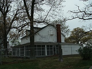
Laurel Hill is a census-designated place in Fairfax County, Virginia, United States. The population at the 2020 census was 8,307. Formerly part of the Lorton CDP, it comprises most of what was formerly the Lorton Reformatory grounds, which were purchased by Fairfax County in 2002 following the prison's closing and redeveloped as a new suburban community. The name "Laurel Hill" was adopted from Laurel Hill House, an 18th-century structure which had served as the residence of the Superintendent of the Reformatory, and originally was the home of Revolutionary War patriot William Lindsay.

<span class="mw-page-title-main">McNair, Virginia</span> Census-designated place in Virginia, United States

McNair is a census-designated place located in the Oak Hill section of Fairfax County, Virginia, United States. It is directly to the east of Washington Dulles International Airport. The population as of the 2020 census was 21,598. Much of the population resides in the McNair Farms planned community. The community has a school called McNair Elementary.

Difficult Run is a census designated place in Fairfax County, Virginia, United States. The population was 10,600 at the 2020 census. The CDP has a land area of 8.38 square miles.

References

  1. 1 2 3 4 5 "Greenbriar CDP, Virginia". data.census.gov. Retrieved January 29, 2024.
  2. "Greenbriar: Chantilly's Levitt town" The Washington Post , 2011-03-04.
  3. "Geographic Identifiers: 2010 Demographic Profile Data (G001): Greenbriar CDP, Virginia". U.S. Census Bureau, American Factfinder. Retrieved October 5, 2016.[ dead link ]
  4. Virginia Trend Report 2: State and Complete Places (Sub-state 2010 Census Data). Missouri Census Data Center. Accessed 2011-06-08.