Rose Hill, Fairfax County, Virginia

Last updated

Rose Hill, Fairfax County, Virginia
Rose Hill shopping plaza.jpg
Rose Hill Shopping Center, August 2015
Fairfax County Virginia Incorporated and Unincorporated Areas Rose Hill highlighted.svg
Location within Fairfax county
USA Virginia Northern location map.svg
Red pog.svg
Rose Hill
USA Virginia location map.svg
Red pog.svg
Rose Hill
Usa edcp location map.svg
Red pog.svg
Rose Hill
Coordinates: 38°47′21″N77°6′32″W / 38.78917°N 77.10889°W / 38.78917; -77.10889
Country Flag of the United States.svg United States
State Flag of Virginia.svg Virginia
County Flag of Fairfax County, Virginia.svg Fairfax
Area
  Total5.57 sq mi (14.43 km2)
  Land5.56 sq mi (14.39 km2)
  Water0.02 sq mi (0.04 km2)
Elevation
203 ft (62 m)
Population
 (2020)
  Total21,045
  Density3,640/sq mi (1,405.6/km2)
Time zone UTC−5 (Eastern (EST))
  Summer (DST) UTC−4 (EDT)
FIPS code 51-68880
GNIS feature ID2389774

Rose Hill is a census-designated place (CDP) in Fairfax County, Virginia, United States. The population was 20,226 at the 2010 census. [1] Built in the mid-1950s, Rose Hill is the largest of the subdivisions that make up the CDP, which is just southwest of Alexandria; others include Wilton Woods, Burgundy Village, and Winslow Heights. Street addresses are in Alexandria ZIP codes 22310, 22303 and 22315.

Contents

Geography

Rose Hill is located in southeastern Fairfax County at 38°47′21″N77°6′32″W / 38.78917°N 77.10889°W / 38.78917; -77.10889 (38.789263, 77.108971). [2] It is bordered to the north by the city of Alexandria, to the east by Huntington, to the south by Groveton and Hayfield, to the southwest by Kingstowne, and to the west by Franconia. The CDP's borders follow the Capital Beltway and CSX rail line on the north, South Van Dorn Street and some smaller roads on the west, South Kings Highway on the south, and Shaffer Drive and Telegraph Road on the east.

According to the United States Census Bureau, the Rose Hill CDP has a total area of 5.57 square miles (14.43 km2), of which 0.02 square miles (0.04 km2), or 0.28%, is water. [1]

History

The community of Rose Hill derives its name from an 18th-century plantation once located nearby; this was established by Daniel French, the first builder of Pohick Church, [3] on land that had been part of the Gunston Hall estate. The house stood on high ground, and was described as having a fine view of the nearby valley and the Potomac River in the distance. [4] The land had been purchased by Daniel French Sr., in 1723, passing to his son, Daniel French Jr., in 1736. At the latter's death, the property went first to his wife Penelope and then to Elizabeth Dulaney, their daughter. The Dulaneys sold the plantation early in the 1800s, and between 1810 and 1868 it passed through the hands of numerous owners. [5]

Rose Hill post office Post office building in Rose Hill, Fairfax County, Virginia - 2.jpg
Rose Hill post office

On September 28, 1863, during the American Civil War, the house was the site of a raid by John S. Mosby and his raiders. They had ridden into Alexandria in an attempt to capture Francis Harrison Pierpont, whom they expected to find at the City Hotel. Discovering that he had left, the raiders burned a railroad bridge before heading along Telegraph Road to Rose Hill Plantation, where they sought Pierpont's aide, Col. Daniel F. Dulaney; the colonel's son, French, was among Mosby's company. Neighbor Anne S. Frobel later wrote in her diary that a "party of Mosby’s boys came very unexpectedly to Rose Hill, and took off Col. Dulaney. One of them was his own son. …This boy’s first greeting to his father when he rushed into the room where his father was in bed [was] ... ‘How do Pa—I’m very glad to see you,’ and the father’s answer sitting up in bed, with proper dignity, ‘Well, sir, I’m d-sorry to see you.’ But they took him down to Richmond nevertheless." The colonel survived the war, but his son was killed in 1864. [6] In the years after the conflict, the area around Rose Hill was the site of farming and gravel mining operations. [7] The frame house burned in 1895. [3] The last owner of the property was Robert L. May. [4]

What is today the community of Rose Hill was established in 1954; [3] that same year the body of Daniel French Jr., which had been buried at the plantation at his death in 1771, was moved to Pohick Church. [4] Within four years a Safeway had been constructed, as had two swimming pools serving residents. An elementary school was opened in 1957, a year after the foundation of the Rose Hill Civic Association. [8] In 1970 the Fairfax County Park Authority purchased 148 acres in the area for construction of a golf course; the Greendale Golf Course was dedicated on August 19, 1976. Today it is one of eight courses managed by the Park Authority. Its property line marks the boundary of the community. [9]

Today the history of Rose Hill is commemorated with a historic marker erected by the Fairfax County History Commission in 2000, located in front of the John Marshall Library. [3] Another marker, erected as part of the Civil War Trails Program, tells the story of the 1863 raid. [6] Also in the vicinity was the plantation Clermont, birthplace of Fitzhugh Lee. The site of the plantation is noted by a marker erected by the Virginia Department of Historic Resources in 2004; located in front of Mark Twain Middle School, it is south of the plantation's actual location. [10] Landmarks in Rose Hill also included a pair of silos that were once part of a dairy farm in the vicinity, and which were later converted to serve as showers for the Rose Hill Swimming and Tennis Club. [8] Attempts were made to list them on the Fairfax County Inventory of Historic Sites. [11] [7]

Demographics

As of the census [12] of 2000, there were 15,058 people, 5,683 households, and 4,080 families residing in the CDP. The population density was 3,273.7 people per square mile (1,263.9/km2). There were 5,783 housing units at an average density of 1,257.3/sq mi (485.4/km2). The racial makeup of the CDP was 73.52% White, 9.52% African American, 0.27% Native American, 8.48% Asian, 0.05% Pacific Islander, 4.40% from other races, and 3.75% from two or more races. Hispanic or Latino of any race were 10.65% of the population.

There were 5,683 households, out of which 31.5% had children under the age of 18 living with them, 60.7% were married couples living together, 7.9% had a female householder with no husband present, and 28.2% were non-families. 21.0% of all households were made up of individuals, and 5.3% had someone living alone who was 65 years of age or older. The average household size was 2.65 and the average family size was 3.09.

In the CDP, the population was spread out, with 22.7% under the age of 18, 5.7% from 18 to 24, 34.0% from 25 to 44, 27.3% from 45 to 64, and 10.3% who were 65 years of age or older. The median age was 38 years. For every 100 females, there were 96.6 males. For every 100 females age 18 and over, there were 94.4 males.

The median income for a household in the CDP was $80,815, and the median income for a family was $89,414. Males had a median income of $53,917 versus $43,245 for females. The per capita income for the CDP was $34,213. About 1.6% of families and 3.6% of the population were below the poverty line, including 5.7% of those under age 18 and 3.1% of those age 65 or over.

Historical population
CensusPop.Note
1970 14,692
1980 11,962−18.6%
1990 12,6756.0%
2000 15,05818.8%
2010 20,22634.3%
2020 21,0454.0%
source: [13]

Education

Fairfax County Public Schools operates public schools.

Fairfax County Public Library operates the John Marshall Library in the CDP. [14] [15]

Related Research Articles

<span class="mw-page-title-main">Clarke County, Virginia</span> County in Virginia, United States

Clarke County is a county in the Commonwealth of Virginia. As of the 2020 census, the population was 14,783. Its county seat is Berryville. Clarke County is included in the Washington-Arlington-Alexandria, DC-VA-MD-WV Metropolitan Statistical Area.

<span class="mw-page-title-main">West Laurel, Maryland</span> Census-designated place in Maryland

West Laurel is an unincorporated area and census-designated place (CDP) in Prince George's County, Maryland, United States. Per the 2020 census, the population was 4,428.

<span class="mw-page-title-main">Annandale, Virginia</span> Census-designated place in Virginia, US

Annandale is a census-designated place (CDP) in Fairfax County, Virginia. The population of the CDP was 43,363 as of the 2020 United States Census. It is home to the oldest and largest branch of the Northern Virginia Community College system, and to one of the D.C. area's Koreatowns.

<span class="mw-page-title-main">Belle Haven, Fairfax County, Virginia</span> Census-designated place in Virginia, United States

Belle Haven is a census-designated place (CDP) in Fairfax County, Virginia, United States. Nearby CDPs are Huntington (northwest), Groveton (southwest) and Fort Hunt (south). The population of Belle Haven was 6,851 at the 2020 census.

<span class="mw-page-title-main">Burke, Virginia</span> Unincorporated section of Fairfax County, Virginia

Burke is an unincorporated section of Fairfax County, Virginia, United States, traditionally defined as the area served by the Burke post office. Burke includes two census-designated places: the Burke CDP, population 42,312 in 2020 and the Burke Centre CDP, population 17,518 in 2020.

<span class="mw-page-title-main">Centreville, Virginia</span> Census-designated Place in Virginia, United States

Centreville is a census-designated place (CDP) in Fairfax County, Virginia, United States. It is a suburb of Washington, D.C., the nation's capital. It had a population of 73,518, making it the most-populous community in Fairfax County as of the 2020 U.S. census

<span class="mw-page-title-main">Chantilly, Virginia</span> CDP in Virginia, United States

Chantilly is a census-designated place (CDP) in western Fairfax County, Virginia. The population was 24,301 as of the 2020 census. Chantilly is named after an early-19th-century mansion and farm, which in turn took the name of an 18th-century plantation that was located in Westmoreland County, Virginia. The name "Chantilly" originated in France with the Château de Chantilly, about 28 miles north of Paris.

<span class="mw-page-title-main">Franconia, Virginia</span> Census-designated place in Virginia, United States

Franconia is a census-designated place (CDP) in Fairfax County, Virginia, United States. The population was 18,943 at the 2020 census.

<span class="mw-page-title-main">Groveton, Virginia</span> Census-designated place in Virginia, United States

Groveton is a census-designated place (CDP) in Fairfax County, Virginia, United States. The population was 14,598 at the 2010 census, down from 21,296 in 2000 due to a reduction in area. Located south of the city of Alexandria, it encompasses numerous neighborhoods including Groveton, Bucknell Manor, Stoneybrooke, and portions of Hollin Hills. Huntley Meadows Park, Fairfax County's largest park, is located in the southwest part of the CDP.

<span class="mw-page-title-main">Huntington, Virginia</span> Census-designated place in Virginia, United States

Huntington is a census-designated place (CDP) in Fairfax County, Virginia, United States. The population was 11,267 at the 2010 census. It is located next to the southern border of the city of Alexandria and is part of the Washington metropolitan area. Its main component is the namesake Huntington subdivision, a late-1940s neighborhood of mainly duplex homes.

<span class="mw-page-title-main">Hybla Valley, Virginia</span> Census-designated place in Virginia, United States

Hybla Valley is a census-designated place (CDP) in Fairfax County, Virginia, United States, south of Alexandria. The population was 15,801 at the 2010 census, down from 16,721 in 2000 due to a reduction in area, resulting from some of the eastward neighborhoods including much of Hollin Hills being moved to the Fort Hunt CDP. The population increased to 16,319 in the 2020 census.

<span class="mw-page-title-main">Lincolnia, Virginia</span> Census-designated place in Virginia, United States

Lincolnia is a census-designated place (CDP) in Fairfax County, Virginia, United States. The population was 22,828 at the 2010 census, an increase of over 44% from 2000.

<span class="mw-page-title-main">Lorton, Virginia</span> Census-designated place in Virginia, United States

Lorton is a census-designated place (CDP) in Fairfax County, Virginia, United States. The population was 20,072 as of the 2020 census.

<span class="mw-page-title-main">Merrifield, Virginia</span> Census-designated place in Virginia, United States

Merrifield is a census-designated place (CDP) in Fairfax County, Virginia, United States. The population was 20,488 at the 2020 census.

<span class="mw-page-title-main">Mount Vernon, Virginia</span> Census-designated place in Virginia, United States

Mount Vernon is a census-designated place (CDP) and unincorporated community in Fairfax County, Virginia, United States. The population was 12,914 at the 2020 census. Primarily due to its historical significance and natural recreation and beauty, the Mount Vernon area receives over one million tourists each year.

<span class="mw-page-title-main">Newington, Virginia</span> Census-designated place in Virginia, United States

Newington is a census-designated place (CDP) in Fairfax County, Virginia, United States. As of the 2020 census, the population was 13,223. The population was 12,943 at the 2010 census. The 2010 census showed a significant decrease after half the population was split off to the newly created Newington Forest CDP.

<span class="mw-page-title-main">West Springfield, Virginia</span> Census-designated place in Virginia, United States

West Springfield is a census-designated place (CDP) in Fairfax County, Virginia, United States. The population was 23,369 at the 2020 census.

<span class="mw-page-title-main">Fairfax Station, Virginia</span> Census-designated place in Virginia, United States

Fairfax Station is a census-designated place (CDP) in Fairfax County, Virginia, United States. The population was 12,420 at the 2020 census. Located in Northern Virginia, its center is located 22 miles (35 km) southwest of Washington, D.C.

<span class="mw-page-title-main">Hayfield, Fairfax County, Virginia</span> Census-designated place in Virginia, United States

Hayfield is a census-designated place (CDP) in Fairfax County, Virginia, United States. The population as of the 2010 census was 3,909.

<span class="mw-page-title-main">Laurel Hill, Virginia</span> Census-designated place in Virginia, United States

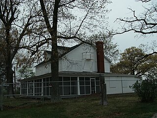
Laurel Hill is a census-designated place in Fairfax County, Virginia, United States. The population at the 2020 census was 8,307. Formerly part of the Lorton CDP, it comprises most of what was formerly the Lorton Reformatory grounds, which were purchased by Fairfax County in 2002 following the prison's closing and redeveloped as a new suburban community. The name "Laurel Hill" was adopted from Laurel Hill House, an 18th-century structure which had served as the residence of the Superintendent of the Reformatory, and originally was the home of Revolutionary War patriot William Lindsay.

References

  1. 1 2 "Geographic Identifiers: 2010 Demographic Profile Data (G001): Rose Hill CDP (Fairfax County), Virginia". U.S. Census Bureau, American Factfinder. Retrieved October 17, 2016.[ dead link ]
  2. "US Gazetteer files: 2010, 2000, and 1990". United States Census Bureau. February 12, 2011. Retrieved April 23, 2011.
  3. 1 2 3 4 "Rose Hill Historical Marker" . Retrieved April 10, 2018.
  4. 1 2 3 "Fairfax Genealogical Society, Inc - Cemetery Records". www.fxgs.org. Retrieved April 10, 2018.
  5. Sapp, Jim. "Rose Hill History". fairy-lamp.com. Retrieved April 18, 2018.
  6. 1 2 "The Rose Hill Raid Historical Marker" . Retrieved April 10, 2018.
  7. 1 2 "Saving Silos: Carl Sell Attempts to Preserve Past in His D.C. Suburb". November 10, 2011. Retrieved April 18, 2018.
  8. 1 2 Sapp, Jim. "Rose Hill History - Birth of a Community". www.fairy-lamp.com. Retrieved April 18, 2018.
  9. Sapp, Jim. "Rose Hill History - Greendale". www.fairy-lamp.com. Retrieved April 18, 2018.
  10. "Birthplace of Fitzhugh Lee Historical Marker" . Retrieved April 10, 2018.
  11. "Are the Rose Hill Silos Historically Significant?". September 20, 2011. Retrieved April 18, 2018.
  12. "U.S. Census website". United States Census Bureau . Retrieved January 31, 2008.
  13. "CENSUS OF POPULATION AND HOUSING (1790-2000)". U.S. Census Bureau . Retrieved July 17, 2010.
  14. "Library Branches." Fairfax County Public Library. Retrieved on October 21, 2009.
  15. "Rose Hill CDP, Virginia [ permanent dead link ]." U.S. Census Bureau. Retrieved on October 21, 2009.