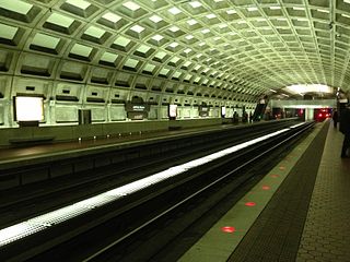
Tenleytown–AU station is a subway station on the Red Line of the Washington Metro in Washington, D.C. Located in the Upper Northwest neighborhood, it is the last station on the Red Line heading outbound wholly within the District of Columbia; the next stop, Friendship Heights, lies within both the District and the state of Maryland. The station serves American University (AU).

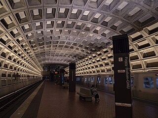
Foggy Bottom–GWU station is an Washington Metro station in the Foggy Bottom neighborhood of Washington, D.C., United States. The island-platformed station was opened on July 1, 1977, and is operated by the Washington Metropolitan Area Transit Authority (WMATA). Providing service for the Blue, Orange, and Silver Lines, the station is located on I Street on the George Washington University (GWU) campus. It is the last westbound station in the District of Columbia on these lines before they dive under the Potomac River to Virginia.

The Red Line is a rapid transit line of the Washington Metro system, consisting of 27 stations in Montgomery County, Maryland, and Washington, D.C., in the United States. It is a primary line through downtown Washington and the oldest and busiest line in the system. It forms a long, narrow "U," capped by its terminal stations at Shady Grove and Glenmont.

Dupont Circle station is an underground rapid transit station on the Red Line of the Washington Metro in Washington, D.C. Located below the traffic circle, it is one of the busiest stations in the Metro system, with an average of 16,948 entries each weekday. The station parallels Connecticut Avenue NW between the southern edge of the circle to the south and Q Street NW to the north.

Woodley Park station is an underground station on the Red Line of the Washington Metro. Located at 24th Street and Connecticut Avenue Northwest, it serves the neighborhoods of Woodley Park and Adams Morgan in Northwest Washington.

Cleveland Park station is an underground rapid transit station on the Red Line of the Washington Metro. Located in the neighborhood of the same name in Washington D.C., it opened on December 5, 1981.

Van Ness–UDC station is a Washington Metro station serving the Forest Hills and North Cleveland Park neighborhoods of Washington, D.C., United States. The island platformed station was opened on December 5, 1981, and is operated by the Washington Metropolitan Area Transit Authority (WMATA). Providing service for the Red Line, the station is on the 4200 block of Connecticut Avenue NW, with exits on either side of the street. The station is also close to the University of the District of Columbia (UDC), as well as to both Howard University School of Law and the Edmund Burke School.

Bethesda station is a rapid transit station on the Red Line of the Washington Metro system in Bethesda, Maryland. It is one of the busiest suburban Metro stations, serving on average 9,142 passengers each weekday in 2017. The Purple Line, a light rail system currently under construction, will terminate at Bethesda, providing rail service to other inner Maryland suburbs such as Silver Spring and College Park, each of which has additional north-south connections by Washington Metro, and New Carrollton, which has Amtrak and MARC connections to both Washington, D.C., and Baltimore.

Medical Center station is a Washington Metro station in Bethesda, Maryland, United States. The island-platformed station was opened on August 25, 1984, and is operated by the Washington Metropolitan Area Transit Authority (WMATA). Providing service for the Red Line, the station serves the National Institutes of Health campus and the Walter Reed National Military Medical Center, and is located at Rockville Pike and South Drive. Since there is little retail in the area and no commuter parking lot, this station is used almost exclusively by employees and visitors to those two institutions.

Judiciary Square station is a Washington Metro station in Washington, D.C., on the Red Line. It is located in the Judiciary Square neighborhood in the Northwest quadrant of the city, with entrances at 4th and D Street and 5th and F Street. It serves the many courthouses and municipal buildings in the area. The 5th and F Street entrance is located in the National Law Enforcement Officers Memorial, which incorporates the escalators and elevators into its architecture.

Grosvenor–Strathmore station is a rapid transit station on the Red Line of the Washington Metro in North Bethesda, Maryland. Grosvenor–Strathmore is the last above-ground station for Glenmont-bound Red Line trains until NoMa-Gallaudet U; south of the station, trains cross over the Capital Beltway before descending underground. It is one of a number of stations on the Rockville Pike corridor in Montgomery County.

Wheaton station is a Washington Metro station in Montgomery County, Maryland on the Red Line. The station serves the suburb of Wheaton, and is located at the intersection of Georgia Avenue and Reedie Drive. The station contains 230-foot-long (70 m) escalators, which are the longest set of single-span escalators in the Western Hemisphere.

Court House station is an island platformed Washington Metro station in the Courthouse neighborhood of Arlington, Virginia, United States. The station was opened on December 1, 1979, and is operated by the Washington Metropolitan Area Transit Authority (WMATA). Weekday ridership is approximately 7,000 passengers per day. The station serves the Orange and Silver Lines.

Rosslyn station is the westernmost station on the shared segment of the Blue, Orange, and Silver lines of the Washington Metro. It is located in the Rosslyn neighborhood of Arlington, Virginia, United States. Rosslyn is the first station in Virginia heading westward from the District on the Orange and Silver Lines and southward on the Blue Line. It is one of four interchange points on the Metrorail system west of the Potomac River and located in a growing business district.

Mount Vernon Square station is a Washington Metro station in Washington, D.C., on the Green and Yellow Lines. It is the northeastern terminus of the Yellow Line.

Friendship Heights is an urban commercial and residential neighborhood in northwest Washington, D.C., and southern Montgomery County, Maryland. Though its borders are not clearly defined, Friendship Heights consists roughly of the neighborhoods and commercial areas around Wisconsin Avenue north of Fessenden Street NW and Tenleytown to Somerset Terrace and Willard Avenue in Maryland, and from River Road in the west to Reno Road and 41st Street in the east. Within Maryland west of Wisconsin Avenue is the Village of Friendship Heights, technically a special taxation district.

Wisconsin Avenue is a major thoroughfare in Washington, D.C., and its Maryland suburbs. The southern terminus begins in Georgetown just north of the Potomac River, at an intersection with K Street under the elevated Whitehurst Freeway. Wisconsin Avenue ends just north of Bethesda, Maryland—though the road designated as Maryland Route 355 continues north for miles under the name of Rockville Pike.

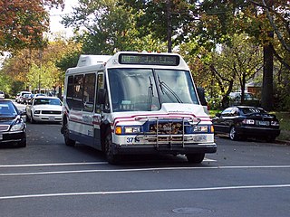
The Tenleytown–Glover Park Line, designated Route N8, was a bus route operated by the Washington Metropolitan Area Transit Authority between Tenleytown–AU station of the Red Line of the Washington Metro and Glover Park. The line operated every 20–40 minutes on weekdays only with trips roughly taking 30 minutes. The route was discontinued on September 23, 2011 due to low ridership.

The Crosstown Line, designated Routes H2 and H4, is a daily bus route operated by the Washington Metropolitan Area Transit Authority between Brookland–CUA station and Tenleytown–AU station of the Red Line of the Washington Metro. The line operates every 24 minutes between 7AM and 9PM, and 20 - 40 minutes after 9PM at a combined frequency of 12 minutes during the day and, 20 minutes during the late nights. Trips roughly take 48 minutes to complete.

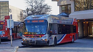
The Massachusetts Avenue Line, designated Route N2, N4, N6, is a daily bus route operated by the Washington Metropolitan Area Transit Authority between Friendship Heights station of the Red Line of the Washington Metro and Farragut Square in Downtown Washington DC. The line operates every 27 minutes during the weekdays and 40 minutes on weekends. Trips take roughly 45 minutes to complete.


