Huntington station (Washington Metro)

Last updated

Huntington
WMATA Yellow.svg
Huntington Station platform full looking towards Kings Hwy. entrance.jpg
Huntington station platform facing south in September 2014
General information
Location2701 Huntington Avenue
Huntington, Virginia, U.S.
Owned by Washington Metropolitan Area Transit Authority
Platforms1 island platform
Tracks2
Connections
Construction
Structure typeOpen cut
Parking3,617 spaces
Bicycle facilities34  racks, 12  lockers
AccessibleYes
Other information
Station codeC15
History
OpenedDecember 17, 1983;40 years ago (December 17, 1983)
Rebuilt2019
Passengers
20232,449 daily [1]
Rank42 out of 98
Services
Preceding station WMATA Metro Logo small.svg Washington Metro Following station
Terminus Yellow Line Eisenhower Avenue
Former services
Preceding station WMATA Metro Logo small.svg Washington Metro Following station
Terminus Blue Line Eisenhower Avenue
Location
Huntington station (Washington Metro)

Huntington station is an island-platformed Washington Metro station in the Huntington area of Fairfax County, Virginia, United States (though its mailing address says Alexandria). The station was opened on December 17, 1983, and is operated by the Washington Metropolitan Area Transit Authority (WMATA). Serving as the southern terminus for the Yellow Line, the station is built into a hillside; the south mezzanine, along with escalator access, is accessible via an incline elevator.

Contents

The station serves the suburban area of Fairfax County and is a popular commuter station with over 3,000 parking spaces. It is located between North Kings Highway (State Route 241) and Huntington Avenue, with parking facilities and station entrances available off of both roads. Service began on December 17, 1983, making it the first station to open in Fairfax County, and the first to extend the system beyond the Capital Beltway. The station is located on the ruins of Fort Lyon, a Civil War-era fort.

History

Originally scheduled to open in summer 1982, its opening was delayed due to both unavailability of new subway cars and the lack of a test track. [2] Construction of the station was complete by summer 1982, [3] and in September 1983 Metro announced the station would open that December as the new cars would be ready for service. [4] The station opened on December 17, 1983. [5] Its opening coincided with the completion of 4.2 miles (6.8 km) [6] of rail between National Airport and Huntington and the opening of the Braddock Road, Eisenhower Avenue, and King Street–Old Town stations. [5]

Huntington station undergoing platform renovations in August 2019 Station work at Huntington Station, August 2019.jpg
Huntington station undergoing platform renovations in August 2019

In May 2018, Metro announced an extensive renovation of platforms at twenty stations across the system. The Blue and Yellow Lines south of Ronald Reagan Washington National Airport station, including the Huntington station, would be closed from May to September 2019. This will allow for the eventual demolition of an abandoned parking structure at Huntington, as well as the rehabilitation of a track crossover. The platform at the Huntington station itself was rebuilt from January to May 2020. [7] [8]

Between September 10, 2022 and November 5, 2022, Huntington was closed due to the Potomac Yard station tie-in, closing all stations south of Ronald Reagan Washington National Airport station. Shuttle buses were provided throughout the shutdown. [9] Additionally, beginning on November 6, 2022, Blue Line trains began serving Huntington due to the suspension of the Yellow Line from the 14th Street Bridge project. Trains operated between Huntington and New Carrollton stations until May 7, 2023, [10] when service on the Yellow Line resumed but truncated from its northeastern terminus from Greenbelt to Mount Vernon Square. [11]

Station layout

Inside Huntington Station's incline elevator. Huntington funicular elevator, looking down from inside elevator car.jpg
Inside Huntington Station's incline elevator.

Architecturally, Huntington station is different from the rest of the Metro network. It is partially elevated and built into the surrounding hillside. Riders enter the station from the north on a viaduct carrying the tracks from downtown Washington, D.C., but the south end of the island platform is below grade. The tracks continue into short tunnels in the hill, allowing for a future extension. The canopy is supported by buttresses that bridge the tracks into the sloped walls of the depression in which the station is built. As a result of the unusual topography, there is an incline elevator at this station, the only one installed anywhere in the Metrorail system and one of only a handful of such elevators in the United States. The WMATA is unsure why the design used such an elevator, rather than a traditional vertical elevator plus a horizontal walkway. [12]

The north (lower) mezzanine is home to one of Metro's few fully public restrooms, an automatic self-cleaning toilet manufactured by Exeloo, opened in October 2003. The automatic restroom was installed as part of a pilot project to determine customer acceptance and feasibility of the concept, as well as the impact on safety and cleanliness. [13] According to then-General Manager Richard A. White in the online Lunchtalk chat dated June 3, 2005, there are no plans to extend the program to any other stations. [14]

Huntington is one of only two stations that is serviced exclusively by the Yellow Line, the other being Eisenhower Avenue.

SStreet levelUpper level exit/entrance, buses, parking
MMezzanineFare gates, ticket machines, station manager
T
Platform level
Northbound WMATA Yellow.svg toward Mount Vernon Square (Eisenhower Avenue)
Island platform
Northbound WMATA Yellow.svg toward Mount Vernon Square (Eisenhower Avenue)
SStreet levelLower level exit/entrance, buses, parking, fare gates, ticket machines, station manager

Buses and parking

Bus routes from Huntington on Metrobus and Fairfax Connector serve much of southern Fairfax County, Virginia. [15]

A new 1,424-space parking garage located on the station's east side opened on August 14, 2008. There are 3,617 parking spaces at the station. The former surface parking lot off North Kings Highway is the center of an ongoing residential and business redevelopment project. Parking at Huntington Station costs $4.85 all day on weekdays, but is free on weekends and federal holidays. [16]

Related Research Articles

<span class="mw-page-title-main">Washington Metro</span> Rapid transit system serving the Washington metropolitan area

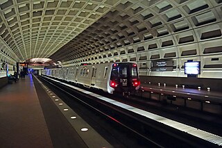
The Washington Metro, often abbreviated as the Metro and formally the Metrorail, is a rapid transit system serving the Washington metropolitan area of the United States. It is administered by the Washington Metropolitan Area Transit Authority (WMATA), which also operates the Metrobus service under the Metro name. Opened in 1976, the network now includes six lines, 98 stations, and 129 miles (208 km) of route.

<span class="mw-page-title-main">Blue Line (Washington Metro)</span> Washington Metro rapid transit line

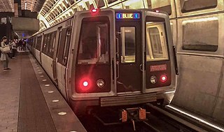
The Blue Line is a rapid transit line of the Washington Metro system, consisting of 28 stations in Fairfax County, Alexandria and Arlington, Virginia; Washington, D.C.; and Prince George's County, Maryland, United States. The Blue Line runs from Franconia–Springfield to Downtown Largo. The line shares track with the Orange Line for 13 stations, the Silver Line for 18, and the Yellow Line for 7. Only 3 stations are exclusive to the Blue Line.

<span class="mw-page-title-main">Red Line (Washington Metro)</span> Washington Metro rapid transit line

The Red Line is a rapid transit line of the Washington Metro system, consisting of 27 stations in Montgomery County, Maryland, and Washington, D.C., in the United States. It is a primary line through downtown Washington and the oldest and busiest line in the system. It forms a long, narrow "U," capped by its terminal stations at Shady Grove and Glenmont.

<span class="mw-page-title-main">Yellow Line (Washington Metro)</span> Washington Metro rapid transit line

The Yellow Line is a rapid transit line of the Washington Metro system that runs between Huntington in Virginia and Mount Vernon Square in Washington, D.C. It consists of 13 stations in Fairfax County, the city of Alexandria, and Arlington County in Virginia, and Washington, D.C. It is the shortest line in the system, and since its truncation to Mount Vernon Square, it is the only line that does not enter Maryland.

<span class="mw-page-title-main">Gallery Place station</span> Washington Metro station

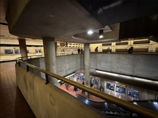
Gallery Place station is a Washington Metro station in Washington, D.C., United States, on the Green, Yellow and Red Lines. It is one of the 4 major transfer points, a transfer station between the Red Line on the upper level and the Green/Yellow Lines on the lower level.

<span class="mw-page-title-main">Dunn Loring station</span> Washington Metro station

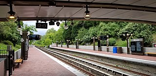
Dunn Loring station is a Washington Metro station in Fairfax County, Virginia, on the Orange Line. The station is in Merrifield, with a Vienna mailing address. The station is in the median of Interstate 66 at Gallows Road, just outside the Capital Beltway, and is accessed by a footbridge over the eastbound lanes.

<span class="mw-page-title-main">Franconia–Springfield station</span> Washington Metro station

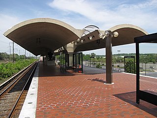
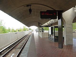
Franconia–Springfield station is a Washington Metro rapid transit station and Virginia Railway Express commuter rail station located in Springfield, Virginia, United States. The station is the southwestern terminus of the Metro Blue Line and an intermediate station on the VRE Fredericksburg Line. It is also a major bus terminal for Fairfax Connector buses, plus other local and intercity bus routes. The station has one island-platform serving the two Metro tracks, plus two side platforms serving the RF&P Subdivision on which the Fredericksburg Line runs.

<span class="mw-page-title-main">King Street–Old Town station</span> Washington Metro station

King Street–Old Town station is a Washington Metro station in Alexandria, Virginia, United States. The station opened on December 17, 1983, and is operated by the Washington Metropolitan Area Transit Authority (WMATA). Providing service for both the Blue and Yellow Lines, this is the southernmost transfer station for the Blue and Yellow lines, as the two lines diverge just south of the station. During inclement weather, Crystal City is commonly used as an unofficial transfer point, being the southernmost underground station common to both lines. King Street was originally served only by the Yellow Line, until the Blue Line was extended from National Airport to Van Dorn Street in 1991.

<span class="mw-page-title-main">Eisenhower Avenue station</span> Washington Metro station

Eisenhower Avenue station is a rapid transit station on the Yellow Line of the Washington Metro in Alexandria, Virginia. It opened on December 17, 1983.

<span class="mw-page-title-main">Braddock Road station</span> Washington Metro station

Braddock Road station is an island-platformed Washington Metro station in Alexandria, Virginia, United States. The station was opened on December 17, 1983, and is operated by the Washington Metropolitan Area Transit Authority (WMATA). Providing service for both the Blue and Yellow Lines, the station is located at Braddock Road and West Street.

<span class="mw-page-title-main">Ronald Reagan Washington National Airport station</span> Washington Metro station

Ronald Reagan Washington National Airport station is a Washington Metro station in Arlington, Virginia on the Blue and Yellow Lines. The station platform is elevated and covered and is the last above-ground station on the Yellow Line in Virginia, heading into Washington, D.C. It is one of only two stations in the system to have three tracks. The station is located across Smith Boulevard from Terminal 2 at Ronald Reagan Washington National Airport; the mezzanine is directly connected to Level 2 of the terminal by two pedestrian bridges. Airport shuttle buses or a walkway connect the station and Terminal 1. The airport's Abingdon Plantation historical site is near the station.

<span class="mw-page-title-main">Arlington Cemetery station</span> Washington Metro station

Arlington Cemetery station is a side platformed Washington Metro station in Arlington, Virginia, United States. The station was opened on July 1, 1977, and is operated by the Washington Metropolitan Area Transit Authority (WMATA). The station provides service for only the Blue Line, and is located at the entrance to Arlington National Cemetery, underneath Memorial Drive. There is no public parking near the station except at the cemetery, which is reserved for cemetery visitors. It is the only station that closes earlier than the rest of the system, closing at 7 PM from October to March, and 10 PM from April to September.

<span class="mw-page-title-main">Capitol South station</span> Washington Metro station

Capitol South station is a Washington Metro station in the Capitol Hill neighborhood of Washington, D.C., United States. The island-platformed station was opened on July 1, 1977, and is operated by the Washington Metropolitan Area Transit Authority (WMATA). The station currently provides service for the Blue, Orange, and Silver Lines.

<span class="mw-page-title-main">Minnesota Avenue station</span> Washington Metro station

Minnesota Avenue station is an island-platformed Washington Metro station in the Central Northeast/Mahaning Heights neighborhood of Northeast Washington, D.C., United States. The station was opened on November 20, 1978, and is operated by the Washington Metropolitan Area Transit Authority (WMATA).

<span class="mw-page-title-main">Deanwood station</span> Washington Metro station

Deanwood station is an island-platformed Washington Metro station in the Deanwood neighborhood of Northeast Washington, D.C., United States. The station was opened on November 20, 1978, and is operated by the Washington Metropolitan Area Transit Authority (WMATA). Providing service for only the Orange Line, the station is the final station in the District of Columbia going east. The station is located at Minnesota Avenue and 48th Street Northeast.

<span class="mw-page-title-main">Cheverly station</span> Washington Metro station

Cheverly station is a side-platformed Washington Metro station in Prince George's County, Maryland, United States. The station was opened on November 20, 1978, and is operated by the Washington Metropolitan Area Transit Authority (WMATA). Providing service for the Orange Line, the station is the first station going east in Maryland on the Orange Line. The station is in the residential area of Cheverly at Columbia Park Road near U.S. Route 50. It is a commuter station with 530 parking spaces.

<span class="mw-page-title-main">Landover station</span> Washington Metro station

Landover station is an island-platformed Washington Metro station in Landover, Maryland, United States. The station was opened on November 20, 1978, and is operated by the Washington Metropolitan Area Transit Authority (WMATA). Providing service for the Orange Line, the station is in a residential area of Landover at Pennsy Drive near Landover Road. It is primarily a commuter station, with parking for over 1,800 cars, but it also served the now-demolished Capital Centre, the former home of the Washington Bullets and Washington Capitals.

<span class="mw-page-title-main">Greenbelt station</span> Washington Metro and MARC Train station

Greenbelt station is a Washington Metro and MARC station in Prince George's County, Maryland. The station is the northeastern terminus of the Green Line of the Washington Metro. MARC commuter rail trains on the Camden Line also stop at Greenbelt on a set of tracks parallel to the Metro tracks.

<span class="mw-page-title-main">Van Dorn Street station</span> Washington Metro station

Van Dorn Street station is a Washington Metro station straddling the boundary between Fairfax County and the independent city of Alexandria in Virginia, United States. The station’s island platform lies in unincorporated Rose Hill in Fairfax County, while the station’s entrance and parking facilities are in Alexandria. The station was opened on June 15, 1991, and is operated by the Washington Metropolitan Area Transit Authority (WMATA). Providing service for only the Blue Line, the station is located at South Van Dorn Street and Eisenhower Avenue, next to the Capital Beltway. From 1991 to 1997 it was the southwestern terminus of the Blue Line.

References

  1. "Metrorail Ridership Summary". Washington Metropolitan Area Transit Authority. Retrieved February 10, 2024.
  2. Feaver, Douglas B. (January 30, 1981). "Status of future Metro openings". The Washington Post. p. C5.
  3. Battiata, Mary (September 22, 1982). "Alexandria angered by delays in opening of subway". The Washington Post. p. VA1.
  4. Lynton, Stephen J. (September 21, 1983). "Metro panel approves plan for December Yellow Line opening". The Washington Post. p. C4.
  5. 1 2 Burgess, John (December 20, 1983). "Yellow Line trains run smoothly as new stations get first test". The Washington Post. p. C3.
  6. Washington Metropolitan Area Transit Authority (July 2009). "Sequence of Metrorail openings" (PDF). Archived from the original (PDF) on January 13, 2010. Retrieved July 25, 2010.
  7. "Metro wants to rebuild 20 station platforms over three years, creating SafeTrack-like disruptions". Washington Post. May 7, 2018. Retrieved February 19, 2019.
  8. "Metro plans 'summer shutdown' on Blue, Yellow lines next year". WTOP. May 7, 2018. Retrieved February 19, 2019.
  9. "Metro announces travel alternatives for major Blue and Yellow Line construction this fall | WMATA". www.wmata.com. Retrieved June 15, 2022.
  10. "Major Blue and Yellow Line Construction | WMATA". www.wmata.com. Retrieved September 10, 2022.
  11. "Metro's Yellow Line reopens Sunday with controversial turnback". WJLA-TV . Sinclair Broadcast Group. May 7, 2023. Retrieved May 7, 2023.
  12. Flegenheimer, Matt (May 29, 2014). "With New Slant on Subway Elevators, Expect Delays". The New York Times . Retrieved May 29, 2014.
  13. "Metro installs public toilet at Huntington station". Archived from the original on November 11, 2005. Retrieved July 19, 2005.
  14. "WMATA Lunchtalk". Washington Metropolitan Area Transit Authority. June 3, 2005. Archived from the original on January 13, 2010. Retrieved May 13, 2010.
  15. "Huntington Station Bus Information" (PDF). Archived from the original (PDF) on January 31, 2010. Retrieved January 2, 2010.
  16. "Parking Information". Archived from the original on January 31, 2010. Retrieved January 2, 2010.

38°47′39″N77°04′31″W / 38.794065°N 77.075261°W / 38.794065; -77.075261