The Washington Metro, often abbreviated as the Metro and formally the Metrorail, is a rapid transit system serving the Washington metropolitan area of the United States. It is administered by the Washington Metropolitan Area Transit Authority (WMATA), which also operates the Metrobus service under the Metro name. Opened in 1976, the network now includes six lines, 98 stations, and 129 miles (208 km) of route.

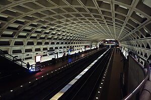
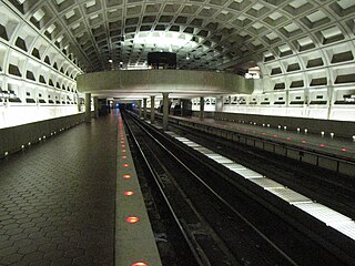
Metro Center station is the central hub station of the Washington Metro, a rapid transit system in Washington, D.C. The station is located in Downtown, centered on the intersection of 12th Street NW and G Street NW. It is one of the 4 major transfer points in the Metrorail network. The Red Line portion of Metro Center station opened on March 27, 1976, as part of the first section of the Metro system.
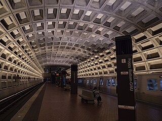
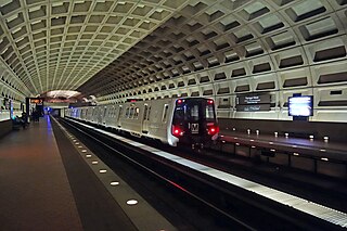
Foggy Bottom–GWU station is a Washington Metro station in the Foggy Bottom neighborhood of Washington, D.C., United States. The island-platformed station was opened on July 1, 1977, and is operated by the Washington Metropolitan Area Transit Authority (WMATA). Providing service for the Blue, Orange, and Silver Lines, the station is located on I Street on the George Washington University (GWU) campus. It is the last westbound station in the District of Columbia on these lines before they dive under the Potomac River to Virginia.
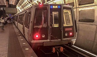
The Blue Line is a rapid transit line of the Washington Metro system, consisting of 28 stations in Fairfax County, Alexandria and Arlington, Virginia; Washington, D.C.; and Prince George's County, Maryland, United States. The Blue Line runs from Franconia–Springfield to Downtown Largo. The line shares track with the Orange Line for 13 stations, the Silver Line for 18, and the Yellow Line for 7. Only 3 stations are exclusive to the Blue Line.

The Orange Line is a rapid transit line of the Washington Metro system, consisting of 26 stations in Fairfax County and Arlington in Northern Virginia; Washington, D.C.; and Prince George's County, Maryland, United States. The Orange Line runs from Vienna in Virginia to New Carrollton in Maryland. Half of the line's stations are shared with the Blue Line and over two thirds are shared with the Silver Line. Orange Line service began on November 20, 1978.

The Red Line is a rapid transit line of the Washington Metro system, consisting of 27 stations in Montgomery County, Maryland, and Washington, D.C., in the United States. It is a primary line through downtown Washington and the oldest and busiest line in the system. It forms a long, narrow "U," capped by its terminal stations at Shady Grove and Glenmont.

Farragut North station is an underground Washington Metro station in Washington, D.C., located on the Red Line. The station serves Downtown Washington and is immediately northwest of Farragut Square. With an average of 7,615 daily riders in 2023, Farragut North was the sixth-busiest stop in the system.

Ballston–MU station is a side platformed Washington Metro station in Arlington County, Virginia. The station opened on December 1, 1979, and is operated by the Washington Metropolitan Area Transit Authority (WMATA). The station is part of the Orange and Silver Lines and serves the transit-oriented community of Ballston, Ballston Quarter, and Marymount University (MU).
Virginia Square–GMU station is a Washington Metro station in the Virginia Square neighborhood of Arlington, Virginia, United States. The side platformed station opened on December 1, 1979, and is operated by the Washington Metropolitan Area Transit Authority (WMATA). The station serves the Orange and Silver Lines. The station serves the Virginia Square neighborhood as well as the Arlington campus of George Mason University (GMU). The station entrance is located at the intersection of Fairfax Drive and North Monroe Street.

Rosslyn station is the westernmost station on the shared segment of the Blue, Orange, and Silver lines of the Washington Metro. It is located in the Rosslyn neighborhood of Arlington, Virginia, United States. Rosslyn is the first station in Virginia heading westward from the District on the Orange and Silver Lines and southward on the Blue Line. It is one of four interchange points on the Metrorail system west of the Potomac River and located in a growing business district.

McPherson Square station is a Washington Metro station in Downtown, Washington, D.C., United States. The side-platformed station is operated by the Washington Metropolitan Area Transit Authority (WMATA). Providing service for the Blue, Orange, and Silver Lines, the station is located between McPherson Square and Franklin Square, with two entrances on I Street at Vermont Avenue and 14th Street NW. This is the main station to access the White House, and the Vermont Avenue exit is directly underneath the Department of Veterans Affairs building.

Federal Triangle station is a Washington Metro station in Washington, D.C., United States. The island-platformed station was opened on July 1, 1977, and is operated by the Washington Metropolitan Area Transit Authority (WMATA). Providing service for the Blue, Orange, and Silver Lines, the station's entrance is beneath the William Jefferson Clinton Federal Building.

Smithsonian station is a Washington Metro station at the National Mall in Washington, D.C., United States. The side platformed station was opened on July 1, 1977, and is operated by the Washington Metropolitan Area Transit Authority (WMATA). It is a stop on the Blue, Orange and Silver Lines. The station's south entrance is at the southwest corner of Independence Avenue and 12th Street, Southwest, the street elevator is at the northwest corner of the same intersection, and the north entrance is on the south side of the Mall near Jefferson Drive, Southwest.

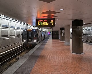
Ronald Reagan Washington National Airport station is a Washington Metro station in Arlington, Virginia on the Blue and Yellow Lines. The station platform is elevated and covered and is the last above-ground station on the Yellow Line in Virginia, heading into Washington, D.C. It is one of only two stations in the system to have three tracks. The station is located across Smith Boulevard from Terminal 2 at Ronald Reagan Washington National Airport; the mezzanine is directly connected to Level 2 of the terminal by two pedestrian bridges. Airport shuttle buses or a walkway connect the station and Terminal 1. The airport's Abingdon Plantation historical site is near the station.
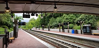
Arlington Cemetery station is a side platformed Washington Metro station in Arlington, Virginia, United States. The station was opened on July 1, 1977, and is operated by the Washington Metropolitan Area Transit Authority (WMATA). The station provides service for only the Blue Line, and is located at the entrance to Arlington National Cemetery, underneath Memorial Drive. There is no public parking near the station except at the cemetery, which is reserved for cemetery visitors. It is the only station that closes earlier than the rest of the system, closing at 7 PM from October to March, and 10 PM from April to September.
Federal Center SW station is a Washington Metro station in an area known as the Southwest Federal Center in Washington, D.C., United States. The island-platformed station was opened on July 1, 1977, and is operated by the Washington Metropolitan Area Transit Authority (WMATA) and is located on the Orange, Silver, and Blue Lines. The station is located at 3rd and D Streets.

Capitol South station is a Washington Metro station in the Capitol Hill neighborhood of Washington, D.C., United States. The island-platformed station was opened on July 1, 1977, and is operated by the Washington Metropolitan Area Transit Authority (WMATA). The station currently provides service for the Blue, Orange, and Silver Lines.

Eastern Market station is a Washington Metro station in the Capitol Hill neighborhood of Washington, D.C., United States. The island platformed station was opened on July 1, 1977, and is operated by the Washington Metropolitan Area Transit Authority (WMATA). The station currently provides service for the Blue, Orange, and Silver Lines. The station is located in Southeast D.C. at Pennsylvania Avenue and 7th Street. It is named after the nearby Eastern Market, a historic public marketplace.

Potomac Avenue station is an island-platformed Washington Metro station in the Capitol Hill neighborhood of Washington, D.C., United States. The station was opened on July 1, 1977, and is operated by the Washington Metropolitan Area Transit Authority (WMATA). The station currently provides service for the Blue, Orange, and Silver Lines. The station serves a dense residential area of Southeast Washington around Potomac Avenue and is located at 14th and G Streets.

The Sibley Hospital–Stadium Armory Line, designated Route D6, is a daily bus route operated by the Washington Metropolitan Area Transit Authority between Stadium–Armory station of the Blue, Orange, and Silver Lines of the Washington Metro and Sibley Hospital in the Palisades neighborhood. The line operates every 15 minutes during the weekday peak hours, 20 minutes during the off-peak hours, and 30-40 minutes during the late nights. Route D6 trips are roughly 60-90 minutes long.