Lemhi County, Idaho

Last updated

Lemhi County
Lemhi County Courthouse 1.jpg
Lemhi County Courthouse in Salmon
Lemhi County, Idaho seal.png
Map of Idaho highlighting Lemhi County.svg
Location within the U.S. state of Idaho
Idaho in United States.svg
Idaho's location within the U.S.
Coordinates: 44°58′N113°57′W / 44.96°N 113.95°W / 44.96; -113.95
CountryFlag of the United States.svg United States
StateFlag of Idaho.svg  Idaho
FoundedJanuary 9, 1869
Named for Fort Lemhi
Seat Salmon
Largest citySalmon
Area
  Total4,569 sq mi (11,830 km2)
  Land4,563 sq mi (11,820 km2)
  Water5.4 sq mi (14 km2)  0.1%
Population
 (2020)
  Total7,974
  Density1.7/sq mi (0.67/km2)
Time zone UTC−7 (Mountain)
  Summer (DST) UTC−6 (MDT)
Congressional district 2nd
Website www.lemhicountyidaho.org

Lemhi County is a county located in the U.S. state of Idaho. As of the 2020 census, the population was 7,974. [1] The largest city and county seat is Salmon. [2] The county was established in 1869 and named after Fort Lemhi (or Limhi), a remote Mormon missionary settlement from 1855 to 1858 in Bannock and Shoshone territory. [3]

Contents

Traffic signals

Geography

According to the U.S. Census Bureau, the county has a total area of 4,569 square miles (11,830 km2), of which 4,563 square miles (11,820 km2) is land and 5.4 square miles (14 km2) (0.1%) is water. [4] It is the fourth-largest county in Idaho by area. The highest point is Bell Mountain at 11,612 ft (3,539 m) above sea level, and the lowest point is the Salmon River as it exits on the county's western border with Idaho County at approximately 3,000 feet (910 m). The river cuts through the center of Lemhi County before turning west. The county's eastern border with Beaverhead County, Montana, is the Continental Divide.

Adjacent counties

National protected areas

History

Native settlement

Habitation of the Lemhi and Salmon Rivers dates back 14,000 years ago. Early natives were spear hunters of big game. The Salmon River was the dividing point among the first cultural split which occurred after 5,000 BC. The Lemhi band of Shoshoni developed culturally in similar fashion to other Shoshoni tribes located south of and east of the Salmon River. [5] The Lemhi band of Shoshoni gained early access to horses and had developed into a migratory culture. They were also known as "Salmon Eaters". Their migratory pattern consisted of fishing for salmon in the Lemhi Valley in the summer, digging camas on Camas Creek in the spring, and hunting buffalo in the Three Forks area of the Missouri River. They were also known to travel to trade with other tribes. The Lemhi band was forced to a reservation on February 12, 1875, even though the tribe failed to ratify the treaty creating it in 1868. The reservation was disbanded in 1907 and the tribe sent to Fort Hall. [6]

Exploration and early settlement

The Lewis and Clark Expedition entered Idaho on August 12, 1805, at Lemhi Pass in present-day Lemhi County. Meriwether Lewis and three other members of the expedition were the first Americans of European descent to enter what is now Idaho. For Sacajawea, their guide and interpreter, the Lemhi Valley was her birthplace and her brother was the Chief of the Lemhi band. Clark went out to scout the expedition's route. Within a month, travel down the Salmon and Snake Rivers was ruled out and the expedition headed for Lolo Pass on the Bitterroot Range. [7] Michael Bourdon of the Hudson's Bay Company established the Lemhi Valley as a base of trapping operations in 1822. The region would support trapping operations for about 20 years. Finnan McDonald, Alexander Ross, David Skene Ogden, Jedediah Smith, and Jim Bridger all spent time in the area. [8] [9] [10] Exploration of the full Salmon River from its source to the Snake River did not occur until 1832. Mormon settlers established Fort Lemhi from 1855 to 1858. The settlement was withdrawn after a native attack on the settlement. The first gold miners ventured into Lemhi County in 1862, with miners working the main Salmon River all the way from Salmon down to Slate Creek. [11]

Mining settlements

F.B. Sharkey and his party struck gold at Leesburg on July 16, 1866. The rush to Leesburg ensued within a month. A stagecoach route was established from Montana in May 1867 to the present location of Salmon City. Additional discovery of gold occurred at Lemhi in 1867 and Shoup in 1868. Salmon City became the county seat of Lemhi County when it was formed in 1869. Additional mining operations occurred at Yellow Jacket in 1869, Gibbonsville in 1877, Gilmore in 1880, Blackbird in 1892, and Leadore in 1904. [12] [13] The Gilmore and Pittsburgh Railroad was completed from Dubois to Salmon on May 18, 1910. The railroad was built to access ore from Gilmore. The railroad ceased operations in 1940. [14]

Development of cities

Salmon City was platted in 1867. While Salmon has gone by the name Salmon City since its inception, it did not have legal status as a city until around 1900. [15]

Leadore and Patterson were incorporated as villages in 1947. Patterson was disincorporated by 1980. [16]

County-boundary history

At the start of mining operations in present-day Lemhi County in 1862, the region was fully within Idaho County, Washington Territory. Boise County was created in 1863, with its northern boundary running just north of the ridge dividing Birch Creek) from the Lemhi River. Under Idaho Territory, the southern portion became part of Alturas County on February 2, 1864, and the dividing line between Alturas and Idaho Counties was adjusted to 44° 30′ North latitude. The Idaho territorial legislature actually created Lemhi County twice. The first occasion was on December 21, 1866. A county government was organized at Salmon City, yet the bill approving the county was misplaced and never published in session laws. The following session, the legislature passed the bill again, officially creating Lemhi County on January 9, 1869. The county government was reorganized at Salmon City on February 22, 1870. [17] The western and southern county boundaries for Lemhi were problematic and adjusted frequently. At its creation, Lemhi inherited Idaho County's southern and eastern boundaries, which effectively created two areas of noncontiguous territory, with one of the sections containing territory along the Salt Lake to Virginia City stagecoach route just north of the present town of Humphrey, Idaho. Finalization of the southern boundary came in several steps from 1885 to 1896. In 1885, the boundary was moved southward, gaining territory in present Clark County, creating a contiguous boundary, and leaving a 6-by-25.5-mile (9.7 by 41.0 km) stretch of the Birch Creek Area in Alturas County. The eastern 6-by-9-mile (9.7 by 14.5 km) portion of that territory was transferred from Alturas to Bingham in 1889. A change in 1891 extended the boundary south to its present location and added territory presently in Clark County. With legislative approval, voters in that territory voted to become part of Fremont County in 1896, finalizing the southern and eastern boundary. At Lemhi's creation, the western boundary was a line drawn from the Bitterroot Mountains to the southern line of Idaho County. The boundary was moved westward to the divide between the Payette and Salmon Rivers in 1873, moved eastward to a line drawn through the confluence of the Middle Fork and main Salmon rivers in 1885, and then mistakenly extended to the northern line of Idaho County in 1903 before being finalized at its present location in 1911. Custer County was partitioned from Lemhi in 1881 with its initial boundary excluding the Loon Creek area. The Loon Creek area was transferred back to Idaho County in 1885. [18]

Demographics

Historical population
CensusPop.Note
1870 988
1880 2,230125.7%
1890 1,915−14.1%
1900 3,44679.9%
1910 4,78638.9%
1920 5,1647.9%
1930 4,643−10.1%
1940 6,52140.4%
1950 6,278−3.7%
1960 5,816−7.4%
1970 5,566−4.3%
1980 7,46034.0%
1990 6,899−7.5%
2000 7,80613.1%
2010 7,9361.7%
2020 7,9740.5%
2023 (est.)8,441 [19] 5.9%
U.S. Decennial Census [20]
1790–1960 [21] 1900–1990 [22]
1990–2000 [23] 2010–2020 [24] 2020 [1]

2000 census

As of the census [25] of 2000, there were 7,806 people, 3,275 households, and 2,217 families living in the county. The population density was 2 people per square mile (0.77 people/km2). There were 4,154 housing units at an average density of 1 units per square mile (0.39 units/km2). The racial makeup of the county was 96.63% White, 0.10% Black or African American, 0.60% Native American, 0.18% Asian, 0.04% Pacific Islander, 0.77% from other races, and 1.68% from two or more races. 2.18% of the population were Hispanic or Latino of any race. 19.5% were of German, 18.0% English, 11.4% American and 6.5% Irish ancestry.

There were 3,275 households, out of which 28.60% had children under the age of 18 living with them, 57.80% were married couples living together, 6.90% had a female householder with no husband present, and 32.30% were non-families. 27.70% of all households were made up of individuals, and 12.40% had someone living alone who was 65 years of age or older. The average household size was 2.38 and the average family size was 2.91.

In the county, the population was spread out, with 25.50% under the age of 18, 5.50% from 18 to 24, 22.70% from 25 to 44, 29.50% from 45 to 64, and 16.80% who were 65 years of age or older. The median age was 43 years. For every 100 females there were 99.20 males. For every 100 females age 18 and over, there were 97.50 males.

The median income for a household in the county was $30,185, and the median income for a family was $35,261. Males had a median income of $30,558 versus $18,289 for females. The per capita income for the county was $16,037. About 10.60% of families and 15.30% of the population were below the poverty line, including 19.80% of those under age 18 and 10.30% of those age 65 or over.

2010 census

As of the 2010 United States Census, there were 7,936 people, 3,576 households, and 2,267 families living in the county. [26] The population density was 1.7 inhabitants per square mile (0.66/km2). There were 4,729 housing units at an average density of 1.0 units per square mile (0.39 units/km2). [27] The racial makeup of the county was 96.4% white, 0.7% American Indian, 0.4% Asian, 0.2% black or African American, 0.6% from other races, and 1.6% from two or more races. Those of Hispanic or Latino origin made up 2.3% of the population. [26] In terms of ancestry, 25.9% were German, 22.4% were English, 13.0% were Irish, 9.9% were American, and 6.2% were Swedish. [28]

Of the 3,576 households, 22.9% had children under the age of 18 living with them, 52.7% were married couples living together, 6.9% had a female householder with no husband present, 36.6% were non-families, and 31.7% of all households were made up of individuals. The average household size was 2.20 and the average family size was 2.74. The median age was 49.7 years. [26]

The median income for a household in the county was $36,411 and the median income for a family was $49,119. Males had a median income of $37,763 versus $21,233 for females. The per capita income for the county was $21,699. About 13.0% of families and 20.0% of the population were below the poverty line, including 36.3% of those under age 18 and 8.3% of those age 65 or over. [29]

Communities

Cities

Unincorporated communities

Politics

Like all of southeastern Idaho, Lemhi County has long been powerfully Republican. In no presidential election since 1940 has the county selected the Democratic nominee, and the last Democrat to pass 30 percent of the county's vote was Michael Dukakis in 1988.

United States presidential election results for Lemhi County, Idaho [30]
Year Republican Democratic Third party
No.%No.%No.%
2020 3,59275.80%1,03221.78%1152.43%
2016 3,01173.51%73317.90%3528.59%
2012 3,02973.70%96023.36%1212.94%
2008 2,93871.57%1,06125.85%1062.58%
2004 3,07975.93%91522.56%611.50%
2000 2,85978.52%66018.13%1223.35%
1996 2,33460.34%1,01526.24%51913.42%
1992 1,54040.30%99626.07%1,28533.63%
1988 2,37866.24%1,15732.23%551.53%
1984 2,81075.78%85222.98%461.24%
1980 2,64671.53%79421.47%2597.00%
1976 1,68556.37%1,15938.78%1454.85%
1972 1,81261.99%52618.00%58520.01%
1968 1,47657.61%54721.35%53921.04%
1964 1,49658.37%1,06741.63%00.00%
1960 1,35551.36%1,28348.64%00.00%
1956 1,79463.35%1,03836.65%00.00%
1952 2,10071.19%84828.75%20.07%
1948 1,03753.51%86444.58%371.91%
1944 1,04851.37%98848.43%40.20%
1940 1,41245.89%1,66454.08%10.03%
1936 94335.37%1,64861.82%752.81%
1932 79336.59%1,33261.47%421.94%
1928 1,13957.12%83741.98%180.90%
1924 1,00554.38%44223.92%40121.70%
1920 1,28964.71%69935.09%40.20%
1916 72338.38%1,08057.32%814.30%
1912 66933.47%91045.52%42021.01%
1908 80948.88%77746.95%694.17%
1904 78655.43%56439.77%684.80%
1900 52336.83%89763.17%00.00%

Education

School districts include: [31]

College of Eastern Idaho includes this county in its catchment zone; however this county is not in its taxation zone. [32]

See also

Related Research Articles

<span class="mw-page-title-main">Valley County, Idaho</span> County in Idaho, United States

Valley County is a rural county located in the U.S. state of Idaho. As of the 2020 census, the population was 11,746. The county seat is Cascade, and the largest city is McCall. Established in 1917, it was named after the Long Valley of the North Fork of the Payette River, which extends over 30 miles (50 km) from Payette Lake at McCall south to Cascade to Round Valley. The valley was formerly a summer pasture for livestock from the Boise Valley. Since the completion of the Cascade Dam in 1948, much of the northern valley has been covered by the Cascade Reservoir.

<span class="mw-page-title-main">Shoshone County, Idaho</span> County in Idaho, United States

Shoshone County is a county in the U.S. state of Idaho. As of the 2020 census, the population was 13,169. The county seat is Wallace and the largest city is Kellogg. The county was established in 1864, named for the Native American Shoshone tribe.

<span class="mw-page-title-main">Lewis County, Idaho</span> County in Idaho, United States

Lewis County is a county located in the north central region of the U.S. state of Idaho. As of the 2020 census, the population was 3,533, making it the fourth-least populous county in Idaho. The county seat is Nezperce, and Kamiah is the largest city. Partitioned from Nez Perce County and established in 1911, it was named after the explorer Meriwether Lewis. Most of the county is within the Nez Perce Indian Reservation, though Native Americans comprise less than 6% of the county population. Similar to the opening of lands in Oklahoma, the U.S. government opened the reservation for white settlement in November 1895. The proclamation had been signed less than two weeks earlier by President Cleveland.

<span class="mw-page-title-main">Latah County, Idaho</span> County in Idaho, United States

Latah County is a county located in the north central region of the U.S. state of Idaho. As of the 2020 census, the population was 39,517. The county seat and largest city is Moscow, the home of the University of Idaho, the state's flagship university.

<span class="mw-page-title-main">Kootenai County, Idaho</span> County in Idaho, United States

Kootenai County is located in the U.S. state of Idaho. As of the 2020 census, its population was 171,362, making it the third-most populous county in Idaho and by far the largest in North Idaho, the county accounting for 45.4% of the region's total population. The county seat and largest city is Coeur d'Alene. The county was established in 1864 and named after the Kootenai tribe.

<span class="mw-page-title-main">Jerome County, Idaho</span> County in Idaho, United States

Jerome County is a county in the U.S. state of Idaho. As of the 2020 Census the county had a population of 24,237. The county seat and largest city is Jerome. The county was created by the Idaho Legislature on February 8, 1919, by a partition of Lincoln County. It was named after either Jerome Hill, a developer of the North Side Irrigation Project, his son-in-law Jerome Kuhn, or his grandson Jerome Kuhn, Jr.

<span class="mw-page-title-main">Idaho County, Idaho</span> County in Idaho, United States

Idaho County is a county in the U.S. state of Idaho, and the largest by area in the state. As of the 2020 census, the population was 16,541. The county seat is Grangeville. Previous county seats of the area were Florence (1864–68), Washington (1868–75), and Mount Idaho (1875–1902).

<span class="mw-page-title-main">Gooding County, Idaho</span> County in Idaho, United States

Gooding County is a county located in the U.S. state of Idaho. As of the 2020 census, the population was 15,598. Its county seat is Gooding. The county was created by the Idaho Legislature on January 28, 1913, by a partition of Lincoln County. It is named for Frank R. Gooding, the 7th governor and a United States Senator from Idaho.

<span class="mw-page-title-main">Gem County, Idaho</span> County in Idaho, United States

Gem County is a county in the U.S. state of Idaho. As of the 2020 census, the population was 19,123. The county seat and largest city is Emmett.

<span class="mw-page-title-main">Elmore County, Idaho</span> County in Idaho, United States

Elmore County is a county in the U.S. state of Idaho. As of the 2020 census, the population was 28,666. The largest city and county seat is Mountain Home.

<span class="mw-page-title-main">Custer County, Idaho</span> County in Idaho, United States

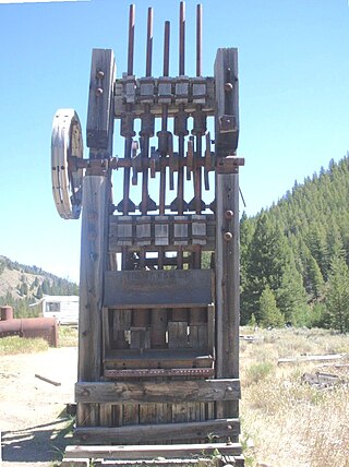
Custer County is a rural mountain county in the center of the U.S. state of Idaho. As of the 2020 census, the population was 4,275, making it the fifth-least populous county in Idaho. The county seat is Challis. Established in 1881, the county was named for the General Custer Mine, where gold was discovered five years earlier. Custer County relies on ranching, mining, and tourism as its main resources.

<span class="mw-page-title-main">Clark County, Idaho</span> County in Idaho, United States

Clark County is a rural county in the U.S. state of Idaho; its county seat and largest city is Dubois. As of the 2020 census, the population was 790, making it the least populous county in the state.

<span class="mw-page-title-main">Caribou County, Idaho</span> County in Idaho, United States

Caribou County is a county located in the U.S. state of Idaho. As of the 2020 Census the county had a population of 7,027. The county seat and largest city is Soda Springs.

<span class="mw-page-title-main">Camas County, Idaho</span> County in Idaho, United States

Camas County is a county in the southern portion of the U.S. state of Idaho. The county seat and largest city is Fairfield. The county was established 107 years ago in 1917 by the Idaho Legislature with a partition of Blaine County on February 6. It is named for the camas root, or Camassia, a lily-like plant with an edible bulb found in the region, that Native Americans and settlers used as a food source. As of the 2020 census, the population was 1,077, making it the second-least populous county in the state, after Clark County.

<span class="mw-page-title-main">Butte County, Idaho</span> County in Idaho, United States

Butte County is a rural county located in the U.S. state of Idaho. As of the 2020 census, the population was 2,574, making it the third-least populous county in Idaho. Its county seat and largest city is Arco. The county was established in 1917 from parts of Bingham, Blaine, and Jefferson counties. The county gained territory in the Clyde area from Custer County in 1937 to reach its present boundary.

<span class="mw-page-title-main">Boundary County, Idaho</span> County in Idaho, United States

Boundary County is the northernmost county of the U.S. state of Idaho. As of the 2020 census, the population was 12,056. The county seat and largest city is Bonners Ferry.

<span class="mw-page-title-main">Bonner County, Idaho</span> County in Idaho, United States

Bonner County is a county in the northern part of the U.S. state of Idaho. As of the 2020 census, the population was 47,110. The county seat and largest city is Sandpoint. Partitioned from Kootenai County and established in 1907, it was named for Edwin L. Bonner, a ferry operator.

<span class="mw-page-title-main">Boise County, Idaho</span> County in Idaho, United States

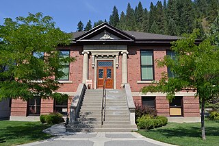
Boise County is a rural mountain county in the U.S. state of Idaho. As of the 2020 United States Census, the population was 7,610. The county seat is historic Idaho City, which is connected through a series of paved and unpaved roads to Lowman, Centerville, Placerville, Pioneerville, Star Ranch, Crouch, Garden Valley, and Horseshoe Bend.

<span class="mw-page-title-main">Leadore, Idaho</span> City in Idaho, United States

Leadore is an incorporated small town in Lemhi County, Idaho, United States. The population was 105 at the 2010 census.

<span class="mw-page-title-main">Salmon, Idaho</span> City in Lemhi County, Idaho, United States

Salmon is a city in Lemhi County, Idaho. The population was 3,112 at the 2010 census. The city is the county seat of Lemhi County.

References

  1. 1 2 "2020 Census Data". data.census.gov.
  2. "Find a County". National Association of Counties. Retrieved June 7, 2011.
  3. "Idaho for the Curious", by Cort Conley, ©1982, ISBN   0-9603566-3-0, p.214-216
  4. "US Gazetteer files: 2010, 2000, and 1990". United States Census Bureau. February 12, 2011. Retrieved April 23, 2011.
  5. "Idaho State Historical Society Reference Series: IDAHO PREHISTORIC CULTURE AREAS" (PDF). Idaho State Historical Society. Archived (PDF) from the original on May 3, 2012. Retrieved February 24, 2017.
  6. "Idaho State Historical Society Reference Series: SHOSHONI AND NORTHERN PAIUTE INDIANS IN IDAHO" (PDF). Idaho State Historical Society Reference Series. Archived (PDF) from the original on May 3, 2012. Retrieved February 24, 2017.
  7. "Idaho State Historical Society Reference Series: The Lewis and Clark Trail Across Idaho" (PDF). Archived (PDF) from the original on May 3, 2012. Retrieved February 24, 2017.
  8. "Idaho State Historical Society Reference Series: JIM BRIDGER IN IDAHO" (PDF). Idaho State Historical Society. Archived (PDF) from the original on May 3, 2012. Retrieved February 24, 2017.
  9. "Idaho State Historical Society Reference Series: Route of Alexander Ross, 1824" (PDF). Idaho State Historical Society Reference Series. Archived (PDF) from the original on May 2, 2012. Retrieved February 24, 2017.
  10. "Idaho State Historical Society Reference Series: Lemhi-Lost River Fur Trade" (PDF). Idaho State Historical Society. Archived (PDF) from the original on May 3, 2012. Retrieved February 24, 2017.
  11. "Idaho State Historical Society Reference Series: EXPLORATION AND SETTLEMENT OF SALMON RIVER" (PDF). Idaho State Historical Society. Archived (PDF) from the original on May 3, 2012. Retrieved February 24, 2017.
  12. "Idaho State Historical Society Reference Series:LEESBURG" (PDF). Idaho State Historical Society. Archived (PDF) from the original on October 5, 2011. Retrieved February 24, 2017.
  13. "Idaho State Historical Society Reference Series: Mining in Idaho" (PDF). Idaho State Historical Society Reference Series. Archived from the original (PDF) on May 20, 2018. Retrieved February 24, 2017.
  14. "Idaho State Historical Society Reference Series: GILMORE AND PITTSBURGH RAILROAD" (PDF). Idaho State Historical Society. Archived (PDF) from the original on May 3, 2012. Retrieved February 25, 2017.
  15. Census Reports Volume I: Twelfth Census of the United States, Taken in the Year 1900 (PDF). Washington: United States Census Office. 1901. p. 112. Archived (PDF) from the original on September 14, 2015. Retrieved February 25, 2017.
  16. A Report of the Seventeenth Census of the United States Census of Population: 1950 (PDF). Washington: United States Government Printing Office. 1952. pp. 12–17. Archived (PDF) from the original on September 12, 2015. Retrieved February 25, 2017.
  17. "Idaho State Historical Society Reference Series: Early Lemhi County" (PDF). Idaho State Historical Society Reference Series. Archived (PDF) from the original on May 3, 2012. Retrieved February 25, 2017.
  18. Idaho Atlas of Historical County Boundaries. Chicago: The Newberry Library. 2010. pp. 12, 42, 76, 95, 98, 123–131.
  19. "Annual Estimates of the Resident Population for Counties: April 1, 2020 to July 1, 2023". United States Census Bureau. Retrieved March 31, 2024.
  20. "U.S. Decennial Census". United States Census Bureau. Retrieved July 1, 2014.
  21. "Historical Census Browser". University of Virginia Library. Retrieved July 1, 2014.
  22. "Population of Counties by Decennial Census: 1900 to 1990". United States Census Bureau. Retrieved July 1, 2014.
  23. "Census 2000 PHC-T-4. Ranking Tables for Counties: 1990 and 2000" (PDF). United States Census Bureau. Archived (PDF) from the original on March 27, 2010. Retrieved July 1, 2014.
  24. "State & County QuickFacts". United States Census Bureau. Archived from the original on July 17, 2011. Retrieved July 1, 2014.
  25. "U.S. Census website". United States Census Bureau . Retrieved January 31, 2008.
  26. 1 2 3 "DP-1 Profile of General Population and Housing Characteristics: 2010 Demographic Profile Data". United States Census Bureau. Archived from the original on February 13, 2020. Retrieved January 9, 2016.
  27. "Population, Housing Units, Area, and Density: 2010 – County". United States Census Bureau. Archived from the original on February 13, 2020. Retrieved January 9, 2016.
  28. "DP02 SELECTED SOCIAL CHARACTERISTICS IN THE UNITED STATES – 2006–2010 American Community Survey 5-Year Estimates". United States Census Bureau. Archived from the original on February 13, 2020. Retrieved January 9, 2016.
  29. "DP03 SELECTED ECONOMIC CHARACTERISTICS – 2006–2010 American Community Survey 5-Year Estimates". United States Census Bureau. Archived from the original on February 13, 2020. Retrieved January 9, 2016.
  30. Leip, David. "Dave Leip's Atlas of U.S. Presidential Elections". uselectionatlas.org. Retrieved April 4, 2018.
  31. "2020 CENSUS - SCHOOL DISTRICT REFERENCE MAP: Lemhi County, ID" (PDF). United States Census Bureau . Retrieved March 12, 2024. - Text list
  32. "Community Colleges" (PDF). Budget Hearing. Idaho Legislature. 2020. p. 1-73 (PDF p. 8/14). Retrieved March 12, 2024.

44°58′N113°57′W / 44.96°N 113.95°W / 44.96; -113.95