National Register of Historic Places listings in Uxbridge, Massachusetts

Last updated

Uxbridge, Massachusetts has 53 sites on the National Register of Historic Places.

Contents

Map all coordinates using: OpenStreetMap

The locations of National Register properties and districts (at least for all showing latitude and longitude coordinates below) may be seen in an online map by clicking on "Map of all coordinates". [1]


    This National Park Service list is complete through NPS recent listings posted February 2, 2024. [2]

Uxbridge

[3] Name on the RegisterImageDate listed [4] LocationDescription
1 Benjamin Adams House
Benjamin Adams House Benjamin Adams House Fall 2007.jpg
Benjamin Adams House
October 7, 1983
(#83004101)
85 N. Main St.
42°04′49″N71°38′03″W / 42.080278°N 71.634167°W / 42.080278; -71.634167 (Benjamin Adams House)
Listed at 81 North Main.
2 E. Albee House
E. Albee House UxbridgeMA EAlbeeHouse.jpg
E. Albee House
October 7, 1983
(#83004102)
217 Chapin St. [5]
42°04′07″N71°35′42″W / 42.068611°N 71.595°W / 42.068611; -71.595 (E. Albee House)
Listed on Highland St.
3 Daniel Aldrich Cottage and Sawmill
Daniel Aldrich Cottage and Sawmill UxbridgeMA DanielAllenMillAndHouse.jpg
Daniel Aldrich Cottage and Sawmill
October 7, 1983
(#83004103)
364 Aldrich St.
42°01′39″N71°38′27″W / 42.0274°N 71.6407°W / 42.0274; -71.6407 (Daniel Aldrich Cottage and Sawmill)
4 J. Aldrich House
J. Aldrich House Jacob Aldrich House, National Historic Site, Uxbridge, MA.jpg
J. Aldrich House
January 20, 1984
(#84002896)
389 Aldrich St.
42°01′38″N71°38′35″W / 42.027222°N 71.643056°W / 42.027222; -71.643056 (J. Aldrich House)
5 S. Aldrich House
S. Aldrich House Seth Aldrich House, Uxbridge, MA.jpg
S. Aldrich House
October 7, 1983
(#83004104)
317 Aldrich St.
42°01′44″N71°38′17″W / 42.028889°N 71.638056°W / 42.028889; -71.638056 (S. Aldrich House)
6 W. Aldrich House
W. Aldrich House UxbridgeMA WAldrichHouse.jpg
W. Aldrich House
October 7, 1983
(#83004105)
180 Henry St.
42°04′50″N71°36′03″W / 42.080556°N 71.600833°W / 42.080556; -71.600833 (W. Aldrich House)
7 Bank Building (Uxbridge, Massachusetts)
Bank Building (Uxbridge, Massachusetts) The Bank Building, Uxbridge MA.jpg
Bank Building (Uxbridge, Massachusetts)
October 7, 1983
(#83004106)
1 South Main Street
42°04′30″N71°37′43″W / 42.075°N 71.628611°W / 42.075; -71.628611 (Bank Building (Uxbridge, Massachusetts))
8 Blackstone Canal Historic District
Blackstone Canal Historic District Stanley Woolen Mill Uxbridge MA reflected in Blackstone canal.jpg
Blackstone Canal Historic District
February 6, 1973
(#73000328)
Historic canal route between Providence, Rhode Island and Worcester, Massachusetts
42°08′39″N71°40′36″W / 42.144167°N 71.676667°W / 42.144167; -71.676667 (Blackstone Canal Historic District)
Initial listing included 3.5 mile stretch of canal in Northbridge and Uxbridge; expanded in 1995 to include the entire historic route of the canal from Worcester to the Rhode Island line (#95001004).
9 E. Brown House
E. Brown House E. Brown House.jpg
E. Brown House
October 7, 1983
(#83004109)
7 Sutton St.
42°05′N71°39′W / 42.09°N 71.65°W / 42.09; -71.65 (E. Brown House)
Listed at 3 Sutton Street.
10 Butler Block
Butler Block Butler Block Uxbridge, MA.jpg
Butler Block
October 7, 1983
(#83004110)
166 Linwood St.
42°05′48″N71°38′41″W / 42.096667°N 71.644722°W / 42.096667; -71.644722 (Butler Block)
Listed at 210 Linwood Street.
11 Charles Capron House
Charles Capron House 2 Capron Street, Uxbridge.JPG
Charles Capron House
October 7, 1983
(#83004111)
2 Capron St.
42°04′40″N71°37′39″W / 42.077778°N 71.6275°W / 42.077778; -71.6275 (Charles Capron House)
12 George Carpenter House
George Carpenter House George Carpenter House.jpg
George Carpenter House
October 7, 1983
(#83004112)
53 S. Main St.
42°04′25″N71°37′42″W / 42.073611°N 71.628333°W / 42.073611; -71.628333 (George Carpenter House)
Listed at 67 South Main Street.
13 Central Woolen Mills District
Central Woolen Mills District StanleyWoolenMillUxbridgeMA 079.jpg
Central Woolen Mills District
January 20, 1984
(#84002905)
Mendon and Cross Sts.
42°04′49″N71°37′16″W / 42.080278°N 71.621111°W / 42.080278; -71.621111 (Central Woolen Mills District)
14 A. Chapin House
A. Chapin House UxbridgeMA AChapinHouse.jpg
A. Chapin House
October 7, 1983
(#83004113)
36 Pleasant St.
42°04′28″N71°37′49″W / 42.074444°N 71.630278°W / 42.074444; -71.630278 (A. Chapin House)
Listed at 26 Pleasant St.
15 A. E. Cook House
A. E. Cook House UxbridgeMA AECookHouse.jpg
A. E. Cook House
October 7, 1983
(#83004115)
176 Aldrich St.
42°01′56″N71°37′46″W / 42.032222°N 71.629444°W / 42.032222; -71.629444 (A. E. Cook House)
16 Francis Deane Cottage
Francis Deane Cottage UxbridgeMA FrancisDeaneCottage1.jpg
Francis Deane Cottage
October 7, 1983
(#83004116)
52 N. Main St.
42°04′43″N71°37′57″W / 42.078611°N 71.6325°W / 42.078611; -71.6325 (Francis Deane Cottage)
Listed at 58 N. Main St.
17 Farnum Block
Farnum Block UxbridgeMA FarnumBlock.jpg
Farnum Block
October 7, 1983
(#83004117)
2-6 N. Main St.
42°04′34″N71°37′49″W / 42.076111°N 71.630278°W / 42.076111; -71.630278 (Farnum Block)
Demolished. [6]
18 Coronet John Farnum House
Coronet John Farnum House Farnum-House-150.jpg
Coronet John Farnum House
May 7, 1980
(#80001682)
44 Mendon St.
42°04′37″N71°37′41″W / 42.076944°N 71.628056°W / 42.076944; -71.628056 (Coronet John Farnum House)
19 Moses Farnum House
Moses Farnum House MosesFarnumHouse 043.jpg
Moses Farnum House
October 7, 1983
(#83004118)
435 Quaker Hwy (MA 146)
42°02′27″N71°37′20″W / 42.040833°N 71.622222°W / 42.040833; -71.622222 (Moses Farnum House)
20 R. Farnum House
R. Farnum House UxbridgeMA RFarnumHouse.jpg
R. Farnum House
October 7, 1983
(#83004119)
22 Oak St.
42°04′46″N71°37′33″W / 42.079444°N 71.625833°W / 42.079444; -71.625833 (R. Farnum House)
Listed at 20 Oak Street.
21 William and Mary Farnum House
William and Mary Farnum House 4 Albee Road easterly view.jpg
William and Mary Farnum House
January 20, 1984
(#84002914)
4 Albee Rd.
42°02′42″N71°36′30″W / 42.045°N 71.608333°W / 42.045; -71.608333 (William and Mary Farnum House)
Destroyed by fire in 2013.
22 Friends Meetinghouse
Friends Meetinghouse FreindsmeetinghouseUxbridgeMA 040.jpg
Friends Meetinghouse
January 24, 1974
(#74000395)
479 Quaker Hwy.
42°02′21″N71°37′16″W / 42.039167°N 71.621111°W / 42.039167; -71.621111 (Friends Meetinghouse)
23 Granite Store
Granite Store Granite Store - Uxbridge, Massachusetts - DSC02858.JPG
Granite Store
October 7, 1983
(#83004120)
110 Hecla St.
42°04′28″N71°36′47″W / 42.074444°N 71.613056°W / 42.074444; -71.613056 (Granite Store)
Listed at 112-116 Hecla Street.
24 S.A. Hall House
S.A. Hall House S.A. Hall House.jpg
S.A. Hall House
October 7, 1983
(#83004121)
147 N. Main St.
42°04′54″N71°38′16″W / 42.081667°N 71.637778°W / 42.081667; -71.637778 (S.A. Hall House)
Listed at 133 North Main Street.
25 William Hayward House
William Hayward House 77 North Main Street, Uxbridge MA.jpg
William Hayward House
October 7, 1983
(#83004122)
77 N. Main St.
42°04′48″N71°38′02″W / 42.08°N 71.633889°W / 42.08; -71.633889 (William Hayward House)
26 Sylvanus Holbrook House
Sylvanus Holbrook House UxbridgeMA SylvanusHolbrookHouse.jpg
Sylvanus Holbrook House
October 7, 1983
(#83004123)
52 Albee Rd.
42°02′41″N71°36′35″W / 42.044722°N 71.609722°W / 42.044722; -71.609722 (Sylvanus Holbrook House)
27 Ironstone Mill Housing and Cellar Hole
Ironstone Mill Housing and Cellar Hole Ironstone, MA 037.jpg
Ironstone Mill Housing and Cellar Hole
October 7, 1983
(#83004124)
135 Ironstone St.
42°01′38″N71°36′34″W / 42.027222°N 71.609444°W / 42.027222; -71.609444 (Ironstone Mill Housing and Cellar Hole)
28 Judson-Taft House
Judson-Taft House UxbridgeMA JudsonTaftHouse.jpg
Judson-Taft House
October 7, 1983
(#83004125)
46 Pleasant St.
42°04′29″N71°37′49″W / 42.074722°N 71.630278°W / 42.074722; -71.630278 (Judson-Taft House)
Listed at 30 Pleasant St.
29 J. Kensley House
J. Kensley House UxbridgeMA JKensleyHouse.jpg
J. Kensley House
October 7, 1983
(#83004126)
342 Chestnut St.
42°01′41″N71°37′32″W / 42.028056°N 71.625556°W / 42.028056; -71.625556 (J. Kensley House)
Misspelled in National Register as "J. Kensely House" [7]
30 North Uxbridge School
North Uxbridge School VirginiaBlanchardCenterUxbridgeMA 103.jpg
North Uxbridge School
October 7, 1983
(#83004127)
87 E. Hartford Ave.
42°05′31″N71°38′21″W / 42.091944°N 71.639167°W / 42.091944; -71.639167 (North Uxbridge School)
31 Dexter Richardson House
Dexter Richardson House UxbridgeMA DexterRIchardsonHouse.jpg
Dexter Richardson House
October 7, 1983
(#83004128)
5 South St.
42°01′29″N71°36′52″W / 42.024722°N 71.614444°W / 42.024722; -71.614444 (Dexter Richardson House)
32 Joseph Richardson House
Joseph Richardson House JRichardson House, Uxbridge, MA.jpg
Joseph Richardson House
October 7, 1983
(#83004129)
685 Chockalog St.
42°01′47″N71°40′21″W / 42.029722°N 71.6725°W / 42.029722; -71.6725 (Joseph Richardson House)
33 Rivulet Mill Complex
Rivulet Mill Complex Rivulet Mill Complex, 1814, North Uxbridge, MA.JPG
Rivulet Mill Complex
October 7, 1983
(#83004130)
60 Rivulet St.
42°05′15″N71°38′40″W / 42.0875°N 71.644444°W / 42.0875; -71.644444 (Rivulet Mill Complex)
34 Richard Sayles House
Richard Sayles House Richard Sayles House, Uxbridge, MA.jpg
Richard Sayles House
October 7, 1983
(#83004131)
80 Mendon St.
42°04′43″N71°37′27″W / 42.0787°N 71.6241°W / 42.0787; -71.6241 (Richard Sayles House)
35 Rogerson's Village Historic District
Rogerson's Village Historic District Crown&EagleMillUxbridge 101.jpg
Rogerson's Village Historic District
November 23, 1971
(#71000092)
Northern and southern sides of Hartford Ave.
42°05′34″N71°38′11″W / 42.092778°N 71.636389°W / 42.092778; -71.636389 (Rogerson's Village Historic District)
36 Elisha Southwick House
Elisha Southwick House UxbridgeMA ElishaSouthwickHouse.jpg
Elisha Southwick House
October 7, 1983
(#83004132)
255 Chockalog St.
42°02′22″N71°38′45″W / 42.039444°N 71.645833°W / 42.039444; -71.645833 (Elisha Southwick House)
37 Israel Southwick House
Israel Southwick House UxbridgeMA IsraelSouthwickHouse.jpg
Israel Southwick House
October 7, 1983
(#83004133)
70 Mendon St.
42°04′42″N71°37′33″W / 42.078333°N 71.625833°W / 42.078333; -71.625833 (Israel Southwick House)
38 Taft Brothers Block
Taft Brothers Block Taft Brothers Block, Uxbridge MA.jpg
Taft Brothers Block
October 7, 1983
(#83004137)
2-8 S. Main St.
42°04′34″N71°37′47″W / 42.076111°N 71.629722°W / 42.076111; -71.629722 (Taft Brothers Block)
39 Aaron Taft House
Aaron Taft House Aaron Taft House, Uxbridge, MA.jpg
Aaron Taft House
October 7, 1983
(#83004134)
215 Hazel St.
42°04′47″N71°39′07″W / 42.079722°N 71.651944°W / 42.079722; -71.651944 (Aaron Taft House)
40 Bazaleel Taft Jr. House and Law Office
Bazaleel Taft Jr. House and Law Office BazaleelTaftJrhouseandLwOffice 049.jpg
Bazaleel Taft Jr. House and Law Office
October 7, 1983
(#83004135)
147 S. Main St.
42°04′01″N71°37′26″W / 42.066944°N 71.623889°W / 42.066944; -71.623889 (Bazaleel Taft Jr. House and Law Office)
41 George Taft House
George Taft House UxbridgeMA GeorgeTaftHouse.jpg
George Taft House
October 7, 1983
(#83004138)
153 Richardson St.
42°03′40″N71°38′18″W / 42.061111°N 71.638333°W / 42.061111; -71.638333 (George Taft House)
42 Hon. Bazaleel Taft House
Hon. Bazaleel Taft House BazaleelTaftSrHouse 046.jpg
Hon. Bazaleel Taft House
October 7, 1983
(#83004136)
195 S. Main St.
42°04′00″N71°36′39″W / 42.066667°N 71.610833°W / 42.066667; -71.610833 (Hon. Bazaleel Taft House)
43 Moses Taft House
Moses Taft House UxbridgeMA MosesTaftHouse.jpg
Moses Taft House
October 7, 1983
(#83004139)
50 S. Main St.
42°04′27″N71°37′41″W / 42.074167°N 71.628056°W / 42.074167; -71.628056 (Moses Taft House)
Listed at 66 S. Main St.
44 Samuel Taft House
Samuel Taft House Samuel Taft House, Natonal Historic Site, Uxbridge, MA.jpg
Samuel Taft House
October 7, 1983
(#83004140)
87 Sutton St.
42°05′28″N71°39′21″W / 42.091111°N 71.655833°W / 42.091111; -71.655833 (Samuel Taft House)
45 Zadock Taft House
Zadock Taft House UxbridgeMA ZadockTaftHouse.jpg
Zadock Taft House
October 7, 1983
(#83004148)
115 S. Main St.
42°04′14″N71°37′34″W / 42.070556°N 71.626111°W / 42.070556; -71.626111 (Zadock Taft House)
Listed at 112 S. Main St.
46 C.R. Thomson House and Barn
C.R. Thomson House and Barn C.R. Thomson House and Barn.jpg
C.R. Thomson House and Barn
October 7, 1983
(#83004142)
795 Chockalog St.
42°01′57″N71°40′47″W / 42.0325°N 71.679722°W / 42.0325; -71.679722 (C.R. Thomson House and Barn)
47 Uxbridge Common District
Uxbridge Common District CongregationalChurchUxbridgeMA1731 051.jpg
Uxbridge Common District
January 20, 1984
(#84002920)
Main, Court, and Douglas Sts.
42°04′38″N71°37′53″W / 42.077222°N 71.631389°W / 42.077222; -71.631389 (Uxbridge Common District)
48 Uxbridge Passenger Depot
Uxbridge Passenger Depot Uxbridge Passenger Depot, Uxbridge MA.jpg
Uxbridge Passenger Depot
October 7, 1983
(#83004143)
28 S. Main St.
42°04′32″N71°37′44″W / 42.075556°N 71.628889°W / 42.075556; -71.628889 (Uxbridge Passenger Depot)
49 Uxbridge Town Hall
Uxbridge Town Hall Uxbridge Town Hall.JPG
Uxbridge Town Hall
October 7, 1983
(#83004144)
45 S. Main St.
42°04′31″N71°37′46″W / 42.075278°N 71.629444°W / 42.075278; -71.629444 (Uxbridge Town Hall)
50 Waucantuck Mill Complex
Waucantuck Mill Complex Waukentuck Mill storage building, Uxbridge MA.jpg
Waucantuck Mill Complex
January 20, 1984
(#84002921)
Mendon and Patrick Henry Sts.
42°04′57″N71°36′31″W / 42.0825°N 71.608611°W / 42.0825; -71.608611 (Waucantuck Mill Complex)
Historic site of original Luke Taft mill, Reference for historic photo [8]
51 Wheelockville District
Wheelockville District Wheelockville, a mill village at Uxbridge, MA, 1825.jpg
Wheelockville District
January 20, 1984
(#84002923)
Mendon and Henry Sts.
42°04′51″N71°36′47″W / 42.080833°N 71.613056°W / 42.080833; -71.613056 (Wheelockville District)
52 A. Whipple House
A. Whipple House A Whipple House, Uxbridge, MA, 1810.jpg
A. Whipple House
October 7, 1983
(#83004146)
398 Sutton St.
42°05′54″N71°40′35″W / 42.098333°N 71.676389°W / 42.098333; -71.676389 (A. Whipple House)
53 N. Williams House
N. Williams House UxbridgeMA NWilliamsHouse.jpg
N. Williams House
October 7, 1983
(#83004147)
7 Rawson St.
42°05′24″N71°40′38″W / 42.09°N 71.677222°W / 42.09; -71.677222 (N. Williams House)

Former listing

[3] Name on the RegisterImageDate listedDate removedLocationDescription
1 Crown and Eagle Mills
Crown and Eagle Mills Crown and Eagle Mills - HABS MA-991 - 077255pu.jpg
Crown and Eagle Mills
September 10, 1971
(#71001098)
November 11, 1975123 Hartford St., E.
Severely damaged by fire on October 2, 1975. Rebuilt.

Related Research Articles

<span class="mw-page-title-main">National Register of Historic Places listings in Berkshire County, Massachusetts</span>

This is a list of the National Register of Historic Places listings in Berkshire County, Massachusetts.

<span class="mw-page-title-main">National Register of Historic Places listings in Essex County, Massachusetts</span>

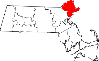
This list is of that portion of the National Register of Historic Places (NRHP) designated in Essex County, Massachusetts. The locations of these properties and districts for which the latitude and longitude coordinates are included below, may be seen in a map.

<span class="mw-page-title-main">National Register of Historic Places listings in Plymouth County, Massachusetts</span>

This is a list of the National Register of Historic Places listings in Plymouth County, Massachusetts.

<span class="mw-page-title-main">National Register of Historic Places listings in Dukes County, Massachusetts</span>

This is a list of the National Register of Historic Places listings in Dukes County, Massachusetts.

<span class="mw-page-title-main">National Register of Historic Places listings in Worcester County, Massachusetts</span>

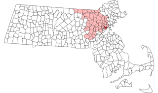
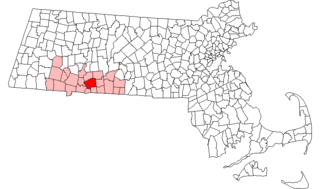
This is a list of the National Register of Historic Places (NRHP) designated in Worcester County, Massachusetts. The locations of NRHP properties and districts for which the latitude and longitude coordinates are included below, may be seen in a map.

<span class="mw-page-title-main">National Register of Historic Places listings in Cambridge, Massachusetts</span>

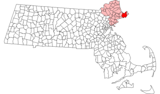
This is a list of sites listed on the National Register of Historic Places in Cambridge, Massachusetts. This is intended to be a complete list of the properties and districts on the National Register of Historic Places in Cambridge, Massachusetts, United States. Latitude and longitude coordinates are provided for many National Register properties and districts; these locations may be seen together in an online map.

<span class="mw-page-title-main">National Register of Historic Places listings in Somerville, Massachusetts</span>

This is a list of properties and historic districts in Somerville, Massachusetts, that have been listed on the National Register of Historic Places.

This is a list of properties and historic districts in Reading, Massachusetts, copied from the National Register of Historic Places. These are in Middlesex County, Massachusetts.

<span class="mw-page-title-main">National Register of Historic Places listings in Stoneham, Massachusetts</span>

This is a list of properties and historic districts in Stoneham, Massachusetts, that are listed on the National Register of Historic Places.

This is a list of properties and historic districts in Wakefield, Massachusetts, that are listed on the National Register of Historic Places.

This is a list of properties and historic districts in Waltham, Massachusetts, that are listed on the National Register of Historic Places.

<span class="mw-page-title-main">National Register of Historic Places listings in Winchester, Massachusetts</span>

This is a list of properties and historic districts in Winchester, Massachusetts, that are listed on the National Register of Historic Places.

This is a list of properties and historic districts listed on the National Register of Historic Places in Sherborn, Massachusetts.

This is a list of properties and historic districts in Milton, Massachusetts, that are listed on the National Register of Historic Places.

<span class="mw-page-title-main">National Register of Historic Places listings in Gloucester, Massachusetts</span>

This is a list of the National Register of Historic Places listings in Gloucester, Massachusetts.

<span class="mw-page-title-main">National Register of Historic Places listings in Ipswich, Massachusetts</span>

This is a list of the National Register of Historic Places listings in Ipswich, Massachusetts.

<span class="mw-page-title-main">National Register of Historic Places listings in Springfield, Massachusetts</span>

This is a list of the National Register of Historic Places listings in Springfield, Massachusetts.

There are 98 properties and historic districts on the National Register of Historic Places in Worcester, Massachusetts, east of I-190 and the north-south section of I-290, which are listed below. Two listings overlap into other parts of Worcester: one of the 1767 Milestones is located in northwestern Worcester, and the Blackstone Canal Historic District traverses all three sections of the city.

There are 112 properties and historic districts on the National Register of Historic Places in Worcester, Massachusetts, west of I-190 and the north–south section of I-290 and north of Massachusetts Route 122, which are listed here. Two listings overlap into other parts of Worcester: one of the 1767 Milestones is located in eastern Worcester, and the Blackstone Canal Historic District traverses all three sections of the city.

There are 291 properties and historic districts on the National Register of Historic Places in Worcester, Massachusetts. Of these, 81 are west of I-190 and the north-south section of I-290 and south of Massachusetts Route 122, and are listed below. One listing, the Blackstone Canal Historic District, overlaps into other parts of the city. Another listing has been removed.

References

  1. The latitude and longitude information provided in this table was derived originally from the National Register Information System, which has been found to be fairly accurate for about 99% of listings. Some locations in this table may have been corrected to current GPS standards.
  2. National Park Service, United States Department of the Interior, "National Register of Historic Places: Weekly List Actions", retrieved February 2, 2024.
  3. 1 2 Numbers represent an alphabetical ordering by significant words. Various colorings, defined here, differentiate National Historic Landmarks and historic districts from other NRHP buildings, structures, sites or objects.
  4. The eight-digit number below each date is the number assigned to each location in the National Register Information System database, which can be viewed by clicking the number.
  5. "MACRIS record for E. Albee House". Commonwealth of Massachusetts. Retrieved 2013-03-06.
  6. MACRIS record for Farnum Block
  7. "MACRIS record for J. Kensley House". Commonwealth of Massachusetts. Retrieved 2013-03-06.
  8. "Waucantuck Mills". Digital Commonwealth. Retrieved 2023-01-05.