National Register of Historic Places listings in southwestern Worcester, Massachusetts

Last updated

There are 291 properties and historic districts on the National Register of Historic Places in Worcester, Massachusetts. Of these, 81 are west of I-190 and the north-south section of I-290 and south of Massachusetts Route 122, and are listed below. One listing, the Blackstone Canal Historic District, overlaps into other parts of the city. Another listing has been removed.

Contents

Map all coordinates using: OpenStreetMap

The locations of National Register properties and districts (at least for all showing latitude and longitude coordinates below) may be seen in an online map by clicking on "Map of all coordinates". [1]


    This National Park Service list is complete through NPS recent listings posted January 5, 2024. [2]

Current listings

[3] Name on the RegisterImageDate listed [4] LocationDescription
1 Adriatic Mills
Adriatic Mills AdriaticMills.jpg
Adriatic Mills
March 5, 1980
(#80000483)
3-35 Armory St.
42°14′48″N71°48′49″W / 42.2467°N 71.8136°W / 42.2467; -71.8136 (Adriatic Mills)
Demolished.
2 Catherine Ahern Three-Decker
Catherine Ahern Three-Decker Catherine Ahern 3 Decker Worcester MA.jpg
Catherine Ahern Three-Decker
February 9, 1990
(#89002392)
215 Cambridge St.
42°14′37″N71°49′20″W / 42.2436°N 71.8222°W / 42.2436; -71.8222 (Catherine Ahern Three-Decker)
3 Ashworth and Jones Factory
Ashworth and Jones Factory Ashworth-Jones Mill.jpg
Ashworth and Jones Factory
March 5, 1980
(#80000489)
1511 Main St.
42°14′23″N71°51′41″W / 42.2397°N 71.8614°W / 42.2397; -71.8614 (Ashworth and Jones Factory)
4 Aurora Hotel
Aurora Hotel Aurora Hotel, Worcester MA.jpg
Aurora Hotel
April 28, 1988
(#88000429)
652-660 Main St.
42°15′34″N71°48′20″W / 42.259499°N 71.805689°W / 42.259499; -71.805689 (Aurora Hotel)
5 Marion Battelle Three-Decker
Marion Battelle Three-Decker WorcesterMA MarionBattelleThreeDecker.jpg
Marion Battelle Three-Decker
February 9, 1990
(#89002429)
13 Preston St.
42°15′31″N71°48′41″W / 42.2586°N 71.8114°W / 42.2586; -71.8114 (Marion Battelle Three-Decker)
6 Beacon Street Firehouse
Beacon Street Firehouse Beacon St Firehouse Worcester MA.jpg
Beacon Street Firehouse
March 5, 1980
(#80000538)
108 Beacon St.
42°15′16″N71°48′34″W / 42.2544°N 71.8094°W / 42.2544; -71.8094 (Beacon Street Firehouse)
7 Beaver Street Historic District
Beaver Street Historic District 35 Beaver St, Worcester MA.jpg
Beaver Street Historic District
February 9, 1990
(#89002377)
31-39 Beaver St.
42°14′58″N71°49′38″W / 42.2494°N 71.8272°W / 42.2494; -71.8272 (Beaver Street Historic District)
8 Blackstone Canal Historic District
Blackstone Canal Historic District WorcesterMA BlackstoneCanal.jpg
Blackstone Canal Historic District
August 15, 1995
(#95001004)
Sites along the historic route of the Blackstone Canal in Massachusetts
42°08′39″N71°40′36″W / 42.1442°N 71.6767°W / 42.1442; -71.6767 (Blackstone Canal Historic District)
Listing extends into other parts of Worcester, as well as Sutton, Grafton, Millbury, Northbridge, Uxbridge, Millville, Blackstone; the Rhode Island section of the canal is the subject of a separate listing (#91001536).
9 Boynton and Windsor
Boynton and Windsor Boynton and Windsor Worcester MA.jpg
Boynton and Windsor
March 5, 1980
(#80000540)
718, 720 Main St.
42°15′28″N71°48′32″W / 42.2578°N 71.8089°W / 42.2578; -71.8089 (Boynton and Windsor)
10 Brightside Apartments
Brightside Apartments Brightside Apartments.jpg
Brightside Apartments
March 5, 1980
(#80000635)
2 King St.
42°15′20″N71°48′50″W / 42.2556°N 71.8139°W / 42.2556; -71.8139 (Brightside Apartments)
11 Cambridge Street Firehouse
Cambridge Street Firehouse Cambridge Street Firehouse Worcester.jpg
Cambridge Street Firehouse
March 5, 1980
(#80000487)
534 Cambridge St.
42°14′38″N71°48′34″W / 42.2439°N 71.8094°W / 42.2439; -71.8094 (Cambridge Street Firehouse)
12 Cambridge Street School
Cambridge Street School Cambridge St. School.jpg
Cambridge Street School
March 5, 1980
(#80000484)
510 Cambridge St.
42°14′37″N71°48′38″W / 42.2436°N 71.8106°W / 42.2436; -71.8106 (Cambridge Street School)
13 Castle Street Row
Castle Street Row Castle Row Worcester MA.jpg
Castle Street Row
March 5, 1980
(#80000625)
4-18 Castle St.; 20-24 Castle St.
42°15′24″N71°48′45″W / 42.2567°N 71.8125°W / 42.2567; -71.8125 (Castle Street Row)
14 Clark University
Clark University JonasClarkBuilding.JPG
Clark University
March 5, 1980
(#80000547)
Clark University campus
42°15′03″N71°49′23″W / 42.2508°N 71.8231°W / 42.2508; -71.8231 (Clark University)
This listing includes the historic core buildings of Clark, bounded by Maywood, Woodland, and Main Streets.
15 Corner Lunch
Corner Lunch Corner lunch.jpg
Corner Lunch
November 15, 2000
(#00001286)
133 Lamartine St.
42°15′10″N71°48′20″W / 42.2528°N 71.8056°W / 42.2528; -71.8056 (Corner Lunch)
16 Thomas Crabtree Three-Decker
Thomas Crabtree Three-Decker WorcesterMA ThomasCrabtreeThreeDecker.jpg
Thomas Crabtree Three-Decker
February 9, 1990
(#89002383)
22 Haynes St.
42°14′41″N71°49′46″W / 42.2447°N 71.8294°W / 42.2447; -71.8294 (Thomas Crabtree Three-Decker)
17 Elias Crawford House
Elias Crawford House Elias Crawford House.JPG
Elias Crawford House
March 5, 1980
(#80000552)
3 Norwood St.
42°15′10″N71°49′09″W / 42.2528°N 71.8192°W / 42.2528; -71.8192 (Elias Crawford House)
18 Crystal Street Historic District
Crystal Street Historic District 34 Crystal St, Worcester MA.jpg
Crystal Street Historic District
February 9, 1990
(#89002379)
30-34 Crystal St.
42°14′47″N71°49′24″W / 42.2464°N 71.8233°W / 42.2464; -71.8233 (Crystal Street Historic District)
19 Dale and Ethan Allen Streets Historic District
Dale and Ethan Allen Streets Historic District WorcesterMA EthanAllenStreet1.jpg
Dale and Ethan Allen Streets Historic District
December 2, 2019
(#100004700)
18, 31-33, 21-23 & 11-15 Dale St./1 Allendale St., 22, 26, 25-27,15 &17 Ethan Allen St.
42°14′54″N71°49′14″W / 42.2483°N 71.8206°W / 42.2483; -71.8206 (Dale and Ethan Allen Streets Historic District)
20 Wesley Davis Three-Decker
Wesley Davis Three-Decker 7 Albert St Worcester MA.jpg
Wesley Davis Three-Decker
February 9, 1990
(#89002386)
7 Albert St.
42°14′54″N71°49′14″W / 42.2483°N 71.8206°W / 42.2483; -71.8206 (Wesley Davis Three-Decker)
21 Dowley-Taylor House
Dowley-Taylor House Dowley-Taylor House Worcester MA.jpg
Dowley-Taylor House
March 5, 1980
(#80000627)
770 Main St.
42°15′24″N71°48′40″W / 42.2567°N 71.8111°W / 42.2567; -71.8111 (Dowley-Taylor House)
22 Downing Street School
Downing Street School TrainaCenter.JPG
Downing Street School
March 5, 1980
(#80000621)
92 Downing St.
42°15′14″N71°49′29″W / 42.253895°N 71.824828°W / 42.253895; -71.824828 (Downing Street School)
23 Emmanuel Baptist
Emmanuel Baptist Emmanel Baptist Church Worcester MA.jpg
Emmanuel Baptist
March 5, 1980
(#80000536)
717 Main St.
42°15′27″N71°48′29″W / 42.2575°N 71.8081°W / 42.2575; -71.8081 (Emmanuel Baptist)
24 Fairlawn
Fairlawn Fairlawn, Worcester MA.jpg
Fairlawn
March 5, 1980
(#80000594)
189 May St.
42°15′37″N71°50′10″W / 42.2603°N 71.8361°W / 42.2603; -71.8361 (Fairlawn)
25 C.H. Fitch House
C.H. Fitch House C.H. Fitch House Worcester MA.jpg
C.H. Fitch House
March 5, 1980
(#80000631)
15 Oread St.
42°15′20″N71°48′41″W / 42.2556°N 71.8114°W / 42.2556; -71.8114 (C.H. Fitch House)
26 Levi Flagg Three-Decker
Levi Flagg Three-Decker 79 Florence St, Worcester MA.jpg
Levi Flagg Three-Decker
February 9, 1990
(#89002362)
79 Florence St.
42°15′02″N71°49′35″W / 42.2506°N 71.8264°W / 42.2506; -71.8264 (Levi Flagg Three-Decker)
27 Freeland Street School
Freeland Street School Freeland Street School, Worcester MA.jpg
Freeland Street School
March 5, 1980
(#80000482)
12 Freeland St.
42°14′49″N71°49′33″W / 42.2469°N 71.8258°W / 42.2469; -71.8258 (Freeland Street School)
28 Hadley Furniture Company Building
Hadley Furniture Company Building Hadley Furniture Bldg.jpg
Hadley Furniture Company Building
March 1, 2011
(#11000068)
651-659 Main St.
42°15′34″N71°48′19″W / 42.2594°N 71.8053°W / 42.2594; -71.8053 (Hadley Furniture Company Building)
29 Charles A. Hall Three-Decker
Charles A. Hall Three-Decker 68 Mason St, Worcester MA.jpg
Charles A. Hall Three-Decker
February 9, 1990
(#89002423)
68 Mason St.
42°15′26″N71°49′16″W / 42.2572°N 71.8211°W / 42.2572; -71.8211 (Charles A. Hall Three-Decker)
30 Hammond Organ Factory
Hammond Organ Factory Hammond Organ Factory.JPG
Hammond Organ Factory
March 5, 1980
(#80000632)
9 May St.
42°15′18″N71°48′57″W / 42.255°N 71.8158°W / 42.255; -71.8158 (Hammond Organ Factory)
31 Samuel Hirst Three-Decker
Samuel Hirst Three-Decker WorcesterMA SamuelHirstThreeDecker.jpg
Samuel Hirst Three-Decker
February 9, 1990
(#89002420)
90 Lovell St.
42°15′10″N71°49′58″W / 42.2528°N 71.8328°W / 42.2528; -71.8328 (Samuel Hirst Three-Decker)
32 Holy Name of Jesus Complex
Holy Name of Jesus Complex Holy Name of Jesus Worcester.jpg
Holy Name of Jesus Complex
June 9, 1988
(#88000721)
Illinois St.
42°14′45″N71°49′16″W / 42.2458°N 71.8211°W / 42.2458; -71.8211 (Holy Name of Jesus Complex)
33 Hope Cemetery
Hope Cemetery Hope Cemetery Worcester MA.jpg
Hope Cemetery
December 22, 1997
(#97001560)
119 Webster St.
42°14′10″N71°49′34″W / 42.2361°N 71.8261°W / 42.2361; -71.8261 (Hope Cemetery)
34 Daniel Hunt Three-Decker
Daniel Hunt Three-Decker 9WymanWorcesterFront.JPG
Daniel Hunt Three-Decker
February 9, 1990
(#89002451)
9 Wyman St.
42°15′02″N71°49′14″W / 42.2506°N 71.8206°W / 42.2506; -71.8206 (Daniel Hunt Three-Decker)
35 IOOF Building
IOOF Building IOOF Building, Worcester MA.jpg
IOOF Building
March 5, 1980
(#80000535)
674 Main St.
42°15′31″N71°48′26″W / 42.2586°N 71.8072°W / 42.2586; -71.8072 (IOOF Building)
36 Harry B. Ingraham Three-Decker
Harry B. Ingraham Three-Decker 19 Freeland St Worcester MA.jpg
Harry B. Ingraham Three-Decker
February 9, 1990
(#89002363)
19 Freeland St.
42°14′48″N71°49′30″W / 42.2467°N 71.825°W / 42.2467; -71.825 (Harry B. Ingraham Three-Decker)
37 Junction Shop and Hermon Street District
Junction Shop and Hermon Street District Jackson Street Worcester.JPG
Junction Shop and Hermon Street District
March 5, 1980
(#80000533)
Properties on Jackson, Hermon, and Beacon Sts.
42°15′22″N71°48′28″W / 42.2561°N 71.8078°W / 42.2561; -71.8078 (Junction Shop and Hermon Street District)
Misspelled "Herman" in the National Register listing.
38 Lucius Knowles House
Lucius Knowles House Knowles House 838 Main Street.jpg
Lucius Knowles House
March 5, 1980
(#80000628)
838 Main St.
42°15′18″N71°48′53″W / 42.255°N 71.8147°W / 42.255; -71.8147 (Lucius Knowles House)
39 John Legg House
John Legg House JohnLeggHouse.jpg
John Legg House
March 5, 1980
(#80000623)
5 Claremont St.
42°15′14″N71°49′03″W / 42.2539°N 71.8175°W / 42.2539; -71.8175 (John Legg House)
40 Thomas Lumb Three-Decker
Thomas Lumb Three-Decker WorcesterMA ThomasLumbThreeDecker 80DeweyStreet.jpg
Thomas Lumb Three-Decker
February 9, 1990
(#89002403)
80 Dewey St.
42°15′36″N71°49′15″W / 42.26°N 71.8208°W / 42.26; -71.8208 (Thomas Lumb Three-Decker)
41 Thomas Lumb Three-Decker
Thomas Lumb Three-Decker 44 Winfield St, Worcester MA.jpg
Thomas Lumb Three-Decker
February 9, 1990
(#89002448)
44 Winfield St.
42°15′36″N71°49′17″W / 42.26°N 71.8214°W / 42.26; -71.8214 (Thomas Lumb Three-Decker)
42 Main Street and Murray Avenue Historic District
Main Street and Murray Avenue Historic District WorcesterMA MurrayMainHD.jpg
Main Street and Murray Avenue Historic District
December 1, 2022
(#100008421)
718 and 720 Main St., 87 and 91 Murray Ave.
42°15′30″N71°48′30″W / 42.2582°N 71.8083°W / 42.2582; -71.8083 (Main Street and Murray Avenue Historic District)
43 John Mark Three-Decker
John Mark Three-Decker John Mark 3 Decker.jpg
John Mark Three-Decker
February 9, 1990
(#89002435)
24 Sigel St.
42°15′06″N71°48′10″W / 42.2517°N 71.8028°W / 42.2517; -71.8028 (John Mark Three-Decker)
44 Masonic Temple
Masonic Temple Masonic Temple, Worcester MA.jpg
Masonic Temple
March 5, 1980
(#80000537)
Ionic Ave.
42°15′29″N71°48′21″W / 42.2581°N 71.8058°W / 42.2581; -71.8058 (Masonic Temple)
45 May Street Historic District
May Street Historic District WorcesterMA MayStreetHD Even.jpg
May Street Historic District
March 5, 1980
(#80000622)
29-46 May St.
42°15′22″N71°49′11″W / 42.2561°N 71.8196°W / 42.2561; -71.8196 (May Street Historic District)
46 Elizabeth McCafferty Three-Decker
Elizabeth McCafferty Three-Decker ElizabethMcCaffertyThreeDecker.jpg
Elizabeth McCafferty Three-Decker
February 9, 1990
(#89002395)
45 Canterbury St.
42°14′57″N71°48′49″W / 42.2492°N 71.8136°W / 42.2492; -71.8136 (Elizabeth McCafferty Three-Decker)
Building demolished. Now a cement block auto body shop on site.
47 Andrew McCarron Three-Decker
Andrew McCarron Three-Decker Andrew McCarron 3 Decker Worcester MA.jpg
Andrew McCarron Three-Decker
February 9, 1990
(#89002442)
3 Pitt St.
42°14′41″N71°48′23″W / 42.2447°N 71.8064°W / 42.2447; -71.8064 (Andrew McCarron Three-Decker)
48 John B. McDermott Three-Decker
John B. McDermott Three-Decker WorcesterMA JohnBMcDermottThreeDecker.jpg
John B. McDermott Three-Decker
February 9, 1990
(#89002366)
21 Freeland St.
42°14′47″N71°49′30″W / 42.2464°N 71.825°W / 42.2464; -71.825 (John B. McDermott Three-Decker)
49 Miss Worcester Diner
Miss Worcester Diner Miss worcester.jpg
Miss Worcester Diner
November 21, 2003
(#03001178)
302 Southbridge St.
42°15′14″N71°48′24″W / 42.2539°N 71.8067°W / 42.2539; -71.8067 (Miss Worcester Diner)
50 S. D. Newton House
S. D. Newton House S. D. Newton House.JPG
S. D. Newton House
March 5, 1980
(#09000142)
8 Sycamore St.
42°16′30″N71°48′21″W / 42.2749°N 71.8059°W / 42.2749; -71.8059 (S. D. Newton House)
51 Norcross Brothers Houses
Norcross Brothers Houses 18ClaremontWorcester.JPG
Norcross Brothers Houses
March 5, 1980
(#80000624)
16, 18 Claremont St.
42°15′18″N71°49′07″W / 42.255°N 71.8186°W / 42.255; -71.8186 (Norcross Brothers Houses)
52 James O'Connor Three-Decker
James O'Connor Three-Decker James O'Connor 3 Decker.jpg
James O'Connor Three-Decker
February 9, 1990
(#89002419)
23 Endicott St.
42°15′03″N71°48′14″W / 42.2508°N 71.8039°W / 42.2508; -71.8039 (James O'Connor Three-Decker)
53 James O'Connor-John Trybowski Three-Decker
James O'Connor-John Trybowski Three-Decker WorcesterMA OConnorTrybowskiThreeDecker.jpg
James O'Connor-John Trybowski Three-Decker
February 9, 1990
(#89002393)
21 Canton St.
42°14′56″N71°48′10″W / 42.2489°N 71.8028°W / 42.2489; -71.8028 (James O'Connor-John Trybowski Three-Decker)
54 Pilgrim Congregational Church
Pilgrim Congregational Church Pilgrim cong church 909 Main.jpg
Pilgrim Congregational Church
March 5, 1980
(#80000551)
909 Main St.
42°15′07″N71°49′08″W / 42.2519°N 71.8189°W / 42.2519; -71.8189 (Pilgrim Congregational Church)
55 Frank Reed Three-Decker
Frank Reed Three-Decker 915 Main St Worc.jpg
Frank Reed Three-Decker
February 9, 1990
(#89002422)
913, 915 Main St.
42°15′06″N71°49′10″W / 42.2517°N 71.8194°W / 42.2517; -71.8194 (Frank Reed Three-Decker)
56 Albert Ridyard Three-Decker
Albert Ridyard Three-Decker 5 Mount Pleasant St, Worcester MA.jpg
Albert Ridyard Three-Decker
February 9, 1990
(#89002431)
5 Mount Pleasant St.
42°15′14″N71°48′46″W / 42.2539°N 71.8128°W / 42.2539; -71.8128 (Albert Ridyard Three-Decker)
57 St. Marks
St. Marks St Marks Episcopal Church, Worcester MA.jpg
St. Marks
March 5, 1980
(#80000481)
Freeland St.
42°14′52″N71°49′34″W / 42.2478°N 71.8261°W / 42.2478; -71.8261 (St. Marks)
58 St. Matthews
St. Matthews Saint Matthews Worcester.jpg
St. Matthews
March 5, 1980
(#80000485)
693 Southbridge St.
42°14′35″N71°48′44″W / 42.2431°N 71.8122°W / 42.2431; -71.8122 (St. Matthews)
59 St. Peters Catholic Church
St. Peters Catholic Church Saint Peters Church Worcester.jpg
St. Peters Catholic Church
March 5, 1980
(#80000548)
935 Main St.
42°14′35″N71°48′44″W / 42.2431°N 71.8122°W / 42.2431; -71.8122 (St. Peters Catholic Church)
60 James Schofield House
James Schofield House 3 Mount Pleasant St, Worcester MA.jpg
James Schofield House
March 5, 1980
(#80000634)
3 Mt. Pleasant St.
42°15′14″N71°48′45″W / 42.2539°N 71.8125°W / 42.2539; -71.8125 (James Schofield House)
61 Moody Shattuck House
Moody Shattuck House Moody Shattuck House Worcester MA.jpg
Moody Shattuck House
March 5, 1980
(#80000626)
768 Main St.
42°15′25″N71°48′38″W / 42.2569°N 71.8106°W / 42.2569; -71.8106 (Moody Shattuck House)
62 Clara Simpson Three-Decker
Clara Simpson Three-Decker WorcesterMA ClaraSimpsonThreeDecker.jpg
Clara Simpson Three-Decker
February 9, 1990
(#89002440)
69 Piedmont St.
42°15′36″N71°48′46″W / 42.26°N 71.8128°W / 42.26; -71.8128 (Clara Simpson Three-Decker)
63 Ellen M. Smith Three-Decker
Ellen M. Smith Three-Decker EllenMSmithThreeDecker.jpg
Ellen M. Smith Three-Decker
February 9, 1990
(#89002409)
22 Kilby St.
42°15′02″N71°48′58″W / 42.2506°N 71.8161°W / 42.2506; -71.8161 (Ellen M. Smith Three-Decker)
House demolished and replaced with a modern duplex at site.
64 Elliot Smith House
Elliot Smith House ElliotSmithHouse.jpg
Elliot Smith House
March 5, 1980
(#80000629)
839 Main St.
42°15′15″N71°48′53″W / 42.2542°N 71.8147°W / 42.2542; -71.8147 (Elliot Smith House)
Building demolished. [5] Empty lot.
65 South Unitarian
South Unitarian 888 Main Street Worcester.jpg
South Unitarian
March 5, 1980
(#80000550)
888 Main St.
42°15′11″N71°49′05″W / 42.2531°N 71.8181°W / 42.2531; -71.8181 (South Unitarian)
66 South Worcester Branch Library
South Worcester Branch Library South Worcester Branch Library.jpg
South Worcester Branch Library
March 5, 1980
(#80000486)
705 Southbridge St.
42°14′33″N71°48′45″W / 42.2425°N 71.8125°W / 42.2425; -71.8125 (South Worcester Branch Library)
67 Southbridge-Sargent Manufacturing District
Southbridge-Sargent Manufacturing District Southbridge-Sargent Mfg District Worcester MA.jpg
Southbridge-Sargent Manufacturing District
March 5, 1980
(#80000534)
Southbridge, Sargent, and Gold Sts.
42°15′15″N71°48′23″W / 42.2542°N 71.8064°W / 42.2542; -71.8064 (Southbridge-Sargent Manufacturing District)
68 Edward Stark House
Edward Stark House Edwin Stark House Worcester MA.jpg
Edward Stark House
March 5, 1980
(#80000633)
21 Oread St.
42°15′18″N71°48′39″W / 42.255°N 71.8108°W / 42.255; -71.8108 (Edward Stark House)
70 Daniel Stevens House
Daniel Stevens House Daniel Stevens House.JPG
Daniel Stevens House
March 5, 1980
(#80000532)
7 Sycamore St.
42°15′28″N71°48′25″W / 42.2578°N 71.8069°W / 42.2578; -71.8069 (Daniel Stevens House)
71 Edward Stone Three-Decker
Edward Stone Three-Decker 8 Wyman St, Worcester MA.jpg
Edward Stone Three-Decker
February 9, 1990
(#89002450)
8 Wyman St.
42°15′01″N71°49′14″W / 42.2503°N 71.8206°W / 42.2503; -71.8206 (Edward Stone Three-Decker)
72 John Troupes Three-Decker
John Troupes Three-Decker 25 Canton Street, Worcester MA.jpg
John Troupes Three-Decker
February 9, 1990
(#89002394)
25 Canton St.
42°14′55″N71°48′12″W / 42.2486°N 71.8033°W / 42.2486; -71.8033 (John Troupes Three-Decker)
73 The Vendome and the St. Ives
The Vendome and the St. Ives Vendome and St. Ives Worcester MA.jpg
The Vendome and the St. Ives
February 9, 1990
(#89002331)
17-19 and 21-23 Chandler St.
42°15′33″N71°48′19″W / 42.2592°N 71.8053°W / 42.2592; -71.8053 (The Vendome and the St. Ives)
74 Webster Street Firehouse
Webster Street Firehouse Webster St. Firehouse.jpg
Webster Street Firehouse
March 5, 1980
(#80000480)
40 Webster St.
42°14′38″N71°50′00″W / 42.2439°N 71.8333°W / 42.2439; -71.8333 (Webster Street Firehouse)
75 Wellington Street Apartment House District
Wellington Street Apartment House District WorcesterMA WellingtonStreetApartments 2.jpg
Wellington Street Apartment House District
March 5, 1980
(#80000539)
Properties along Jacques Ave. and Wellington and Irving Sts.
42°15′35″N71°48′34″W / 42.2597°N 71.8094°W / 42.2597; -71.8094 (Wellington Street Apartment House District)
76 Franklin Wesson House
Franklin Wesson House FranklinWessonHouse.JPG
Franklin Wesson House
March 5, 1980
(#80000603)
8 Claremont St.
42°15′16″N71°49′02″W / 42.2544°N 71.8172°W / 42.2544; -71.8172 (Franklin Wesson House)
77 Whittall Mills
Whittall Mills Whittall Mills Complex.jpg
Whittall Mills
March 5, 1980
(#80000490)
Properties off Brussels St.
42°14′27″N71°48′54″W / 42.2408°N 71.815°W / 42.2408; -71.815 (Whittall Mills)
78 Woodland Street Firehouse
Woodland Street Firehouse Woodland St Firehouse.jpg
Woodland Street Firehouse
March 5, 1980
(#80000630)
36 Woodland St.
42°15′26″N71°49′05″W / 42.2572°N 71.818°W / 42.2572; -71.818 (Woodland Street Firehouse)
79 Woodland Street Historic District
Woodland Street Historic District HarringtonHouseClarkUniversity.JPG
Woodland Street Historic District
March 5, 1980
(#80000549)
Properties along Hawthorne, Loudon, Norwood, and Woodland Sts.
42°15′11″N71°49′15″W / 42.2531°N 71.8208°W / 42.2531; -71.8208 (Woodland Street Historic District)
80 Worcester Bleach and Dye Works
Worcester Bleach and Dye Works Worcester Bleach and Dye Works Worcester MA.jpg
Worcester Bleach and Dye Works
November 8, 2000
(#00001343)
60 Fremont St.
42°14′29″N71°49′03″W / 42.2414°N 71.8175°W / 42.2414; -71.8175 (Worcester Bleach and Dye Works)
81 Worcester Corset Company Factory
Worcester Corset Company Factory Worcester Corset Factory.jpg
Worcester Corset Company Factory
October 4, 1984
(#84000097)
30 Wyman St.
42°14′56″N71°49′10″W / 42.2489°N 71.8194°W / 42.2489; -71.8194 (Worcester Corset Company Factory)
82 Worcester Market Building
Worcester Market Building Worcester Market Bldg.jpg
Worcester Market Building
March 5, 1980
(#80000612)
831 Main St.
42°15′34″N71°48′18″W / 42.2594°N 71.805°W / 42.2594; -71.805 (Worcester Market Building)

Former listings

[3] Name on the RegisterImageDate listedDate removedLocationCity or townDescription
1 Stearns Tavern
Stearns Tavern Stearns Tavern Worcester MA.jpg
Stearns Tavern
March 5, 1980
(#80000479)
December 26, 2023651 Park Ave.
42°14′44″N71°50′08″W / 42.2456°N 71.8356°W / 42.2456; -71.8356 (Stearns Tavern)
Worcester, Massachusetts


See also

Related Research Articles

<span class="mw-page-title-main">National Register of Historic Places listings in Hampshire County, Massachusetts</span>

This is a list of properties on the National Register of Historic Places in Hampshire County, Massachusetts.

<span class="mw-page-title-main">National Register of Historic Places listings in Nantucket County, Massachusetts</span>

This is a list of the National Register of Historic Places listings in Nantucket County, Massachusetts.

<span class="mw-page-title-main">National Register of Historic Places listings in Worcester County, Massachusetts</span>

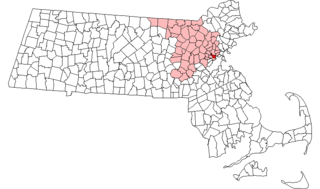
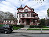
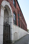
This is a list of the National Register of Historic Places (NRHP) designated in Worcester County, Massachusetts. The locations of NRHP properties and districts for which the latitude and longitude coordinates are included below, may be seen in a map.

<span class="mw-page-title-main">National Register of Historic Places listings in Somerville, Massachusetts</span>

This is a list of properties and historic districts in Somerville, Massachusetts, that have been listed on the National Register of Historic Places.

This is a list of properties and historic districts in Reading, Massachusetts, copied from the National Register of Historic Places. These are in Middlesex County, Massachusetts.

<span class="mw-page-title-main">National Register of Historic Places listings in Stoneham, Massachusetts</span>

This is a list of properties and historic districts in Stoneham, Massachusetts, that are listed on the National Register of Historic Places.

This is a list of properties and historic districts in Wakefield, Massachusetts, that are listed on the National Register of Historic Places.

This is a list of properties and historic districts in Waltham, Massachusetts, that are listed on the National Register of Historic Places.

<span class="mw-page-title-main">National Register of Historic Places listings in Winchester, Massachusetts</span>

This is a list of properties and historic districts in Winchester, Massachusetts, that are listed on the National Register of Historic Places.

This is a list of properties and historic districts listed on the National Register of Historic Places in Sherborn, Massachusetts.

This is a list of properties and historic districts in Milton, Massachusetts, that are listed on the National Register of Historic Places.

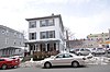
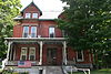
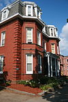
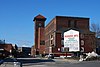
Uxbridge, Massachusetts has 53 sites on the National Register of Historic Places.

<span class="mw-page-title-main">National Register of Historic Places listings in Worcester County, Maryland</span>

This is a list of the National Register of Historic Places listings in Worcester County, Maryland.

<span class="mw-page-title-main">National Register of Historic Places listings in Andover, Massachusetts</span>

This is a list of the National Register of Historic Places listings in Andover, Massachusetts.

<span class="mw-page-title-main">National Register of Historic Places listings in Lawrence, Massachusetts</span>

The following properties are listed on the National Register of Historic Places in Lawrence, Massachusetts.

<span class="mw-page-title-main">National Register of Historic Places listings in Salem, Massachusetts</span>

This is a list of the National Register of Historic Places listings in Salem, Massachusetts.

<span class="mw-page-title-main">National Register of Historic Places listings in Ipswich, Massachusetts</span>

This is a list of the National Register of Historic Places listings in Ipswich, Massachusetts.

This is a list of the National Register of Historic Places listings in Cape Cod National Seashore.

There are 98 properties and historic districts on the National Register of Historic Places in Worcester, Massachusetts, east of I-190 and the north-south section of I-290, which are listed below. Two listings overlap into other parts of Worcester: one of the 1767 Milestones is located in northwestern Worcester, and the Blackstone Canal Historic District traverses all three sections of the city.

There are 112 properties and historic districts on the National Register of Historic Places in Worcester, Massachusetts, west of I-190 and the north–south section of I-290 and north of Massachusetts Route 122, which are listed here. Two listings overlap into other parts of Worcester: one of the 1767 Milestones is located in eastern Worcester, and the Blackstone Canal Historic District traverses all three sections of the city.

References

  1. The latitude and longitude information provided in this table was derived originally from the National Register Information System, which has been found to be fairly accurate for about 99% of listings. Some locations in this table may have been corrected to current GPS standards.
  2. National Park Service, United States Department of the Interior, "National Register of Historic Places: Weekly List Actions", retrieved January 5, 2024.
  3. 1 2 Numbers represent an alphabetical ordering by significant words. Various colorings, defined here, differentiate National Historic Landmarks and historic districts from other NRHP buildings, structures, sites or objects.
  4. The eight-digit number below each date is the number assigned to each location in the National Register Information System database, which can be viewed by clicking the number.
  5. "MACRIS Inventory record for Elliot Smith House". Commonwealth of Massachusetts. Retrieved 2013-03-12.