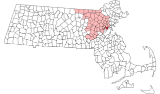
National Register of Historic Places listings in northern Worcester County, Massachusetts
Last updated
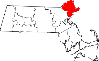
Location of Worcester County in Massachusetts
This is a list of the National Register of Historic Places (NRHP) designated in northern Worcester County, Massachusetts. It includes listings from all Worcester County communities through which Massachusetts Route 2 passes, and those that lie to their north. This includes the communities of Ashburnham, Ashby, Athol, Fitchburg, Gardner, Harvard, Lancaster, Leominster, Lunenburg, Phillipston, Royalston, Templeton, Westminster, and Winchendon. National Register listings for other communities in the county are listed elsewhere.
List of Registered Historic Places in Bristol County, Massachusetts:
This list is of that portion of the National Register of Historic Places (NRHP) designated in Essex County, Massachusetts. The locations of these properties and districts for which the latitude and longitude coordinates are included below, may be seen in a map.
This is a list of the National Register of Historic Places listings in Hampden County, Massachusetts.
This is a list of the National Register of Historic Places listings in Suffolk County, Massachusetts.
This is a list of properties on the National Register of Historic Places in Hampshire County, Massachusetts.
This is a list of the National Register of Historic Places listings in Nantucket County, Massachusetts.
This is a list of the National Register of Historic Places listings in Dukes County, Massachusetts.
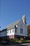
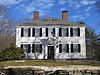
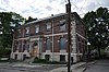
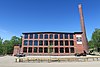
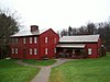
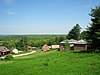
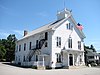
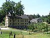
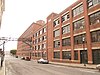
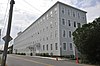
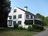
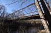
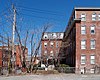
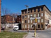
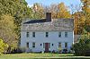
This is a list of the National Register of Historic Places (NRHP) designated in Worcester County, Massachusetts. The locations of NRHP properties and districts for which the latitude and longitude coordinates are included below, may be seen in a map.
The following properties are listed on the National Register of Historic Places in Arlington, Massachusetts. This National Park Service list is complete through NPS recent listings posted May 10, 2024.
This is a list of properties and historic districts in Somerville, Massachusetts, that have been listed on the National Register of Historic Places.
This is a list of properties and historic districts in Milton, Massachusetts, that are listed on the National Register of Historic Places.
The following properties in Fall River, Massachusetts are listed on the Registered Historic Places. This is a subset of the National Register of Historic Places listings in Bristol County, Massachusetts.
List of Registered Historic Places in Taunton, Massachusetts, which has been transferred from and is an integral part of National Register of Historic Places listings in Bristol County, Massachusetts
This is a list of the National Register of Historic Places listings in Worcester County, Maryland.
Boston, Massachusetts is home to many listings on the National Register of Historic Places. This list encompasses those locations that are located north of the Massachusetts Turnpike. See National Register of Historic Places listings in southern Boston for listings south of the Turnpike. Properties and districts located elsewhere in Suffolk County's other three municipalities are also listed separately.
Boston, Massachusetts is home to many listings on the National Register of Historic Places. This list encompasses those locations that are located south of the Massachusetts Turnpike. See National Register of Historic Places listings in northern Boston for listings north of the Turnpike. Properties and districts located elsewhere in Suffolk County's other three municipalities are also listed separately.
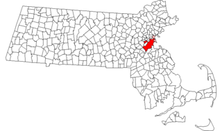
There are 98 properties and historic districts on the National Register of Historic Places in Worcester, Massachusetts, east of I-190 and the north-south section of I-290, which are listed below. Two listings overlap into other parts of Worcester: one of the 1767 Milestones is located in northwestern Worcester, and the Blackstone Canal Historic District traverses all three sections of the city.
There are 112 properties and historic districts on the National Register of Historic Places in Worcester, Massachusetts, west of I-190 and the north–south section of I-290 and north of Massachusetts Route 122, which are listed here. Two listings overlap into other parts of Worcester: one of the 1767 Milestones is located in eastern Worcester, and the Blackstone Canal Historic District traverses all three sections of the city.
There are 291 properties and historic districts on the National Register of Historic Places in Worcester, Massachusetts. Of these, 81 are west of I-190 and the north-south section of I-290 and south of Massachusetts Route 122, and are listed below. One listing, the Blackstone Canal Historic District, overlaps into other parts of the city. Another listing has been removed.
Barnstable, Massachusetts, has more than 75 entries on the National Register of Historic Places. For listings elsewhere in Barnstable County, see National Register of Historic Places listings in Barnstable County, Massachusetts.
↑ Numbers represent an alphabetical ordering by significant words. Various colorings, defined here, differentiate National Historic Landmarks and historic districts from other NRHP buildings, structures, sites or objects.
↑ The eight-digit number below each date is the number assigned to each location in the National Register Information System database, which can be viewed by clicking the number.
This page is based on this Wikipedia article Text is available under the CC BY-SA 4.0 license; additional terms may apply. Images, videos and audio are available under their respective licenses.