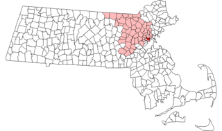
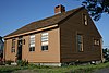
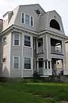
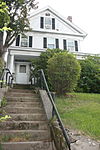
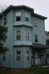
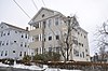
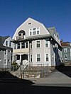
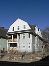
[3] Name on the Register Image Date listed [4] Location Description 1 1767 Milestones 1767 Milestones April 7, 1971 (# 71000084 Various locations between Springfield and Boston 42°16′41″N 71°47′40″W / 42.2781°N 71.7944°W / 42.2781; -71.7944 (1767 Milestones ) Milestone 47 is in eastern Worcester; Milestone 48 is in northwestern Worcester. 2 Arad Alexander House Arad Alexander House March 5, 1980 (# 80000544 53 Waverly St. 42°15′24″N 71°47′33″W / 42.2567°N 71.7925°W / 42.2567; -71.7925 (Arad Alexander House ) 3 Ludwig Anderson Three-Decker Ludwig Anderson Three-Decker February 9, 1990 (# 89002355 4 Fairbanks St. 42°14′41″N 71°47′42″W / 42.2447°N 71.795°W / 42.2447; -71.795 (Ludwig Anderson Three-Decker ) 4 Peter Baker Three-Decker Peter Baker Three-Decker February 9, 1990 (# 89002445 90 Vernon St. 42°14′54″N 71°47′42″W / 42.2483°N 71.7951°W / 42.2483; -71.7951 (Peter Baker Three-Decker ) 5 Richard Barker Octagon House Richard Barker Octagon House March 5, 1980 (# 80000592 312 Plantation St. 42°16′11″N 71°46′16″W / 42.2697°N 71.7711°W / 42.2697; -71.7711 (Richard Barker Octagon House ) 6 George Bentley House George Bentley House March 5, 1980 (# 80000560 9 Earle St. 42°16′16″N 71°47′29″W / 42.2711°N 71.7914°W / 42.2711; -71.7914 (George Bentley House ) 7 Blackstone Canal Historic District Blackstone Canal Historic District August 15, 1995 (# 95001004 Sites along the historic route of the Blackstone Canal 42°13′24″N 71°47′15″W / 42.2234°N 71.7876°W / 42.2234; -71.7876 (Blackstone Canal Historic District ) Listing extends into other parts of Worcester, as well as Sutton, Grafton, Millbury, Northbridge, Uxbridge, Millville, Blackstone; the Rhode Island section of the canal is the subject of a separate listing (#91001536). 8 Lydia Blodgett Three-Decker Lydia Blodgett Three-Decker February 9, 1990 (# 89002417 167 Eastern Ave. 42°16′29″N 71°47′18″W / 42.2747°N 71.7883°W / 42.2747; -71.7883 (Lydia Blodgett Three-Decker ) 9 Bloomingdale Firehouse Bloomingdale Firehouse March 5, 1980 (# 80000593 676 Franklin St. 42°16′02″N 71°46′27″W / 42.2672°N 71.7742°W / 42.2672; -71.7742 (Bloomingdale Firehouse ) 10 Bloomingdale School Bloomingdale School March 5, 1980 (# 80000562 327 Plantation St. 42°16′15″N 71°46′15″W / 42.2708°N 71.7709°W / 42.2708; -71.7709 (Bloomingdale School ) 11 Borden-Pond House Borden-Pond House March 5, 1980 (# 80000590 40 Laurel St. 42°16′08″N 71°47′34″W / 42.2689°N 71.7928°W / 42.2689; -71.7928 (Borden-Pond House ) 12 Eric Bostrom Three-Decker Eric Bostrom Three-Decker February 9, 1990 (# 89002414 152 Eastern Ave. 42°16′26″N 71°47′21″W / 42.2739°N 71.7892°W / 42.2739; -71.7892 (Eric Bostrom Three-Decker ) 13 Boulevard Diner Boulevard Diner November 22, 2000 (# 00001394 155 Shrewsbury St. 42°15′53″N 71°47′14″W / 42.2647°N 71.7872°W / 42.2647; -71.7872 (Boulevard Diner ) 14 Henry Bousquet Three-Decker Henry Bousquet Three-Decker February 9, 1990 (# 89002360 8-10 Fairmont Ave. 42°15′39″N 71°46′48″W / 42.2607°N 71.7801°W / 42.2607; -71.7801 (Henry Bousquet Three-Decker ) 15 Eric Carlson Three-Decker Eric Carlson Three-Decker February 9, 1990 (# 89002415 154 Eastern Ave. 42°16′27″N 71°47′20″W / 42.2742°N 71.7889°W / 42.2742; -71.7889 (Eric Carlson Three-Decker ) 16 Chadwick-Brittan House Chadwick-Brittan House March 5, 1980 (# 80000518 309 Lincoln St. 42°17′11″N 71°47′25″W / 42.2864°N 71.7903°W / 42.2864; -71.7903 (Chadwick-Brittan House ) 17 Frederick Daniels House Frederick Daniels House March 5, 1980 (# 80000526 148 Lincoln St. 42°16′43″N 71°47′39″W / 42.2786°N 71.7942°W / 42.2786; -71.7942 (Frederick Daniels House ) 18 Dartmouth Street School Dartmouth Street School March 5, 1980 (# 80000546 13 Dartmouth St. 42°15′28″N 71°46′53″W / 42.2578°N 71.7814°W / 42.2578; -71.7814 (Dartmouth Street School ) 19 Rodney Davis Three-Decker Rodney Davis Three-Decker February 9, 1990 (# 89002398 62 Catharine St. 42°16′27″N 71°47′16″W / 42.2741°N 71.7878°W / 42.2741; -71.7878 (Rodney Davis Three-Decker ) 20 Mary Dean Three-Decker Mary Dean Three-Decker February 9, 1990 (# 89002390 130 Belmont St. 42°16′19″N 71°47′29″W / 42.2719°N 71.7914°W / 42.2719; -71.7914 (Mary Dean Three-Decker ) Demolished. 21 Louis Delsignore Three-Decker Louis Delsignore Three-Decker February 9, 1990 (# 89002396 12 Imperial Rd. 42°16′18″N 71°46′37″W / 42.2716°N 71.7769°W / 42.2716; -71.7769 (Louis Delsignore Three-Decker ) 22 Philip Duke Three-Decker Philip Duke Three-Decker February 9, 1990 (# 89002425 7 Maxwell St. 42°14′25″N 71°47′59″W / 42.2403°N 71.7997°W / 42.2403; -71.7997 (Philip Duke Three-Decker ) 23 David Dworman Three-Decker David Dworman Three-Decker February 9, 1990 (# 89002430 159 Providence St. 42°14′41″N 71°47′30″W / 42.2447°N 71.7917°W / 42.2447; -71.7917 (David Dworman Three-Decker ) 24 East Worcester School-Norcross Factory East Worcester School-Norcross Factory March 5, 1980 (# 80000618 10 E. Worcester St. 42°15′45″N 71°47′26″W / 42.2625°N 71.7906°W / 42.2625; -71.7906 (East Worcester School-Norcross Factory ) 25 Elizabeth Street School Elizabeth Street School March 5, 1980 (# 80000589 31 Elizabeth St. 42°16′12″N 71°47′29″W / 42.27°N 71.7914°W / 42.27; -71.7914 (Elizabeth Street School ) 26 Knut Erikson Three-Decker Knut Erikson Three-Decker February 9, 1990 (# 89002438 19 Stanton St. 42°16′24″N 71°47′09″W / 42.2733°N 71.7858°W / 42.2733; -71.7858 (Knut Erikson Three-Decker ) 27 Euclid Avenue-Montrose Street Historic District Euclid Avenue-Montrose Street Historic District February 9, 1990 (# 89002357 Along Euclid Ave. and Montrose St., between Vernon St. and Perry Ave. 42°14′46″N 71°47′52″W / 42.2461°N 71.7978°W / 42.2461; -71.7978 (Euclid Avenue-Montrose Street Historic District ) 28 Fay Street Historic District Fay Street Historic District February 9, 1990 (# 89002372 4-6 Fay St. 42°15′25″N 71°47′16″W / 42.2569°N 71.7878°W / 42.2569; -71.7878 (Fay Street Historic District ) 29 Amos Flagg House Amos Flagg House March 5, 1980 (# 80000515 246 Burncoat St. 42°18′11″N 71°47′24″W / 42.3031°N 71.79°W / 42.3031; -71.79 (Amos Flagg House ) 30 Benjamin Flagg House Benjamin Flagg House March 5, 1980 (# 80000620 136 Plantation St. 42°15′35″N 71°46′52″W / 42.2597°N 71.7811°W / 42.2597; -71.7811 (Benjamin Flagg House ) 31 George Fontaine Three-Decker George Fontaine Three-Decker February 9, 1990 (# 89002447 141 Vernon St. 42°14′40″N 71°47′47″W / 42.2444°N 71.7964°W / 42.2444; -71.7964 (George Fontaine Three-Decker ) 32 Forest Hill Cottage Forest Hill Cottage March 5, 1980 (# 80000529 22 Windsor St. 42°16′40″N 71°47′27″W / 42.2778°N 71.7908°W / 42.2778; -71.7908 (Forest Hill Cottage ) 33 Andrew Friberg Three-Decker Andrew Friberg Three-Decker February 9, 1990 (# 89002387 26 Ames St. 42°14′33″N 71°47′43″W / 42.2425°N 71.7953°W / 42.2425; -71.7953 (Andrew Friberg Three-Decker ) 34 George Gale House George Gale House March 5, 1980 (# 80000561 15 Elizabeth St. 42°16′15″N 71°47′27″W / 42.2708°N 71.7908°W / 42.2708; -71.7908 (George Gale House ) 35 Thomas Giguere Three-Decker Thomas Giguere Three-Decker February 9, 1990 (# 89002356 18 Fairhaven Rd. 42°18′32″N 71°47′52″W / 42.3089°N 71.7978°W / 42.3089; -71.7978 (Thomas Giguere Three-Decker ) 36 Goddard House Goddard House March 5, 1980 (# 80000555 12 Catharine St. 42°16′31″N 71°47′39″W / 42.2753°N 71.7942°W / 42.2753; -71.7942 (Goddard House ) House demolished. [5] Now a parking lot for an Oak Ave. business. 37 Goldberg Building Goldberg Building November 19, 2007 (# 07001202 97-103 Water St. 42°15′23″N 71°47′46″W / 42.2563°N 71.796°W / 42.2563; -71.796 (Goldberg Building ) 38 Grafton Street School Grafton Street School March 5, 1980 (# 80000545 311 Grafton St. 42°15′23″N 71°47′15″W / 42.2564°N 71.7875°W / 42.2564; -71.7875 (Grafton Street School ) 39 Green Hill Park Shelter Green Hill Park Shelter March 5, 1980 (# 80000522 Green Hill Parkway 42°16′54″N 71°46′58″W / 42.2817°N 71.7828°W / 42.2817; -71.7828 (Green Hill Park Shelter ) 40 Greendale Branch Library Greendale Branch Library March 5, 1980 (# 80000511 470 W. Boylston St. 42°18′26″N 71°47′59″W / 42.3072°N 71.7997°W / 42.3072; -71.7997 (Greendale Branch Library ) 41 Greendale Village Improvement Society Building Greendale Village Improvement Society Building November 7, 1976 (# 76000949 480 W. Boylston St. 42°18′27″N 71°47′59″W / 42.3075°N 71.7997°W / 42.3075; -71.7997 (Greendale Village Improvement Society Building ) 42 Evert Gullberg Three-Decker Evert Gullberg Three-Decker February 9, 1990 (# 89002388 18 Ashton St. 42°16′58″N 71°47′27″W / 42.2828°N 71.7908°W / 42.2828; -71.7908 (Evert Gullberg Three-Decker ) 43 Higgins Armory Museum Higgins Armory Museum March 5, 1980 (# 80000514 100 Barber Ave. 42°17′50″N 71°47′57″W / 42.2972°N 71.7992°W / 42.2972; -71.7992 (Higgins Armory Museum ) 44 College of the Holy Cross College of the Holy Cross March 5, 1980 (# 80000491 Holy Cross College Campus 42°14′21″N 71°48′30″W / 42.2392°N 71.8083°W / 42.2392; -71.8083 (College of the Holy Cross ) This listing encompasses only Fenwick and O'Kane Halls. 45 Houghton Street Historic District Houghton Street Historic District February 9, 1990 (# 89002371 Houghton St. between Palm and Dorchester Sts. 42°15′10″N 71°47′08″W / 42.2528°N 71.7856°W / 42.2528; -71.7856 (Houghton Street Historic District ) 46 David Hunt Three-Decker David Hunt Three-Decker February 9, 1990 (# 89002412 26 Louise St. 42°14′28″N 71°47′46″W / 42.2411°N 71.7961°W / 42.2411; -71.7961 (David Hunt Three-Decker ) 47 Ingleside Avenue Historic District Ingleside Avenue Historic District February 9, 1990 (# 89002369 218-220 and 226-228 Ingleside Ave. 42°15′05″N 71°46′48″W / 42.2515°N 71.7801°W / 42.2515; -71.7801 (Ingleside Avenue Historic District ) 48 John and Edward Johnson Three-Decker John and Edward Johnson Three-Decker February 9, 1990 (# 89002416 31 Louise St. 42°14′29″N 71°47′46″W / 42.2415°N 71.7961°W / 42.2415; -71.7961 (John and Edward Johnson Three-Decker ) 49 John Johnson Three-Decker John Johnson Three-Decker February 9, 1990 (# 89002408 140 Eastern St. 42°16′23″N 71°47′22″W / 42.2731°N 71.7894°W / 42.2731; -71.7894 (John Johnson Three-Decker ) 50 Paul Johnson Three-Decker Paul Johnson Three-Decker February 9, 1990 (# 89002437 7 Stanton St. 42°16′23″N 71°47′10″W / 42.2731°N 71.7861°W / 42.2731; -71.7861 (Paul Johnson Three-Decker ) 51 Erick Kaller Three-Decker Erick Kaller Three-Decker February 9, 1990 (# 89002413 146 Eastern Ave. 42°16′24″N 71°47′22″W / 42.2733°N 71.7894°W / 42.2733; -71.7894 (Erick Kaller Three-Decker ) 52 Erick Kaller Three-Decker Erick Kaller Three-Decker February 9, 1990 (# 89002411 148 Eastern Ave. 42°16′25″N 71°47′22″W / 42.2736°N 71.7894°W / 42.2736; -71.7894 (Erick Kaller Three-Decker ) 53 Larchmont Larchmont March 5, 1980 (# 80000492 36 Butler St. 42°14′06″N 71°47′58″W / 42.235°N 71.7994°W / 42.235; -71.7994 (Larchmont ) 54 Swan Larson Three-Decker Swan Larson Three-Decker February 9, 1990 (# 89002443 12 Summerhill Ave. 42°18′20″N 71°47′56″W / 42.3056°N 71.7989°W / 42.3056; -71.7989 (Swan Larson Three-Decker ) 55 Morris Levenson Three-Decker Morris Levenson Three-Decker February 9, 1990 (# 89002446 38 Plantation St. 42°15′12″N 71°46′56″W / 42.2533°N 71.7822°W / 42.2533; -71.7822 (Morris Levenson Three-Decker ) 56 Charles Lundberg Three-Decker Charles Lundberg Three-Decker February 9, 1990 (# 89002399 67 Catharine St. 42°16′27″N 71°47′16″W / 42.2742°N 71.7878°W / 42.2742; -71.7878 (Charles Lundberg Three-Decker ) 57 Charles Magnuson Three-Decker Charles Magnuson Three-Decker February 9, 1990 (# 89002434 56/58 Olga Ave. 42°16′27″N 71°47′03″W / 42.2742°N 71.7842°W / 42.2742; -71.7842 (Charles Magnuson Three-Decker ) 58 Malvern Road School Malvern Road School October 4, 1984 (# 84000096 Malvern Rd. and Southbridge St. 42°14′07″N 71°49′01″W / 42.2353°N 71.8169°W / 42.2353; -71.8169 (Malvern Road School ) 59 Anthony Massad Three-Decker Anthony Massad Three-Decker February 9, 1990 (# 89002380 14 Harlow St. 42°17′01″N 71°47′39″W / 42.2836°N 71.7942°W / 42.2836; -71.7942 (Anthony Massad Three-Decker ) 60 Patrick McGrath Three-Decker Patrick McGrath Three-Decker February 9, 1990 (# 89002407 40 Dorchester St. 42°15′05″N 71°47′40″W / 42.2514°N 71.7944°W / 42.2514; -71.7944 (Patrick McGrath Three-Decker ) 61 Patrick McGuinness Three-Decker Patrick McGuinness Three-Decker February 9, 1990 (# 89002439 25 Suffield St. 42°14′59″N 71°47′50″W / 42.2497°N 71.7972°W / 42.2497; -71.7972 (Patrick McGuinness Three-Decker ) 62 Frank McPartland Three-Decker Frank McPartland Three-Decker February 9, 1990 (# 89002436 61 Paine St. 42°16′54″N 71°47′40″W / 42.2817°N 71.7944°W / 42.2817; -71.7944 (Frank McPartland Three-Decker ) 63 Charles Miles House Charles Miles House March 5, 1980 (# 80000527 13 Lincoln St. 42°16′41″N 71°47′39″W / 42.2781°N 71.7942°W / 42.2781; -71.7942 (Charles Miles House ) 64 Jesse Moore House Jesse Moore House March 5, 1980 (# 80000557 25 Catharine St. 42°16′32″N 71°47′32″W / 42.2756°N 71.7922°W / 42.2756; -71.7922 (Jesse Moore House ) 65 Sarah Munroe Three-Decker Sarah Munroe Three-Decker February 9, 1990 (# 89002432 11 Rodney St. 42°16′23″N 71°47′15″W / 42.2731°N 71.7875°W / 42.2731; -71.7875 (Sarah Munroe Three-Decker ) Also spelled "Monroe". 66 Patrick Murphy Three-Decker Patrick Murphy Three-Decker February 9, 1990 (# 89002404 31 Jefferson St. 42°15′13″N 71°47′38″W / 42.2536°N 71.7939°W / 42.2536; -71.7939 (Patrick Murphy Three-Decker ) 67 Christina Nelson Three-Decker Christina Nelson Three-Decker February 9, 1990 (# 89002391 45 Butler St. 42°14′03″N 71°48′00″W / 42.2342°N 71.8°W / 42.2342; -71.8 (Christina Nelson Three-Decker ) 68 Richard O'Brien Three-Decker Richard O'Brien Three-Decker February 9, 1990 (# 89002441 43 Suffolk St. 42°15′30″N 71°47′15″W / 42.2583°N 71.7875°W / 42.2583; -71.7875 (Richard O'Brien Three-Decker ) 69 Odd Fellows' Home Odd Fellows' Home March 5, 1980 (# 80000513 40 Randolph Rd. 42°17′56″N 71°47′51″W / 42.2989°N 71.7975°W / 42.2989; -71.7975 (Odd Fellows' Home ) Building was torn down to make way for construction of an alzheimer's/dementia facility. 70 Timothy Paine House Timothy Paine House April 30, 1976 (# 76000948 140 Lincoln St. 42°16′41″N 71°47′42″W / 42.2781°N 71.795°W / 42.2781; -71.795 (Timothy Paine House ) 71 Perry Avenue Historic District Perry Avenue Historic District February 9, 1990 (# 89002367 45-55 Perry Ave. 42°14′53″N 71°47′54″W / 42.2481°N 71.7983°W / 42.2481; -71.7983 (Perry Avenue Historic District ) 72 Lars Petterson-Adolph Carlson Three-Decker Lars Petterson-Adolph Carlson Three-Decker February 9, 1990 (# 89002358 76 Fairhaven Rd. 42°18′32″N 71°47′43″W / 42.3089°N 71.7953°W / 42.3089; -71.7953 (Lars Petterson-Adolph Carlson Three-Decker ) 73 Lars Petterson-Fred Gurney Three-Decker Lars Petterson-Fred Gurney Three-Decker February 9, 1990 (# 89002368 2 Harlow St. 42°17′00″N 71°47′33″W / 42.2833°N 71.7925°W / 42.2833; -71.7925 (Lars Petterson-Fred Gurney Three-Decker ) 74 Lars Petterson-Silas Archer Three-Decker Lars Petterson-Silas Archer Three-Decker February 9, 1990 (# 89002359 80 Fairhaven Rd. 42°18′32″N 71°47′40″W / 42.3089°N 71.7944°W / 42.3089; -71.7944 (Lars Petterson-Silas Archer Three-Decker ) 75 Lars Petterson-James Reidy Three-Decker Lars Petterson-James Reidy Three-Decker February 9, 1990 (# 89002376 4 Harlow St. 42°17′00″N 71°47′35″W / 42.2833°N 71.7931°W / 42.2833; -71.7931 (Lars Petterson-James Reidy Three-Decker ) 76 Addison Prentiss House Addison Prentiss House March 5, 1980 (# 80000558 3 Channing Way 42°16′26″N 71°47′32″W / 42.274°N 71.7923°W / 42.274; -71.7923 (Addison Prentiss House ) 77 Providence Street Firehouse Providence Street Firehouse March 5, 1980 (# 80000553 98 Providence St. 42°15′04″N 71°47′36″W / 42.2511°N 71.7933°W / 42.2511; -71.7933 (Providence Street Firehouse ) 78 Providence Street Historic District Providence Street Historic District February 9, 1990 (# 89002381 127-145 Providence St. 42°14′47″N 71°47′32″W / 42.2464°N 71.7922°W / 42.2464; -71.7922 (Providence Street Historic District ) 79 Arthur Provost Three-Decker Arthur Provost Three-Decker February 9, 1990 (# 89002444 30 Thorne St. 42°15′27″N 71°47′04″W / 42.2575°N 71.7844°W / 42.2575; -71.7844 (Arthur Provost Three-Decker ) 80 Quinsigamond Branch Library Quinsigamond Branch Library March 5, 1980 (# 80000494 812 Millbury St. 42°14′03″N 71°47′47″W / 42.2342°N 71.7964°W / 42.2342; -71.7964 (Quinsigamond Branch Library ) 81 Quinsigamond Firehouse Quinsigamond Firehouse March 5, 1980 (# 80000495 15 Blackstone River Rd. 42°14′01″N 71°47′44″W / 42.2336°N 71.7956°W / 42.2336; -71.7956 (Quinsigamond Firehouse ) 82 Ezra Rice House Ezra Rice House March 5, 1980 (# 80000507 1133 W. Boylston St. 42°20′04″N 71°47′24″W / 42.3344°N 71.79°W / 42.3344; -71.79 (Ezra Rice House ) 83 Catharine Roynane Three-Decker Catharine Roynane Three-Decker February 9, 1990 (# 89002397 18 Ingalls St. 42°15′15″N 71°47′44″W / 42.2541°N 71.7956°W / 42.2541; -71.7956 (Catharine Roynane Three-Decker ) Also spelled "Ronayne". 84 Draper Ruggles House Draper Ruggles House March 5, 1980 (# 80000556 21 Catharine St. 42°16′32″N 71°47′35″W / 42.2756°N 71.7931°W / 42.2756; -71.7931 (Draper Ruggles House ) 85 Shaarai Torah Synagogue Shaarai Torah Synagogue May 7, 1990 (# 90000729 32 Providence St. 42°15′21″N 71°47′38″W / 42.2558°N 71.7939°W / 42.2558; -71.7939 (Shaarai Torah Synagogue ) 86 Bridget Shea Three-Decker Bridget Shea Three-Decker February 9, 1990 (# 89002400 21 Jefferson St. 42°15′13″N 71°47′43″W / 42.2536°N 71.7953°W / 42.2536; -71.7953 (Bridget Shea Three-Decker ) 87 Soho Cottage Soho Cottage March 5, 1980 (# 80000528 21 Windsor St. 42°16′40″N 71°47′28″W / 42.2778°N 71.7912°W / 42.2778; -71.7912 (Soho Cottage ) 88 Edna Stoliker Three-Decker Edna Stoliker Three-Decker February 9, 1990 (# 89002449 41 Plantation St. 42°15′13″N 71°46′57″W / 42.2536°N 71.7825°W / 42.2536; -71.7825 (Edna Stoliker Three-Decker ) 89 Leonard Sturtevant House Leonard Sturtevant House March 5, 1980 (# 80000591 84 Mulberry St. 42°16′02″N 71°47′32″W / 42.2671°N 71.7923°W / 42.2671; -71.7923 (Leonard Sturtevant House ) 90 D. Wheeler Swift House D. Wheeler Swift House March 5, 1980 (# 80000559 22 Oak Ave. 42°16′23″N 71°47′37″W / 42.2731°N 71.7936°W / 42.2731; -71.7936 (D. Wheeler Swift House ) 91 Upsala Street School Upsala Street School March 5, 1980 (# 80000493 36 Upsala St. 42°14′30″N 71°47′44″W / 42.2417°N 71.7956°W / 42.2417; -71.7956 (Upsala Street School ) 92 View Street Historic District View Street Historic District February 9, 1990 (# 89002361 7-17 and 8-16 View St. 42°14′49″N 71°47′50″W / 42.2469°N 71.7972°W / 42.2469; -71.7972 (View Street Historic District ) 93 Ward Street School-Millbury Street Ward Street School-Millbury Street March 5, 1980 (# 80000488 389 Millbury St. 42°14′43″N 71°48′06″W / 42.2453°N 71.8017°W / 42.2453; -71.8017 (Ward Street School-Millbury Street ) 94 Woodford Street Historic District Woodford Street Historic District February 9, 1990 (# 89002365 34-39 and 38-40 Woodford St. 42°14′36″N 71°47′26″W / 42.2433°N 71.7906°W / 42.2433; -71.7906 (Woodford Street Historic District ) 95 Worcester Academy Historic District Worcester Academy Historic District March 5, 1980 (# 80000478 Worcester Academy Campus 42°15′10″N 71°47′30″W / 42.2528°N 71.7917°W / 42.2528; -71.7917 (Worcester Academy Historic District ) District includes Walker Hall, the Megaron, Adams Hall, Dexter Hall, Kingsley Laboratories, and Daniels Gymnasium. 96 Worcester Asylum and related buildings Worcester Asylum and related buildings March 5, 1980 (# 80000530 305 Belmont St. 42°16′39″N 71°46′25″W / 42.2775°N 71.7736°W / 42.2775; -71.7736 (Worcester Asylum and related buildings ) Now known as the Worcester State Hospital. 97 Worcester State Hospital Farmhouse Worcester State Hospital Farmhouse July 3, 2017 (# 100001262 361 Plantation St. 42°16′32″N 71°46′02″W / 42.275439°N 71.767231°W / 42.275439; -71.767231 (Worcester State Hospital Farmhouse ) 98 Anthony Zemaitis Three-Decker Anthony Zemaitis Three-Decker February 9, 1990 (# 89002401 35 Dartmouth St. 42°15′28″N 71°46′46″W / 42.2578°N 71.7794°W / 42.2578; -71.7794 (Anthony Zemaitis Three-Decker )