The Hanford Site is a decommissioned nuclear production complex operated by the United States federal government on the Columbia River in Benton County in the U.S. state of Washington. It has also been known as Site W and the Hanford Nuclear Reservation. Established in 1943 as part of the Manhattan Project, the site was home to the Hanford Engineer Works and B Reactor, the first full-scale plutonium production reactor in the world. Plutonium manufactured at the site was used in the first atomic bomb, which was tested in the Trinity nuclear test, and in the Fat Man bomb used in the bombing of Nagasaki.

The Tri-Cities are three closely linked cities at the confluence of the Yakima, Snake, and Columbia Rivers in the Columbia Basin of Eastern Washington. The cities border one another, making the Tri-Cities seem like one uninterrupted mid-sized city. The three cities function as the center of the Tri-Cities metropolitan area, which consists of Benton and Franklin counties. The Tri-Cities urban area consists of the city of West Richland, the census-designated places (CDP) of West Pasco, Washington and Finley, as well as the CDP of Burbank, despite the latter being located in Walla Walla County.

Richland is a city in Benton County, Washington, United States. It is located in southeastern Washington at the confluence of the Yakima and the Columbia Rivers. As of the 2020 census, the city's population was 60,560. Along with the nearby cities of Pasco and Kennewick, Richland is one of the Tri-Cities, and is home to the Hanford nuclear site.

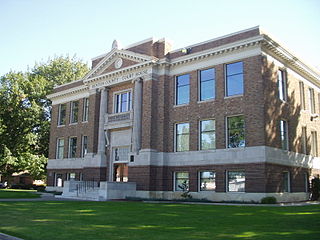
Benton County is a county in the south-central portion of the U.S. state of Washington. As of the 2020 census, its population was 206,873. The county seat is Prosser, and its most populous city is Kennewick. The Columbia River demarcates the county's north, south, and east boundaries.

Grant County is a county located in the U.S. state of Washington. As of the 2020 census, the population was 99,123. The county seat is Ephrata, and the largest city is Moses Lake. The county was formed out of Douglas County in February 1909 and is named for U.S. President Ulysses S. Grant.

The Columbia River drainage basin is the drainage basin of the Columbia River in the Pacific Northwest region of North America. It covers 668,000 km2 or 258,000 sq mi. In common usage, the term often refers to a smaller area, generally the portion of the drainage basin that lies within eastern Washington.

The B Reactor at the Hanford Site, near Richland, Washington, was the first large-scale nuclear reactor ever built. The project was a key part of the Manhattan Project, the United States nuclear weapons development program during World War II. Its purpose was to convert natural uranium metal into plutonium-239 by neutron activation, as plutonium is simpler to chemically separate from spent fuel assemblies, for use in nuclear weapons, than it is to isotopically enrich uranium into weapon-grade material. The B reactor was fueled with metallic natural uranium, graphite moderated, and water-cooled. It has been designated a U.S. National Historic Landmark since August 19, 2008 and in July 2011 the National Park Service recommended that the B Reactor be included in the Manhattan Project National Historical Park commemorating the Manhattan Project. Visitors can take a tour of the reactor by advance reservation.

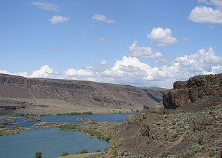
The Hanford Reach National Monument is a national monument in the U.S. state of Washington. It was created in 2000, mostly from the former security buffer surrounding the Hanford Nuclear Reservation. The area has been untouched by development or agriculture since 1943. For this reason, it is considered an involuntary park.

State Route 24 (SR 24) is a state highway in the south-central region of Washington, in the United States. It travels 79 miles (127 km) from Yakima to Othello, across a portion of the Columbia Plateau. The highway crosses the Columbia River on the Vernita Bridge, located near the Hanford Site. SR 24 terminates to the west at an interchange with Interstate 82 (I-82) in Yakima and to the east at SR 26 in Othello.

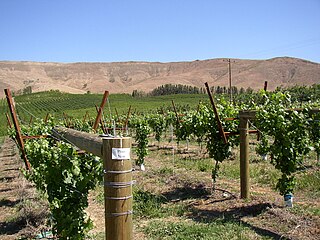
Washington wine is a wine produced from grape varieties grown in the U.S. state of Washington. Washington ranks second in the United States in the production of wine. By 2017, the state had over 55,000 acres (220 km2) of vineyards, a harvest of 229,000 short tons (208,000 t) of grapes, and exports going to over 40 countries around the world from the 940+ wineries located in the state. While there are some viticultural activities in the cooler, wetter western half of the state, the majority (99.9%) of wine grape production takes place in the shrub-steppe eastern half. The rain shadow of the Cascade Range leaves the Columbia River Basin with around 8 inches (200 mm) of annual rain fall, making irrigation and water rights of paramount interest to the Washington wine industry. Viticulture in the state is also influenced by long sunlight hours and consistent temperatures.

Columbia Valley is an American Viticultural Area (AVA) which lies within the Columbia River Plateau, through much of central and southern Washington state, with a section crossing the state boundary into northern Oregon south of the Columbia River. The viticultural area includes the drainage basin of the Columbia River and its tributaries through much of Washington. It was established by the Bureau of Alcohol, Tobacco and Firearms (ATF), Treasury on December 13, 1984 after evaluating the petition filed by Drs, Walter Clore and Wade Wolfe of Prosser, Washington on behalf of Washington’s oldest and largest winery, Chateau Ste. Michelle, and by William Blosser of the Sokol Blosser Winery, Dundee, Oregon. Allen Shoup, president of Chateau Ste. Michelle, understood the importance of obtaining appellation status to grow the reputation of the Northwest viticulture industry.

Wahluke Slope is an American Viticultural Area (AVA) located within Grant County, Washington established on January 6. 2006 by the Alcohol and Tobacco Tax and Trade Bureau {TTB), Treasury after reviewing the petition submitted by the Wahluke Slope Wine Grape Growers Association (WSWGGA), represented by Alan J. Busacca, Ph.D., proposing the establishment of the viticultural area named "Wahluke Slope."

Crab Creek is a stream in the U.S. state of Washington. Named for the presence of crayfish, it is one of the few perennial streams in the Columbia Basin of central Washington, flowing from the northeastern Columbia River Plateau, roughly 5 km (3.1 mi) east of Reardan, west-southwest to empty into the Columbia River near the small town of Beverly. Its course exhibits many examples of the erosive powers of extremely large glacial Missoula Floods of the late Pleistocene, which scoured the region. In addition, Crab Creek and its region have been transformed by the large-scale irrigation of the Bureau of Reclamation's Columbia Basin Project (CBP), which has raised water table levels, significantly extending the length of Crab Creek and created new lakes and streams.

State Route 243 (SR 243) is a state highway in Grant County, Washington. It travels north–south along the Columbia River for 28 miles (45 km), connecting SR 24 at the Vernita Bridge to SR 26 near Vantage. The highway travels through a predominantly rural and desert area, serving two hydroelectric dams and the communities of Desert Aire, Mattawa, and Beverly.

The Columbia Plateau ecoregion is a Level III ecoregion designated by the United States Environmental Protection Agency (EPA) encompassing approximately 32,100 square miles (83,139 km2) of land within the U.S. states of Washington, Oregon, and Idaho. The ecoregion extends across a wide swath of the Columbia River Basin from The Dalles, Oregon to Lewiston, Idaho to Okanogan, Washington near the Canada–U.S. border. It includes nearly 500 miles (800 km) of the Columbia River, as well as the lower reaches of major tributaries such as the Snake and Yakima rivers and the associated drainage basins. It is named for the Columbia Plateau, a flood basalt plateau formed by the Columbia River Basalt Group during the late Miocene and early Pliocene. The arid sagebrush steppe and grasslands of the region are flanked by moister, predominantly forested, mountainous ecoregions on all sides. The underlying basalt is up to 2 miles (3 km) thick and partially covered by thick loess deposits. Where precipitation amounts are sufficient, the deep loess soils have been extensively cultivated for wheat. Water from the Columbia River is subject to resource allocation debates involving fisheries, navigation, hydropower, recreation, and irrigation, and the Columbia Basin Project has dramatically converted much of the region to agricultural use.

Savage Island lies on the last free flowing stretch of the Columbia River known as the Hanford Reach in Washington, United States; other interesting geological features of the area include the White Bluffs, as well across the river the Hanford Dunes. The island is within the boundaries of the Wahluke Wildlife Unit, a natural preserve managed by the US Fish and Wildlife Service as part of the Hanford Reach National Monument. Historically, Savage Island has supported small farms and settlements ranging from prior to the Manhattan Project buyout of the lands in 1943; The Wanapum tribe were known to inhabit this particular region. The wildlife of the island include mule deer, coyote, burrowing owl, and western diamondback rattlesnake; the island is primarily arid shrub steppe, with some wetland habitat by the shore of the river.

The Rattlesnake Hills, also known as Rattlesnake Ridge, is a 16-mile (26 km) long anticline mountain ridge in Yakima County and Benton County in the U.S. state of Washington. It should not be confused with the much smaller Rattlesnake Ridge located near the west end of Ahtanum Ridge just south of Yakima, Washington and west of Union Gap, Washington. The highest point in the hills is the 3,629 feet (1,106 m) Lookout Summit, which surpasses the more well-known Rattlesnake Mountain by approximately 100 ft (30 m). The Rattlesnake Hills are part of the Yakima Fold Belt of east-tending long ridges formed by the folding of Miocene Columbia River basalt flows.
The Yakima Fold Belt of south-central Washington, also called the Yakima fold-and-thrust belt, is an area of topographical folds raised by tectonic compression. It is a 14,000 km2 (5,400 sq mi) structural-tectonic sub province of the western Columbia Plateau Province resulting from complex and poorly understood regional tectonics. The folds are associated with geological faults whose seismic risk is of particular concern to the nuclear facilities at the Hanford Nuclear Reservation and major dams on the Columbia and Snake Rivers.

Sentinel Gap is a water gap formed by the Columbia River in the Saddle Mountains, near Mattawa in Washington state. The gap is "a water gap where erosion by the Columbia River was able to keep pace with folding, faulting and uplifting across the Saddle Mountain anticline". During Ice Age floods in which waters from the Channeled Scablands found passage to the Pacific Ocean here and at Wallula Gap, this opening was "repeatedly reamed out, which probably widened and steepened the walls of the gap". Strandlines from the floods can be seen on the basalt walls of the gap.

The Hanford Engineer Works (HEW) was a nuclear production complex in Benton County, Washington, established by the United States federal government in 1943 as part of the Manhattan Project during World War II. It built and operated the B Reactor, the first full-scale plutonium production reactor. Plutonium manufactured at the HEW was used in the atomic bomb detonated in the Trinity test in July 1945, and in the Fat Man bomb used in the atomic bombing of Nagasaki in August 1945. The HEW was commanded by Colonel Franklin T. Matthias until January 1946, and then by Colonel Frederick J. Clarke.


