Whiting, Maine

Last updated

Whiting, Maine
WhitingME CommunityChurch.jpg
The Union Meeting Hall
USA Maine location map.svg
Red pog.svg
Whiting, Maine
Location within the state of Maine
Coordinates: 44°45′19″N67°15′38″W / 44.75528°N 67.26056°W / 44.75528; -67.26056
Country United States
State Maine
County Washington
Area
[1]
  Total52.07 sq mi (134.86 km2)
  Land46.74 sq mi (121.06 km2)
  Water5.33 sq mi (13.80 km2)
Elevation
95 ft (29 m)
Population
 (2020)
  Total482
  Density10/sq mi (4.0/km2)
Time zone UTC-5 (Eastern (EST))
  Summer (DST) UTC-4 (EDT)
ZIP code
04691
Area code 207
FIPS code 23-85185
GNIS feature ID0582812

Whiting is a town in Washington County, Maine, United States. The town was named after Tate Whiting, an early settler. [2] The population was 482 at the 2020 census. [3] The town was originally known as Orangetown. [4] [5] [6]

Contents

Geography

According to the United States Census Bureau, the town has a total area of 52.07 square miles (134.86 km2), of which 46.74 square miles (121.06 km2) is land and 5.33 square miles (13.80 km2) is water. [1]

Demographics

Historical population
CensusPop.Note
1830 309
1840 46249.5%
1850 4701.7%
1860 4791.9%
1870 414−13.6%
1880 4252.7%
1890 393−7.5%
1900 3991.5%
1910 368−7.8%
1920 3741.6%
1930 327−12.6%
1940 3589.5%
1950 354−1.1%
1960 339−4.2%
1970 269−20.6%
1980 33524.5%
1990 40721.5%
2000 4305.7%
2010 48713.3%
2020 482−1.0%
U.S. Decennial Census [7]

2010 census

As of the census of 2010, there were 487 people, 206 households, and 145 families living in the town. [8] The population density was 10.4 inhabitants per square mile (4.0/km2). There were 378 housing units at an average density of 8.1 per square mile (3.1/km2). The racial makeup of the town was 93.6% White, 0.2% African American, 1.2% Native American, 2.3% Asian, 0.8% from other races, and 1.8% from two or more races. Hispanic or Latino of any race were 1.2% of the population.

There were 206 households, of which 27.2% had children under the age of 18 living with them, 59.2% were married couples living together, 6.8% had a female householder with no husband present, 4.4% had a male householder with no wife present, and 29.6% were non-families. 24.3% of all households were made up of individuals, and 8.7% had someone living alone who was 65 years of age or older. The average household size was 2.36 and the average family size was 2.78.

The median age in the town was 48 years. 21.1% of residents were under the age of 18; 6.3% were between the ages of 18 and 24; 17.1% were from 25 to 44; 40.8% were from 45 to 64; and 15% were 65 years of age or older. The gender makeup of the town was 49.5% male and 50.5% female.

2000 census

As of the census of 2000, there were 430 people, 181 households, and 116 families living in the town. [9] The population density was 9.2 people per square mile (3.5/km2). There were 342 housing units at an average density of 7.3 per square mile (2.8/km2). The racial makeup of the town was 98.14% White, 0.70% Native American, 0.23% Asian, and 0.93% from two or more races. Hispanic or Latino of any race were 0.23% of the population.

There were 181 households, out of which 24.3% had children under the age of 18 living with them, 59.1% were married couples living together, 3.9% had a female householder with no husband present, and 35.4% were non-families. 28.7% of all households were made up of individuals, and 12.2% had someone living alone who was 65 years of age or older. The average household size was 2.34 and the average family size was 2.87.

In the town, the population was spread out, with 20.9% under the age of 18, 6.7% from 18 to 24, 25.6% from 25 to 44, 29.5% from 45 to 64, and 17.2% who were 65 years of age or older. The median age was 43 years. For every 100 females, there were 110.8 males. For every 100 females age 18 and over, there were 106.1 males.

The median income for a household in the town was $28,304, and the median income for a family was $35,673. Males had a median income of $25,625 versus $18,750 for females. The per capita income for the town was $13,771. About 15.3% of families and 22.2% of the population were below the poverty line, including 36.6% of those under age 18 and 11.4% of those age 65 or over.

Economy

Whiting has several small businesses, including a village store and doctor's office, along with several small contractors, such as a plumber and a forester. [10]

Related Research Articles

<span class="mw-page-title-main">Eagle Lake, Maine</span> Town in the state of Maine, United States

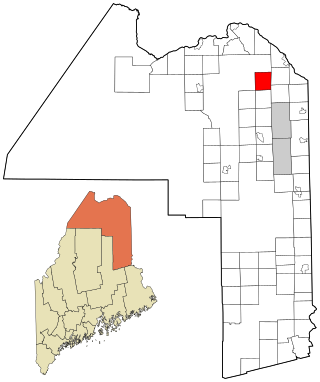
Eagle Lake is a town in Aroostook County, Maine, United States. The population was 772 at the 2020 census. The town was named by a body of troops heading from Bangor to the Aroostook War for the many eagles that they saw around the lake. A total of 49.0% of the population speaks French, reflecting a trend in Northeastern Maine.

<span class="mw-page-title-main">Mapleton, Maine</span> Town in the state of Maine, United States

Mapleton is a town in Aroostook County, Maine, United States. The population was 1,886 at the 2020 census.

<span class="mw-page-title-main">Masardis, Maine</span> Town in Maine, United States

Masardis is a town in Aroostook County, Maine, United States. The population was 204 at the 2020 census.

<span class="mw-page-title-main">Merrill, Maine</span> Town in the state of Maine, United States

Merrill is a town in Aroostook County, Maine, United States. The population was 208 at the 2020 census.

<span class="mw-page-title-main">Perham, Maine</span> Town in the state of Maine, United States

Perham is a town in Aroostook County, Maine, United States. The population was 371 at the 2020 census. The town was named after Maine's 33rd governor, Sidney Perham.

<span class="mw-page-title-main">St. Francis, Maine</span> Town in the state of Maine, United States

St. Francis is a town in Aroostook County, Maine, United States on the Canada–United States border at the junction of the St. Francis River and the Saint John River. The population was 438 at the 2020 census. First settled by English speakers from southern Maine, the original population has been supplanted by French-speaking Acadians.

<span class="mw-page-title-main">Stockholm, Maine</span> Town in the state of Maine, United States

Stockholm is a town in Aroostook County, Maine, United States. The population was 250 at the 2020 census.

Waltham is a town in Hancock County, Maine, United States. The population was 332 at the 2020 census.

<span class="mw-page-title-main">Manchester, Maine</span> Town in Maine, United States

Manchester is a town in Kennebec County, Maine, United States, located at 44.33°N 69.87°W. The population was 2,456 at the 2020 census. The southern part of the town bordering Cobbosseecontee Lake is a popular recreation spot in central Maine, and part of the Winthrop Lakes Region. Manchester is included in the Augusta, Maine micropolitan and included in the Lewiston-Auburn, Maine metropolitan New England City and Town Area.

<span class="mw-page-title-main">Vienna, Maine</span> Town in the state of Maine, United States

Vienna is a town in Kennebec County, Maine, United States. The population was 578 at the 2020 census.

<span class="mw-page-title-main">Gilead, Maine</span> Town in the state of Maine, United States

Gilead is a town in Oxford County, Maine, United States. Upon incorporation in 1804, it was named for the large quantity of Balm of Gilead trees in the town center. The population was 195 at the 2020 census.

<span class="mw-page-title-main">Hartford, Maine</span> Town in the state of Maine, United States

Hartford is a town in Oxford County, Maine, United States. Hartford is included in the Lewiston-Auburn, Maine metropolitan New England City and Town Area. The population was 1,203 at the 2020 census.

Stoneham is a town in Oxford County, Maine, United States. The population was 261 at the 2020 census.

<span class="mw-page-title-main">Stow, Maine</span> Town in the state of Maine, United States

Stow is a town in Oxford County, Maine, United States. The population was 393 at the 2020 census.

<span class="mw-page-title-main">Upton, Maine</span> Town in the state of Maine, United States

Upton is a town in Oxford County, Maine, United States. The population was 69 at the 2020 census.

Orrington is a town on the Penobscot River estuary in Penobscot County, Maine, United States. The population was 3,812 at the 2020 census.

<span class="mw-page-title-main">Troy, Maine</span> Town in the state of Maine, United States

Troy is a town in Waldo County, Maine, United States. The population was 1,018 at the 2020 census.

Beddington is a town in Washington County, Maine, United States. The population was 60 at the 2020 census. It is the third-smallest organized town in Maine after Frye Island and Frenchboro.

<span class="mw-page-title-main">St. Albans, Maine</span> Town in the state of Maine, United States

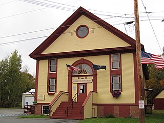
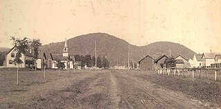
St. Albans is a town in Somerset County, Maine, United States. The population was 2,045 at the 2020 census.

Norridgewock is a census-designated place (CDP) in the town of Norridgewock in Somerset County, Maine, United States. The population was 1,351 at the 2020 census.

References

  1. 1 2 "US Gazetteer files 2010". United States Census Bureau . Retrieved December 16, 2012.
  2. "Profile for Whiting, Maine". ePodunk . Retrieved May 8, 2010.
  3. "Census - Geography Profile: Whiting town, Washington County, Maine" . Retrieved February 26, 2022.
  4. Haskell, John D. (John Duncan) (1977). "Maine, a bibliography of its history". Boston : G. K. Hall. p. 254. Retrieved March 11, 2019. Orangetown, former name of Whiting
  5. "Maine, a guide 'down east,'". Boston, Houghton Mifflin Company. 1937. Retrieved March 11, 2019. Whiting...,a village formerly called Orangetown, in an area where extensive lumbering operations are still carried on,
  6. Maine League of Historical Societies and Museums (1970). Doris A. Isaacson (ed.). Maine: A Guide 'Down East'. Rockland, Me: Courier-Gazette, Inc. p. 283. ...formerly was called Orangetown for the nearby lake and the river...
  7. "Census of Population and Housing". Census.gov. Retrieved June 4, 2015.
  8. "U.S. Census website". United States Census Bureau . Retrieved December 16, 2012.
  9. "U.S. Census website". United States Census Bureau . Retrieved January 31, 2008.
  10. "Local Businesses – Town of Whiting, Maine" . Retrieved May 23, 2024.

44°47′27″N67°10′32″W / 44.79083°N 67.17556°W / 44.79083; -67.17556