Amiret Township, Lyon County, Minnesota

Last updated

Amiret Township, Minnesota
USA Minnesota location map.svg
Red pog.svg
Amiret Township, Minnesota
Location within the state of Minnesota
Usa edcp location map.svg
Red pog.svg
Amiret Township, Minnesota
Amiret Township, Minnesota (the United States)
Coordinates: 44°19′50″N95°40′0″W / 44.33056°N 95.66667°W / 44.33056; -95.66667
Country United States
State Minnesota
County Lyon
Area
  Total36.3 sq mi (94.0 km2)
  Land36.3 sq mi (94.0 km2)
  Water0.0 sq mi (0.0 km2)
Elevation
1,207 ft (368 m)
Population
 (2000)
  Total230
  Density6.3/sq mi (2.4/km2)
Time zone UTC-6 (Central (CST))
  Summer (DST) UTC-5 (CDT)
ZIP code
56175
Area code 507
FIPS code 27-01432 [1]
GNIS feature ID0663429 [2]

Amiret Township is a township in Lyon County, Minnesota, United States. The population was 230 at the 2000 census.

Contents

History

Historically the Native American tribe that inhabited the area were the Dakota people, specifically the Wahpekute Dakota.  The Wahpekute Dakota resided primarily along the Minnesota River Valley and its tributaries, including areas within Lyon County.

The first white settlers arrived in Amiret Township in 1868, with Charles and Lafayette Grover staking their claims. James Mitchell followed suit in 1869, establishing a presence in the area. The township was officially organized on March 19, 1874, initially named "Madison Township." The name, however, proved short-lived. In 1879, it was renamed "Amiret Township" in honor of Amiretta Sykes, the wife of a prominent railroad official, M.L. Sykes. [3]

The construction of the Chicago and Northwestern Railway (later known as the Chicago and North Western Transportation Company) through the county in 1872 played a pivotal role in Amiret Township's development. A village sprang up around the railroad station, initially called "Saratoga" (located about three miles southwest of present-day Amiret). The post office, established in 1873, was first named "Coburg" after William Coburn, a pioneer merchant and the first postmaster. The village and township continued to grow throughout the late 19th and early 20th centuries, primarily centered around agriculture. [4] [5] [3]

Geography

According to the United States Census Bureau, the township has a total area of 36.3 square miles (94 km2), all land.

Lyon County itself falls within the Dissected Till Plains ecoregion. This region is characterized by rolling hills that were formed by glaciers during the last ice age. Melting glaciers left behind numerous lakes and wetlands dotting the landscape. The Minnesota River and its tributaries carve through the region, shaping the terrain and providing water sources.

Demographics

As of the census [1] of 2000, there were 230 people, 85 households, and 71 families residing in the township. The population density was 6.3 inhabitants per square mile (2.4/km2). There were 95 housing units at an average density of 2.6 per square mile (1.0/km2). The racial makeup of the township was 100.00% White.

There were 85 households, out of which 30.6% had children under the age of 18 living with them, 83.5% were married couples living together, and 15.3% were non-families. 11.8% of all households were made up of individuals, and 5.9% had someone living alone who was 65 years of age or older. The average household size was 2.71 and the average family size was 2.96.

In the township the population was spread out, with 25.2% under the age of 18, 7.0% from 18 to 24, 23.9% from 25 to 44, 30.4% from 45 to 64, and 13.5% who were 65 years of age or older. The median age was 43 years. For every 100 females, there were 96.6 males. For every 100 females age 18 and over, there were 104.8 males.

The median income for a household in the township was $49,375, and the median income for a family was $55,250. Males had a median income of $29,583 versus $21,875 for females. The per capita income for the township was $16,683. About 9.5% of families and 13.2% of the population were below the poverty line, including 19.4% of those under the age of eighteen and none of those 65 or over.

Related Research Articles

<span class="mw-page-title-main">Watonwan County, Minnesota</span> County in Minnesota, United States

Watonwan County is a county in the U.S. state of Minnesota. As of the 2020 census, the population was 11,253. Its county seat is St. James.

<span class="mw-page-title-main">Rock County, Minnesota</span> County in Minnesota, United States

Rock County is a county located in the southwestern corner of the U.S. state of Minnesota. According to the 2020 census, its population was 9,704. The county seat is Luverne. It is located within the Sioux Falls MSA.

<span class="mw-page-title-main">Pipestone County, Minnesota</span> County in Minnesota, United States

Pipestone County is a county in the U.S. state of Minnesota. As of the 2020 census, the population was 9,424. Its county seat is Pipestone.

<span class="mw-page-title-main">Lyon County, Minnesota</span> County in Minnesota, United States

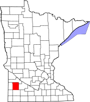
Lyon County is a county in the U.S. state of Minnesota. As of the 2020 census, the population was 25,269. Its county seat is Marshall.

Cambria Township is a township in Blue Earth County, Minnesota, United States. The population was 271 as of the 2000 census.

<span class="mw-page-title-main">Milford Township, Brown County, Minnesota</span> Township in Minnesota, United States

Milford Township is a township in Brown County, Minnesota, United States. The population was 793 as of the 2000 census.

Poplar Township is a township in Cass County, Minnesota, United States. The population was 173 as of the 2000 census. Poplar Township was named from the groves of poplar trees within its borders.

Empire is a city in Dakota County, Minnesota. The population was 2,444 at the 2010 census. It is part of the Minneapolis-St. Paul metropolitan area.

Greenvale Township is a township in Dakota County, Minnesota, United States. The population was 684 at the 2000 census.

<span class="mw-page-title-main">Nininger Township, Dakota County, Minnesota</span> Township in Minnesota, United States

Nininger Township is a township in Dakota County, Minnesota, United States. The population was 865 at the 2000 census.

Sciota Township is a township in Dakota County, Minnesota, United States. The population was 285 at the 2000 census. The ghost town of Lewiston was located in the township.

Claremont Township is a township in Dodge County, Minnesota, United States. The population was 468 at the 2000 census.

<span class="mw-page-title-main">Wacouta Township, Goodhue County, Minnesota</span> Township in Minnesota, United States

Wacouta Township is a township in Goodhue County, Minnesota, United States. The population was 410 at the 2000 census.

<span class="mw-page-title-main">Garvin, Minnesota</span> City in Minnesota, United States

Garvin is a city in Lyon County, Minnesota, United States. The population was 135 at the 2010 census.

Lynd Township is a township in Lyon County, Minnesota, United States. The population was 471 at the 2000 census.

Lyons Township is a township in Lyon County, Minnesota, United States, not to be confused with Lyons Township in Wadena County. The population was 208 at the 2000 census.

Shelburne Township is a township in Lyon County, Minnesota, United States. The population was 180 at the 2000 census.

Faxon Township is a township in Sibley County, Minnesota, United States. The population was 712 at the 2020 census.

Watopa Township is a township in Wabasha County, Minnesota, United States. The population was 265 at the 2000 census.

<span class="mw-page-title-main">Wolsey, South Dakota</span> Town in South Dakota, United States

Wolsey is a town in Beadle County, South Dakota, United States. The population was 459 at the 2020 census.

References

  1. 1 2 "U.S. Census website". United States Census Bureau . Retrieved January 31, 2008.
  2. "US Board on Geographic Names". United States Geological Survey. October 25, 2007. Retrieved January 31, 2008.
  3. 1 2 "AMIRET TOWNSHIP". Lyon County Museum. Retrieved April 16, 2024.
  4. Upham, Warren (1920). Minnesota Geographic Names: Their Origin and Historic Significance. Minnesota Historical Society. p.  311.
  5. Chicago and North Western Railway Company (1908). A History of the Origin of the Place Names Connected with the Chicago & North Western and Chicago, St. Paul, Minneapolis & Omaha Railways. p. 37.