Clifton Township, Lyon County, Minnesota

Last updated

Clifton Township, Minnesota
USA Minnesota location map.svg
Red pog.svg
Clifton Township, Minnesota
Location within the state of Minnesota
Usa edcp location map.svg
Red pog.svg
Clifton Township, Minnesota
Clifton Township, Minnesota (the United States)
Coordinates: 44°24′25″N95°38′41″W / 44.40694°N 95.64472°W / 44.40694; -95.64472
Country United States
State Minnesota
County Lyon
Area
  Total36.2 sq mi (93.6 km2)
  Land36.1 sq mi (93.4 km2)
  Water0.1 sq mi (0.2 km2)
Elevation
1,125 ft (343 m)
Population
 (2000)
  Total288
  Density8.0/sq mi (3.1/km2)
Time zone UTC-6 (Central (CST))
  Summer (DST) UTC-5 (CDT)
FIPS code 27-11926 [1]
GNIS feature ID0663822 [2]

Clifton Township is a township in Lyon County, Minnesota, United States. The population was 288 at the 2000 census. The unincorporated community of Dudley is located within the township.

Contents

Clifton Township was organized in 1876. [3]

Geography

According to the United States Census Bureau, the township has a total area of 36.2 square miles (94 km2), of which 36.1 square miles (93 km2) is land and 0.1 square miles (0.26 km2) (0.19%) is water.

Demographics

As of the census [1] of 2000, there were 288 people, 94 households, and 78 families residing in the township. The population density was 8.0 inhabitants per square mile (3.1/km2). There were 101 housing units at an average density of 2.8 per square mile (1.1/km2). The racial makeup of the township was 94.44% White, 1.04% African American, 1.04% Native American and 3.47% Asian.

There were 94 households, out of which 45.7% had children under the age of 18 living with them, 73.4% were married couples living together, 6.4% had a female householder with no husband present, and 16.0% were non-families. 10.6% of all households were made up of individuals, and 4.3% had someone living alone who was 65 years of age or older. The average household size was 3.06 and the average family size was 3.34.

In the township the population was spread out, with 35.4% under the age of 18, 4.9% from 18 to 24, 30.2% from 25 to 44, 18.1% from 45 to 64, and 11.5% who were 65 years of age or older. The median age was 34 years. For every 100 females, there were 111.8 males. For every 100 females age 18 and over, there were 116.3 males.

The median income for a household in the township was $48,750, and the median income for a family was $51,250. Males had a median income of $35,750 versus $25,179 for females. The per capita income for the township was $19,237. About 5.0% of families and 6.8% of the population were below the poverty line, including 7.5% of those under the age of eighteen and 16.7% of those 65 or over.

Related Research Articles

Pliny Township is a township in Aitkin County, Minnesota, United States. The population was 109 as of the 2010 census.

Shooks Township is a township in Beltrami County, Minnesota, United States. The population was 190 as of the 2000 census.

Shotley Township is a township in Beltrami County, Minnesota, United States. The population was 54 as of the 2000 census. Shotley Township took its name from Shotley Brook.

Kurtz Township is a township in Clay County, Minnesota, United States. The population was 288 at the 2000 census.

Bay Lake Township is a township in Crow Wing County, Minnesota, United States. The population was 923 at the 2000 census. This township took its name from Bay Lake.

Nore Township is a township in Itasca County, Minnesota, United States. The population was 57 at the 2010 census.

Marble Township is a township in Lincoln County, Minnesota, United States. The population was 195 at the 2000 census.

Rosedale Township is a township in Mahnomen County, Minnesota, United States. The population was 136 at the 2000 census.

Cedar Township is a township in Marshall County, Minnesota, United States. The population was 94 at the 2000 census.

Foldahl Township is a township in Marshall County, Minnesota, United States. The population was 94 at the 2000 census.

Spruce Valley Township is a township in Marshall County, Minnesota, United States. The population was 238 at the 2000 census.

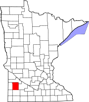
East Chain Township is a township in Martin County, Minnesota, United States. The population was 345 at the 2000 census.

Waverly Township is a township in Martin County, Minnesota, United States. The population was 245 at the 2000 census.

Bear Park Township is a township in Norman County, Minnesota, United States. The population was 209 at the 2000 census.

Danforth Township is a township in Pine County, Minnesota, United States. The population was 84 at the 2000 census.

Camp Township is a township in Renville County, Minnesota, United States. The population was 207 at the time of the 2000 census. Camp Township was organized in 1867.

Albany Township is a township in Stearns County, Minnesota, United States. The population was 980 at the 2010 census. The city of Albany is surrounded by the township.

Clifton Township is a township in Traverse County, Minnesota, United States. The population was 92 at the 2000 census.

Freedom Township is a township in Waseca County, Minnesota, United States. The population was 397 at the 2000 census.

Omro Township is a township in Yellow Medicine County, Minnesota, United States. The population was 184 at the 2000 census.

References

  1. 1 2 "U.S. Census website". United States Census Bureau . Retrieved January 31, 2008.
  2. "US Board on Geographic Names". United States Geological Survey. October 25, 2007. Retrieved January 31, 2008.
  3. Upham, Warren (1920). Minnesota Geographic Names: Their Origin and Historic Significance. Minnesota Historical Society. p.  312.