Verdi is an unincorporated community located in Verdi Township, Lincoln County, Minnesota, United States. The elevation is 1,762 feet (537 m). Verdi appears on the Verdi U.S. Geological Survey Map.
Ash Creek is an unincorporated community in Clinton Township, Rock County, Minnesota, United States. The community took its name from nearby Ash Creek.

Brill is an unincorporated community located in Barron County, Wisconsin, United States. Brill is east of Haugen, in the town of Oak Grove.

Miloma is an unincorporated community located in Jackson County, Minnesota, United States at latitude 43.763 and longitude -95.368. The elevation is 1,427 feet. Miloma appears on the Heron Lake U.S. Geological Survey Map.
Imogene is an unincorporated community located in Martin County in the U.S. state of Minnesota. The elevation is 1,129 feet. Imogene appears on the Granada U.S. Geological Survey Map.

Minnesota Junction is an unincorporated community located, in the town of Oak Grove, in Dodge County, Wisconsin, United States. Minnesota Junction is located on Wisconsin Highway 26. It is located at latitude 43.452 and longitude -88.697 at 925 feet above mean sea level.
Blakeley is an unincorporated community in Blakeley Township, Scott County, Minnesota, United States, along the Minnesota River. The community is located west-southwest of Belle Plaine near the junction of Scott County Roads 1, 6, and 60.
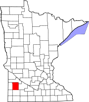
Amiret is an unincorporated community in Lyon County, in the U.S. state of Minnesota.
Burchard is an unincorporated community in Lyon County, in the U.S. state of Minnesota.
Burr is an unincorporated community in Florida Township, Yellow Medicine County, in the U.S. state of Minnesota.
Cambria is an unincorporated community in Blue Earth County, in the U.S. state of Minnesota.
Smiths Mill is an unincorporated community in Blue Earth and Waseca counties in the U.S. state of Minnesota. The community is located along 631st Avenue near 206th Street and U.S. Highway 14. Smiths Mill is located within Le Ray Township in Blue Earth County; and also located within Janesville Township in Waseca County. Nearby places include Janesville and Eagle Lake.
Fox Lake is an unincorporated community in Martin County, in the U.S. state of Minnesota.

Gilfillan is an unincorporated community in Redwood County, in the U.S. state of Minnesota.
Guckeen is an unincorporated community in Faribault County, in the U.S. state of Minnesota.
Judson is an unincorporated community in Blue Earth County, in the U.S. state of Minnesota.
Marna is an unincorporated community in Faribault County, in the U.S. state of Minnesota.
Rowena is an unincorporated community in Redwood County, in the U.S. state of Minnesota.
Merriam was a town in Scott County, in the U.S. state of Minnesota. The town has since been closed altogether.
Perth is an unincorporated community in Blue Earth County, in the U.S. state of Minnesota.