Coon Creek Township, Lyon County, Minnesota

Last updated

Coon Creek Township, Minnesota
USA Minnesota location map.svg
Red pog.svg
Coon Creek Township, Minnesota
Location within the state of Minnesota
Usa edcp location map.svg
Red pog.svg
Coon Creek Township, Minnesota
Coon Creek Township, Minnesota (the United States)
Coordinates: 44°19′11″N96°0′30″W / 44.31972°N 96.00833°W / 44.31972; -96.00833
Country United States
State Minnesota
County Lyon
Area
  Total36.4 sq mi (94.3 km2)
  Land35.9 sq mi (93.0 km2)
  Water0.5 sq mi (1.4 km2)
Elevation
1,601 ft (488 m)
Population
 (2000)
  Total282
  Density7.9/sq mi (3.0/km2)
Time zone UTC-6 (Central (CST))
  Summer (DST) UTC-5 (CDT)
FIPS code 27-13078 [1]
GNIS feature ID0663865 [2]

Coon Creek Township is a township in Lyon County, Minnesota, United States. The population was 282 at the 2000 census.

Contents

Coon Creek Township was organized in 1883, and named for Coon Creek. [3]

Geography

According to the United States Census Bureau, the township has a total area of 36.4 square miles (94 km2), of which 35.9 square miles (93 km2) is land and 0.5 square miles (1.3 km2) (1.43%) is water.

Demographics

As of the census [1] of 2000, there were 282 people, 98 households, and 79 families residing in the township. The population density was 7.9/mi2 (3.0/km2). There were 101 housing units at an average density of 2.8/mi2 (1.1/km2). The racial makeup of the township was 97.16% White, 0.35% African American, and 2.48% from two or more races. Hispanic or Latino of any race were 0.35% of the population.

There were 98 households, out of which 40.8% had children under the age of 18 living with them, 71.4% were married couples living together, 5.1% had a female householder with no husband present, and 18.4% were non-families. 18.4% of all households were made up of individuals, and 6.1% had someone living alone who was 65 years of age or older. The average household size was 2.88 and the average family size was 3.25.

In the township the population was spread out, with 31.2% under the age of 18, 5.3% from 18 to 24, 25.2% from 25 to 44, 24.8% from 45 to 64, and 13.5% who were 65 years of age or older. The median age was 39 years. For every 100 females, there were 95.8 males. For every 100 females age 18 and over, there were 96.0 males.

The median income for a household in the township was $42,083, and the median income for a family was $45,568. Males had a median income of $23,438 versus $21,000 for females. The per capita income for the township was $14,150. About 5.9% of families and 6.1% of the population were below the poverty line, including 10.0% of those under the age of eighteen and 11.1% of those 65 or over.

Related Research Articles

<span class="mw-page-title-main">East Bethel, Minnesota</span> City in Minnesota, United States

East Bethel is a city in Anoka County, Minnesota, United States. The population was 11,786 at the 2020 census.

Carlos Township is a township in Douglas County, Minnesota, United States. The population was 1,912 at the 2000 census.

Brush Creek Township is a township in Faribault County, Minnesota, United States. The population was 241 at the 2000 census.

Crooked Creek Township is a township in Houston County, Minnesota, United States. The population was 285 at the 2010 census. The unincorporated community of Reno is located in the township.

Money Creek Township is a township in Houston County, Minnesota, United States. The population was 547 at the 2000 census.

Silver Creek Township is a township in Lake County, Minnesota, United States. The population was 1,178 at the 2000 census.

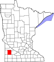
Rock Lake Township is a township in Lyon County, Minnesota, United States. The population was 282 at the 2000 census.

Sodus Township is a township in Lyon County, Minnesota, United States. The population was 282 at the 2000 census.

Hillman Township is a township in Morrison County, Minnesota, United States. The population was 164 at the 2000 census.

Pike Creek Township is a township in Morrison County, Minnesota, United States. The population was 932 at the 2000 census.

Dane Prairie Township is a township in Otter Tail County, Minnesota, United States. The population was 892 at the 2000 census.

<span class="mw-page-title-main">Deer Creek Township, Otter Tail County, Minnesota</span> Township in Minnesota, United States

Deer Creek Township is a township in Otter Tail County, Minnesota, United States. The population was 348 at the 2000 census.

Mission Creek Township is a township in Pine County, Minnesota, United States. The population was 590 at the 2000 census.

Beaver Falls Township is a township in Renville County, Minnesota, United States. The population was 331 at the 2000 census.

Hawk Creek Township is a township in Renville County, Minnesota, United States. The population was 227 at the 2000 census.

Sand Creek Township is a township in Scott County, Minnesota, United States. The population was 1,551 at the 2000 census.

Waasa Township is a township in Saint Louis County, Minnesota, United States. The population was 249 at the 2010 census.

Burnhamville Township is a township in Todd County, Minnesota, United States. The population was 751 at the 2000 census. By the 2020 census the population had risen to 773.

Turtle Creek Township is a township in Todd County, Minnesota, United States. The population was 323 at the 2000 census and was 270 at the time of the 2020 census.

Silver Creek Township is a township in Wright County, Minnesota, United States. The population was 2,332 at the 2000 census.

References

  1. 1 2 "U.S. Census website". United States Census Bureau . Retrieved January 31, 2008.
  2. "US Board on Geographic Names". United States Geological Survey. October 25, 2007. Retrieved January 31, 2008.
  3. Upham, Warren (1920). Minnesota Geographic Names: Their Origin and Historic Significance. Minnesota Historical Society. p.  312.