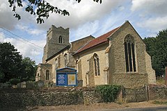
Barningham is a village and civil parish in the West Suffolk district of Suffolk, England, about twelve miles north-east of Bury St Edmunds. According to Eilert Ekwall, the meaning of the village name is the homestead of Beorn's people. The Domesday Book records the population of Barningham in 1086 to be 36. It has a primary school, a pub called the Royal George, a shop with a post office, a church, a hairdresser's, a village hall and a flower shop.
The puritan Maurice Barrow, one of the richest men in 17th-century Suffolk, bought the manor and estate of Barningham in 1628 from the widow of Henry Mason.
The pharmaceutical company Fisons, founded by James Fison and Lee Charters in the late 18th century, began as a flour mill and bakery in the village. The building has since been developed into terraced homes.
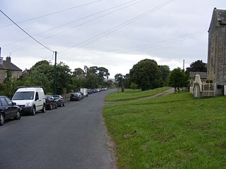
Barningham is a village in County Durham, in the Pennines of England.
Snape is a small village in the English county of Suffolk, on the River Alde close to Aldeburgh. At the 2011 census the population was 611. In Anglo-Saxon England, Snape was the site of an Anglo-Saxon ship burial. Snape is now best known for Snape Maltings, no longer in commercial use, but converted into a tourist centre together with a concert hall that hosts the major part of the annual Aldeburgh Festival.
Alderton is a village and civil parish in the East Suffolk district of Suffolk, England, about six miles north of Felixstowe, 10 miles south-east of Woodbridge and 2 miles south of Hollesley, on the North Sea coast and in the heart of the Suffolk Coast and Heaths Area of Outstanding Natural Beauty. In 2007 its population was 430, reducing to 423 at the 2011 Census.
Assington is a village in Suffolk, England, 4 miles (6.4 km) south-east of Sudbury. At the 2011 Census it had a population of 402, estimated at 445 in 2019. The parish includes the hamlets of Rose Green and Dorking Tye.
Stanton is a village and civil parish in the West Suffolk district of Suffolk in eastern England, about nine miles north-east of Bury St Edmunds, on the A143 road to Diss. Close to the village lies the former WW II airfield RAF Shepherds Grove, where American forces were based. One of the main landmarks in the village is the fine restored windmill at Upthorpe Farm, to the east of the village. The name " Stanton" means 'a homestead on stony ground'.
Matlaske is a village and a civil parish in the English county of Norfolk. The village is 21.6 miles (34.8 km) North-north-west of Norwich, 9.3 miles (15.0 km) south-west of Cromer and 136 miles (219 km) north-north-east of London. The nearest railway station is at Sheringham for the Bittern Line which runs between Sheringham, Cromer and Norwich. The nearest airport is Norwich International Airport. The parish of Matlask in the 2001 census, a population of 124, increasing to 139 at the 2011 Census. For the purposes of local government, the parish falls within the district of North Norfolk.
Sustead is a small village and parish in the county of Norfolk, England, about four miles south-west of Cromer. The parish also includes the villages of Bessingham and Metton. The parish is bounded by Aldborough and Hanworth to the south, Roughton to the east, Felbrigg and Aylmerton to the north and Gresham to the west.
Coney Weston is a village and civil parish in Suffolk, England, within the West Suffolk district. It is a primarily rural residential town that has dormitory town status. It is 5 miles (8 km) north of Ixworth and 12 miles (19 km) from Bury St Edmunds
Lorimer Fison was an Australian anthropologist, Methodist minister and journalist.
Little Barningham is a village and a civil parish in the English county of Norfolk. The village is 19 miles (31 km) north of Norwich, 10 miles (16 km) south-west of Cromer and 133 miles (214 km) north-east of London. The nearest railway station is in the town of Sheringham where access to the national rail network can be made via the Bittern Line to Norwich. The nearest airport is Norwich International Airport. Little Barningham is within the area covered by North Norfolk District Council.
Willingham St Mary, also known simply as Willingham, is a village and civil parish in the English county of Suffolk located about 3.5 miles (6 km) south of Beccles in the East Suffolk district. At the 2011 United Kingdom census it had a population of 152.
Weston is a village and civil parish in the English county of Suffolk. It is around 2 miles (3 km) south of Beccles in the East Suffolk district. The parish lies either side of the A145 road and is crossed by the Ipswich to Lowestoft railway line. Neighbouring parishes include Ellough, Ringsfield, Willingham St Mary and Shadingfield. The village is largely dispersed with a population of around 230.
North Barningham is a hamlet within the civil parish of Gresham in the English county of Norfolk. The hamlet is 7 miles (11 km) south-west of Cromer, 23.2 miles (37.3 km) north-northwest of Norwich and 138 miles (222 km) north-northeast of London. The hamlet lies 4.6 miles (7.4 km) south of the town of Sheringham. The nearest railway station is at Sheringham for the Bittern Line which runs between Sheringham, Cromer and Norwich. The nearest airport is Norwich International Airport. The hamlet is within the parish of Gresham, which had, in the 2001 census, a population of 443. For the purposes of local government, the hamlet falls within the district of North Norfolk.
Ringsfield is a village and civil parish in the English county of Suffolk. It is 2 miles (3.2 km) south-west of Beccles in the East Suffolk district.
Weston Colville is a village in South Cambridgeshire, 10 miles southeast of Cambridge and 6 miles south of Newmarket, close to the border with Suffolk.
Market Weston is a small village and civil parish in the West Suffolk district of Suffolk in eastern England. It is located near the Norfolk border around seven miles east-south-east of Thetford. In 2005 its population was estimated to be 260. 245 people were recorded at 2011 census. The parish also contains the Weston Fen SSSI.
Hawkedon is a village and civil parish in the West Suffolk district of Suffolk in eastern England. Located around 7 miles (11 km) south-south-west of Bury St Edmunds, the parish also contains the hamlet of Thurston End, and in 2005 had a population of 120. The majority of the village is classed as a conservation area.
Hepworth is a village and civil parish in the West Suffolk district of the English county of Suffolk. Nearby settlements include the villages of Stanton and Barningham. For transport there is the A143 road nearby. Hepworth has a place of worship. The population at the 2011 Census was 536.
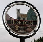
Hopton is a village and civil parish in the West Suffolk district of Suffolk in eastern England. Located just south of the Norfolk border on the B1111 road between Stanton and Garboldisham, in 2011 it had a population of 653. It shares a parish council with neighbouring Knettishall.
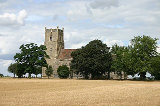
Barningham Hall is a Grade I listed building which stands in the grounds of the estate called Barningham Winter. Both the hall and estate privately owned. The house is close to the village of Matlask in the English County of Norfolk in the United Kingdom. The house was built for Sir Edward Paston in 1612 although the house seen today is the result of renovations, alterations and enlargement carried out under the control and design of Humphry Repton and his architect son John Adey Repton in 1805.
This page is based on this Wikipedia article Text is available under the CC BY-SA 4.0 license; additional terms may apply. Images, videos and audio are available under their respective licenses.