
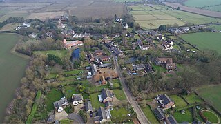
John Lydgate of Bury was an English monk and poet, born in Lidgate, near Haverhill, Suffolk, England.

Garthorpe is a village and civil parish in Leicestershire, England, in the Melton district. It is about five miles east of Melton Mowbray. The parish includes the villages of Garthorpe and Coston, and is near Saxby, Wymondham, Buckminster and Sproxton.
Benefield is a civil parish in North Northamptonshire, England, along the A427 road and about 6 miles (9.7 km) east of Corby and 3 miles (4.8 km) west of Oundle.

Blundeston is a village and civil parish in the north of the English county of Suffolk. It is 3.5 miles (5.6 km) north-west of Lowestoft, 6 miles (9.7 km) south of Great Yarmouth and around 1.75 miles (2.82 km) inland from the North Sea coast. It is part of the area known as Lothingland in the East Suffolk district. Blundeston Prison was located on the southern edge of the village but closed in early 2014.

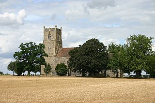
Friston is a village and civil parish in the East Suffolk district, in the county of Suffolk, England. It is 3 miles (5 km) southeast of Saxmundham, its post town, and 4 miles (6 km) northwest of Aldeburgh. The River Alde bounds the village on the south. The surrounding land is chiefly arable. The soil becomes partly marshy in the lower grounds. The village is noted for its early nineteenth century post mill. It is located next to the village of Knodishall.

Wyken, a suburb of Coventry, West Midlands, England, is situated between the areas of Stoke and Walsgrave, three miles east-northeast of Coventry city centre. The population of this Coventry Ward taken at the 2011 census was 16,818. It is a fairly large ward spreading as far as the Binley area. The majority of the houses in Wyken are terraced houses.

Creeting St Mary is a village and civil parish in the Mid Suffolk district of Suffolk in eastern England. Sandwiched between the A14 and A140 to the north of Needham Market, the parish also includes the hamlet of Creeting Bottoms. In 2005 the parish population was 710, which decreased to 697 at the 2011 Census.

Worlingworth is a village and civil parish in the Mid Suffolk district of Suffolk in eastern England, located around ten miles south-east of Diss. In 2011 it had a total population of 802 people.
Westley is a village and civil parish in the West Suffolk district of Suffolk in eastern England. It is located south of Junction 42 of the A14 providing primary access to adjacent market towns Bury St Edmunds (East) and Newmarket (West). The village consists of two central roads: Fornham Lane and Hill Road running north and south through the parish, with adjoining roads accommodating Westley's total population of 183.

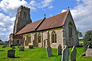
Ousden is a village and civil parish in the West Suffolk district of Suffolk in eastern England. It is located around six miles west of Bury St Edmunds and 72 miles north of London, and as of 2011, its population is 266. The village has an Anglican church of St Peter's and a chapel in the cemetery dedicated to St Barnabas.
Market Weston is a small village and civil parish in the West Suffolk district of Suffolk in eastern England. It is located near the Norfolk border around seven miles east-south-east of Thetford. In 2005 its population was estimated to be 260. 245 people were recorded at 2011 census. The parish also contains the Weston Fen SSSI.

Denham is a village and civil parish in the West Suffolk district of Suffolk in eastern England. Located around five miles west of Bury St Edmunds, in 2005 its population was 170, increasing to 171 at the 2011 Census. The parish also includes the hamlet of Denham End, as well as the remains of Denham Castle, a motte-and-bailey structure. The parish council is shared with neighbouring Barrow.
Hawkedon is a village and civil parish in the West Suffolk district of Suffolk in eastern England. Located around 7 miles (11 km) south-south-west of Bury St Edmunds, the parish also contains the hamlet of Thurston End, and in 2005 had a population of 120. The majority of the village is classed as a conservation area.

Hepworth is a village and civil parish in the West Suffolk district of the English county of Suffolk. Nearby settlements include the villages of Stanton and Barningham. For transport there is the A143 road nearby. Hepworth has a place of worship. The population at the 2011 Census was 536.

Walpole is a small village and civil parish in the district of East Suffolk in Suffolk, England. Walpole has a parish church, a redundant chapel, but the primary school has closed. The village is on the River Blyth. Nearby settlements include the town of Halesworth and the village of Cookley. It was in the hundred of Blything. It had a population of 238 according to the 2011 census.

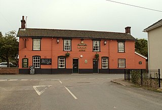
Swilland is a village and civil parish, in the East Suffolk district, in the English county of Suffolk. It is north of the large town of Ipswich. Swilland has a church called St Mary's Church and a pub called The Moon & Mushroom Inn which has been awarded Suffolk Pub of The Year on two occasions by the Evening Star. Swilland shares a parish council with Witnesham called "Swilland and Witnesham Grouped Parish Council".

Falkenham is a village and a civil parish in the East Suffolk district, in the English county of Suffolk, near the village of Kirton and the towns of Ipswich and Felixstowe. The population of the civil parish as of the 2011 census was 170.

Lidgate Castle is a medieval motte and bailey castle in the village of Lidgate, Suffolk, England, built to an unusual quadrangular design.
Rougham is a village and former civil parish 19 miles (31 km) north west of Ipswich, now in the parish of Rushbrooke with Rougham, in the West Suffolk district, in the county of Suffolk, England. Until April 2019 Rougham was in the St Edmundsbury district. In 1961 the parish had a population of 777. Rougham is also a ward, in 2011 the ward had a population of 2341. The ward touches Chadacre, Thurston, Rattlesden, The Fornhams & Great Barton, Moreton Hall, Lavenham, Horringer and Southgate. Rougham is pronounced "Ruff'm". In 1958 the parish had settlements at Mouse Lane estate, Rougham Green, Kingshall Street and Chapmans Close.
Washbrook is a village and former civil parish 3 miles (4.8 km) south west of Ipswich, now in the parish of Copdock and Washbrook, in the Babergh district, in the county of Suffolk, England. In 2011 the built-up area had a population of 517.
