The Peddars Way is a long distance footpath that passes through Suffolk and Norfolk, England.
Knettishall Heath is a 91.7-hectare (227-acre) biological Site of Special Scientific Interest west of Knettishall in Suffolk. A larger area of 176 hectares is the Knettishall Heath Nature Reserve, which is managed by the Suffolk Wildlife Trust.

Ickleford is a large village situated on the northern outskirts of Hitchin in North Hertfordshire in England. It lies on the west bank of the River Hiz and to the east of the main A600 road. The population at the time of the 2011 census was 1,833.

Pirton is a large village and civil parish three miles northwest of Hitchin in Hertfordshire, England. The population of the civil parish at the 2011 census was 1,274.
Warden Hill is a suburb of Luton, about 3 miles (4.8 km) north of the town centre, in Bedfordshire, England. It is roughly bounded by Central Bedfordshire to the north; Enderby Road, the A6 and Weybourne Drive to the south; Birdsfoot Lane, Grasmere Road, Icknield Way, and the A6 to the west; and Warden Hill and Galley Hill to the east.

Chalgrave is a civil parish in the Central Bedfordshire district of Bedfordshire, England. The hamlets of Tebworth and Wingfield are in the west of the parish, with the church and manor in the east. Nearby places are Toddington, Chalton, Houghton Regis, and Hockliffe. Before 1929, the parish also included part of the village of Hockliffe.
Barrow is a village and civil parish in the West Suffolk district of Suffolk, England, about eight miles west of Bury St Edmunds. According to Eilert Ekwall the meaning of the village name is grove or wood, hill or mound. The Domesday Book records the population of Barrow in 1086 to have been 27, rising to 1429 in 2001 and 1960 in the 2021 census records.

Burrough Green is a village and parish in Cambridgeshire, England. The population of the village at the 2011 census was 378. The soil is various; subsoil, clay and chalk. The chief crops are wheat, barley and roots. The area of the parish is 2,272 acres (919 ha); the population in 1921 was 334."

Streatley is a village and civil parish in the Central Bedfordshire district of Bedfordshire, England.

Wingfield is a hamlet located in the Central Bedfordshire district of Bedfordshire, England.

Upper Sundon is a village located in the Central Bedfordshire district of Bedfordshire, England.

The Icknield Way Path or Icknield Way Trail is a long distance footpath and riding route in East Anglia, England. The ancient Icknield Way itself is unique among long-distance trails because it can claim to be ‘the oldest road in Britain’. It consists of prehistoric pathways, ancient when the Romans came; the route is dotted with archaeological remains. It survives today in splendid tracks and green lanes along the ‘chalk spine’ of southern England.
Heydon is a village and civil parish in Cambridgeshire, England.

Icklingham is a village and civil parish in the West Suffolk district of Suffolk in eastern England. It is located about 7 miles (11 km) north-west of Bury St Edmunds, 4 miles (6.4 km) south-east of Mildenhall and 9 miles (14 km) south-west of Thetford in Norfolk. The village is on the A1101 road between Bury St Edmunds and Mildenhall in the north-west of the county. The area around the village, characterised by a sandy gravel-laden soil, is known as Breckland, though an arm of the fen-like peat follows the River Lark past the village.

Dalham is a village and civil parish in the West Suffolk district of Suffolk, England. The name, meaning 'homestead/village in a valley' is of Old English origin and first recorded in the Domesday Book.
Tuddenham is a village and civil parish in the West Suffolk district of Suffolk in eastern England. In 2005 it had a population of 450. falling to 423 at the 2011 Census.

Euston is a village and civil parish in the West Suffolk district of Suffolk in eastern England. Located on the A1088 around two miles south of Thetford, in 2005 its population was 130.
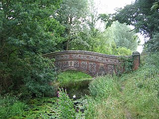
Wixoe is a village and civil parish in the West Suffolk district of Suffolk in eastern England. Located on the northern bank of the River Stour, two miles south-east of Haverhill, in 2005 its population was 140. It consists largely of Victorian cottages along a narrow lane. There is a church of 12th-century origin, St Leonard's, much restored in the 1880s. It was recorded in the Domesday Book, at 600 acres one of the smallest parishes in the hundred of Risbridge. There are some 13 listed buildings, including a 19th-century bridge and a water mill.

Lackford is a village and civil parish in the West Suffolk district of Suffolk in eastern England. Located around four miles north-west of Bury St Edmunds on the A1101, in 2005 it had a population of 270.

Sandon is a village and civil parish in the North Hertfordshire district, in the county of Hertfordshire, England. Sandon is located near the towns of Baldock and Buntingford. The parish also includes the hamlets of Green End and Roe Green, and Blagrove Common, a nature reserve. At the 2011 Census the population of the civil parish was 495.


