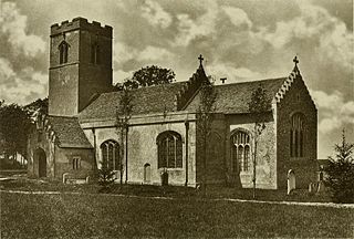
Ilketshall St Margaret is a village and civil parish in the East Suffolk district of Suffolk in eastern England. Located south of Bungay, in 2010 its population was 160. Of the twelve parishes in the Saints, St Margaret is one of only three proper villages.

The Saxhams is a civil parish in the West Suffolk district of Suffolk in eastern England. Located around two miles west of Bury St Edmunds, the parish covers the villages of Great Saxham and Little Saxham, as well as the Saxham Industrial Estate on the A14. In 2005 its population was 300. The parish was formed in 1998 from "Great Saxham" and "Little Saxham" and part of Risby.

Little Cornard is a village and civil parish in Suffolk, England. Located around 0.5 miles (0.8 km) from its larger sibling, Great Cornard, on the B1508 road between Sudbury and Colchester, it is part of Babergh district, and has a population of 305, reducing to 286 at the 2011 Census. The parish also includes the hamlet of Workhouse Green.
Copdock and Washbrook is a civil parish in the Babergh district, in the county of Suffolk, England. It covers the villages of Copdock and Washbrook, as well as the hamlets of Coles Green, Mace Green and Washbrook Street.

Kentford is a village and civil parish in the West Suffolk district of Suffolk in eastern England. In 2010 it had a population of 457. Located just off the A14, close to the border with Cambridgeshire, it is served by nearby Kennett railway station.
Tuddenham is a village and civil parish in the West Suffolk district of Suffolk in eastern England. In 2005 it had a population of 450. falling to 423 at the 2011 Census.

Gosbeck is a village and civil parish in the Mid Suffolk district of Suffolk in eastern England. Located around five miles north of Ipswich, in 2005 its population was 220.

Chedburgh is a village and civil parish in the West Suffolk district of Suffolk in eastern England. Located on the A143 around five miles south-west of Bury St Edmunds, in 2005 its population was 650, reducing to 597 at the 2011 Census.

Euston is a village and civil parish in the West Suffolk district of Suffolk in eastern England. Located on the A1088 around two miles south of Thetford, in 2005 its population was 130.
Depden is a village and civil parish in the West Suffolk district of Suffolk in eastern England. Located on the A143 around five miles south-west of Bury St Edmunds, in 2005 its population was 200, reducing to 184 at the 2011 Census.

Rede is a village and civil parish in the West Suffolk district of Suffolk in eastern England. Its location is situated South East of Chedburgh. In 1887 Rede was described as being "7 miles S[outh] W[est] of Bury St Edmonds, 1224 ac[res], pop[ulation] 224".

Great Whelnetham is a village and civil parish in the St Edmundsbury district of Suffolk in eastern England. Located around two miles south of Bury St Edmunds, in 2005 its population was 820.

Little Whelnetham (well-NEE-tham) is a village and civil parish in the West Suffolk district of Suffolk in eastern England. Located around two miles south of Bury St Edmunds, in 2005 its population was 180.
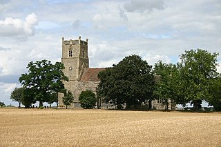
Rushbrooke with Rougham is a large civil parish in the West Suffolk district of Suffolk in eastern England covering the villages of Blackthorpe, Rougham and Rushbrooke as well as Rougham Airfield. Located directly south-east of Bury St Edmunds, in 2005 its population was 1,140. One 'Henry of Rushbrook' was Abbot of Bury St Edmunds from 1235 to 1248. The site of a former stately home, Rushbrooke Hall, is situated to the south of Rushbrooke. Until April 2019 it was in the St Edmundsbury district. The parish was created on 1 April 1988 from Rougham and parts of Great Barton, Great Whelnetham and Rushbrooke.
Market Weston is a small village and civil parish in the West Suffolk district of Suffolk in eastern England. It is located near the Norfolk border around seven miles east-south-east of Thetford. In 2005 its population was 260. The parish also contains the Weston Fen SSSI.

Denham is a village and civil parish in the West Suffolk district of Suffolk in eastern England. Located around five miles west of Bury St Edmunds, in 2005 its population was 170, reducing again to 171 at the 2011 Census. The parish also includes the hamlet of Denham End, as well as the remains of Denham Castle, a motte-and-bailey structure. The parish council is shared with neighbouring Barrow.
Hopton is a village and civil parish in the West Suffolk district of Suffolk in eastern England. Located just south of the Norfolk border on the B1111 road between Stanton and Garboldisham, in 2005 it had a population of 650. It shares a parish council with neighbouring Knettishall.

Lackford is a village and civil parish in the West Suffolk district of Suffolk in eastern England. Located around four miles north-west of Bury St Edmunds on the A1101, in 2005 it had a population of 270.

Purdis Farm is a civil parish, in the East Suffolk district, in the English county of Suffolk. It is located on the eastern edge of Ipswich and includes areas of suburban housing and industrial development along the A1156, including the area of Warren Heath. In 2001 the population of the area was 1743, the population increasing to 2,092 at the 2011 Census.

Ilketshall St Lawrence is a village and civil parish in the East Suffolk district of Suffolk in eastern England. One of the Saints, in 2010 its population was 160.
