Arlington County, or simply Arlington, is a county in the U.S. state of Virginia. The county is located in Northern Virginia on the southwestern bank of the Potomac River directly across from Washington, D.C., the national capital.
Interstate 66 (I-66) is a 76.32 mile east–west Interstate Highway in the eastern United States. The highway runs from an interchange with I-81 near Middletown, Virginia, on its western end to an interchange with U.S. Route 29 (US 29) in Washington, D.C., at the eastern terminus. Much of the route parallels US 29 or State Route 55 (SR 55) in Virginia. I-66 has no physical or historical connection to US 66, which was located in a different region of the United States.

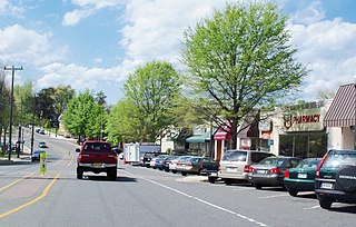
Ballston is a neighborhood in Arlington County, Virginia. Ballston is located at the western end of the Rosslyn-Ballston corridor. It is a major transportation hub and has one of the nation's highest concentrations of scientific research institutes and research and development agencies, including DARPA, the Office of Naval Research, the Advanced Research Institute of Virginia Tech, the Air Force Research Laboratory, and engineering, management, and public sector consulting firms. Ballston also includes a section known as Virginia Square and sometimes the area is collectively known as Ballston-Virginia Square.

Clarendon is an urbanized, upper-class neighborhood in Arlington County, Virginia, located between the Rosslyn area and the Ballston area. It was named after Edward Hyde, 1st Earl of Clarendon, a leading statesman and historian of the English Civil War. The main thoroughfares are Wilson Boulevard and Clarendon Boulevard.

State Route 120 is a primary state highway in the U.S. state of Virginia. Known as Glebe Road, the state highway runs 9.10 miles (14.65 km) from U.S. Route 1 (US 1) in Crystal City north to SR 123 at the Chain Bridge. SR 120 is a partial circumferential highway in Arlington County that connects the southeastern and northwestern corners of the county with several urban villages along its crescent-shaped path, including Ballston. The state highway also connects all of the major highways in Virginia that radiate from Washington, including Interstate 395, I-66, US 50, and US 29. SR 120 is a part of the National Highway System for its entire length.

The Washington and Old Dominion Railroad was an intrastate short-line railroad located in Northern Virginia, United States. The railroad was a successor to the bankrupt Washington and Old Dominion Railway and to several earlier railroads, the first of which began operating in 1859. The railroad closed in 1968.

The Washington and Old Dominion Railroad Regional Park is a linear regional park in Northern Virginia. The park's primary feature is the Washington and Old Dominion Railroad Trail, an asphalt-surfaced paved rail trail that runs through densely populated urban and suburban communities as well as through rural areas. Most of the trail travels on top of the rail bed of the former Washington and Old Dominion Railroad, which closed in 1968.

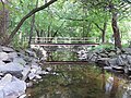
Four Mile Run is a 9.4-mile-long (15.1 km) stream in Northern Virginia that starts near Interstate 66, at Gordon Avenue in Fairfax County and proceeds southeast through Falls Church to Arlington County in the U.S. state of Virginia. Most of the stretch is parkland and is paralleled by two paved non-motorized transport and recreational trails, the Washington and Old Dominion Railroad Trail and the Four Mile Run Trail.

The Custis Trail is a hilly 4.5 miles (7.2 km)-long shared use path in Arlington County, Virginia. The asphalt-paved trail travels along Interstate 66 (I-66) between Rosslyn and the Washington and Old Dominion Railroad Trail at Bon Air Park.

The Northern Virginia trolleys were the network of electric streetcars that moved people around the Northern Virginia suburbs of Washington, D.C., from 1892 to 1941. They consisted of six lines operated by as many as three separate companies connecting Rosslyn, Great Falls, Bluemont, Mount Vernon, Fairfax, Camp Humphries, and Nauck across the Potomac River to Washington, D.C.

The Great Falls and Old Dominion Railroad (GF&OD) was an interurban trolley line that ran in Northern Virginia during the early 20th century.
Westover is a neighborhood in Arlington County, Virginia, The neighborhood has been named to the National Register of Historic Places. It is centered on Washington Boulevard between North McKinley Road and North Longfellow Street.

State Route 237 is a primary state highway in the U.S. state of Virginia. The state highway runs 13.07 miles (21.03 km) from SR 236 in Fairfax east to U.S. Route 50 in Arlington. SR 237 connects Fairfax and Arlington with Falls Church. Between Fairfax and Falls Church, the state highway mostly runs concurrently with US 29. East of Falls Church, SR 237 parallels Interstate 66 (I-66) and connects several of Arlington's urban villages.
State Route 309 is a primary state highway in the U.S. state of Virginia. Known for most of its length as Old Dominion Drive, which was once the right of way of the Great Falls Division of the Washington and Old Dominion Railroad, the state highway runs 5.33 miles (8.58 km) from SR 123 in McLean east to U.S. Route 29 in Arlington.

Washington Boulevard is a major arterial road in Arlington County, Virginia and Washington, DC. The western portion is designated State Route 237, the eastern portion is State Route 27 and the center is an arterial road with no designation. A short portion of the road enters the District of Columbia on Columbia Island, providing a connection between SR 27 and the Arlington Memorial Bridge.

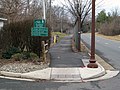
The Bluemont Junction Trail is a 1.2-mile (1.9 km) asphalt-paved rail trail in Arlington County, Virginia, United States, that the Arlington County government constructed along a former branch of the defunct Washington and Old Dominion Railroad. The shared use path travels southwest from Ballston through Bluemont Junction Park to Bluemont Junction. The trail connects Ballston to the Washington and Old Dominion Railroad Trail and the Four Mile Run Trail in and near Bluemont Park.
Nauck is a neighborhood in the southern part of Arlington County, Virginia, known locally as Green Valley. It is bordered by Four Mile Run and Shirlington to the south, Douglas Park to the west, I-395 to the east, and Columbia Heights and the Army-Navy Country Club to the north. The southeastern corner of the neighborhood borders the City of Alexandria.

The Wilson Boulevard–Vienna Line, designated as Route 1A, or Route 1B, is a daily bus route operated by the Washington Metropolitan Area Transit Authority between Vienna station (1A) or Dunn Loring station (1B) of the Orange Line of the Washington Metro and Ballston–MU station of the Orange and Silver lines of the Washington Metro.
The Washington Blvd.–Dunn Loring Line, designated as Route 2A, is a daily bus route operated by the Washington Metropolitan Area Transit Authority between Dunn Loring station of the Orange Line of the Washington Metro and Ballston–MU station of the Orange and Silver lines of the Washington Metro.

The Bluemont Junction was part of the Washington and Old Dominion Railway that began operation in 1912. Located in Bluemont, Arlington, the wye junction served as a transfer point for passengers and freight from Alexandria and Georgetown to points west ending at Bluemont, the a popular resort in the Blue Ridge Mountains.