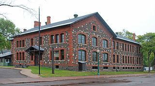
Keweenaw National Historical Park is a unit of the U.S. National Park Service. Established in 1992, the park celebrates the life and history of the Keweenaw Peninsula in the Upper Peninsula of the U.S. state of Michigan. As of 2009, it is a partly privatized park made up of two primary units, the Calumet Unit and the Quincy Unit, and 21 cooperating "Heritage Sites" located on federal, state, and privately owned land in and around the Keweenaw Peninsula. The National Park Service owns approximately 1,700 acres (690 ha) in the Calumet and Quincy Units. Units are located in Baraga, Houghton, Keweenaw, and Ontonagon counties.

Hilltop is one of the largest neighborhoods in Columbus, Ohio, located west of Franklinton and Downtown. The Greater Hilltop area contains newer and historic neighborhoods, schools, various stores, industrial areas, and recreational facilities. The development pattern is considered a distinct suburb. The majority of the area is predominantly single family residential.
Columbus, the state capital and Ohio's largest city, has numerous neighborhoods within its city limits. Neighborhood names and boundaries are not officially defined. They may vary or change from time to time due to demographic and economic variables.

Tantiusques ("Tant-E-oos-kwiss") is a 57-acre (230,000 m2) open space reservation and historic site registered with the National Register of Historic Places. The reservation is located in Sturbridge, Massachusetts, and is owned and managed by The Trustees of Reservations; it is notable for its historic, defunct graphite mines. This is a rural area with much of the adjacent and surrounding area undeveloped and forested. The reservation is entirely forested with oak-hickory forest and red maple in the wet areas and mountain laurel abundant throughout the understory. The name Tantiusques comes from a Nipmuc word meaning “the place between two low hills." The Nipmuc used the graphite to make ceremonial paints. The property also contains the ruins of a 19th-century period house that belonged to a mine worker of mixed African American and Native American ancestry.
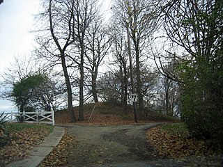
Norwood Mound, also known as “Indian Mound” by locals, is a prehistoric Native American earthwork mound located in Norwood, Ohio, United States, an enclave city of Cincinnati in Hamilton County, Ohio. It was listed on the National Register of Historic Places on May 2, 1974.

The Perin Village Site is an archaeological site in the southwestern part of the U.S. state of Ohio. Located in Newtown in Hamilton County, it is believed to have been inhabited by peoples of the Hopewell tradition.
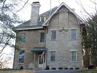
Twin Oaks, also known as the "Robert Reily House", is a historically significant residence in the city of Wyoming, located near Cincinnati in the southwestern corner of the U.S. state of Ohio. Constructed in the middle of the nineteenth century, it was the home of Robert Reily, one of the leading citizens of early Wyoming. Its heavy stone architecture features a mix of two important architectural styles of the period, and it has been named a historic site.

Farnams Village Historic District is a historic district in Cheshire, Massachusetts, United States. It encompasses the historic limestone mining community known as Farnams Village and the associated surviving industrial and mining infrastructure associated with a mining operation active from the late 19th century into the mid-20th century. The main village area is centered on Lanesborough Road in southern Cheshire, near Farnams and Quarry Roads, with quarry sites on the hillside to the west. The district was listed on the National Register of Historic Places in 2000.

The Barnesville Petroglyph petroglyph site in the eastern part of the U.S. state of Ohio. Located approximately 3 miles (4.8 km) southwest of the village of Barnesville in Belmont County, the petroglyphs have been known both by archaeologists and the general public since the 1850s or earlier. Although the site was significantly damaged during the twentieth century, it is still a significant archaeological site, and has been named a historic site.
The Tower Site is a prehistoric village site dating from 1000 to 1499 AD and is closely associated with the Monongahela culture. Located around 4 miles (6.4 km) north-west of Barnesville, Ohio, United States, the site was placed on the National Register of Historic Places in 1982.
The Squirrel Hill Site is an archaeological site in northeastern Westmoreland County, Pennsylvania, United States. Located in St. Clair Township west of the borough of New Florence, it was once occupied by a large Monongahela village during the pre-contact period.

The Fisher site is an archaeological site in northwestern Greene County, Pennsylvania, United States. Located along a tributary of Wheeling Creek in northern Richhill Township, it was once occupied by a Monongahela village. It has been ranked as one of southwestern Pennsylvania's most important locations for prehistoric preservation.
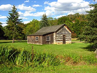
The Bedford Village Archeological Site (36BD90) is an archaeological site in central Bedford County, Pennsylvania, United States. Located in Bedford Township north of the borough of Bedford, it was once occupied by a Monongahela culture village. Today, the site is the location of Old Bedford Village, an open-air museum, containing a variety of historic structures transported to the site from the surrounding towns of Bedford, Everett, and Rainsburg.

The Gatch Site is an archaeological site located near Milford, Ohio, United States. One of the largest archaeological sites in Clermont County, it is believed to have been a Native American village site during the Middle Woodland period.

The Cary Village Site is an archaeological site in the west-central portion of the U.S. state of Ohio. Located southeast of the village of Plain City in Madison County, the site occupies a group of grassy terraces located amid two farm fields. In this grassy area, archaeologists have discovered a wide range of artifacts, including stone tools, materials made of flint, and various types of pottery.
The Beam Farm Woodland Archaeological District is a group of archaeological sites in the southwestern part of the U.S. state of Ohio. Located at 3983 Stone Road near the village of Sabina in Clinton County, the district is composed of one Native American mound and two other archaeological sites spread out over an area of 2 acres (0.81 ha). Known as the Beam Farm Mound and the Beam Sites 9 and 12, the sites that compose the district have yielded artifacts from the Adena culture and the Hopewell tradition, both of which inhabited southwestern Ohio during the Woodland period. Because both the Adena and the Hopewell lived around the mound, and because both cultures built mounds, the identity of the people who constructed the Beam Farm Mound cannot be established; all that can be known with reasonable certainty is that it was raised during the early or middle portion of the Woodland period, or between 800 BC and AD 500.

The Bullskin Creek Site is an archaeological site in the southwestern portion of the U.S. state of Ohio. Located near Felicity in Clermont County, the site appears to have been a base camp for nomads during the Late Archaic period. The site comprises three loci: two significant areas of various debris and a large midden that underlies everything else. From these components, which cover an area of approximately 400 feet (120 m) by 600 feet (180 m), collectors and archaeologists have recovered hundreds of artifacts, including stone tools, weapons, and bone tools. Because the site is located in a farm field, it has frequently been cultivated, and the plow has brought at least five burials to the surface from a cemetery on the edge of the site. Among the types of features found at the site are ovens, trash pits, and postmolds. Bodies at the site were generally adorned with red ochre and buried in a flexed position.
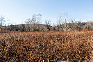
The Mountain Lake Site is an archaeological site in Mountain Lake Township, Minnesota, United States. It is a deeply stratified village site spanning the precontact era from the late Archaic to an Oneota occupation, with a particular concentration of Woodland period ceramics. The site is atop a hill that was formerly an island in a lake. The site was listed on the National Register of Historic Places in 1977 for its state significance in the theme of archaeology.
The Orr-Herl Mound and Village Site is an archaeological site located along the Ohio River in Hardin County, Illinois, United States. The site consists of a mound, which includes a sizable midden, and the remains of a village. The village was inhabited from roughly 900 to 1500 AD by Mississippian peoples. The site was an important source of fluorspar, which Mississippian peoples used for carvings and beads. The village was likely a manufacturing site for fluorspar items, which were then traded to other villages; this theory is supported by fluorspar artifacts recovered from the Kincaid Site, a Mississippian chiefdom center on the Ohio River in Illinois.
Whittlesey culture is an archaeological designation for a Native American people, who lived in northeastern Ohio during the Late Precontact and Early Contact period between A.D. 1000 to 1640. By 1500, they flourished as an agrarian society that grew maize, beans, and squash. After European contact, their population decreased due to disease, malnutrition, and warfare. There was a period of long, cold winters that would have impacted their success cultivating food from about 1500.


