Emigsville, Pennsylvania

Last updated

Emigsville
CDP
York County Pennsylvania incorporated and unincorporated areas Emigsville highlighted.svg
Location in York County and the U.S. state of Pennsylvania.
Coordinates: 40°00′12″N76°43′51″W / 40.00333°N 76.73083°W / 40.00333; -76.73083
Country United States
State Pennsylvania
County York
Township Manchester
Area
[1]
  Total1.37 sq mi (3.56 km2)
  Land1.37 sq mi (3.55 km2)
  Water0.00 sq mi (0.00 km2)
Elevation
[2]
423 ft (129 m)
Population
 (2020) [3]
  Total3,563
  Density2,596.94/sq mi (1,002.82/km2)
Time zone UTC-5 (Eastern (EST))
  Summer (DST) UTC-4 (EDT)
ZIP code
17318 [4]
Area code 717
FIPS code 42-23560
GNIS feature ID2389042 [2]

Emigsville is a census-designated place (CDP) in York County, Pennsylvania, United States. The population was 3,563 at the 2020 census. [5]

Contents

History

The Emig Mansion was listed on the National Register of Historic Places in 1984. [6]

Emigsville is home to the Emigsville Band, formerly known as the Acme Cornet Band of Emigsville, PA. The organization traces its roots to 1872 when it was founded as a company band for the Acme Wagon Works Company. The band owns its Band Hall located at 3175 North George Street. It is one of a few remaining community concert bands in the county.

Geography

Emigsville is located in Manchester Township just north of the city of York.

According to the United States Census Bureau, the CDP has a total area of 1.2 square miles (3.1 km2), all land.

Demographics

Historical population
CensusPop.Note
2020 3,563
U.S. Decennial Census [7] [3]

At the 2000 census there were 2,467 people, 1,045 households, and 731 families living in the CDP. The population density was 2,067.9 inhabitants per square mile (798.4/km2). There were 1,086 housing units at an average density of 910.3 per square mile (351.5/km2). The racial makeup of the CDP was 93.88% White, 2.23% Black, 0.16% Native American, 1.58% Asian, 0.04% Pacific Islander, 1.22% from other races, and 0.89% from two or more races. Hispanic or Latino of any race were 2.03%. [8]

Of the 1,045 households 27.4% had children under the age of 18 living with them, 58.5% were married couples living together, 7.8% had a female householder with no husband present, and 30.0% were non-families. 23.5% of households were one person and 10.0% were one person aged 65 or older. The average household size was 2.36 and the average family size was 2.77.

The age distribution was 21.0% under the age of 18, 6.8% from 18 to 24, 29.6% from 25 to 44, 22.5% from 45 to 64, and 20.1% 65 or older. The median age was 40 years. For every 100 females, there were 92.9 males. For every 100 females age 18 and over, there were 88.9 males.

The median household income was $44,116 and the median family income was $47,420. Males had a median income of $37,370 versus $24,375 for females. The per capita income for the CDP was $19,740. About 2.0% of families and 3.1% of the population were below the poverty line, including none of those under age 18 and 8.3% of those age 65 or over.

Education

Related Research Articles

<span class="mw-page-title-main">Tara Hills, California</span> Census-designated place in California, United States

Tara Hills is a census-designated place (CDP) in Contra Costa County, California, United States. The population was 5,126 at the 2010 census.

<span class="mw-page-title-main">Grove City, Florida</span> Census-designated place in Florida, United States

Grove City is an unincorporated community and census-designated place (CDP) in Charlotte County, Florida, United States. The population was 2,174 at the 2020 census. It is part of the Sarasota-Bradenton-Punta Gorda Combined Statistical Area.

<span class="mw-page-title-main">Macy, Nebraska</span> Census-designated place in Thurston County, Nebraska, United States

Macy is a census-designated place (CDP) in Thurston County, Nebraska, United States. The population was 1,045 at the 2020 census. It is within the Omaha Reservation, and includes Omaha Nation Public Schools.

<span class="mw-page-title-main">Lenape Heights, Pennsylvania</span> Census-designated place in Pennsylvania, United States

Lenape Heights is a census-designated place (CDP) in Armstrong County, Pennsylvania, United States. The population was 1,144 at the 2020 census.

<span class="mw-page-title-main">Nixon, Pennsylvania</span> Census-designated place in Pennsylvania, United States

Nixon is a census-designated place (CDP) in Penn Township, Butler County, Pennsylvania, United States. The population was 1,373 at the 2010 census.

<span class="mw-page-title-main">Eyers Grove, Pennsylvania</span> Census-designated place in Pennsylvania, United States

Eyers Grove is a census-designated place in Columbia County, Pennsylvania, United States. It is part of Northeastern Pennsylvania. The population was 102 at the 2020 census. It is part of the Bloomsburg-Berwick micropolitan area.

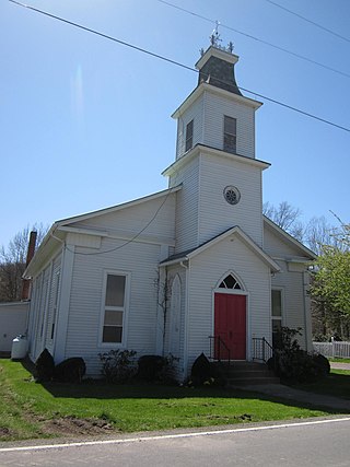
Locustdale is a census-designated place (CDP) that is located on the border of Columbia and Schuylkill counties, Pennsylvania, United States. It is part of Northeastern Pennsylvania.

<span class="mw-page-title-main">Pymatuning Central, Pennsylvania</span> Census-designated place in Pennsylvania, United States

Pymatuning Central is a census-designated place (CDP) in Crawford County, Pennsylvania, United States. The population was 2,269 at the 2010 census.

<span class="mw-page-title-main">Buck Run, Pennsylvania</span> CDP in Pennsylvania, United States

Buck Run is a census-designated place (CDP) in Schuylkill County, Pennsylvania, United States. The population was 176 at the 2010 census.

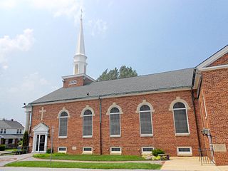
Fountain Springs is a census-designated place in Butler Township, Schuylkill County, Pennsylvania, United States. The population was 100 at the 2000 census.

<span class="mw-page-title-main">Marlin, Pennsylvania</span> CDP in Pennsylvania, United States

Marlin, or MarLin is a census-designated place (CDP) in Schuylkill County, Pennsylvania, United States. The population was 640 at the 2000 census. It is a village of Norwegian Township. The village is the seat of government for the township.

Renningers is a census-designated place (CDP) in Schuylkill County, Pennsylvania, United States. The population was 380 at the 2000 census.

<span class="mw-page-title-main">Grantley, Pennsylvania</span> CDP in Pennsylvania, United States

Grantley is a census-designated place (CDP) in York County, Pennsylvania, United States. The population was 3,628 at the 2010 census.

<span class="mw-page-title-main">Manchester Township, York County, Pennsylvania</span> Township in Pennsylvania, United States

Manchester Township is a township in York County, Pennsylvania, United States. The population was 19,511 at the 2020 census.

<span class="mw-page-title-main">Parkville, Pennsylvania</span> CDP in Pennsylvania, United States

Parkville is a census-designated place (CDP) in York County, Pennsylvania, United States. The population was 6,706 at the 2010 census.

<span class="mw-page-title-main">Spry, Pennsylvania</span> CDP in Pennsylvania, United States

Spry is a census-designated place (CDP) that is located in York County, Pennsylvania, United States. The population was 4,891 at the time of the 2010 census.

<span class="mw-page-title-main">Valley Green, Pennsylvania</span> CDP in Pennsylvania, United States

Valley Green is a census-designated place (CDP) in York County, Pennsylvania, United States. The population was 3,429 at the 2010 census.

<span class="mw-page-title-main">Valley View, York County, Pennsylvania</span> CDP in Pennsylvania, United States

Valley View is a census-designated place (CDP) in York County, Pennsylvania, United States. The population was 2,817 at the 2010 census.

<span class="mw-page-title-main">Acme, Washington</span> Village in Washington, United States

Acme is a rural village in Whatcom County, Washington, United States. There is a general store, post office, gas station, diner, elementary school and two churches located there. Acme is also included in, and the source-name for, a larger census-designated place (CDP). The Census Bureau no longer tracks the population for the village itself, but for the entire CDP the population was 246 at the 2010 census.

<span class="mw-page-title-main">Lenox (CDP), Massachusetts</span> Census-designated place in Massachusetts, United States

Lenox, also known as Lenox Center, is a census-designated place (CDP) in the town of Lenox in Berkshire County, Massachusetts, United States. The population was 1,675 at the 2010 census, out of 5,025 in the entire town of Lenox.

References

  1. "ArcGIS REST Services Directory". United States Census Bureau. Retrieved October 15, 2022.
  2. 1 2 U.S. Geological Survey Geographic Names Information System: Emigsville, Pennsylvania
  3. 1 2 "Census Population API". United States Census Bureau. Retrieved October 15, 2022.
  4. "Emigsville PA ZIP Code". zipdatamaps.com. 2023. Retrieved May 13, 2023.
  5. "Race, Hispanic or Latino, Age, and Housing Occupancy: 2010 Census Redistricting Data (Public Law 94-171) Summary File (QT-PL), Emigsville CDP, Pennsylvania". United States Census Bureau . Retrieved October 17, 2011.
  6. "National Register Information System". National Register of Historic Places . National Park Service. July 9, 2010.
  7. "Census of Population and Housing". Census.gov. Retrieved June 4, 2016.
  8. "U.S. Census website". United States Census Bureau . Retrieved January 31, 2008.