Mount Wolf, Pennsylvania

Last updated

Mount Wolf, Pennsylvania
Borough
By depot Mt. Wolf PA.JPG
Warehouses by the depot
York County Pennsylvania incorporated and unincorporated areas Mount Wolf highlighted.svg
Location in York County and the U.S. state of Pennsylvania.
USA Pennsylvania location map.svg
Red pog.svg
Mount Wolf
Location of Mount Wolf in Pennsylvania
Usa edcp location map.svg
Red pog.svg
Mount Wolf
Mount Wolf (the United States)
Coordinates: 40°03′46″N76°42′20″W / 40.06278°N 76.70556°W / 40.06278; -76.70556
Country United States
State Pennsylvania
County York
Settled1867
Incorporated1910
Government
  TypeBorough Council
  MayorMaureen Starner [1]
Area
[2]
  Total0.52 sq mi (1.36 km2)
  Land0.52 sq mi (1.36 km2)
  Water0.00 sq mi (0.00 km2)
Elevation
374 ft (114 m)
Population
 (2020) [3]
  Total1,368
  Density2,610.69/sq mi (1,007.54/km2)
Time zone UTC-5 (Eastern (EST))
  Summer (DST) UTC-4 (EDT)
Zip code
17347
Area code 717
FIPS code 42-52056
Website Mount Wolf Borough website

Mount Wolf is a borough in York County, Pennsylvania, United States. The population was 1,367 at the 2020 census. [4]

Contents

Geography

Mount Wolf is located at 40°3′46″N76°42′20″W / 40.06278°N 76.70556°W / 40.06278; -76.70556 (40.062794, -76.705587). [5]

According to the United States Census Bureau, the borough has a total area of 0.5 square mile (1.4 km2), all land.

History

In the area later to become Mount Wolf, the earliest recorded land deeds were dated 1746. [6] Around 1850, the York and Cumberland Railroad decided to locate a station between Emigsville, Liverpool (now Manchester) and New Holland (now Saginaw). [7] The station was named Mount Campbell in honor of Thomas Campbell, who was instrumental in urging completion of the railway to Harrisburg. In the late 1850s, the station and post office became known as Mount Wolf in honor of George H. Wolf, who was the stationmaster, postmaster, and owner of a local store and warehouse.

Mount Wolf became incorporated as a self-governing borough on August 23, 1910. A mayor and a six-member council govern it. [8] [9] [10] [11]

In April 2011, the Mount Wolf Centennial Committee received second-place recognition in the 2011 Borough News Municipal Website contest for the population category under 2,500 from the Pennsylvania State Association of Boroughs. In September 2011, the Mount Wolf Centennial Committee received the "Community Award - Government/Civic Organization", at the annual board meeting of the York County Heritage Trust.

Thomas Westerman Wolf, who was elected Governor of Pennsylvania in 2014, is from Mount Wolf and is a descendant of George H. Wolf.

Demographics

Historical population
CensusPop.Note
1880 148
1920 688
1930 99945.2%
1940 970−2.9%
1950 1,16420.0%
1960 1,51430.1%
1970 1,81119.6%
1980 1,517−16.2%
1990 1,365−10.0%
2000 1,3730.6%
2010 1,3931.5%
2020 1,367−1.9%
2021 (est.)1,363 [4] −0.3%
Sources: [12] [13] [14] [3]

As of the census [13] of 2000, there were 1,373 people, 548 households, and 396 families residing in the borough. The population density was 2,530.6 inhabitants per square mile (977.1/km2). There were 570 housing units at an average density of 1,050.6 per square mile (405.6/km2). The racial makeup of the borough was 97.01% White, 1.24% African American, 0.15% Native American, 0.22% Asian, 0.22% from other races, and 1.17% from two or more races. Hispanic or Latino of any race were 1.60% of the population.

There were 548 households, out of which 28.5% had children under the age of 18 living with them, 56.8% were married couples living together, 10.9% had a female householder with no husband present, and 27.6% were non-families. 23.2% of all households were made up of individuals, and 11.5% had someone living alone who was 65 years of age or older. The average household size was 2.44 and the average family size was 2.85.

The borough's population distribution by age was as follows: 24.4% under the age of 18 years, 7.1% from 18 to 24 years, 29.3% from 25 to 44 years, 22.2% from 45 to 64 years, and 17.0% 65 years of age or older. The median age was 40 years. For every 100 females there were 92.6 males. For every 100 females age 18 and over, there were 90.5 males.

The median income for a household in the borough was $42,135, and the median income for a family was $47,813. Males had a median income of $35,268 versus $25,859 for females. The per capita income for the borough was $19,760. About 2.5% of families and 4.7% of the population were below the poverty line, including 2.1% of those under age 18 and 3.1% of those age 65 or over.

Education

Mount Wolf is served by the Northeastern York School District.

Related Research Articles

<span class="mw-page-title-main">Marietta, Pennsylvania</span> Borough in Pennsylvania, United States

Marietta is a borough in Lancaster County, Pennsylvania, United States. The population was 2,633 at the 2020 census. It is located on the east bank of the Susquehanna River, northwest of Columbia.

<span class="mw-page-title-main">Mount Oliver, Pennsylvania</span> Borough in Pennsylvania, United States

Mount Oliver is a borough in Allegheny County, Pennsylvania, United States. It is a largely residential area situated atop a crest about 3 miles (5 km) west of the Monongahela River. The borough is surrounded entirely by the city of Pittsburgh, having resisted annexations by the city, as it prefers to manage its own local needs and finances.

<span class="mw-page-title-main">South Waverly, Pennsylvania</span> Borough in Pennsylvania, United States

South Waverly is a borough in Bradford County, Pennsylvania, United States. It is part of Northeastern Pennsylvania. The population was 1,070 at the 2020 census. South Waverly is part of the Penn-York Valley, a group of four contiguous communities in New York and Pennsylvania: Waverly, New York, South Waverly, Sayre, and Athens, with a combined population near 30,000.

<span class="mw-page-title-main">Slippery Rock Township, Butler County, Pennsylvania</span> Township in Pennsylvania, United States

Slippery Rock Township is a township in Butler County, Pennsylvania, United States. The population was 6,719 at the 2020 census.

<span class="mw-page-title-main">New Cumberland, Pennsylvania</span> Borough in Pennsylvania, United States

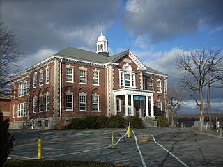
New Cumberland is a borough in easternmost Cumberland County, Pennsylvania, United States. New Cumberland was incorporated on March 21, 1831. The population was 7,277 at the 2010 census. The borough is noted for its historic downtown which includes landmarks like the historic West Shore Theater, Borough park, the yearly Apple Festival, which gathers hundreds of vendors and thousands of visitors.

<span class="mw-page-title-main">Mountville, Pennsylvania</span> Borough in Pennsylvania, United States

Mountville is a borough in Lancaster County, Pennsylvania, United States. The population was 3,022 at the 2020 census, an increase over the figure of 2,802 tabulated in 2010. The original Charles Chips potato chip factory was located here.

<span class="mw-page-title-main">Terre Hill, Pennsylvania</span> Borough in Pennsylvania, United States

Terre Hill is a borough in Lancaster County, Pennsylvania, United States. The population was 1,363 at the 2020 census.

<span class="mw-page-title-main">Mount Gretna, Pennsylvania</span> Borough in Pennsylvania, United States

Mount Gretna is a borough in Lebanon County, Pennsylvania, United States. It is part of the Lebanon, PA, Metropolitan Statistical Area. The population was 188 at the 2020 census. It was founded by the Pennsylvania Chautauqua Society, which was attracted by the area's natural landscape and beauty, by the 1890s.

Mount Gretna Heights is an unincorporated community and census-designated place (CDP) in Lebanon County, Pennsylvania, United States, adjacent to the borough of Mount Gretna. The population was 323 at the 2010 census.

<span class="mw-page-title-main">Conyngham, Pennsylvania</span> Borough in Pennsylvania, United States

Conyngham is a borough in Luzerne County, Pennsylvania, United States. The population was 1,820 at the 2020 census.

<span class="mw-page-title-main">East Berwick, Pennsylvania</span> Census-designated place in Pennsylvania, United States

East Berwick is a census-designated place (CDP) in Salem Township, Luzerne County, Pennsylvania, United States. The population was 2,007 at the 2010 census.

<span class="mw-page-title-main">Auburn, Pennsylvania</span> Borough in Pennsylvania, United States

Auburn is a borough in Schuylkill County, Pennsylvania, United States. The population was 663 at the 2020 census.

<span class="mw-page-title-main">Jennerstown, Pennsylvania</span> Borough in Pennsylvania, United States

Jennerstown is a borough in Somerset County, Pennsylvania, United States. It is part of the Johnstown, Pennsylvania Metropolitan Statistical Area. The population was 679 at the 2020 census. The borough is the home of Jennerstown Speedway. The town was named for Edward Jenner.

<span class="mw-page-title-main">Mount Pleasant, Pennsylvania</span> Borough in Pennsylvania, United States

Mount Pleasant is a borough in Westmoreland County, Pennsylvania, United States. It stands 45 miles (72 km) southeast of Pittsburgh. As of the 2020 census, the borough's population was 4,245.

<span class="mw-page-title-main">East Manchester Township, York County, Pennsylvania</span> Township in Pennsylvania, United States

East Manchester Township is a township in York County, Pennsylvania, United States. As of the 2020 census, the township population was 8,327.

<span class="mw-page-title-main">Hallam, Pennsylvania</span> Borough in Pennsylvania, United States

HallamHEL-əm is a borough in York County, Pennsylvania, United States. The population was 2,774 at the 2020 census.

<span class="mw-page-title-main">Manchester, Pennsylvania</span> Borough in Pennsylvania, United States

Manchester is a borough in York County, Pennsylvania, United States. The population was 2,798 at the 2020 census.

<span class="mw-page-title-main">New Freedom, Pennsylvania</span> Borough in Pennsylvania, United States

New Freedom is a borough in York County, Pennsylvania, United States. As of the 2020 census, the borough had a population of 4,874. Once an industrial/railroad town, the community has evolved into a predominantly residential community.

<span class="mw-page-title-main">Wellsville, Pennsylvania</span> Historic district in Pennsylvania, United States

Wellsville is a borough in York County, Pennsylvania, United States. The population was 299 at the 2020 census.

<span class="mw-page-title-main">York Haven, Pennsylvania</span> Borough in Pennsylvania, United States

York Haven is a borough in York County, Pennsylvania, United States. The population was 691 at the 2020 census. The borough is the home of the Brunner Island coal-fired electrical generation plant, located on the Susquehanna River on Wago Road and operated by PPL Corporation.

References

  1. "Administration". mtwolfborough.com. Retrieved May 10, 2016.
  2. "ArcGIS REST Services Directory". United States Census Bureau. Retrieved October 12, 2022.
  3. 1 2 "Census Population API". United States Census Bureau. Retrieved October 12, 2022.
  4. 1 2 Bureau, US Census. "City and Town Population Totals: 2020-2021". Census.gov. US Census Bureau. Retrieved July 9, 2022.
  5. "US Gazetteer files: 2010, 2000, and 1990". United States Census Bureau. February 12, 2011. Retrieved April 23, 2011.
  6. "Mount Wolf Borough History Before 1850". North Eastern York County History In Preservation. Retrieved August 30, 2018.
  7. "Mount Wolf Borough 1850-1910". North Eastern York County History In Preservation. Retrieved August 30, 2018.
  8. "Example Domain".
  9. "A History of Mount Wolf The Centennial Edition" released September 22, 2010 ISBN   978-1-4507-3908-5 edited by Brad Rentzel and Charles Stambaugh.
  10. Borough of Mount Wolf history
  11. "Administration". Mt. Wolf Borough official site. Retrieved August 30, 2018.
  12. "Census of Population and Housing". U.S. Census Bureau. Retrieved December 11, 2013.
  13. 1 2 "U.S. Census website". United States Census Bureau . Retrieved January 31, 2008.
  14. "Incorporated Places and Minor Civil Divisions Datasets: Subcounty Resident Population Estimates: April 1, 2010 to July 1, 2012". Population Estimates. U.S. Census Bureau. Archived from the original on June 11, 2013. Retrieved December 11, 2013.