Loganville, Pennsylvania

Last updated
Loganville, Pennsylvania
Borough
Loganville, Pennsylvania (8481862933).jpg
York County Pennsylvania incorporated and unincorporated areas Loganville highlighted.svg
Location in York County and the U.S. state of Pennsylvania.
USA Pennsylvania location map.svg
Red pog.svg
Loganville
Location of Loganville in Pennsylvania
Usa edcp location map.svg
Red pog.svg
Loganville
Loganville (the United States)
Coordinates: 39°51′19″N76°42′30″W / 39.85528°N 76.70833°W / 39.85528; -76.70833
Country United States
State Pennsylvania
County York
Settled1820
Incorporated1852
Government
  TypeBorough Council
  MayorEric Mueller
Area
[1]
  Total1.00 sq mi (2.59 km2)
  Land1.00 sq mi (2.59 km2)
  Water0.00 sq mi (0.00 km2)
Elevation
778 ft (237 m)
Population
 (2020) [2]
  Total1,426
  Density1,426.00/sq mi (550.49/km2)
Time zone UTC-5 (Eastern (EST))
  Summer (DST) UTC-4 (EDT)
ZIP Code
17342
Area code 717
FIPS code 42-44416
Website www.loganvillepa.us

Loganville, which was founded in 1820 and named after Colonel Henry Logan, is a borough in York County, Pennsylvania, United States. [3]

Contents

The population was 1,427 at the time of the 2020 census. [4]

History

Established in the center of Springfield Township in York County, Pennsylvania in 1820, the land which would ultimately become the community of Loganville was surveyed by Robert Richie and plotted by auctioneer Robert Wilson, who later named the town in honor of Colonel Henry Logan, a prominent, 19th-century politician. [5]

Wilson subsequently established the town's first post office, operating it from his home as his new town's first postmaster. He was succeeded by Samuel Keyser. [6]

The town's first store was operated by Jacob Gipe; additional stores were subsequently opened and operated by Frederick Asper, Paul Burbank and Frederick Overmiller. Between 1830 and 1840, the town grew from one store, one hotel and twelve houses to include a total of twenty houses and a population of ninety. [7]

The town was subsequently incorporated as a borough on April 2, 1852. Its first elected officials were Chief Burgess John F. Beck Sr., Assistant Burgess Michael Snyder, Judge John F. Beck, Constable Charles Overmiller, and borough council members Daniel Goodling, John Hildebrand, Adam Krout, Samuel Smith, and Frederick Venus. School directors were Joseph Hartman, Casper Hildebrand and Henry Kerlinger. Jacob Glatfelter and George H. Reever held positions as inspectors. [8]

On August 20, 1858, musicians Henry Decker and Henry Kerlinger succeeded in forming the Loganville Cornet Band. The original membership roster also included Deterich Hildebrand. [9]

George P. Yost, MD and George W. Holtzapple, MD were two of the community's first physicians. [10]

By 1880, the borough's population had climbed to three hundred and twelve. [11]

By the middle of that decade, leaders of the increasingly popular Logan Cornet Band had increased the ensemble's membership to twenty and had purchased new silver-plated instruments for its members, as well as a concert hall in which to host the band's performances. [12]

Teachers in the community's public schools at that time included J. M. Bailey and E. B. Goodling. [13]

Geography

Loganville is located at 39°51′19″N76°42′30″W / 39.85528°N 76.70833°W / 39.85528; -76.70833 (39.855156, -76.708459). [14]

According to the United States Census Bureau, the borough has a total area of 1.0 square mile (2.6 km2), all land.

Demographics

Historical population
CensusPop.Note
1860 221
1870 25615.8%
1880 31221.9%
1890 296−5.1%
1900 34315.9%
1910 298−13.1%
1920 284−4.7%
1930 40442.3%
1940 4081.0%
1950 56939.5%
1960 74230.4%
1970 92124.1%
1980 1,02010.7%
1990 954−6.5%
2000 908−4.8%
2010 1,24036.6%
2020 1,42715.1%
2021 (est.)1,446 [4] 1.3%
Sources: [15] [16] [17] [2]

As of the census [16] of 2000, there were nine hundred and eight people, three hundred and sixty-one households and two hundred and fifty-eight families living in the borough.

The population density was 914.1 inhabitants per square mile (352.9/km2). There were three hundred seventy-seven housing units at an average density of 379.5 per square mile (146.5/km2).

The racial makeup of the borough was 97.03% White, 0.33% African American, 0.33% Native American, 0.66% Asian, and 1.65% from two or more races. Hispanic or Latino of any race were 0.88% of the population.

There were three hundred sixty-one households, out of which 33.5% had children under the age of eighteen living with them; 61.5% were married couples living together, 6.4% had a female householder with no husband present, and 28.5% were non-families. 23.8% of all households were made up of individuals, and 11.1% had someone living alone who was sixty-five years of age or older.

The average household size was 2.52 and the average family size was 2.96.

In the borough the population was spread out, with 26.1% under the age of eighteen, 7.0% from eighteen to twenty-four, 27.8% from twenty-five to forty-four, 23.5% from forty-five to sixty-four, and 15.6% who were sixty-five years of age or older. The median age was thirty-seven years.

For every one hundred females there were 92.0 males. For every one hundred females aged eighteen and over, there were 88.0 males.

The median income for a household in the borough was $37,857, and the median income for a family was $47,266. Males had a median income of $35,875 compared with that of $22,438 for females. The per capita income for the borough was $18,101.

Roughly 3.9% of families and 6.2% of the population were below the poverty line, including 10.0% of those under age 18 and 2.9% of those age 65 or over.

Related Research Articles

<span class="mw-page-title-main">Homewood, Pennsylvania</span> Borough in Pennsylvania, United States

Homewood is a borough which is located in northern Beaver County, Pennsylvania, United States. The population was 104 at the time of the 2020 census.

<span class="mw-page-title-main">Karns City, Pennsylvania</span> Borough in Pennsylvania, United States

Karns City is a borough that is located in Butler County, Pennsylvania, United States. The population was 209 at the time of the 2010 census.

<span class="mw-page-title-main">Worthville, Pennsylvania</span> Borough in Pennsylvania, United States

Worthville is a borough in Jefferson County, Pennsylvania, United States. The population was sixty-seven at the time of the 2010 census, a decline from the figure of eighty-five, which had been tabulated in 2000.

<span class="mw-page-title-main">Laflin, Pennsylvania</span> Borough in Pennsylvania, United States

Laflin is a borough in the Greater Pittston area of Luzerne County, Pennsylvania, United States. The population was 1,443 at the time of the 2020 census.

<span class="mw-page-title-main">Pringle, Pennsylvania</span> Borough in Pennsylvania, United States

Pringle is a borough in Luzerne County, Pennsylvania, United States. As of the 2020 census, the borough population was eight hundred and ninety-one.

<span class="mw-page-title-main">Shinglehouse, Pennsylvania</span> Borough in Pennsylvania, United States

Shinglehouse is a borough in Potter County, Pennsylvania, United States. The population was 1,108 at the time of the 2020 census.

<span class="mw-page-title-main">Mechanicsville, Schuylkill County, Pennsylvania</span> Borough in Pennsylvania, United States

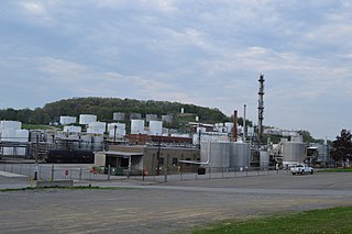
Mechanicsville is a borough in Schuylkill County, Pennsylvania, United States. Part of the Pottsville Area School District, it lies between Pottsville and Port Carbon. Pottsville Street is the community's main street.

<span class="mw-page-title-main">Middleport, Pennsylvania</span> Borough in Pennsylvania, United States

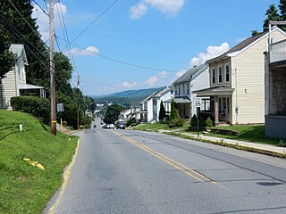
Middleport is a borough in Schuylkill County, Pennsylvania, United States. The population was 363 at the time of the 2020 census.

<span class="mw-page-title-main">New Castle Township, Schuylkill County, Pennsylvania</span> Township in Pennsylvania, United States

New Castle Township is a township that is located in Schuylkill County, Pennsylvania, United States, in the state's Coal Region. The population was 348 at the time of the 2020 census.

<span class="mw-page-title-main">New Ringgold, Pennsylvania</span> Borough in Pennsylvania, United States

New Ringgold is a borough in Schuylkill County, Pennsylvania, United States. The population was 253 at the time of the 2020 census.

<span class="mw-page-title-main">Tremont, Pennsylvania</span> Borough in Pennsylvania, United States

Tremont is a borough in Schuylkill County, Pennsylvania, United States. Situated in the eastern section of Tremont Township, it was incorporated as a borough in 1866, around the same time that a water system was erected in the community.

<span class="mw-page-title-main">Liberty, Tioga County, Pennsylvania</span> Borough in Pennsylvania, United States

Liberty is a small borough in Tioga County, Pennsylvania, United States. The population was 232 at the time of the 2020 census.

<span class="mw-page-title-main">Westfield, Pennsylvania</span> Borough in Pennsylvania, United States

Westfield is a borough in Tioga County, Pennsylvania, United States. The population was 1,113 at the time of the 2020 census.

<span class="mw-page-title-main">Midway, Washington County, Pennsylvania</span> Borough in Pennsylvania, United States

Midway is a borough that is located in Washington County, Pennsylvania, United States. The population was 921 at the time of the 2020 census.

<span class="mw-page-title-main">Laurel Mountain, Pennsylvania</span> Borough in Pennsylvania, United States

Laurel Mountain is a borough that is located in Westmoreland County, Pennsylvania, United States. The population was 185 at the time of the 2000 census.

<span class="mw-page-title-main">Manor, Pennsylvania</span> Borough in Pennsylvania, United States

Manor is a borough that is located in Westmoreland County, Pennsylvania, United States. The population was 3,585 at the time of the 2020 census.

<span class="mw-page-title-main">North Hopewell Township, York County, Pennsylvania</span> Township in Pennsylvania, United States

North Hopewell Township is a township that is located in York County, Pennsylvania, United States. The population was 2,723 at the time of the 2020 census.

<span class="mw-page-title-main">Railroad, Pennsylvania</span> Borough in Pennsylvania, United States

Railroad is a borough in York County, Pennsylvania, United States. The population was two hundred fifty-nine at the time of the 2020 census.

<span class="mw-page-title-main">Shrewsbury, Pennsylvania</span> Borough in Pennsylvania, United States

Shrewsbury is a borough in York County, Pennsylvania, United States. The population was 3,848 at the time of the 2020 census.

<span class="mw-page-title-main">Winterstown, Pennsylvania</span> Borough in Pennsylvania, United States

Winterstown is a borough in York County, Pennsylvania, United States. The population was 609 at the time of the 2020 census.

References

  1. "ArcGIS REST Services Directory". United States Census Bureau. Retrieved October 12, 2022.
  2. 1 2 "Census Population API". United States Census Bureau. Retrieved Oct 12, 2022.
  3. Gibson, John, ed. History of York County Pennsylvania From the Earliest Time to the Present , pp. 247, 386, 481, 490-491, 550, 715-720. Chicago, Illinois: F.A. Battey Publishing Co., 1886.
  4. 1 2 Bureau, US Census. "City and Town Population Totals: 2020-2021". Census.gov. US Census Bureau. Retrieved 9 July 2022.
  5. Gibson, History of York County Pennsylvania From the Earliest Time to the Present, pp. 550, 715.
  6. Gibson, History of York County Pennsylvania From the Earliest Time to the Present, pp. 550, 715.
  7. Gibson, History of York County Pennsylvania From the Earliest Time to the Present, pp. 715-716.
  8. Gibson, History of York County Pennsylvania From the Earliest Time to the Present, p. 716.
  9. Gibson, History of York County Pennsylvania From the Earliest Time to the Present, p. 716.
  10. Gibson, History of York County Pennsylvania From the Earliest Time to the Present, p. 716.
  11. Gibson, History of York County Pennsylvania From the Earliest Time to the Present, p. 716.
  12. Gibson, History of York County Pennsylvania From the Earliest Time to the Present, p. 716.
  13. Gibson, History of York County Pennsylvania From the Earliest Time to the Present, p. 716.
  14. "US Gazetteer files: 2010, 2000, and 1990". United States Census Bureau. 2011-02-12. Retrieved 2011-04-23.
  15. "Census of Population and Housing". U.S. Census Bureau. Retrieved 11 December 2013.
  16. 1 2 "U.S. Census website". United States Census Bureau . Retrieved 2008-01-31.
  17. "Incorporated Places and Minor Civil Divisions Datasets: Subcounty Resident Population Estimates: April 1, 2010 to July 1, 2012". Population Estimates. U.S. Census Bureau. Archived from the original on 11 June 2013. Retrieved 11 December 2013.